Black Paddock

Downs, Moorland in Westmorland Eden

England

Black Paddock

Sheepfolds on east side of Hell Gill
Sheepfolds on east side of Hell Gill Credit: Roger Templeman

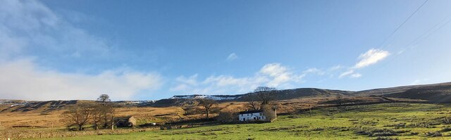
Black Paddock is a scenic and captivating area located in Westmorland, a county in the northwestern region of England. Nestled in the heart of the countryside, it is renowned for its natural beauty and diverse landscapes, encompassing both downs and moorland.

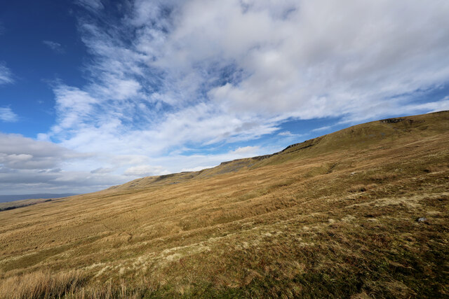
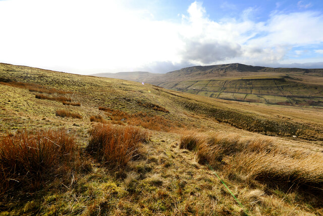
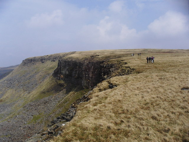
As the name suggests, Black Paddock is characterized by its dark, peaty soil, which lends a unique and striking appearance to the area. The downs, with their gently rolling hills and lush green pastures, create a picturesque panorama that stretches for miles. These open grasslands are often dotted with grazing sheep, adding to the rural charm and tranquility of the region.

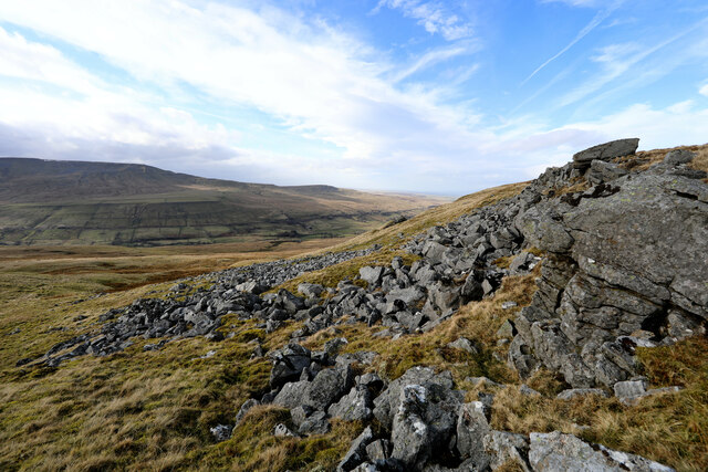
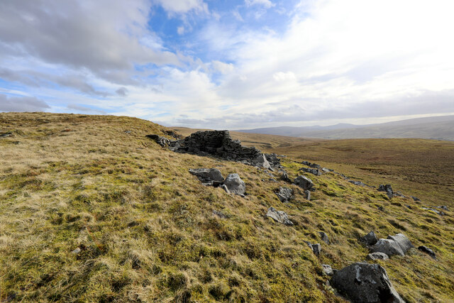
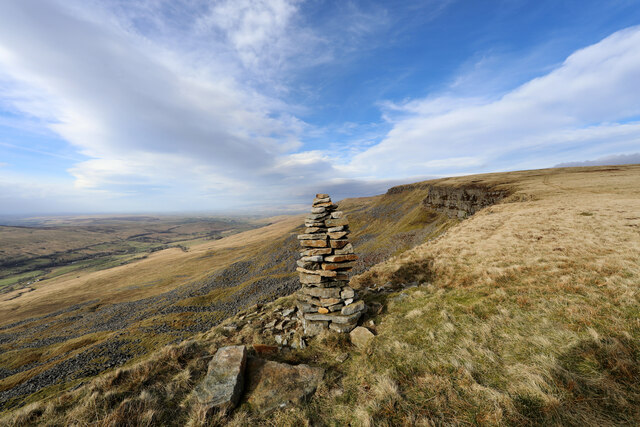
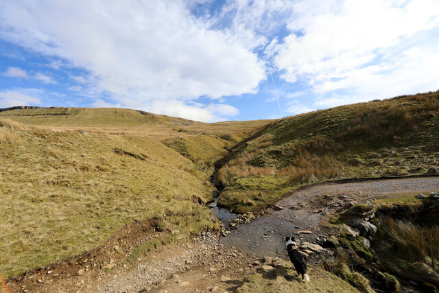
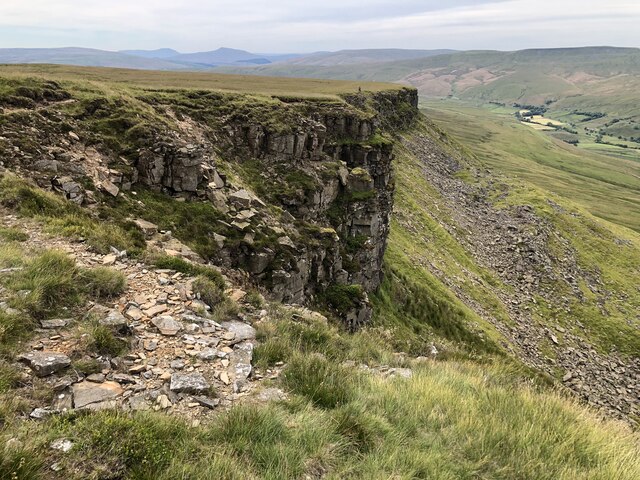
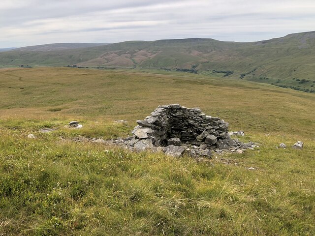
In contrast, the moorland of Black Paddock offers a more rugged and wild terrain. Covered in heather, bracken, and scattered with rocky outcrops, the moors provide a habitat for various flora and fauna, including grouse, curlews, and other moorland birds. The moors are intersected by winding footpaths and trails, inviting outdoor enthusiasts to explore and immerse themselves in the untamed beauty of the area.

Black Paddock is not only a haven for nature lovers but also holds historical significance. The remnants of ancient settlements, burial mounds, and standing stones can be found throughout the landscape, offering glimpses into the area's rich past.

Overall, Black Paddock is a captivating destination that showcases the natural splendor and cultural heritage of Westmorland. Whether it be a leisurely stroll through the downs or an adventurous hike across the moorland, visitors are sure to be captivated by the breathtaking beauty and tranquility of this remarkable area.

If you have any feedback on the listing, please let us know in the comments section below.

Black Paddock Images

Images are sourced within 2km of 54.37861/-2.3142909 or Grid Reference SD7998. Thanks to Geograph Open Source API. All images are credited.

Sheepfolds on east side of Hell Gill
Lime kiln at Hell Gill Green
Waterfall on Hell Gill Beck
Hell Gill Beck north of Sour Hill
Looking SW along Hell Gill Beck north of Sour Hill
Looking NE along Hell Gill Beck
Valley with Hell Gill Beck
New forestry on west bank of Hell Gill Beck seen over wall of sheepfold Is that a meadow pipit on the wall?
New forestry on west bank of Hell Gill Beck seen over wall of sheepfold
Is that a meadow pipit on the wall?
Little Ing Farm
Little Ing Farm
Moorland below Mallerstang Edge From where Old Road, a Byway open to all traffic, crosses Elm Gill, an ascent of 180m of a pathless section of the moor leads upwards to the southern end of Mallerstang Edge. This is looking towards the edge from near the start of the climb.
Moorland below Mallerstang Edge
From where Old Road, a Byway open to all traffic, crosses Elm Gill, an ascent of 180m of a pathless section of the moor leads upwards to the southern end of Mallerstang Edge. This is looking towards the edge from near the start of the climb.
Below Rowantree Cove looking across to Wild Boar Fell Partway up the pathless climb from the easy Old Road (a Byway open to all traffic) to the southern end of Mallerstang Edge, views start to open up across the Eden Valley towards Wild Boar Fell and Swarth Fell.
Below Rowantree Cove looking across to Wild Boar Fell
Partway up the pathless climb from the easy Old Road (a Byway open to all traffic) to the southern end of Mallerstang Edge, views start to open up across the Eden Valley towards Wild Boar Fell and Swarth Fell.
Ravens Nest commands a view over the Eden Valley A faint path appears as the first rocks are reached south of Ravens Nest at the southern end of Mallerstang Edge when climbed from the Eden Valley - the ascent route below has been pathless, though not too rough, gaining 180m of height in about threequarters of a kilometre to reach this point.
Ravens Nest commands a view over the Eden Valley
A faint path appears as the first rocks are reached south of Ravens Nest at the southern end of Mallerstang Edge when climbed from the Eden Valley - the ascent route below has been pathless, though not too rough, gaining 180m of height in about threequarters of a kilometre to reach this point.
Shelter on High Rigg Whether this was once part of a building is in some doubt. It certainly forms a minimal shelter from the wind now, fine for lunch perhaps, but would make a very uncomfortable bivouac. It seems to mark the start of an increasingly well-defined path on the southern approach to Mallerstang Edge.
Shelter on High Rigg
Whether this was once part of a building is in some doubt. It certainly forms a minimal shelter from the wind now, fine for lunch perhaps, but would make a very uncomfortable bivouac. It seems to mark the start of an increasingly well-defined path on the southern approach to Mallerstang Edge.
Cairn on Hangingstone Scar The map suggests a number of cairns hereabouts, but this rather elegantly-built one was the only one currently in evidence, in an apparently rather random spot on the edge just west of the path along Mallerstang Edge. There are quite a few cairns and piles of stones (the map makes a distinction between these categories, but it is far from clear why) scattered across the plateau, only a small number of which are on summits or other topographic features of note, so perhaps they mark boundaries of some sort.
Cairn on Hangingstone Scar
The map suggests a number of cairns hereabouts, but this rather elegantly-built one was the only one currently in evidence, in an apparently rather random spot on the edge just west of the path along Mallerstang Edge. There are quite a few cairns and piles of stones (the map makes a distinction between these categories, but it is far from clear why) scattered across the plateau, only a small number of which are on summits or other topographic features of note, so perhaps they mark boundaries of some sort.
Old Road crosses Elm Gill Old Road runs from the Thrang right round to the junction of Cotterdale with Wensleydale, a distance of over 11.5 kilometres, with often fine views, but doesn't seem to be anywhere near as popular with off-road drivers and trail bikes as some of the BOATs in the dales. The point where it crosses Elm Gill was the spot where we had chosen (well, the dog didn't actually get a vote) to leave the track to ascend to the southern end of Mallerstang Edge. There don't seem to be any actual paths up the CROW Access Land, so the choice is a little arbitrary, but our route reached the beginnings of a faint path on the ridge in three quarters of a kilometre with 180m of ascent.
Old Road crosses Elm Gill
Old Road runs from the Thrang right round to the junction of Cotterdale with Wensleydale, a distance of over 11.5 kilometres, with often fine views, but doesn't seem to be anywhere near as popular with off-road drivers and trail bikes as some of the BOATs in the dales. The point where it crosses Elm Gill was the spot where we had chosen (well, the dog didn't actually get a vote) to leave the track to ascend to the southern end of Mallerstang Edge. There don't seem to be any actual paths up the CROW Access Land, so the choice is a little arbitrary, but our route reached the beginnings of a faint path on the ridge in three quarters of a kilometre with 180m of ascent.
Hangingstone Scar
Hangingstone Scar
Remains of a shelter on High Rigg
Rough track on The Riggs
Show me another place!

Black Paddock is located at Grid Ref: SD7998 (Lat: 54.37861, Lng: -2.3142909)

Administrative County: Cumbria

District: Eden

Police Authority: Cumbria

What 3 Words

///cities.safari.straying. Near Kirkby Stephen, Cumbria

Related Wikis

Hugh Seat

Hugh Seat is a mountain, or more accurately a fell, in Mallerstang on the eastern edge of Cumbria, England. It lies on the border between Cumbria and North...

Vale of Eden

The Vale of Eden is formed by the course of the River Eden, one of the major rivers of Northwest England. It is however of much greater extent than the...

Eden Sike Cave

Eden Sike Cave is a small cave in Mallerstang in the Eden valley in Cumbria, England 400 metres (440 yd) north of Hell Gill. The entrance is 391 metres...

1995 Ais Gill rail accident

The 1995 Ais Gill rail accident occurred near Aisgill, Cumbria, UK, at about 18:55 hrs on 31 January 1995 when a class 156 Super-Sprinter was derailed...

Gregory Chapel

Gregory Chapel is one of the high points of the fells on the border between Cumbria and North Yorkshire. The summit is marked by a nearby sheep shelter...

Aisgill

Aisgill is the southernmost of the hamlets that form the parish of Mallerstang in the English county of Cumbria. It is on the B6259 road, at the head of...

1913 Ais Gill rail accident

The Ais Gill rail accident occurred on the Settle–Carlisle line in Northwest England on 2 September 1913. Two long trains were both ascending a steep gradient...

High Seat (Yorkshire Dales)

High Seat is a fell in the dale of Mallerstang, Cumbria. With a summit at 709 metres (2,326 ft), it is the fourth highest fell in the Yorkshire Dales...

Nearby Amenities

Located within 500m of 54.37861,-2.3142909
Black Paddock
Place: locality
Lat/Long: 54.3782272/-2.3129938
The data included in this document is from www.openstreetmap.org. The data is made available under ODbL.

Have you been to Black Paddock?

Leave your review of Black Paddock below (or comments, questions and feedback).