Low Moor

Downs, Moorland in Yorkshire Craven

England

Low Moor

Ribble Way & Pennine Way leading south towards Horton in Ribblesddale
Ribble Way & Pennine Way leading south towards Horton in Ribblesddale Credit: Colin Park

Low Moor is a small village located in the metropolitan borough of the City of Bradford, in West Yorkshire, England. Situated approximately 4 miles south of Bradford city center, the village lies on the eastern edge of the picturesque Yorkshire Downs, offering stunning views of the surrounding countryside.

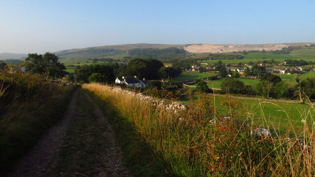
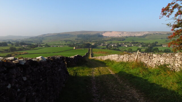
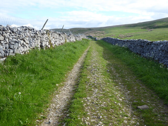
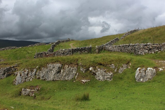
The area is known for its diverse landscape, which includes both moorland and farmland. The Yorkshire Downs, characterized by rolling hills and expansive open spaces, provide ample opportunities for outdoor activities such as hiking, cycling, and horseback riding. The moorland, with its heather-clad hills and vast stretches of unspoiled land, is a haven for wildlife enthusiasts and nature lovers.

Low Moor itself is a close-knit community, with a population of around 5,000 residents. The village boasts a range of amenities, including schools, shops, and a local library, catering to the everyday needs of its residents. Additionally, the village is well-connected to the nearby city of Bradford and other major towns in the region, making it a desirable place to live for those who seek a balance between rural tranquility and urban convenience.

The area has a rich industrial history, with Low Moor being historically associated with the textile industry. Today, remnants of this heritage can still be seen in the form of former textile mills and warehouses that dot the landscape.

In summary, Low Moor, Yorkshire offers a blend of natural beauty, community spirit, and historical significance, making it an attractive place to live or visit for those seeking a quintessentially Yorkshire experience.

If you have any feedback on the listing, please let us know in the comments section below.
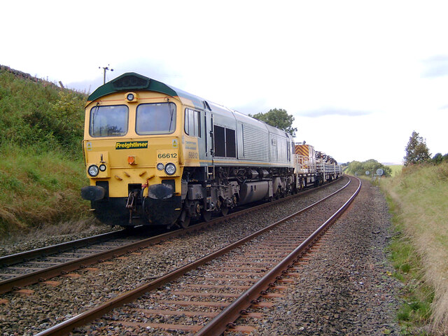
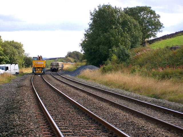
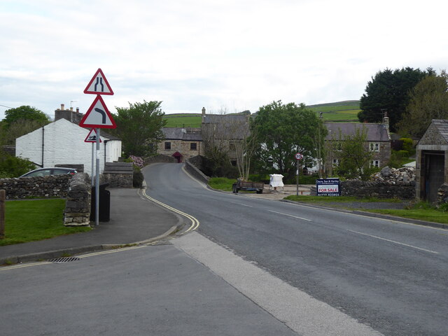
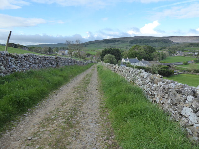
Low Moor Images

Images are sourced within 2km of 54.162644/-2.3149173 or Grid Reference SD7974. Thanks to Geograph Open Source API. All images are credited.

Ribble Way & Pennine Way leading south towards Horton in Ribblesddale
Footpath leading southwest from Sell Gill Holes near Horton in Ribblesdale
Horton-in-Ribblesdale Station A close-up of the line maintenance engines in the distance can be seen in <a href="https://www.geograph.org.uk/photo/7046846">SD8072 : Line maintenance near Horton-in-Ribblesdale Station</a>.
Horton-in-Ribblesdale Station
A close-up of the line maintenance engines in the distance can be seen in SD8072 : Line maintenance near Horton-in-Ribblesdale Station.
Horton-in-Ribblesdale Station A close-up of the freight train (which is involved in line maintenance) can be seen in <a href="https://www.geograph.org.uk/photo/7046840">SD8072 : Freight train near Horton-in-Ribblesdale Station</a>.
Horton-in-Ribblesdale Station
A close-up of the freight train (which is involved in line maintenance) can be seen in SD8072 : Freight train near Horton-in-Ribblesdale Station.
Freight train near Horton-in-Ribblesdale Station This train (involved in line maintenance) can be seen in context in <a href="https://www.geograph.org.uk/photo/7046835">SD8072 : Horton-in-Ribblesdale Station</a>.
Freight train near Horton-in-Ribblesdale Station
This train (involved in line maintenance) can be seen in context in SD8072 : Horton-in-Ribblesdale Station.
Line maintenance near Horton-in-Ribblesdale Station These can be seen in context in <a href="https://www.geograph.org.uk/photo/7046828">SD8072 : Horton-in-Ribblesdale Station</a>.
Line maintenance near Horton-in-Ribblesdale Station
These can be seen in context in SD8072 : Horton-in-Ribblesdale Station.
The Pennine Way along the B6479 in Horton in Ribblesdale
The Pennine Way near Horton in Ribblesdale
The Pennine Way near Harber Scar
The Pennine Way near Whitber Pasture
The Pennine Way near Sell Gill Holes
The Pennine Way near Sell Gill Hill
The Pennine Way near Penyghent Long Churn
Barn Ruins by Sell Gill Ruins of a barn with a splendid view down Ribblesdale as seen from the Pennine Way at Sell Gill.
Barn Ruins by Sell Gill
Ruins of a barn with a splendid view down Ribblesdale as seen from the Pennine Way at Sell Gill.
Pennine Way at Sell Gill The Pennine Way National Trail is joined by the Ribble Way long distance footpath along this section of an ancient packhorse route called Harber Scar Road.
Pennine Way at Sell Gill
The Pennine Way National Trail is joined by the Ribble Way long distance footpath along this section of an ancient packhorse route called Harber Scar Road.
Public Conveniences, Horton-in-Ribblesdale Located in the village car park, and handily placed for Pennine Way walkers passing by.
Public Conveniences, Horton-in-Ribblesdale
Located in the village car park, and handily placed for Pennine Way walkers passing by.
Show me another place!

Low Moor is located at Grid Ref: SD7974 (Lat: 54.162644, Lng: -2.3149173)

Division: West Riding

Administrative County: North Yorkshire

District: Craven

Police Authority: North Yorkshire

What 3 Words

///small.consoles.poems. Near Ingleton, North Yorkshire

Related Wikis

Three Peaks Cyclo-Cross

The Three Peaks Cyclo-Cross is an annual cyclo-cross event over the Yorkshire three peaks of Ingleborough, Whernside and Pen-y-ghent, in Yorkshire, England...
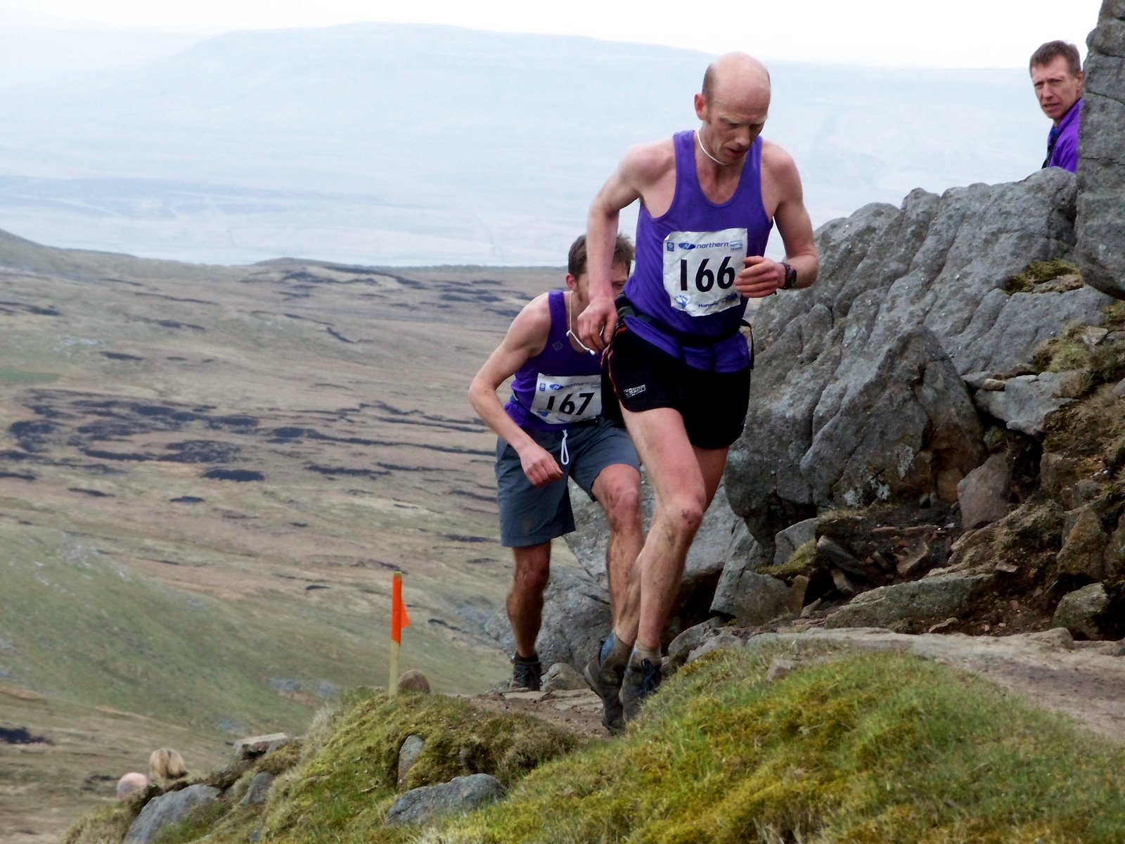
Three Peaks Race

The Three Peaks Race is a fell race held annually on the last weekend in April, starting and finishing in Horton in Ribblesdale. The course traverses the...

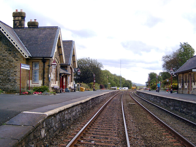
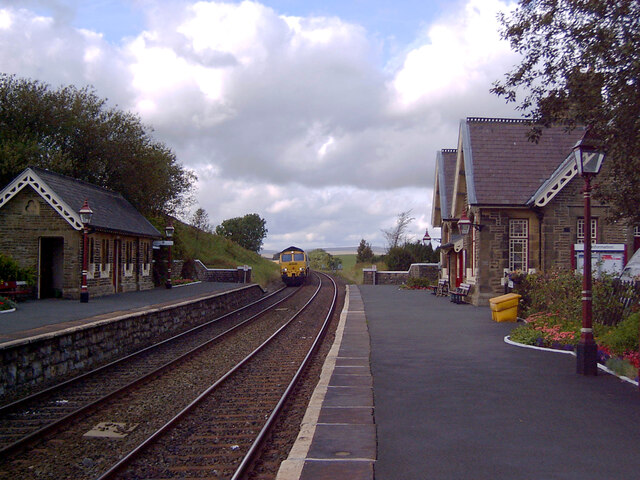
Horton-in-Ribblesdale railway station

Horton-in-Ribblesdale is a railway station on the Settle and Carlisle Line, which runs between Carlisle and Leeds via Settle. The station, situated 47...

Selside, North Yorkshire

Selside is a small village in Ribblesdale in North Yorkshire, England. It lies 2 miles (3 km) north west of Horton in Ribblesdale. Selside was mentioned...

Nearby Amenities

Located within 500m of 54.162644,-2.3149173
Power: pole
Lat/Long: 54.1612381/-2.309011
Power: pole
Lat/Long: 54.161874/-2.3099567
Power: pole
Lat/Long: 54.1624635/-2.3108541
Power: pole
Lat/Long: 54.1630531/-2.3117209
Power: pole
Lat/Long: 54.1635695/-2.3124805
Power: pole
Lat/Long: 54.1642277/-2.313411
Power: pole
Lat/Long: 54.1647322/-2.3141452
Power: pole
Lat/Long: 54.1651501/-2.3147673
Power: pole
Lat/Long: 54.165659/-2.3155295
Power: pole
Lat/Long: 54.1662859/-2.3164498
Barrier: stile
Lat/Long: 54.1627656/-2.3207643
Information: guidepost
Tourism: information
Lat/Long: 54.1627814/-2.3207676
Natural: sinkhole
Sinkhole: ponor
Lat/Long: 54.1631186/-2.3202289
Natural: sinkhole
Sinkhole: ponor
Lat/Long: 54.1633336/-2.3203679
Natural: sinkhole
Sinkhole: ponor
Lat/Long: 54.1634335/-2.32101
Natural: sinkhole
Sinkhole: ponor
Lat/Long: 54.163629/-2.3209027
Natural: sinkhole
Sinkhole: ponor
Lat/Long: 54.1636166/-2.3205688
Natural: sinkhole
Sinkhole: ponor
Lat/Long: 54.1637485/-2.3206867
Natural: sinkhole
Sinkhole: ponor
Lat/Long: 54.1638493/-2.3210176
Natural: sinkhole
Sinkhole: ponor
Lat/Long: 54.1638944/-2.321214
Natural: sinkhole
Sinkhole: ponor
Lat/Long: 54.16402/-2.3209662
Natural: sinkhole
Sinkhole: ponor
Lat/Long: 54.1639077/-2.3208227
Natural: sinkhole
Sinkhole: ponor
Lat/Long: 54.1640068/-2.3206625
Natural: sinkhole
Sinkhole: ponor
Lat/Long: 54.1643383/-2.3206676
Natural: sinkhole
Sinkhole: ponor
Lat/Long: 54.1643928/-2.3209777
Natural: sinkhole
Sinkhole: ponor
Lat/Long: 54.1644537/-2.3210774
Natural: sinkhole
Sinkhole: ponor
Lat/Long: 54.1644369/-2.3202179
Natural: sinkhole
Sinkhole: ponor
Lat/Long: 54.1644784/-2.3202733
Natural: sinkhole
Sinkhole: ponor
Lat/Long: 54.1645808/-2.320229
Natural: sinkhole
Sinkhole: ponor
Lat/Long: 54.1645302/-2.3199499
Natural: sinkhole
Sinkhole: ponor
Lat/Long: 54.1646444/-2.3199632
Natural: sinkhole
Sinkhole: ponor
Lat/Long: 54.1645808/-2.3195977
Natural: sinkhole
Sinkhole: ponor
Lat/Long: 54.1644719/-2.3199565
Natural: sinkhole
Sinkhole: ponor
Lat/Long: 54.1646716/-2.3194293
Natural: sinkhole
Sinkhole: ponor
Lat/Long: 54.1640945/-2.3192942
Natural: sinkhole
Sinkhole: ponor
Lat/Long: 54.1640608/-2.3189708
Natural: sinkhole
Sinkhole: ponor
Lat/Long: 54.164101/-2.3198724
Natural: sinkhole
Sinkhole: ponor
Lat/Long: 54.1644485/-2.3195201
Natural: sinkhole
Sinkhole: ponor
Lat/Long: 54.1646846/-2.3195866
Natural: sinkhole
Sinkhole: ponor
Lat/Long: 54.1649089/-2.3202312
Natural: sinkhole
Sinkhole: ponor
Lat/Long: 54.1648739/-2.3203353
Natural: sinkhole
Sinkhole: ponor
Lat/Long: 54.16487/-2.3205458
Natural: sinkhole
Sinkhole: ponor
Lat/Long: 54.1648298/-2.3187781
Natural: sinkhole
Sinkhole: ponor
Lat/Long: 54.164944/-2.3186739
Natural: sinkhole
Sinkhole: ponor
Lat/Long: 54.1650659/-2.3179828
Natural: sinkhole
Sinkhole: ponor
Lat/Long: 54.164599/-2.3184857
Natural: sinkhole
Sinkhole: ponor
Lat/Long: 54.1644382/-2.3186008
Natural: sinkhole
Sinkhole: ponor
Lat/Long: 54.164538/-2.3182907
Natural: sinkhole
Sinkhole: ponor
Lat/Long: 54.1645147/-2.3180958
Natural: sinkhole
Sinkhole: ponor
Lat/Long: 54.1644148/-2.3178809
Natural: sinkhole
Sinkhole: ponor
Lat/Long: 54.1647313/-2.3178543
Natural: sinkhole
Sinkhole: ponor
Lat/Long: 54.1647702/-2.3175575
Natural: sinkhole
Sinkhole: ponor
Lat/Long: 54.1645367/-2.3172806
Natural: sinkhole
Sinkhole: ponor
Lat/Long: 54.164669/-2.3176749
Natural: sinkhole
Sinkhole: ponor
Lat/Long: 54.1647481/-2.3167467
Natural: sinkhole
Sinkhole: ponor
Lat/Long: 54.1649478/-2.3169107
Natural: sinkhole
Sinkhole: ponor
Lat/Long: 54.1648856/-2.3161863
Natural: sinkhole
Sinkhole: ponor
Lat/Long: 54.1648687/-2.3163436
Natural: sinkhole
Sinkhole: ponor
Lat/Long: 54.1648921/-2.3164078
Natural: sinkhole
Sinkhole: ponor
Lat/Long: 54.1651281/-2.3161996
Natural: sinkhole
Sinkhole: ponor
Lat/Long: 54.1642605/-2.3177081
Natural: sinkhole
Sinkhole: ponor
Lat/Long: 54.1641736/-2.3177325
Natural: sinkhole
Sinkhole: ponor
Lat/Long: 54.1643137/-2.3174755
Natural: sinkhole
Sinkhole: ponor
Lat/Long: 54.1639479/-2.3170259
Natural: sinkhole
Sinkhole: ponor
Lat/Long: 54.1639337/-2.3171765
Natural: sinkhole
Sinkhole: ponor
Lat/Long: 54.163909/-2.3169461
Natural: sinkhole
Sinkhole: ponor
Lat/Long: 54.1637936/-2.3167534
Natural: sinkhole
Sinkhole: ponor
Lat/Long: 54.1639259/-2.3176328
Natural: sinkhole
Sinkhole: ponor
Lat/Long: 54.1636963/-2.3175287
Natural: sinkhole
Sinkhole: ponor
Lat/Long: 54.1637015/-2.3176793
Natural: sinkhole
Sinkhole: ponor
Lat/Long: 54.1638169/-2.3175708
Natural: sinkhole
Sinkhole: ponor
Lat/Long: 54.1634019/-2.3174512
Natural: sinkhole
Sinkhole: ponor
Lat/Long: 54.1635835/-2.3180493
Natural: sinkhole
Sinkhole: ponor
Lat/Long: 54.1630907/-2.3181755
Natural: sinkhole
Sinkhole: ponor
Lat/Long: 54.1631529/-2.3181423
Natural: sinkhole
Sinkhole: ponor
Lat/Long: 54.1632139/-2.3181357
Natural: sinkhole
Sinkhole: ponor
Lat/Long: 54.1630141/-2.3181777
Natural: sinkhole
Sinkhole: ponor
Lat/Long: 54.1631218/-2.3185233
Natural: sinkhole
Sinkhole: ponor
Lat/Long: 54.1630777/-2.318479
Natural: sinkhole
Sinkhole: ponor
Lat/Long: 54.1631737/-2.3190638
Natural: sinkhole
Sinkhole: ponor
Lat/Long: 54.1636081/-2.3192277
Natural: sinkhole
Sinkhole: ponor
Lat/Long: 54.1635692/-2.3191325
Natural: sinkhole
Sinkhole: ponor
Lat/Long: 54.1635537/-2.3187559
Natural: sinkhole
Sinkhole: ponor
Lat/Long: 54.1635666/-2.3185698
Natural: sinkhole
Sinkhole: ponor
Lat/Long: 54.1636535/-2.3199122
Natural: sinkhole
Sinkhole: ponor
Lat/Long: 54.1634823/-2.3198724
Natural: sinkhole
Sinkhole: ponor
Lat/Long: 54.1635602/-2.3196508
Natural: sinkhole
Sinkhole: ponor
Lat/Long: 54.1636406/-2.3195401
The data included in this document is from www.openstreetmap.org. The data is made available under ODbL.

Have you been to Low Moor?

Leave your review of Low Moor below (or comments, questions and feedback).