Arten Gill Moss

Downs, Moorland in Yorkshire South Lakeland

England

Arten Gill Moss

Artengill viaduct from Lea Yeat Brow A well known feature of the Settle-Carlisle line, dramatic seen close up, but this photo shows its setting in the landscape of Upper Dentdale.  Unusually it is both a listed structure (grade II, list entry 1383817) and a scheduled monument (1007242).
Artengill viaduct from Lea Yeat Brow Credit: Stephen Craven

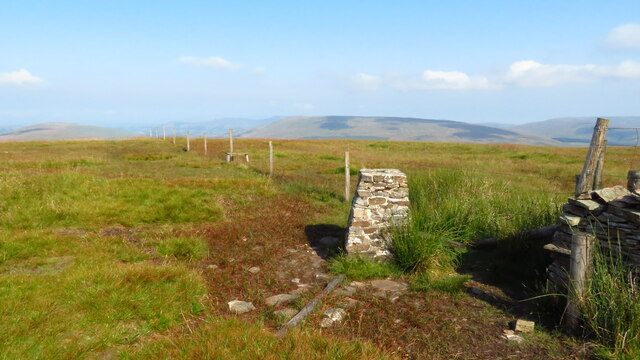
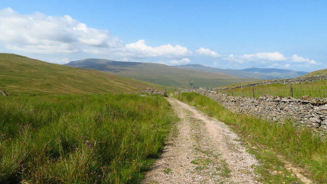
Arten Gill Moss is a vast area of moorland located in the county of Yorkshire, England. Nestled within the Yorkshire Dales National Park, it spans across a significant portion of the upland landscape. This expansive peatland is situated in the western part of the park, close to the border with Lancashire.

Covering an area of approximately 4 square kilometers, Arten Gill Moss is characterized by its unique and captivating natural beauty. The moorland is adorned with a variety of heather species, including the iconic purple-colored common heather that dominates the landscape during the summer months. The rich purple hues contrast beautifully with the vibrant green of the surrounding vegetation, creating a picturesque scene.

Arten Gill Moss is home to a diverse range of wildlife species. The open moorland provides a habitat for numerous bird species, including the red grouse, curlew, and lapwing. The area is also known for its breeding population of merlin, a small falcon that thrives in the upland environment. Mammals such as mountain hare and red deer can also be spotted in this remote and tranquil wilderness.

Visitors to Arten Gill Moss can enjoy the peacefulness of the moorland and the stunning panoramic views it offers. The area is crisscrossed by a network of walking trails, allowing visitors to explore the landscape and immerse themselves in the natural beauty of the Yorkshire Dales. Arten Gill Moss provides a unique opportunity to experience the wild, rugged beauty of the Yorkshire moors in all its glory.

If you have any feedback on the listing, please let us know in the comments section below.

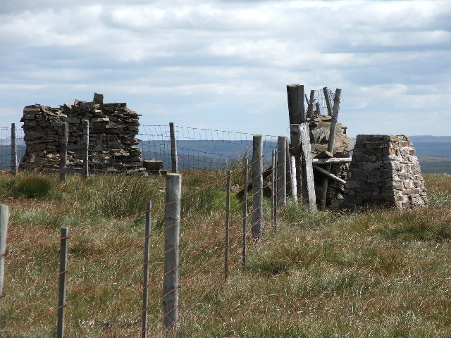
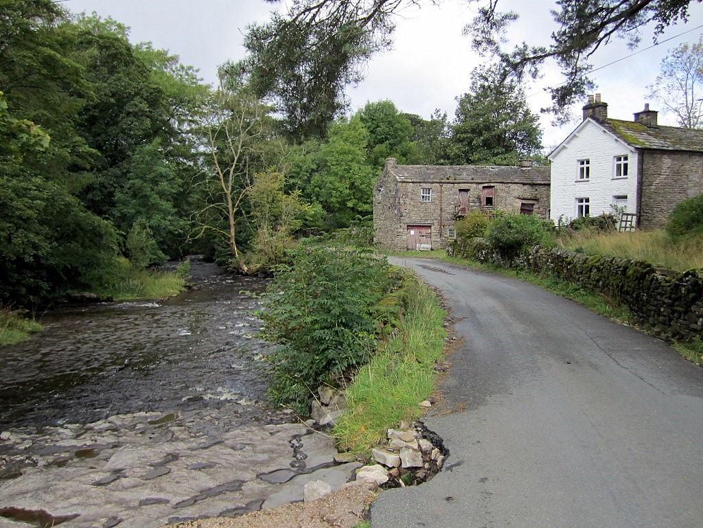
Arten Gill Moss Images

Images are sourced within 2km of 54.270651/-2.3159558 or Grid Reference SD7986. Thanks to Geograph Open Source API. All images are credited.

Artengill viaduct from Lea Yeat Brow A well known feature of the Settle-Carlisle line, dramatic seen close up, but this photo shows its setting in the landscape of Upper Dentdale.  Unusually it is both a listed structure (grade II, list entry 1383817) and a scheduled monument (1007242).
Artengill viaduct from Lea Yeat Brow
A well known feature of the Settle-Carlisle line, dramatic seen close up, but this photo shows its setting in the landscape of Upper Dentdale. Unusually it is both a listed structure (grade II, list entry 1383817) and a scheduled monument (1007242).
Arten Gill Viaduct, 1968 On the Settle and Carlisle Line, a grade II listed structure. The train crossing, of nineteen hopper wagons and a brake van, appears to be hauled by a class 40 locomotive.
Arten Gill Viaduct, 1968
On the Settle and Carlisle Line, a grade II listed structure. The train crossing, of nineteen hopper wagons and a brake van, appears to be hauled by a class 40 locomotive.
Trig Point on Great Knoutberry Hill
Hill track at Arten Gill Moss
Track descending Arten Gill towards Arten Gill Viaduct
Arten Gill Viaduct
Arten Gill Viaduct
Ford on Arten Gill This is a second ford of 28 fords on the track leading up Arten Gill. The viaduct is Artengill Viaduct on the Settle to Carlisle line.
Ford on Arten Gill
This is a second ford of 28 fords on the track leading up Arten Gill. The viaduct is Artengill Viaduct on the Settle to Carlisle line.
Ford on Arten Gill This is a third ford of 28 fords along this track on Arten Gill.
Ford on Arten Gill
This is a third ford of 28 fords along this track on Arten Gill.
Ford on Arten Gill This is a fourth ford of 28 fords along the track leading up Arten Gill.
Ford on Arten Gill
This is a fourth ford of 28 fords along the track leading up Arten Gill.
Ford on Arten Gill This is the most elaborate of the 28 fords on the Arten Gill Drove track.
Ford on Arten Gill
This is the most elaborate of the 28 fords on the Arten Gill Drove track.
Brant Side Ford This ford is found on Brant Side on Dent Fell.
Brant Side Ford
This ford is found on Brant Side on Dent Fell.
Brant Nook Ford This ford is found at Brant Nook on Dent Fell.
Brant Nook Ford
This ford is found at Brant Nook on Dent Fell.
The steep slopes of Brant Side Along the Pennine Bridleway.
The steep slopes of Brant Side
Along the Pennine Bridleway.
Brant Nook ford Along the Pennine Bridleway.
Brant Nook ford
Along the Pennine Bridleway.
Arten Gill Moss Climbing Great Knoutberry Hill.
Arten Gill Moss
Climbing Great Knoutberry Hill.
Boulders on Pikes Edge Dropping down off Great Knoutberry Hill.
Boulders on Pikes Edge
Dropping down off Great Knoutberry Hill.
The trig point on Great Knoutberry Hill
Old milestone At SD 7984 is the boundary between the old West & North Ridings.   The last West Riding CC milestone south of the boundary is reached has now disappeared completely.   <a href="https://www.geograph.org.uk/photo/6072143">SD7984 : Old Boundary Marker by the B6255, Newby Head, Ingleton parish</a>.   This old, weathered stone is the most southerly one on the B6255, at Widdale Head, probably set up by the Sedbergh Turnpike trust in the early 19C.   This Trust covered a total of 62 miles on roads leading from and near Sedbergh   There is a very faint 6/HAWES near the base which has been highlighted in chalk.
Old milestone
At SD 7984 is the boundary between the old West & North Ridings. The last West Riding CC milestone south of the boundary is reached has now disappeared completely. SD7984 : Old Boundary Marker by the B6255, Newby Head, Ingleton parish. This old, weathered stone is the most southerly one on the B6255, at Widdale Head, probably set up by the Sedbergh Turnpike trust in the early 19C. This Trust covered a total of 62 miles on roads leading from and near Sedbergh There is a very faint 6/HAWES near the base which has been highlighted in chalk.
Show me another place!

Arten Gill Moss is located at Grid Ref: SD7986 (Lat: 54.270651, Lng: -2.3159558)

Division: West Riding

Administrative County: Cumbria

District: South Lakeland

Police Authority: Cumbria

What 3 Words

///dairies.tickets.pheasants. Near Sedbergh, Cumbria

Nearby Locations

Arten Gill Moss

Related Wikis

Great Knoutberry Hill

Great Knoutberry Hill, also commonly known as Widdale Fell, is a mountain located near Dent at the heads of Ribblesdale, Dentdale and Wensleydale, in the...
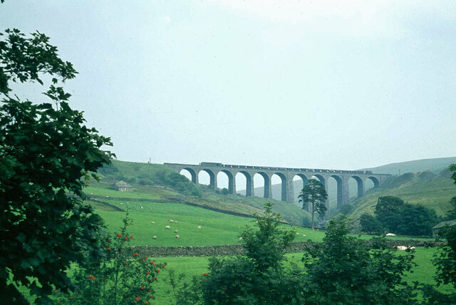
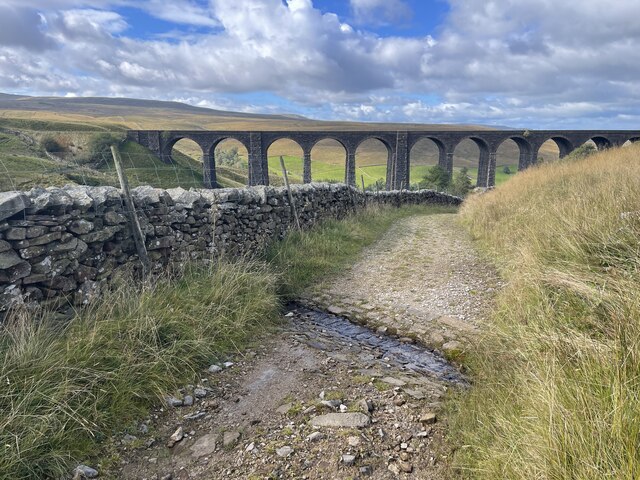
Arten Gill Viaduct

Arten Gill Viaduct is an eleven-arch railway bridge in Dentdale, Cumbria, England. The viaduct carries the Settle to Carlisle railway line over Artengill...

Newby Head

Newby Head, Newby Head Farm or Newby Head Inn is part of the Beresford Estate and was a popular drovers' inn in North Yorkshire, England. Now a farmhouse...

Stone House, Cumbria

Stone House is a locality at Dent Head on the River Dee, in the county of Cumbria, England, to the south-east of Cowgill and to the north-west of Newby...

Nearby Amenities

Located within 500m of 54.270651,-2.3159558
Barrier: stile
Foot: yes
Lat/Long: 54.2716143/-2.3169715
The data included in this document is from www.openstreetmap.org. The data is made available under ODbL.

Have you been to Arten Gill Moss?

Leave your review of Arten Gill Moss below (or comments, questions and feedback).