Bents Brae

Downs, Moorland in Westmorland Eden

England

Bents Brae

The northerly cairn on High Seat Not quite the highest point but located on the northern edge of the gentle summit dome. The view is of an endless expanse of snow-speckled moorland extending towards Nine Standards Rigg and the distant North Pennines.
The northerly cairn on High Seat Credit: Karl and Ali

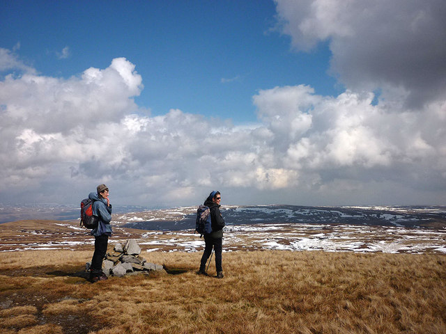
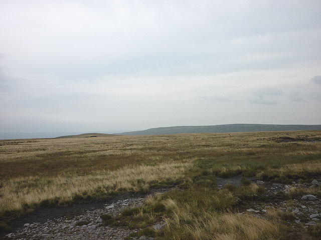
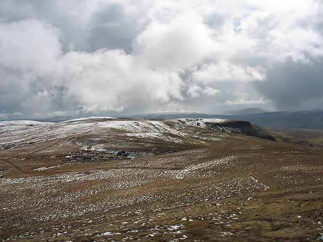
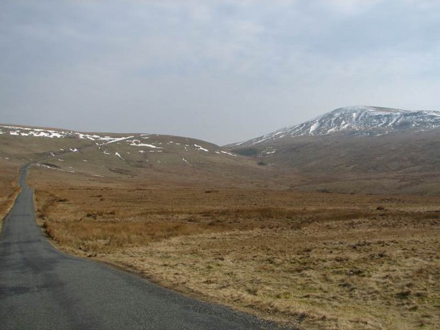
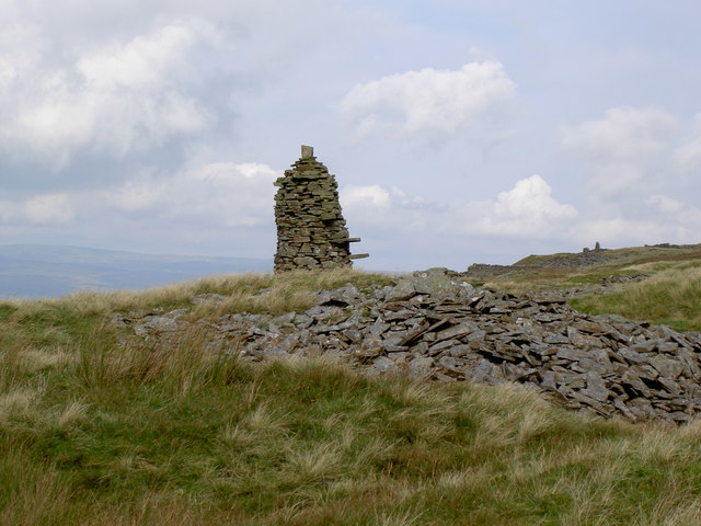
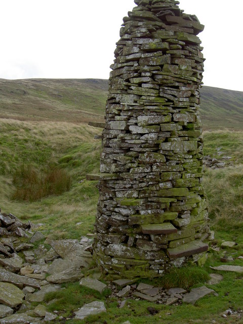
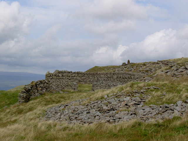
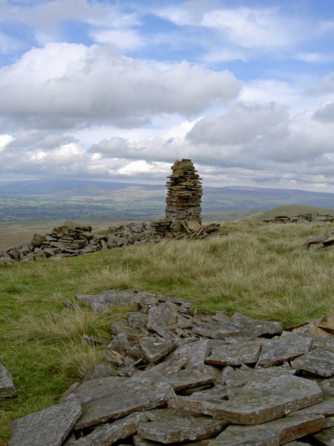
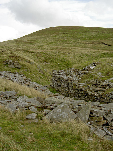
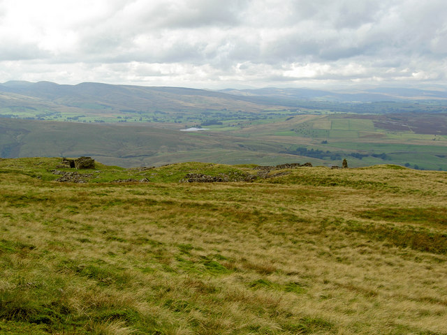
Bents Brae is a picturesque area located in the county of Westmorland, England. Situated between the Downs and Moorland, it showcases the diverse natural beauty of the region. With its rolling hills, lush green meadows, and enchanting landscapes, Bents Brae is a haven for nature lovers and outdoor enthusiasts alike.

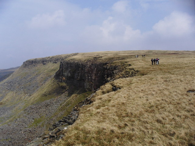
The area is renowned for its stunning views, offering panoramic vistas of the surrounding countryside. From the top of Bents Brae, one can admire the majestic peaks of the nearby fells, such as Helvellyn and Scafell Pike, which stand tall in the distance. The ever-changing weather conditions in this part of Westmorland create a dramatic and awe-inspiring atmosphere, with misty mornings and vibrant sunsets painting the sky.

Bents Brae is also home to a variety of wildlife, including red deer, foxes, and a rich bird population. Birdwatchers flock to the area to catch a glimpse of rare species such as the red kite and peregrine falcon. The meandering streams and tranquil ponds provide a habitat for diverse aquatic life, adding to the ecological significance of the region.

For visitors seeking outdoor activities, Bents Brae offers ample opportunities for hiking, cycling, and exploring nature trails. The area is crisscrossed by well-maintained footpaths that lead adventurers through enchanting woodlands, across moorlands, and up challenging ascents. The open spaces and clean air make Bents Brae an ideal destination for relaxation and rejuvenation.

Overall, Bents Brae, with its stunning natural landscapes, diverse wildlife, and recreational opportunities, is a must-visit destination for anyone looking to immerse themselves in the beauty of Westmorland.

If you have any feedback on the listing, please let us know in the comments section below.

Bents Brae Images

Images are sourced within 2km of 54.421435/-2.3239888 or Grid Reference NY7902. Thanks to Geograph Open Source API. All images are credited.

The northerly cairn on High Seat Not quite the highest point but located on the northern edge of the gentle summit dome. The view is of an endless expanse of snow-speckled moorland extending towards Nine Standards Rigg and the distant North Pennines.
The northerly cairn on High Seat
Not quite the highest point but located on the northern edge of the gentle summit dome. The view is of an endless expanse of snow-speckled moorland extending towards Nine Standards Rigg and the distant North Pennines.
Between High Seat and High Pike Hill 'Ridge' is an ambitious name for the elongated plateau of peaty moorland that extends north behind the facade of Mallerstang Edge. High Pike Hill is the bump on the left with Nine Standards Rigg beyond.
Between High Seat and High Pike Hill
'Ridge' is an ambitious name for the elongated plateau of peaty moorland that extends north behind the facade of Mallerstang Edge. High Pike Hill is the bump on the left with Nine Standards Rigg beyond.
East of Mallerstang Edge Moorland above Mallerstang Edge, viewed in early April during a break in snow flurries.
East of Mallerstang Edge
Moorland above Mallerstang Edge, viewed in early April during a break in snow flurries.
Pile of stones on High Seat Cracking summit views.
Pile of stones on High Seat
Cracking summit views.
The B6270 running SE up over the edge of Lamp Moss On the right is High Pike Hill with Lamp Moss leading left to Tail Bridge Hill. The valley is Kitchen Gill which runs into the river Eden South of Nateby.
The B6270 running SE up over the edge of Lamp Moss
On the right is High Pike Hill with Lamp Moss leading left to Tail Bridge Hill. The valley is Kitchen Gill which runs into the river Eden South of Nateby.
Between High Seat and High Pike. The surrounding peat has been washed away over the years and replaced by rough grass on sparse soil. This hag and several others remain as "islands".
Between High Seat and High Pike.
The surrounding peat has been washed away over the years and replaced by rough grass on sparse soil. This hag and several others remain as "islands".
High Pike A cairn on High Pike, one of several which mark the old county boundary between Westmorland and the North Riding along Mallerstang Edge. This is now the Yorkshire Dales National Park boundary.
High Pike
A cairn on High Pike, one of several which mark the old county boundary between Westmorland and the North Riding along Mallerstang Edge. This is now the Yorkshire Dales National Park boundary.
Careless Bank A disused quarry near the Kirkby Stephen to Keld road.
Careless Bank
A disused quarry near the Kirkby Stephen to Keld road.
Not a standing stone or pillar but a nicely built cairn The OS shows a "pile of stones" 
<a href="https://www.geograph.org.uk/photo/563442">NY7903 : ...but there is a pillar or standing stone on the skyline that bears investigation</a>
Not a standing stone or pillar but a nicely built cairn
The cairn is about 12 feet tall and even has a spiral staircase built around it. "Pile of stones" indeed!
The cairn is about 12 feet tall and even has a spiral staircase built around it.
"Pile of stones" indeed!
A tidily built sheepfold Not the one shown on the map - or not in that position
A tidily built sheepfold
Not the one shown on the map - or not in that position
Another neatly built cairn but not as big as the one to the south Once again, ignored by the OS
Another neatly built cairn but not as big as the one to the south
Once again, ignored by the OS
There is plenty of evidence of the old mineworkings
Looking back at the mine workings and the cairn
The cairn on the approach to High Pike Hill
The barren top with the occasional huddle of peat that has somehow escaped erosion
"Pile of stones"
"Pile of stones"
Near Uldale Gill Head I cannot understand why this place is not heaving with walkers. You've got boggy peat, inpenetrable heather, driving rain, and views like this. It's character building.
Near Uldale Gill Head
I cannot understand why this place is not heaving with walkers. You've got boggy peat, inpenetrable heather, driving rain, and views like this. It's character building.
Show me another place!

Bents Brae is located at Grid Ref: NY7902 (Lat: 54.421435, Lng: -2.3239888)

Administrative County: Cumbria

District: Eden

Police Authority: Cumbria

What 3 Words

///hatter.talent.flippers. Near Kirkby Stephen, Cumbria

Nearby Locations

Bents Brae

Related Wikis

Pendragon Castle

Pendragon Castle is a ruin located in Mallerstang Dale, Cumbria, south of Kirkby Stephen, and close to the hamlet of Outhgill (at grid reference NY781025...

Outhgill

Outhgill is a hamlet in Mallerstang, Cumbria, England. It lies about 5 miles (8 km) south of Kirkby Stephen. It is the main hamlet in the dale of Mallerstang...

Mallerstang

Mallerstang is a civil parish in the extreme east of Cumbria, and, geographically, a dale at the head of the upper Eden Valley. Originally part of Westmorland...

High Seat (Yorkshire Dales)

High Seat is a fell in the dale of Mallerstang, Cumbria. With a summit at 709 metres (2,326 ft), it is the fourth highest fell in the Yorkshire Dales...

Gregory Chapel

Gregory Chapel is one of the high points of the fells on the border between Cumbria and North Yorkshire. The summit is marked by a nearby sheep shelter...
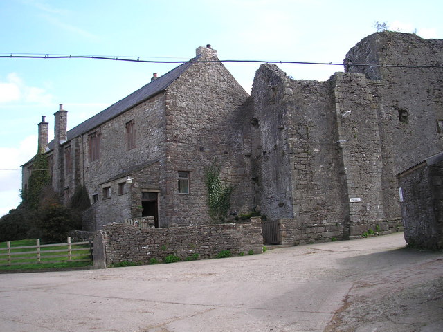
Wharton Hall

Wharton Hall in Wharton, Cumbria, England, is a medieval fortified manor house. == History == At the heart of Wharton Hall is a 15th-century hall, built...

Nateby, Cumbria

Nateby is a village and civil parish in the Eden district of Cumbria, England. The parish had a population of 110 in 2001, increasing to 120 at the 2011...

Vale of Eden

The Vale of Eden is formed by the course of the River Eden, one of the major rivers of Northwest England. It is however of much greater extent than the...

Nearby Amenities

Located within 500m of 54.421435,-2.3239888
Power: pole
Lat/Long: 54.422666/-2.3307588
Power: pole
Lat/Long: 54.4217125/-2.3305969
Power: pole
Lat/Long: 54.4207294/-2.3306599
Power: pole
Lat/Long: 54.4198266/-2.3307283
Red Scar
Place: locality
Lat/Long: 54.4198069/-2.3255566
Waterway: waterfall
Lat/Long: 54.4193332/-2.3263815
Bleakham Nook
Place: locality
Lat/Long: 54.4191503/-2.3181978
Bleakham Fold
Place: locality
Lat/Long: 54.4204742/-2.3174102
Power: pole
Lat/Long: 54.4233134/-2.3308595
The data included in this document is from www.openstreetmap.org. The data is made available under ODbL.

Have you been to Bents Brae?

Leave your review of Bents Brae below (or comments, questions and feedback).