Beck Side Pasture
Downs, Moorland in Yorkshire Richmondshire
England
Beck Side Pasture

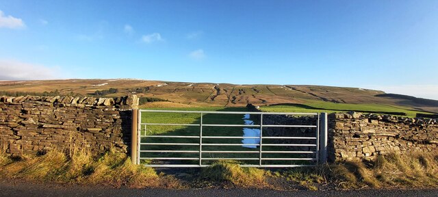
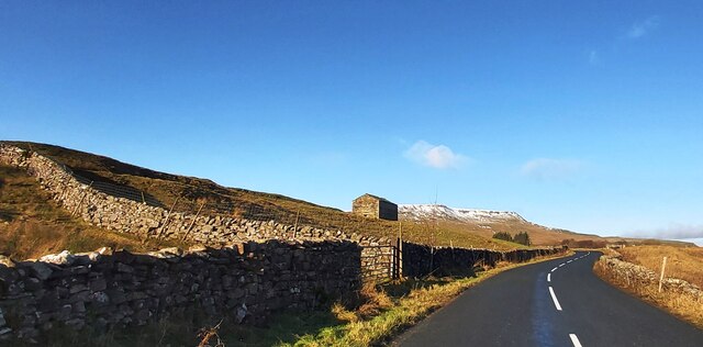
Beck Side Pasture is a picturesque area located in the heart of Yorkshire, England. Situated amidst the stunning landscape of the Yorkshire Downs and Moorland, this region offers breathtaking views and a tranquil atmosphere. The area is characterized by its rolling green hills, meandering streams, and scattered woodlands.
Beck Side Pasture is renowned for its rich biodiversity and is home to a diverse range of plant and animal species. The fertile soil supports a variety of vegetation, including wildflowers, grasses, and heather, which adds vibrant colors to the landscape throughout the year. The area is particularly famous for its expansive heather moorland, which turns a beautiful shade of purple during the summer months.
The region serves as an important habitat for numerous bird species, making it a haven for birdwatching enthusiasts. Visitors can spot birds such as curlews, lapwings, red grouse, and skylarks, among others. The moorland also provides a suitable environment for smaller mammals like hares, foxes, and stoats.
Beck Side Pasture is a popular destination for outdoor activities such as hiking, cycling, and picnicking. The area offers a network of well-maintained footpaths and trails, allowing visitors to explore the stunning scenery at their own pace. The peaceful surroundings and fresh air make it an ideal spot for nature lovers and those seeking a break from the hustle and bustle of city life.
In conclusion, Beck Side Pasture, Yorkshire, is a captivating region that showcases the natural beauty of the Yorkshire Downs and Moorland. Its diverse flora and fauna, combined with its tranquil ambiance, make it a must-visit destination for anyone seeking a peaceful retreat in the lap of nature.
If you have any feedback on the listing, please let us know in the comments section below.
Beck Side Pasture Images
Images are sourced within 2km of 54.348416/-2.3267982 or Grid Reference SD7894. Thanks to Geograph Open Source API. All images are credited.


Beck Side Pasture is located at Grid Ref: SD7894 (Lat: 54.348416, Lng: -2.3267982)
Division: North Riding
Administrative County: North Yorkshire
District: Richmondshire
Police Authority: North Yorkshire
What 3 Words
///shun.dunes.lowest. Near Sedbergh, Cumbria
Nearby Locations
Related Wikis

Lunds, North Yorkshire
Lunds is a hamlet in North Yorkshire, England, near to the watershed of the Eden and Ure rivers. It is on the border between Cumbria and North Yorkshire...
Hawes Junction rail crash
The Hawes Junction rail crash occurred at 5.49 am on 24 December 1910, just north of Lunds Viaduct between Hawes Junction (now known as Garsdale station...

Grisedale
Grisedale (sometimes Grisdale, or Grizedale [archaic]) is a south east facing Dale in Cumbria, England, 8 miles (13 km) east of Sedbergh, and 7 miles...

Aisgill
Aisgill is the southernmost of the hamlets that form the parish of Mallerstang in the English county of Cumbria. It is on the B6259 road, at the head of...

Eden Sike Cave
Eden Sike Cave is a small cave in Mallerstang in the Eden valley in Cumbria, England 400 metres (440 yd) north of Hell Gill. The entrance is 391 metres...
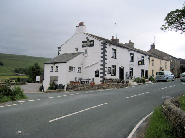
Moorcock Inn
The Moorcock Inn is a public house at the watershed of the Eden, Clough and Ure rivers, in Upper Wensleydale, North Yorkshire, England. It is adjacent...

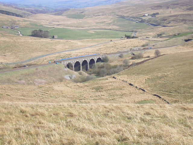
Dandry Mire Viaduct
Dandry Mire Viaduct, (or Dandrymire Viaduct), is a railway viaduct on the Settle & Carlisle line in Cumbria, England. It is just north of Garsdale station...

1913 Ais Gill rail accident
The Ais Gill rail accident occurred on the Settle–Carlisle line in Northwest England on 2 September 1913. Two long trains were both ascending a steep gradient...
Nearby Amenities
Located within 500m of 54.348416,-2.3267982Have you been to Beck Side Pasture?
Leave your review of Beck Side Pasture below (or comments, questions and feedback).