Pikes Moss

Downs, Moorland in Yorkshire South Lakeland

England

Pikes Moss

Artengill viaduct from Lea Yeat Brow A well known feature of the Settle-Carlisle line, dramatic seen close up, but this photo shows its setting in the landscape of Upper Dentdale.  Unusually it is both a listed structure (grade II, list entry 1383817) and a scheduled monument (1007242).
Artengill viaduct from Lea Yeat Brow Credit: Stephen Craven

Pikes Moss is a picturesque area located in the county of Yorkshire, England. Situated amidst the breathtaking Yorkshire Downs and Moorland, it is a haven for nature lovers and outdoor enthusiasts.

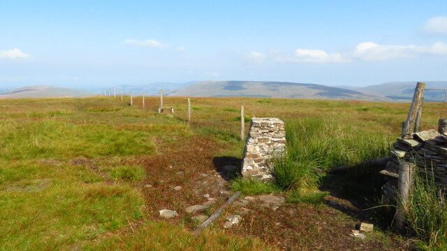
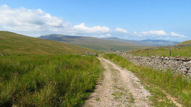
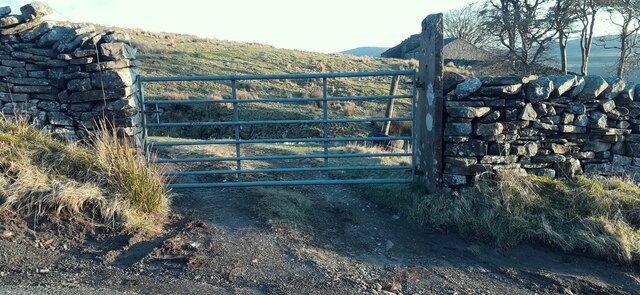
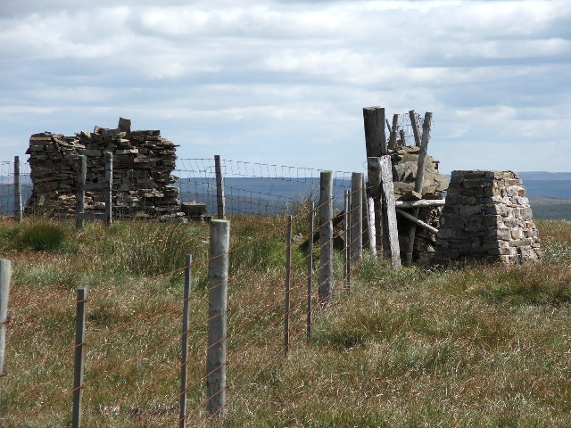
Covering several acres, Pikes Moss is characterized by its diverse and unique landscape. It is home to a vast expanse of heather-covered moors, interspersed with patches of peatland and meandering streams. The area boasts a rich and varied ecosystem, supporting a wide range of flora and fauna.

Visitors to Pikes Moss can indulge in a multitude of outdoor activities. Hiking and walking trails crisscross the area, allowing visitors to explore the stunning natural beauty and take in panoramic views of the surrounding countryside. The moorland also offers ample opportunities for birdwatching, with several species of birds, including curlews and merlins, making their homes here.

Pikes Moss is famous for its unique geological features, including the presence of several ancient stone formations and remnants of prehistoric settlements. These historical landmarks provide a glimpse into the area's rich cultural heritage and offer an intriguing insight into the lives of its past inhabitants.

The tranquil and serene atmosphere of Pikes Moss makes it an ideal destination for those seeking a peaceful retreat away from the hustle and bustle of city life. Its unspoiled natural beauty and abundant wildlife make it a must-visit location for nature enthusiasts and those looking to reconnect with the great outdoors.

If you have any feedback on the listing, please let us know in the comments section below.

Pikes Moss Images

Images are sourced within 2km of 54.280111/-2.3372537 or Grid Reference SD7887. Thanks to Geograph Open Source API. All images are credited.

Artengill viaduct from Lea Yeat Brow A well known feature of the Settle-Carlisle line, dramatic seen close up, but this photo shows its setting in the landscape of Upper Dentdale.  Unusually it is both a listed structure (grade II, list entry 1383817) and a scheduled monument (1007242).
Artengill viaduct from Lea Yeat Brow
A well known feature of the Settle-Carlisle line, dramatic seen close up, but this photo shows its setting in the landscape of Upper Dentdale. Unusually it is both a listed structure (grade II, list entry 1383817) and a scheduled monument (1007242).
Dent station car park The car park has been resurfaced since last photographed for this site in 2018 <a href="https://www.geograph.org.uk/photo/5718497">SD7687 : Dent station entrance</a>. The bus stop is served only by a very irregular service; most passengers arriving here without a car probably book a taxi unless they live very locally or are prepared to walk or cycle the five miles to/from Dent village or beyond.
Dent station car park
The car park has been resurfaced since last photographed for this site in 2018 SD7687 : Dent station entrance. The bus stop is served only by a very irregular service; most passengers arriving here without a car probably book a taxi unless they live very locally or are prepared to walk or cycle the five miles to/from Dent village or beyond.
Early evening train at Dent Sprinter unit 158756 calls with the 17.32 to Leeds.
Early evening train at Dent
Sprinter unit 158756 calls with the 17.32 to Leeds.
Arten Gill Viaduct, 1968 On the Settle and Carlisle Line, a grade II listed structure. The train crossing, of nineteen hopper wagons and a brake van, appears to be hauled by a class 40 locomotive.
Arten Gill Viaduct, 1968
On the Settle and Carlisle Line, a grade II listed structure. The train crossing, of nineteen hopper wagons and a brake van, appears to be hauled by a class 40 locomotive.
Dent Station
Dent Station
On the Coal Road above Dent Station
Trig Point on Great Knoutberry Hill
Hill track at Arten Gill Moss
Track descending Arten Gill towards Arten Gill Viaduct
Arten Gill Viaduct
Arten Gill Viaduct
Track leading down to Stone House, Dentdale
The Sportsman Inn, Stone House, Dentdale
Station House Former stationmaster's house at Dent Station.
Station House
Former stationmaster's house at Dent Station.
Field gateway from south side of Coal Road at Blackmire There is an Ordnance Survey benchmark <a href="https://www.geograph.org.uk/photo/2978614">SD7687 : Benchmarked gatepost at Blackmire</a> on the inside face of the right hand gatepost
Field gateway from south side of Coal Road at Blackmire
There is an Ordnance Survey benchmark SD7687 : Benchmarked gatepost at Blackmire on the inside face of the right hand gatepost
Snow fences on east side of Settle-Carlisle Railway near Dent Station
Narrow bridge in Dentdale Stonehouse Bridge carries a minor road over the River Dee in Dentdale; roadside warnings are given to traffic in advance alerting them to the narrow space between its parapets. Buildings at Stonehouse Farm lie beyond the bridge.
Narrow bridge in Dentdale
Stonehouse Bridge carries a minor road over the River Dee in Dentdale; roadside warnings are given to traffic in advance alerting them to the narrow space between its parapets. Buildings at Stonehouse Farm lie beyond the bridge.
Minor road on west side of Widdale Fell The road appears to be known as Galloway Gate; it rises out of Cowgill in Dentdale and descends in the direction in view, to Garsdale.
Minor road on west side of Widdale Fell
The road appears to be known as Galloway Gate; it rises out of Cowgill in Dentdale and descends in the direction in view, to Garsdale.
Pennine Bridleway heading north The rough road in the foreground is in the vicinity of Monkeybeck Grains; it's part of the Pennine Bridleway. The route continues to meet and then join the minor public road in the distance.
Pennine Bridleway heading north
The rough road in the foreground is in the vicinity of Monkeybeck Grains; it's part of the Pennine Bridleway. The route continues to meet and then join the minor public road in the distance.
Show me another place!

Pikes Moss is located at Grid Ref: SD7887 (Lat: 54.280111, Lng: -2.3372537)

Division: West Riding

Administrative County: Cumbria

District: South Lakeland

Police Authority: Cumbria

What 3 Words

///doubts.distract.committee. Near Sedbergh, Cumbria

Related Wikis

Great Knoutberry Hill

Great Knoutberry Hill, also commonly known as Widdale Fell, is a mountain located near Dent at the heads of Ribblesdale, Dentdale and Wensleydale, in the...
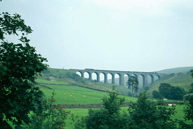
Arten Gill Viaduct

Arten Gill Viaduct is an eleven-arch railway bridge in Dentdale, Cumbria, England. The viaduct carries the Settle to Carlisle railway line over Artengill...

Stone House, Cumbria

Stone House is a locality at Dent Head on the River Dee, in the county of Cumbria, England, to the south-east of Cowgill and to the north-west of Newby...

Dent railway station

Dent is a railway station on the Settle and Carlisle Line, which runs between Carlisle and Leeds via Settle. The station, situated 58 miles 29 chains...

Nearby Amenities

Located within 500m of 54.280111,-2.3372537
Man Made: cairn
Lat/Long: 54.2808039/-2.3392663
The data included in this document is from www.openstreetmap.org. The data is made available under ODbL.

Have you been to Pikes Moss?

Leave your review of Pikes Moss below (or comments, questions and feedback).