Castlemorton Common

Downs, Moorland in Worcestershire Malvern Hills

England

Castlemorton Common

Dog walkers on the Malvern Hills Dog walkers on a path below the British Camp in the Malvern Hills.
Dog walkers on the Malvern Hills Credit: Philip Halling

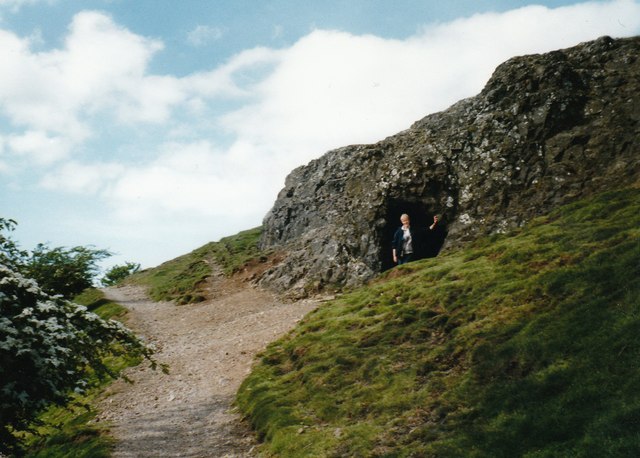
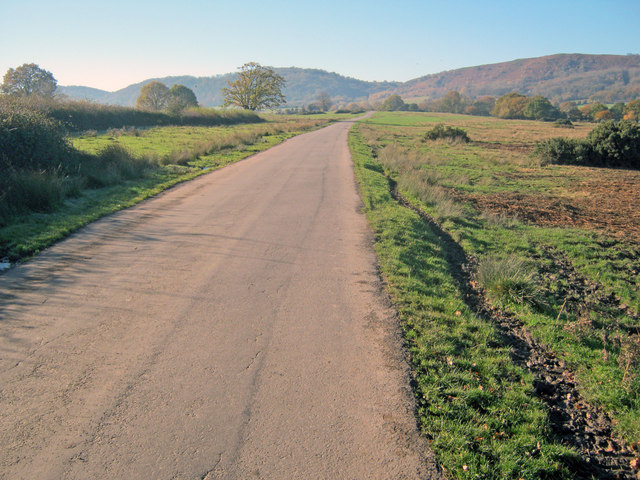
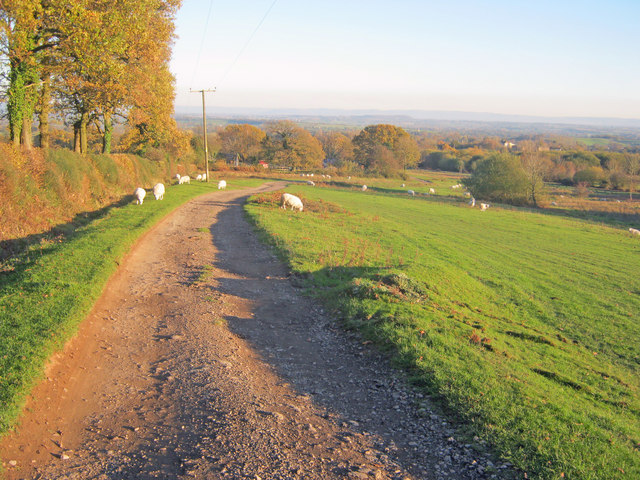
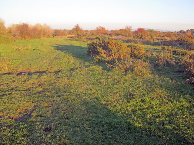
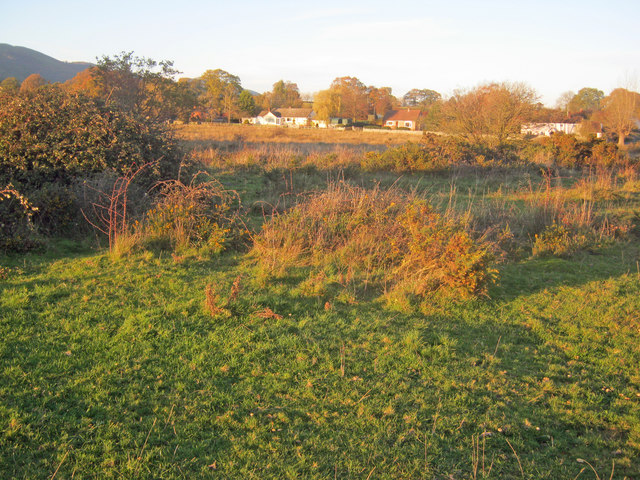
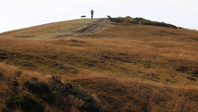
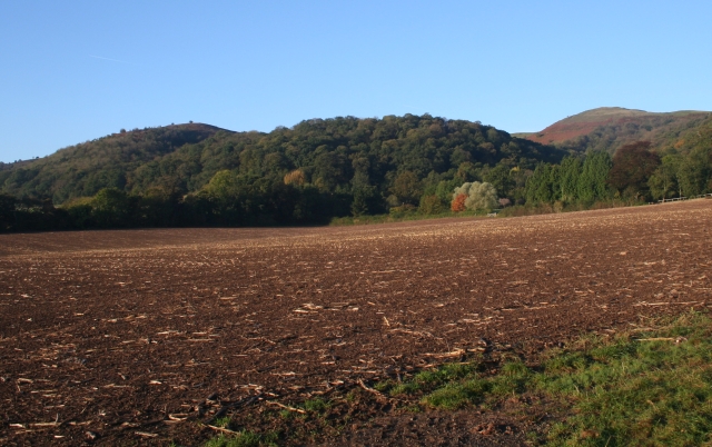
Castlemorton Common is a vast expanse of natural beauty located in Worcestershire, England. Spanning over 850 acres, this common is a combination of downs and moorland, offering a diverse and captivating landscape for visitors to explore.

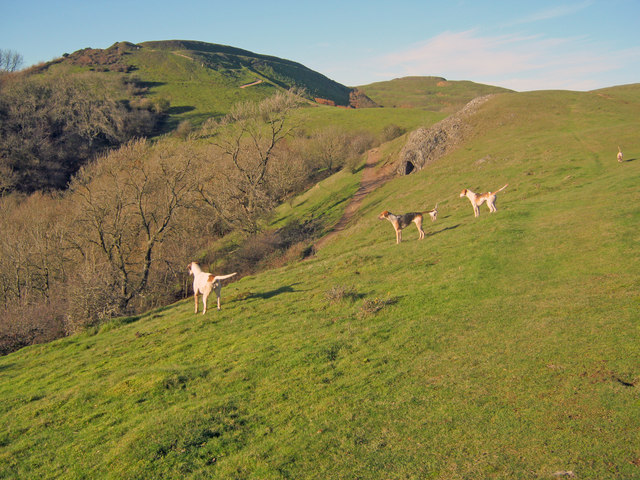
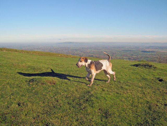
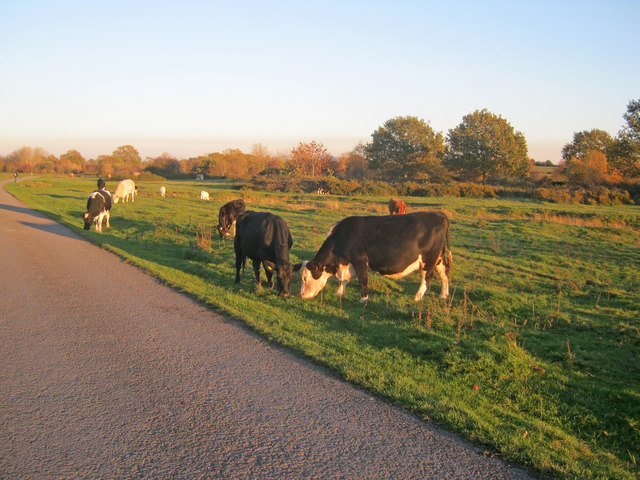
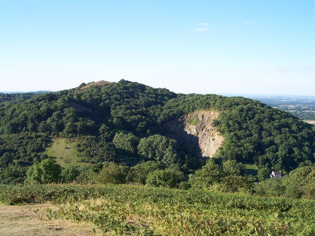
Situated on the western slopes of the Malvern Hills, Castlemorton Common boasts stunning panoramic views of the surrounding countryside. The common is characterized by its rolling hills, open grasslands, and heather-covered moorland, providing a habitat for a rich variety of flora and fauna.

One of the main attractions of Castlemorton Common is the abundance of walking trails that crisscross the area. These paths cater to all abilities, from leisurely strolls to more challenging hikes, offering visitors the opportunity to immerse themselves in the natural beauty of the common. Along the way, walkers may encounter a variety of wildlife, including birds, butterflies, and small mammals.

In addition to its natural beauty, Castlemorton Common also holds historical significance. The area was once the site of protests against the Criminal Justice and Public Order Act of 1994, which led to the infamous week-long rave known as the Castlemorton Common Festival. This event attracted thousands of party-goers and resulted in changes to the UK's laws regarding outdoor events.

Today, Castlemorton Common remains a peaceful and tranquil location, attracting nature enthusiasts, walkers, and those seeking a serene escape from the bustle of everyday life. With its stunning vistas, diverse ecosystems, and rich history, it is no wonder that Castlemorton Common is a cherished gem of Worcestershire.

If you have any feedback on the listing, please let us know in the comments section below.

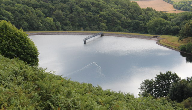
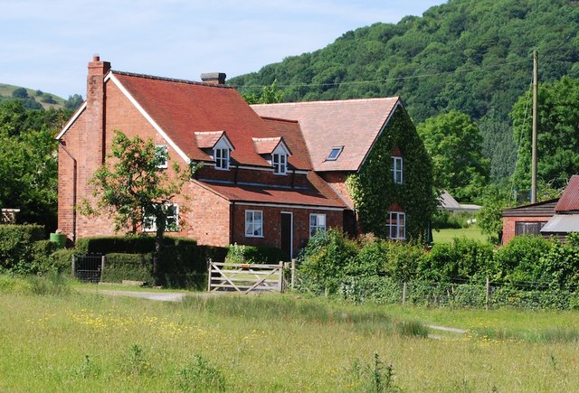
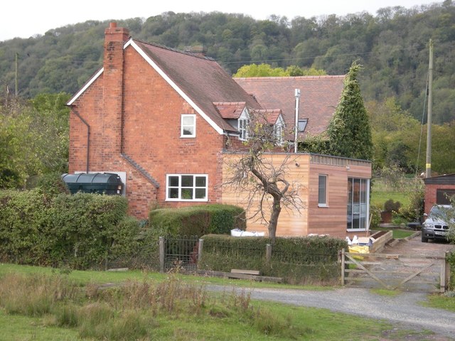
Castlemorton Common Images

Images are sourced within 2km of 52.046124/-2.3264105 or Grid Reference SO7738. Thanks to Geograph Open Source API. All images are credited.

Dog walkers on the Malvern Hills Dog walkers on a path below the British Camp in the Malvern Hills.
Dog walkers on the Malvern Hills
Dog walkers on a path below the British Camp in the Malvern Hills.
Path below the British Camp Path below the British Camp, a large Iron Age hill fort which is on the Herefordshire Beacon.  This path is followed by the Three Choirs Way.
Path below the British Camp
Path below the British Camp, a large Iron Age hill fort which is on the Herefordshire Beacon. This path is followed by the Three Choirs Way.
The Malvern Hills on Christmas Day View of the Malvern Hills from the summit of Millennium Hill, during a dog walk on Christmas Day.  The British Camp on the Herefordshire Beacon can be seen in the middle distance, with the spine of the Malvern Hills in the distance.  This was taken at 10:43 on Christmas morning.  A little early for the regular Geograph midday picture but due to family commitments it was not possible to take it closer to noon.
The Malvern Hills on Christmas Day
View of the Malvern Hills from the summit of Millennium Hill, during a dog walk on Christmas Day. The British Camp on the Herefordshire Beacon can be seen in the middle distance, with the spine of the Malvern Hills in the distance. This was taken at 10:43 on Christmas morning. A little early for the regular Geograph midday picture but due to family commitments it was not possible to take it closer to noon.
Giant's Cave, Hangman's Hill, Malvern Hills
Cattle on Castlemorton Common Looking north-west from near Hurst Farm towards Pinnacle Hill in the background. Cattle spend most of the year on the common, managed by commoners under licence from the Malvern Hills Conservators.
Cattle on Castlemorton Common
Looking north-west from near Hurst Farm towards Pinnacle Hill in the background. Cattle spend most of the year on the common, managed by commoners under licence from the Malvern Hills Conservators.
Castlemorton Common Looking south-west along the south edge of the large common stretching right up to the foot of the Malvern Hills.
Castlemorton Common
Looking south-west along the south edge of the large common stretching right up to the foot of the Malvern Hills.
Cattle on Castlemorton Common - 2 Looking west with Little Malvern Priory in the background.
Cattle on Castlemorton Common - 2
Looking west with Little Malvern Priory in the background.
Lane across Castlemorton Common Long straight lane heading towards Hollybush. Popular route for weekend picnics as it is possible to park on many of the green spaces.
Lane across Castlemorton Common
Long straight lane heading towards Hollybush. Popular route for weekend picnics as it is possible to park on many of the green spaces.
Hounds on Broad Down View north to the Herefordshire Beacon with Clutter's Cave just ahead. The Ledbury Hunt is scouring the Eastnor estate off to the left and these hounds have come up to the hilltop to check things out.
Hounds on Broad Down
View north to the Herefordshire Beacon with Clutter's Cave just ahead. The Ledbury Hunt is scouring the Eastnor estate off to the left and these hounds have come up to the hilltop to check things out.
Hound on Broad Down A member of the Ledbury Hunt pack bounds across the top of the down. Bredon Hill and the Cotswold escarpment in the distance to the east.
Hound on Broad Down
A member of the Ledbury Hunt pack bounds across the top of the down. Bredon Hill and the Cotswold escarpment in the distance to the east.
Track across Castlemorton Common Heading east towards Bowling Green.
Track across Castlemorton Common
Heading east towards Bowling Green.
Scrubland at Castlemorton Common View east with Bredon Hill just visible on the horizon. The evening sun highlights the mixture of rough grazing, gorse and scrub in this more inaccessible part of the common.
Scrubland at Castlemorton Common
View east with Bredon Hill just visible on the horizon. The evening sun highlights the mixture of rough grazing, gorse and scrub in this more inaccessible part of the common.
West side of Castlemorton Common Looking north to the cottages on Hancock's Lane lit up by the evening sun.
West side of Castlemorton Common
Looking north to the cottages on Hancock's Lane lit up by the evening sun.
Cattle grazing near Hancocks Lane Cattle are always to be found somewhere on the common where commoners exercise their grazing rights.
Cattle grazing near Hancocks Lane
Cattle are always to be found somewhere on the common where commoners exercise their grazing rights.
Millennium Hill, Malvern Hills The hill is the southern of two peaks included in the iron-age hill fort known as British Camp.
Almost all of the Malvern Hills is under the care of the Malvern Hills Conservators and is open to the public and very popular with dog walkers.
Millennium Hill, Malvern Hills
The hill is the southern of two peaks included in the iron-age hill fort known as British Camp. Almost all of the Malvern Hills is under the care of the Malvern Hills Conservators and is open to the public and very popular with dog walkers.
Wake detection, British Camp reservoir The ducks were almost invisible (to my eyes), but with the sun at the right angle the wake indicates their location.
The reservoir is no longer used as a water supply, but it remains as an iconic reminder of Victorian engineering and it is also a picturesque scene
Wake detection, British Camp reservoir
The ducks were almost invisible (to my eyes), but with the sun at the right angle the wake indicates their location. The reservoir is no longer used as a water supply, but it remains as an iconic reminder of Victorian engineering and it is also a picturesque scene
'Ambleside' Castlemorton Common 2009 A large victorian house, considerably extended with matching gables, tiles and brickwork.
'Ambleside' Castlemorton Common 2009
A large victorian house, considerably extended with matching gables, tiles and brickwork.
Ambleside, Castlemorton Common 2011 Large Victorian House now altered and extended. 

Design by Josh Thomas Design House, Ledbury.
<span class="nowrap"><a title="http://www.joshthomasdesignhouse.co.uk/architecture/" rel="nofollow ugc noopener" href="http://www.joshthomasdesignhouse.co.uk/architecture/">Link</a><img style="margin-left:2px;" alt="External link" title="External link - shift click to open in new window" src="https://s1.geograph.org.uk/img/external.png" width="10" height="10"/></span>
Ambleside, Castlemorton Common 2011
Large Victorian House now altered and extended. Design by Josh Thomas Design House, Ledbury. LinkExternal link
Show me another place!

Castlemorton Common is located at Grid Ref: SO7738 (Lat: 52.046124, Lng: -2.3264105)

Administrative County: Worcestershire

District: Malvern Hills

Police Authority: West Mercia

What 3 Words

///dictation.defends.version. Near Ledbury, Herefordshire

Related Wikis

Castlemorton Common Festival

The Castlemorton Common Festival was a week-long free festival and rave held in the Malvern Hills near Malvern, Worcestershire, England between 22 and...

Hollybed Farm Meadows

Hollybed Farm Meadows is nature reserve of the Worcestershire Wildlife Trust, about 1 mile (1.6 km) west of the village of Castlemorton, in Worcestershire...

Swinyard Hill

Swinyard Hill is a hill in the Malvern Range, a line of hills that runs approximately 13 kilometres (8 mi) north-south along the Herefordshire-Worcestershire...

Tinkers Hill

Tinkers Hill is situated in the range of Malvern Hills that runs about 13 kilometres (8 mi) north-south along the Herefordshire-Worcestershire border....

Little Malvern

Little Malvern is a small village and civil parish in Worcestershire, England. It is situated on the lower slopes of the Malvern Hills, south of Malvern...

Midsummer Hill

Midsummer Hill is situated in the range of Malvern Hills that runs approximately 13 kilometres (8 mi) north-south along the Herefordshire-Worcestershire...

Hollybush Hill

Hollybush Hill is situated in the range of Malvern Hills that runs approximately 13 kilometres (8 mi) north–south along the Herefordshire–Worcestershire...

Hollybush, Worcestershire

Hollybush is a small village in Worcestershire at the southern end of the Malvern Hills and close to the borders of both Gloucestershire and Herefordshire...

Nearby Amenities

Located within 500m of 52.046124,-2.3264105
Chandler's Cross
Naptan AtcoCode: 2000G063500
Naptan Bearing: NW
Naptan BusStopType: CUS
Naptan CommonName: Chandler's Cross
Naptan Indicator: Adj
Naptan Landmark: Chandler's Farm
Naptan NaptanCode: wocdjpag
Naptan Street: New Road
Naptan Verified: no
Source: naptan_import
Lat/Long: 52.042566/-2.3250691
Post Box
Historic Operator: Royal Mail
Note: No collection plate
Note2: Looks like it's been nicked and then replaced. Why on Earth do RM replace a nicked box in THE SAME PLACE ?
Post Box Type: lamp
Ref: WR13 90
Lat/Long: 52.0425687/-2.3249404
Hollybed Farm Meadows
Addr City: Castlemorton
Addr Housename: New Road Worcestershire
Addr Postcode: WR13 6BU
Addr Street: New Road
Leisure: nature_reserve
Source: http://www.worcswildlifetrust.co.uk/reserves/hollybedfarmmeadows
Lat/Long: 52.0421138/-2.3237978
Power: pole
Lat/Long: 52.0500349/-2.3299538
Power: pole
Lat/Long: 52.0491965/-2.3307612
Power: pole
Lat/Long: 52.0484076/-2.3313392
Power: pole
Lat/Long: 52.0474785/-2.3320319
Bowling Green
Power: pole
Transformer: distribution
Voltage Primary: 11000
Lat/Long: 52.0459023/-2.3303501
Power: pole
Lat/Long: 52.046184/-2.3309892
Power: pole
Lat/Long: 52.0464859/-2.3316772
Power: pole
Lat/Long: 52.0468537/-2.332508
Power: pole
Lat/Long: 52.0462825/-2.3331249
Power: pole
Lat/Long: 52.0418737/-2.3276793
Power: pole
Lat/Long: 52.0433552/-2.3239195
Mission Room
Power: pole
Transformer: distribution
Voltage Primary: 11000
Lat/Long: 52.0445545/-2.3262866
Power: pole
Lat/Long: 52.0445698/-2.3254303
Power: pole
Lat/Long: 52.044583/-2.3246545
Power: pole
Lat/Long: 52.0446081/-2.3240778
Eight Oaks
Power: pole
Transformer: distribution
Voltage Primary: 220000
Lat/Long: 52.0445521/-2.3235521
Power: pole
Lat/Long: 52.0441636/-2.3236728
Power: pole
Lat/Long: 52.0437767/-2.3237841
Plough Inn
Power: pole
Transformer: distribution
Voltage Primary: 11000
Lat/Long: 52.0430067/-2.3240248
Power: pole
Lat/Long: 52.0426536/-2.3241395
Power: pole
Lat/Long: 52.0423509/-2.3242629
The data included in this document is from www.openstreetmap.org. The data is made available under ODbL.

Have you been to Castlemorton Common?

Leave your review of Castlemorton Common below (or comments, questions and feedback).