Hannington Wick

Settlement in Wiltshire

England

Hannington Wick

Stone Buildings in Hannington At the top of Nell Hill.
Stone Buildings in Hannington Credit: Des Blenkinsopp

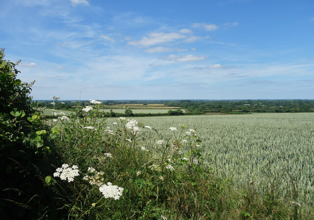
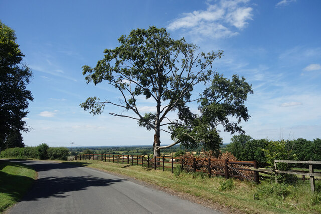
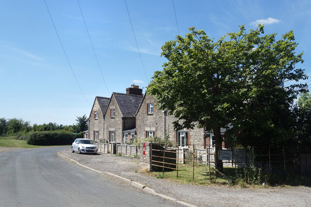
Hannington Wick is a picturesque village located in the county of Wiltshire, England. Situated in the south-western part of the county, the village is nestled in the rolling hills of the North Wessex Downs, an Area of Outstanding Natural Beauty. It is part of the civil parish of Hannington, which also includes the nearby village of Hannington.

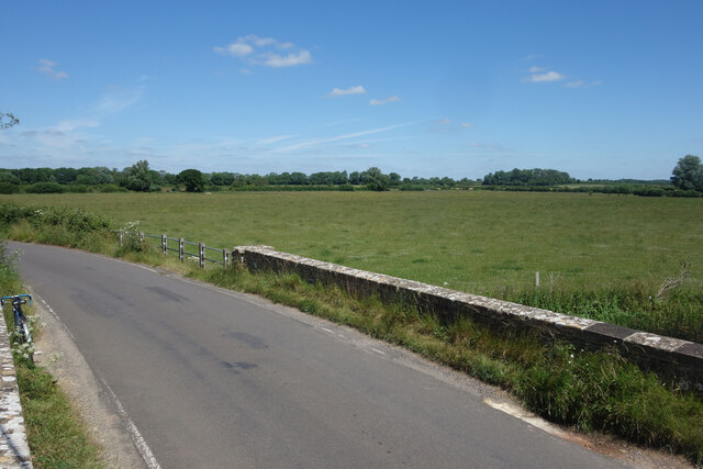
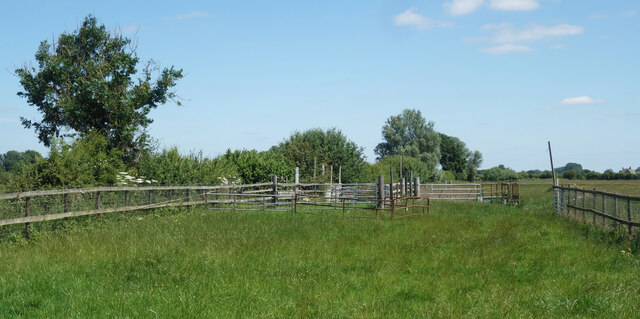
The village is known for its rural charm and tranquil atmosphere. It is characterized by a collection of traditional stone cottages, many of which date back several centuries. The surrounding countryside provides a stunning backdrop, with vast open fields, meandering streams, and patches of woodland.

Although small in size, Hannington Wick has a strong sense of community. The village is home to a close-knit population that takes pride in maintaining its rural heritage. Local amenities include a village hall, which hosts various community events and gatherings, and a well-regarded primary school.

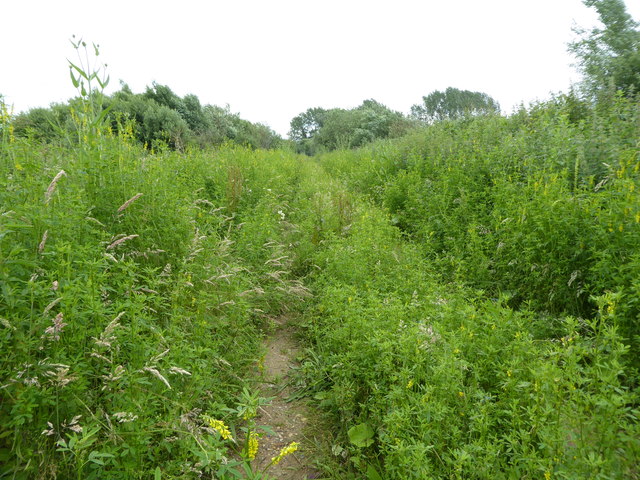
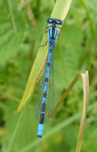
The area surrounding Hannington Wick offers plenty of opportunities for outdoor activities and exploration. The village is surrounded by numerous walking trails, where visitors can enjoy the beauty of the countryside and spot local wildlife. Additionally, the nearby River Thames allows for boating and fishing activities.

Overall, Hannington Wick is a charming and idyllic village that provides a peaceful and picturesque retreat for residents and visitors alike. Its natural beauty, strong community spirit, and access to the great outdoors make it a desirable place to live and explore.

If you have any feedback on the listing, please let us know in the comments section below.

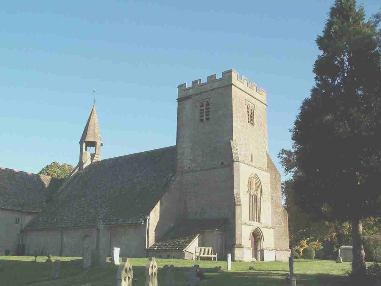
Hannington Wick Images

Images are sourced within 2km of 51.656892/-1.749009 or Grid Reference SU1795. Thanks to Geograph Open Source API. All images are credited.

Stone Buildings in Hannington At the top of Nell Hill.
Stone Buildings in Hannington
At the top of Nell Hill.
Scenery at Hannington Bridge Standing on the bridge parapet for a better look around. This is pretty much it. Thames flood plain, meadowland and trees.
Scenery at Hannington Bridge
Standing on the bridge parapet for a better look around. This is pretty much it. Thames flood plain, meadowland and trees.
Stock Fencing in a Field Some sort of corral arrangement.
Stock Fencing in a Field
Some sort of corral arrangement.
Ham Lane, Kempsford The big street name board has a list of all the places it leads to.
The quarry isn't one of them.
Ham Lane, Kempsford
The big street name board has a list of all the places it leads to. The quarry isn't one of them.
Poplar Trees near Kempsford
Sky, Crops and a Tree The flat landscape of the upper Thames valley. A random shot of healthy looking farmland.
Kempsford church tower is just visible behind the far trees.
Sky, Crops and a Tree
The flat landscape of the upper Thames valley. A random shot of healthy looking farmland. Kempsford church tower is just visible behind the far trees.
Signpost on the Bridleway I would guess most walkers cross SU1695 on the Thames Path along the north of the square, by the trees on the horizon.
But the bridleway a bit to the south is an alternative. It looks fairly well used.
Another path heads off southwards just here.
Signpost on the Bridleway
I would guess most walkers cross SU1695 on the Thames Path along the north of the square, by the trees on the horizon. But the bridleway a bit to the south is an alternative. It looks fairly well used. Another path heads off southwards just here.
Along the Bridleway Two paths cross SU1695. The Thames Path by the river and this one through the fields.
Along the Bridleway
Two paths cross SU1695. The Thames Path by the river and this one through the fields.
View from Lus Hill Lus Hill isn't very high and this isn't the top, but the map contours are putting us 25 metres or so above the flat Thames Valley to the north. That's enough for quite a wide view over a predominantly agricultural landscape.
View from Lus Hill
Lus Hill isn't very high and this isn't the top, but the map contours are putting us 25 metres or so above the flat Thames Valley to the north. That's enough for quite a wide view over a predominantly agricultural landscape.
Road on Lus Hill The road from Hannington to Castle Eaton goes through the SW corner of SU1694.
Road on Lus Hill
The road from Hannington to Castle Eaton goes through the SW corner of SU1694.
View from Lus Hill Looking NE from near the top of Lus Hill at an elevation of around 100 metres.
View from Lus Hill
Looking NE from near the top of Lus Hill at an elevation of around 100 metres.
Houses at Lus Hill There is a large house at the top of the hill, a farm about half way down and these roadside houses are at the bottom of the hill.
An old post box is outside the nearest one.
Houses at Lus Hill
There is a large house at the top of the hill, a farm about half way down and these roadside houses are at the bottom of the hill. An old post box is outside the nearest one.
30 mph through Hannington Wick Speed limit signs outside Box Hedge Farm. This is the southernmost of the seven named farms which make up the small hamlet of Hannington Wick.
In quick succession after Box Hedge Farm come Pond, Cherry Tree, Manor, Sycamore Tree, Yew Tree and Bridge Farms, all in just over 1 km.
30 mph through Hannington Wick
Speed limit signs outside Box Hedge Farm. This is the southernmost of the seven named farms which make up the small hamlet of Hannington Wick. In quick succession after Box Hedge Farm come Pond, Cherry Tree, Manor, Sycamore Tree, Yew Tree and Bridge Farms, all in just over 1 km.
Flag at Sycamore Tree Farm One of the many flags put up for Queen Elizabeth's Platinum Jubilee in June 2022. It's outside one of the seven farms in the hamlet of Hannington Wick.
Flag at Sycamore Tree Farm
One of the many flags put up for Queen Elizabeth's Platinum Jubilee in June 2022. It's outside one of the seven farms in the hamlet of Hannington Wick.
Thames Path at Hannington Wick On a well maintained bit of farm track for a while.
Thames Path at Hannington Wick
On a well maintained bit of farm track for a while.
Along the Thames Path An inevitable similarity to the pictures of the Thames Path in SU1895. It's not the most stunning section of the route, along a farm track at some distance from the Thames.
Along the Thames Path
An inevitable similarity to the pictures of the Thames Path in SU1895. It's not the most stunning section of the route, along a farm track at some distance from the Thames.
Green Lane, near Kempsford Route with public access/recreational path along low-lying land between opencast gravel workings.
Green Lane, near Kempsford
Route with public access/recreational path along low-lying land between opencast gravel workings.
Damselfly, Green Lane, near Kempsford The luxuriant verdure and low-lying nature of Green Lane make it an ideal habitat for the Damselfly, which is present in its hundreds at the end of June, flitting about like sparks of electricity.
Damselfly, Green Lane, near Kempsford
The luxuriant verdure and low-lying nature of Green Lane make it an ideal habitat for the Damselfly, which is present in its hundreds at the end of June, flitting about like sparks of electricity.
Show me another place!

Hannington Wick is located at Grid Ref: SU1795 (Lat: 51.656892, Lng: -1.749009)

Unitary Authority: Swindon

Police Authority: Wiltshire

What 3 Words

///vast.fault.fulfilled. Near Hannington, Wiltshire

Nearby Locations

Hannington Wick

Related Wikis

Hannington Bridge

Hannington Bridge is a road bridge across the River Thames in England. It carries a minor road between Kempsford in Gloucestershire and Hannington Wick...

Church of St Mary the Virgin, Kempsford

The Anglican Church of St Mary the Virgin at Kempsford in the Cotswold District of Gloucestershire, England was built in the 12th century. It is a grade...

Kempsford

Kempsford is a village and civil parish in Gloucestershire, England, about 2.5 miles (4 km) south of Fairford. RAF Fairford is immediately north of the...

Hannington, Wiltshire

Hannington is a village and civil parish in Wiltshire, England, about 2 miles (3.2 km) north-west of Highworth, within the Borough of Swindon. The parish...

Hannington Hall

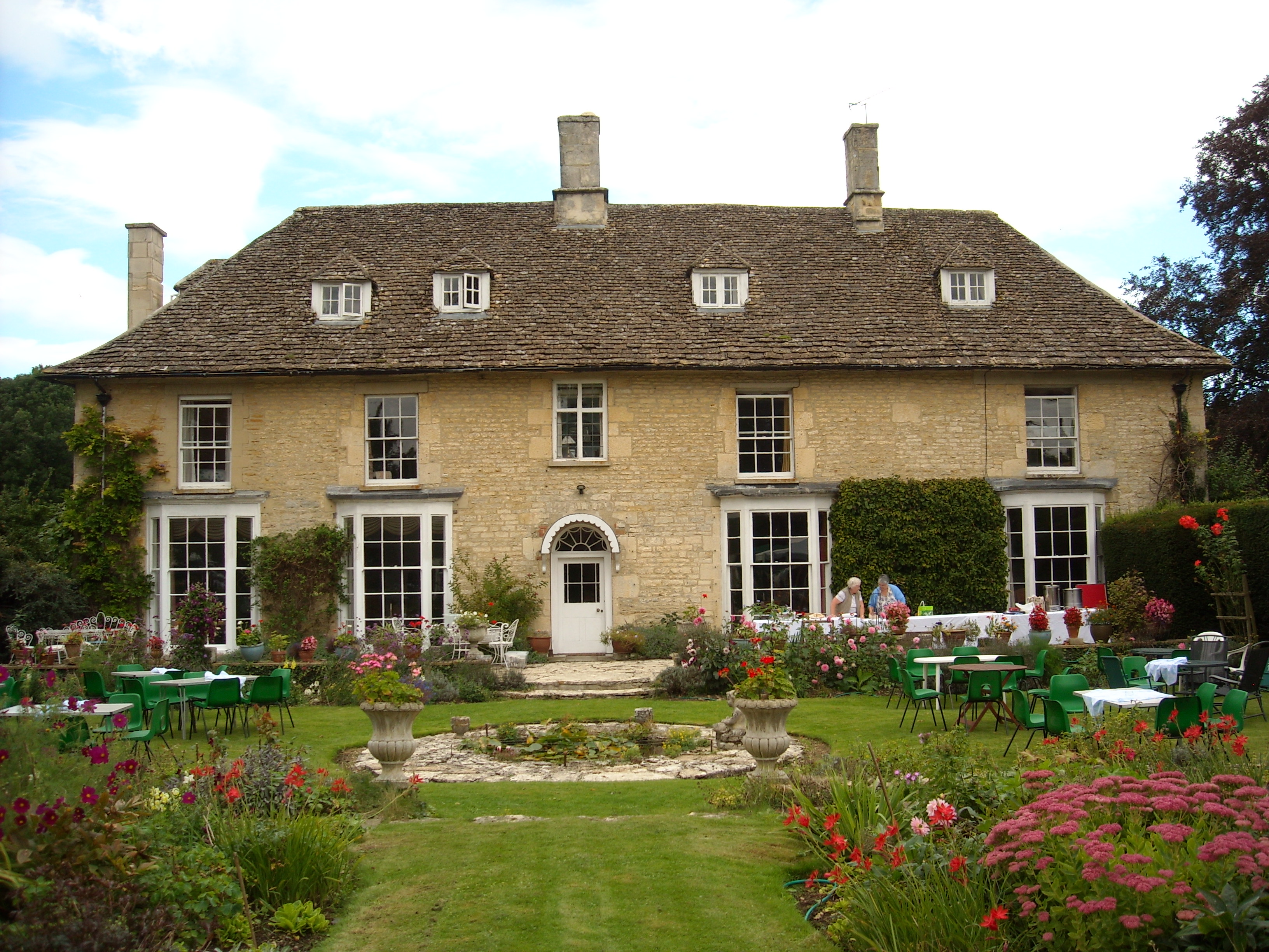
Hannington Hall is a Grade II* listed country house in the village of Hannington, Wiltshire, England. The house was built in 1653 by the Freke family,...

Castle Eaton

Castle Eaton is a village and civil parish in the ceremonial county of Wiltshire, England, on the River Thames about 4 miles (6.4 km) northwest of Highworth...

Castle Eaton Bridge

Castle Eaton Bridge is a road bridge across the River Thames in England at Castle Eaton in Wiltshire. It carries a minor road between Cricklade, 4 miles...

Hannington railway station

Hannington railway station is a former railway station near Hannington, in Wiltshire, England on the Highworth Branch Line from Swindon. The station was...

Nearby Amenities

Located within 500m of 51.656892,-1.749009
Hannington Wick
Created By: Potlatch 0.10f
Place: hamlet
Wikidata: Q26818025
Lat/Long: 51.6555273/-1.7520011
Post Box
Lat/Long: 51.6561855/-1.7512738
Power: pole
Source: Bing
Lat/Long: 51.6586973/-1.7532099
Power: pole
Source: Bing
Lat/Long: 51.6609351/-1.7501093
Power: pole
Source: Bing
Lat/Long: 51.6597919/-1.751724
Power: pole
Source: Bing
Lat/Long: 51.6561164/-1.7546234
Power: pole
Source: Bing
Lat/Long: 51.6592561/-1.7524267
Power: pole
Source: Bing
Lat/Long: 51.6563776/-1.7534138
Power: pole
Source: Bing
Lat/Long: 51.6575591/-1.7541326
Power: pole
Source: Bing
Lat/Long: 51.6603809/-1.7509166
Power: pole
Source: Bing
Lat/Long: 51.6575856/-1.7532636
Power: pole
Source: Bing
Lat/Long: 51.6579585/-1.7530544
Crossing
Lat/Long: 51.6585697/-1.751793
The data included in this document is from www.openstreetmap.org. The data is made available under ODbL.

Have you been to Hannington Wick?

Leave your review of Hannington Wick below (or comments, questions and feedback).