Kingswood Common

Downs, Moorland in Northumberland

England

Kingswood Common

Fell House Farm
Fell House Farm Credit: David Purchase

Kingswood Common is a picturesque natural area located in the county of Northumberland, England. Spread across a sprawling landscape, it encompasses a diverse range of terrains, including downs, moorland, and woodland. The common is situated in close proximity to the village of Kingswood, adding to its charm and accessibility.

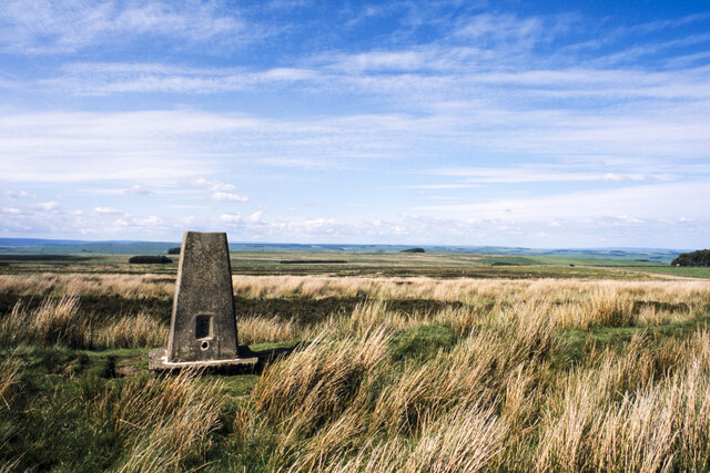
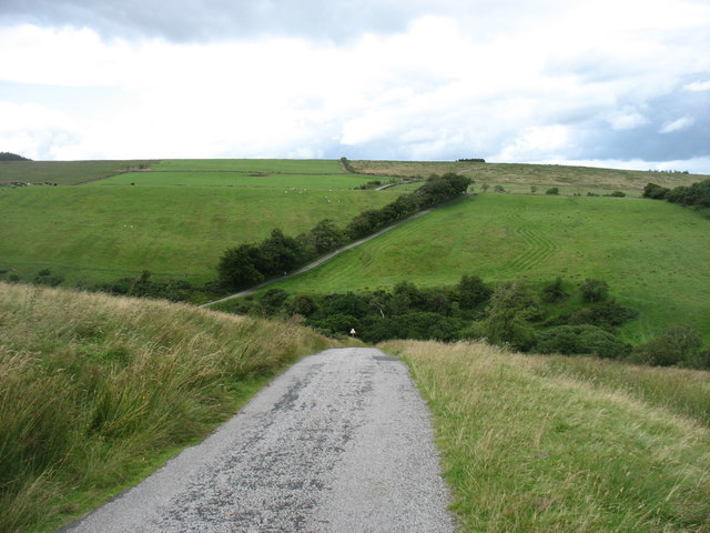
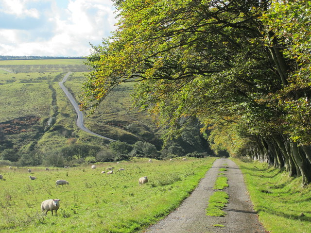
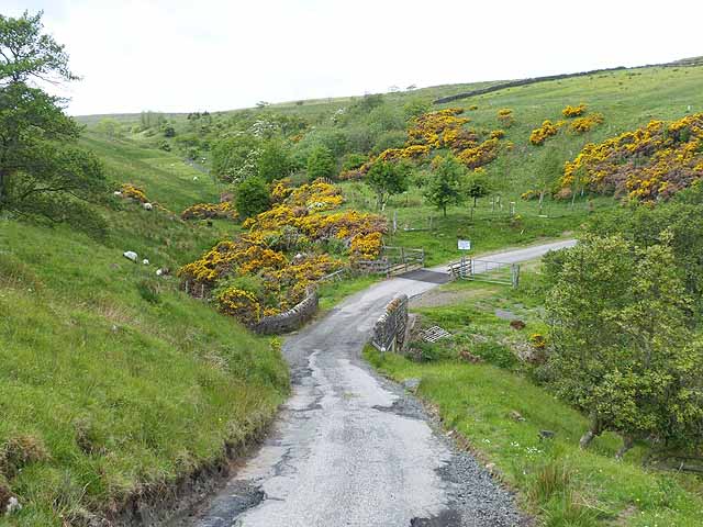
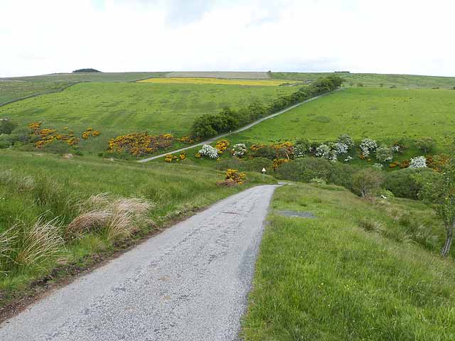
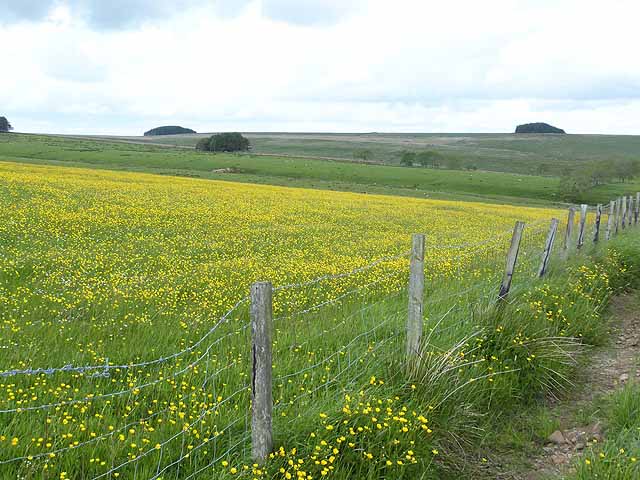
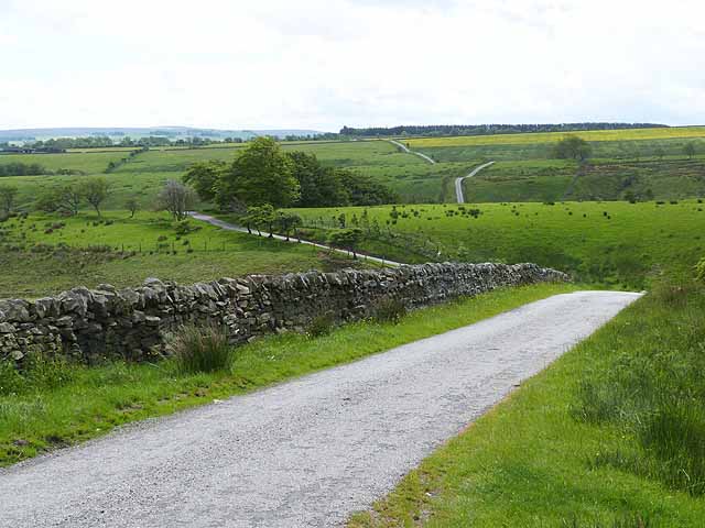
The downs of Kingswood Common are characterized by their gently rolling hills and expansive grasslands. These open spaces offer breathtaking panoramic views of the surrounding countryside, making it a popular spot for hikers and nature enthusiasts. The downs are dotted with wildflowers during the spring and summer months, creating a vibrant and colorful display.

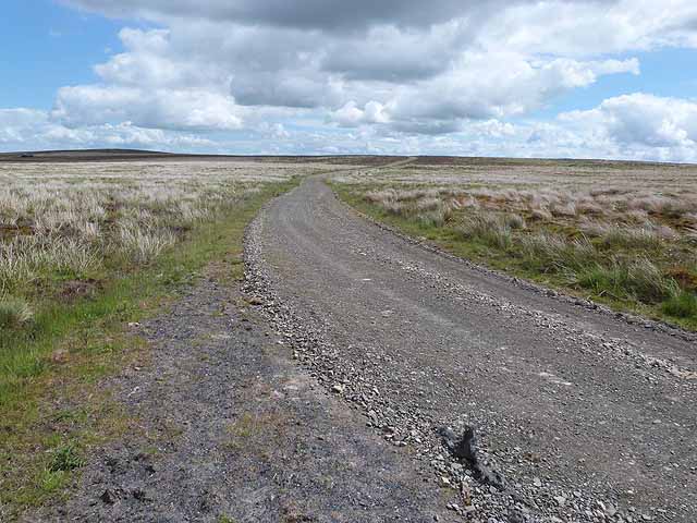
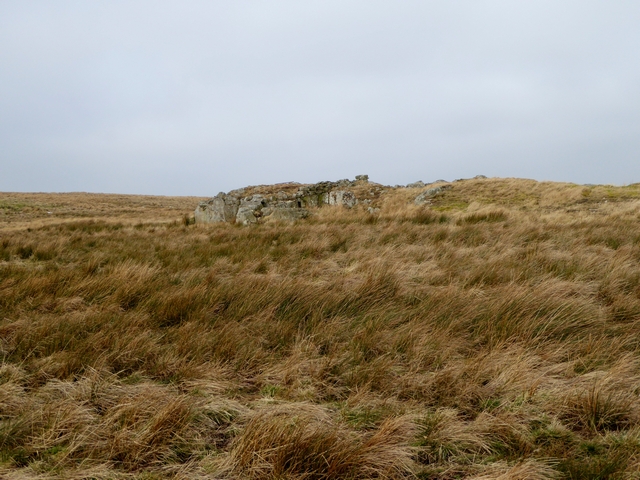
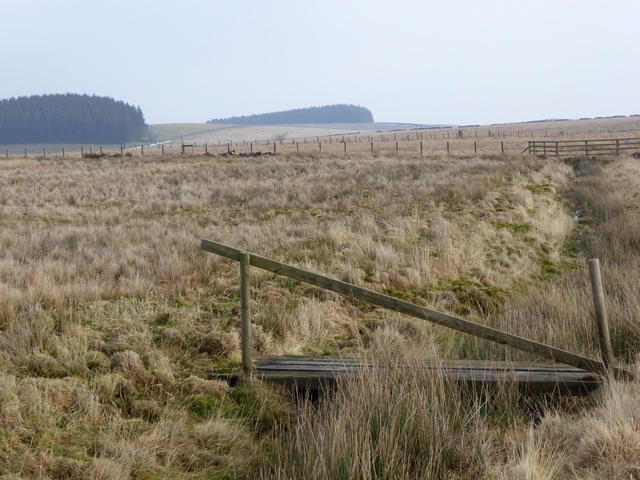
Moving towards the moorland areas of Kingswood Common, visitors will be greeted by a more rugged and untamed landscape. Here, heather-covered hills stretch as far as the eye can see, providing a habitat for a variety of wildlife. The moorland is home to numerous bird species, including the iconic red grouse, which can often be spotted darting across the heath.

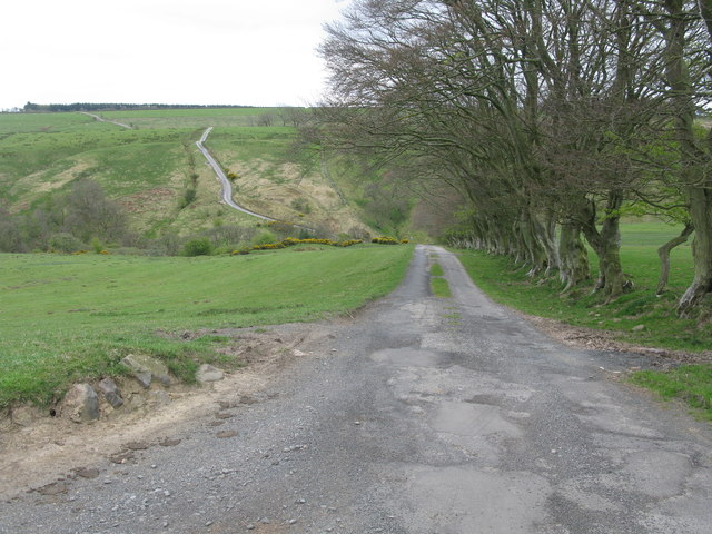
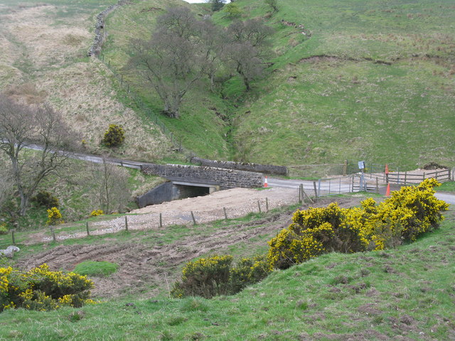
Nestled within the common are pockets of ancient woodland, adding a touch of enchantment to the area. These woodlands are a haven for flora and fauna, with towering trees, mossy rocks, and babbling brooks creating a serene and peaceful atmosphere. Walking trails meander through the woods, allowing visitors to explore and discover the hidden treasures within.

Kingswood Common, with its diverse landscapes and natural beauty, provides a tranquil escape for those seeking solace in nature. Whether it's the rolling downs, the wild moorland, or the enchanting woodlands, this common offers something for everyone to enjoy.

If you have any feedback on the listing, please let us know in the comments section below.

Kingswood Common Images

Images are sourced within 2km of 54.936979/-2.3808467 or Grid Reference NY7560. Thanks to Geograph Open Source API. All images are credited.

Fell House Farm
Fell House Farm
Moorland of Beacon Hill with trig point Beacon Hill is part of Fellhouse Fell, close to Whitfield in West Allendale.
Moorland of Beacon Hill with trig point
Beacon Hill is part of Fellhouse Fell, close to Whitfield in West Allendale.
The lane to Whitfield As others have noted, it is a bit of a switchback!
The lane to Whitfield
As others have noted, it is a bit of a switchback!
The lane to Beltingham As others have pointed out, this is a real 'switchback' road. Ahead is the dip for the Kingswood Burn.
The lane to Beltingham
As others have pointed out, this is a real 'switchback' road. Ahead is the dip for the Kingswood Burn.
Start of the steep descent to the Kingswood Burn Steep descent and an even steeper ascent on the other side of the burn. The road is much steeper than is apparent in the photograph, 1 in 4 in places.
Start of the steep descent to the Kingswood Burn
Steep descent and an even steeper ascent on the other side of the burn. The road is much steeper than is apparent in the photograph, 1 in 4 in places.
Bridge over the Kingswood Burn At the foot of very steep descents on both sides of the burn.
Bridge over the Kingswood Burn
At the foot of very steep descents on both sides of the burn.
The cleugh of Kingswood Burn (6)
Plaques on Plenmeller Common The left hand plaque reads 

"Plenmeller Site opened b Mr John H Northard CBE Deputy Chairman British Coal Corporation 19th September 1991"

The right hand plaque reads

"1.91 Million tonnes of coal recovered Site completed May 2002 UK Coal Mining Ltd"
Plaques on Plenmeller Common
The left hand plaque reads "Plenmeller Site opened b Mr John H Northard CBE Deputy Chairman British Coal Corporation 19th September 1991" The right hand plaque reads "1.91 Million tonnes of coal recovered Site completed May 2002 UK Coal Mining Ltd"
Public byway to Whinshield Side A good stone road was constructed along the line of this byway to facilitate open cast mining over the period 1991 to 2002.
Public byway to Whinshield Side
A good stone road was constructed along the line of this byway to facilitate open cast mining over the period 1991 to 2002.
The Cleugh of Kingswood Burn A little-used road descends by a 1 in 4 hill to the floor of this valley before climbing almost as precipitously on the far side.
The Cleugh of Kingswood Burn
A little-used road descends by a 1 in 4 hill to the floor of this valley before climbing almost as precipitously on the far side.
Looking across the Cleugh of Kingswood Burn A little-used road descends by a 1 in 4 hill to the floor of this valley before climbing almost as precipitously on the other side.
Looking across the Cleugh of Kingswood Burn
A little-used road descends by a 1 in 4 hill to the floor of this valley before climbing almost as precipitously on the other side.
Field of buttercups near Huntershield Farm Buttercups seem to be particularly rampant this year.
Field of buttercups near Huntershield Farm
Buttercups seem to be particularly rampant this year.
Switchback road In the middle distance, the road descends precipitously to cross the Kingswood Burn before climbing by a 1 in 4 hill to regain the plateau. The far field  to the right can also be seen at <a href="https://www.geograph.org.uk/photo/3516949">NY7760 : Field of buttercups near Huntershield Farm</a>.
Switchback road
In the middle distance, the road descends precipitously to cross the Kingswood Burn before climbing by a 1 in 4 hill to regain the plateau. The far field to the right can also be seen at NY7760 : Field of buttercups near Huntershield Farm.
Old bridge on Blackcleugh Burn Primitive bridge composed of slabs of stone.
Old bridge on Blackcleugh Burn
Primitive bridge composed of slabs of stone.
Flooded quarry in the valley of the Blackcleugh Burn.
War memorial cairn on Plenmeller Common This unusual cairn poised on an overhang was constructed to commemorate the fallen of the 1914-18 war by the Tynedale Shepherds. The plinth nearby contains the dedication. The Ordnance Survey map apparently identifies this cairn as a currick, although this is hardly a correct identification, The nearby moorland to the north is called "Curricks Rigg" and there is a much older cairn on the summit which might well be a currick (see <a href="https://www.geograph.org.uk/photo/1913146">NY7461 : Currick on Curricks Rigg</a>).
War memorial cairn on Plenmeller Common
This unusual cairn poised on an overhang was constructed to commemorate the fallen of the 1914-18 war by the Tynedale Shepherds. The plinth nearby contains the dedication. The Ordnance Survey map apparently identifies this cairn as a currick, although this is hardly a correct identification, The nearby moorland to the north is called "Curricks Rigg" and there is a much older cairn on the summit which might well be a currick (see NY7461 : Currick on Curricks Rigg).
Rock outcrop on Rock House Fell
Footbridge and ditch below Rock House Fell
Show me another place!

Kingswood Common is located at Grid Ref: NY7560 (Lat: 54.936979, Lng: -2.3808467)

Unitary Authority: Northumberland

Police Authority: Northumbria

What 3 Words

///recliner.dirt.equipment. Near Bardon Mill, Northumberland

Nearby Locations

Kingswood Common

Related Wikis

Whitfield, Northumberland

Whitfield is a village and former civil parish, now in the parish of Plenmeller with Whitfield, in the county of Northumberland, England about 10 miles...

Unthank Hall

Unthank Hall is a Grade II listed property now serving as commercial offices, situated on the southern bank of the River South Tyne east of Plenmeller...

Unthank, Haltwhistle

Unthank is a village near Haltwhistle in Northumberland, England. It is first mentioned in writing as Unthanc around 1200. == Governance == Unthank is...

Briarwood Banks

Briarwood Banks is the name given to a woodland Site of Special Scientific Interest (SSSI) in north Northumberland, North East England. Composed mainly...

Nearby Amenities

Located within 500m of 54.936979,-2.3808467
Kingswqood Common
Place: locality
Lat/Long: 54.9374819/-2.3826387
The data included in this document is from www.openstreetmap.org. The data is made available under ODbL.

Have you been to Kingswood Common?

Leave your review of Kingswood Common below (or comments, questions and feedback).