Parker's Moss

Downs, Moorland in Yorkshire Craven

England

Parker's Moss

Ruined building on the slope of Whernside See <a href="https://www.geograph.org.uk/photo/4533242">SD7580 : Ruin by Little Dale Beck</a> for a closer view.
Ruined building on the slope of Whernside Credit: Stephen Craven

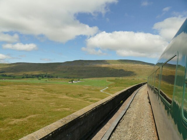
Parker's Moss is a picturesque and diverse natural area located in Yorkshire, England. Spread across the Yorkshire Downs and Moorland, this vast expanse of land stretches over several thousand acres and is renowned for its stunning beauty and rich biodiversity.

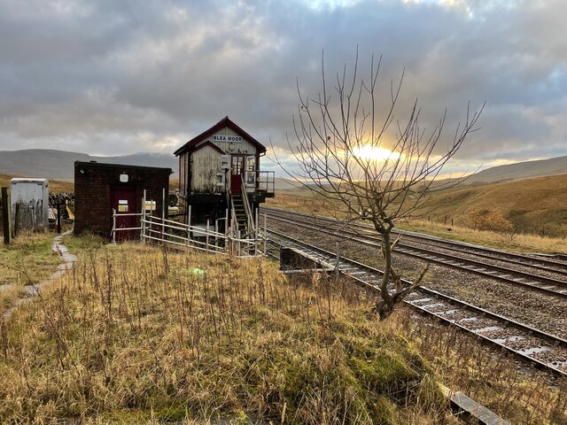
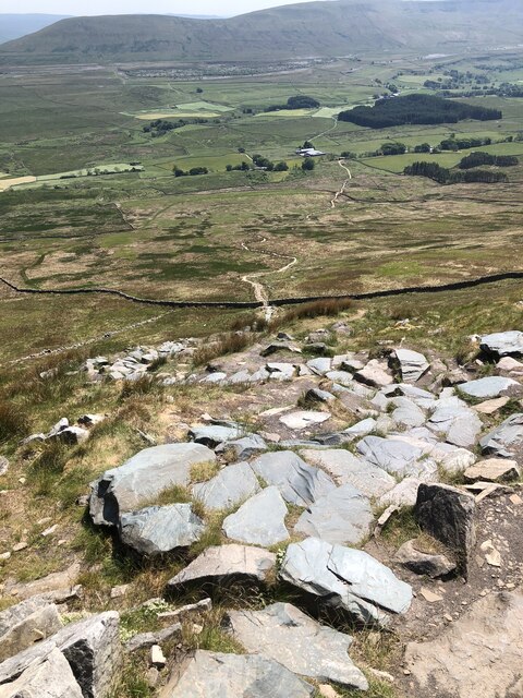
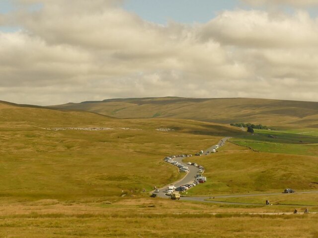
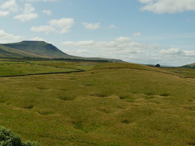
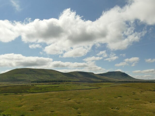
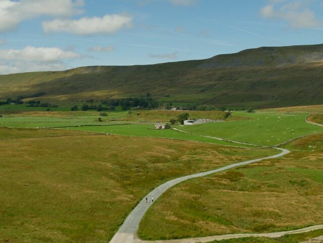
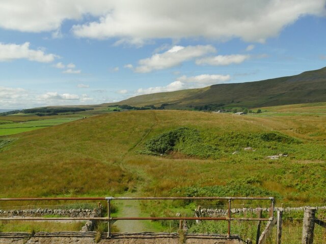
The area is characterized by its rolling hills, heather-covered moorlands, and meandering streams, creating a serene and tranquil atmosphere for visitors to enjoy. The landscape is dotted with ancient oak trees and scattered with moss-covered rocks, adding to its enchanting appeal.

Parker's Moss is a haven for wildlife enthusiasts and nature lovers alike. The moorland is home to a variety of bird species, including curlews, lapwings, and red grouse, making it an ideal destination for birdwatching. The diverse vegetation supports a wide range of flora and fauna, with wildflowers such as heather, bilberry, and cotton grass carpeting the landscape.

The area is also steeped in history and archaeological significance. Several ancient burial mounds and stone circles can be found within Parker's Moss, providing a glimpse into the region's past. Visitors can explore these historical sites and learn about the rich cultural heritage of the area.

Parker's Moss offers a range of recreational activities, including hiking and cycling trails that allow visitors to explore the stunning scenery at their own pace. With its unspoiled beauty and abundant wildlife, Parker's Moss is a must-visit destination for those seeking a serene and immersive experience in the heart of Yorkshire's natural wonders.

If you have any feedback on the listing, please let us know in the comments section below.

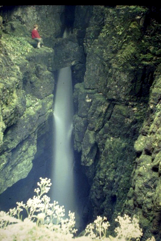
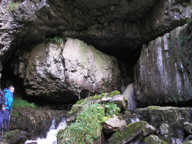
Parker's Moss Images

Images are sourced within 2km of 54.20586/-2.3843277 or Grid Reference SD7578. Thanks to Geograph Open Source API. All images are credited.

Ruined building on the slope of Whernside See <a href="https://www.geograph.org.uk/photo/4533242">SD7580 : Ruin by Little Dale Beck</a> for a closer view.
Ruined building on the slope of Whernside
See SD7580 : Ruin by Little Dale Beck for a closer view.
Blea Moor Cottage and Signal Box Buildings at Blea Moor Summit on the Settle and Carlisle Railway, viewed from a passing train.
Blea Moor Cottage and Signal Box
Buildings at Blea Moor Summit on the Settle and Carlisle Railway, viewed from a passing train.
Blea Moor Signal Box Viewed from a south bound train
Blea Moor Signal Box
Viewed from a south bound train
Blea Moor sidings and signal box Viewed from Smithy Hill on the ascent of Whernside.
Blea Moor sidings and signal box
Viewed from Smithy Hill on the ascent of Whernside.
Walled Track at Winterscales Approaching Winterscales Farm along the bridleway from Blea Sidings
Walled Track at Winterscales
Approaching Winterscales Farm along the bridleway from Blea Sidings
Blea Moor signal box, Settle-Carlisle railway line A very isolated spot, about a kilometre from the nearest road.
Blea Moor signal box, Settle-Carlisle railway line
A very isolated spot, about a kilometre from the nearest road.
Bleamoor signal box
Bleamoor signal box
Blea moor signal box. The Settle to Carlisle line.
Blea moor signal box.
The Settle to Carlisle line.
Rivet - Railway Bridge - Blea Moor - Ribblehead Rivet on abutment of railway bridge, Settle to Carlisle line over Blea Moor, Ribblehead
Rivet - Railway Bridge - Blea Moor - Ribblehead
Rivet on abutment of railway bridge, Settle to Carlisle line over Blea Moor, Ribblehead
Railway Bridge - Blea Moor - Ribblehead Rivet on abutment of railway bridge, Settle to Carlisle line over Blea Moor, Ribblehead
Railway Bridge - Blea Moor - Ribblehead
Rivet on abutment of railway bridge, Settle to Carlisle line over Blea Moor, Ribblehead
Signpost and semaphore signal at Bleamoor
Descent from Whernside
Cars parked at Gearstones This road junction at Ribblehead is popular with both visitors to the famous viaduct, and longer distance walkers.
Cars parked at Gearstones
This road junction at Ribblehead is popular with both visitors to the famous viaduct, and longer distance walkers.
Shake Holes at Batty Moss Taken from a train on the embankment approaching Ribblehead viaduct, you can see why this was difficult terrain for railway building. Ingleborough is in the distance.
Shake Holes at Batty Moss
Taken from a train on the embankment approaching Ribblehead viaduct, you can see why this was difficult terrain for railway building. Ingleborough is in the distance.
View towards Whernside Taken from a train on the Grade II* listed Ribblehead viaduct.
View towards Whernside
Taken from a train on the Grade II* listed Ribblehead viaduct.
View towards Ingleborough Taken from a train on the Grade II* listed Ribblehead viaduct.
View towards Ingleborough
Taken from a train on the Grade II* listed Ribblehead viaduct.
Gunnerfleet Farm Taken from a train on Ribblehead viaduct. See <a href="https://www.geograph.org.uk/photo/5521446">SD7579 : Gunnersfleet Farm from the north-west</a> for a view of the same farm from a different direction.
Gunnerfleet Farm
Taken from a train on Ribblehead viaduct. See SD7579 : Gunnersfleet Farm from the north-west for a view of the same farm from a different direction.
Minor path under the railway embankment This path isn't shown on maps as a public right of way, but is available to cross the line by means of an underpass <a href="https://www.geograph.org.uk/photo/5521457">SD7579 : Railway bridge at Gunnersfleet</a>, presumably provided originally either for local farm traffic (horse drawn in those days) or as part of the railway construction works.
Minor path under the railway embankment
This path isn't shown on maps as a public right of way, but is available to cross the line by means of an underpass SD7579 : Railway bridge at Gunnersfleet, presumably provided originally either for local farm traffic (horse drawn in those days) or as part of the railway construction works.
Show me another place!

Parker's Moss is located at Grid Ref: SD7578 (Lat: 54.20586, Lng: -2.3843277)

Division: West Riding

Administrative County: North Yorkshire

District: Craven

Police Authority: North Yorkshire

What 3 Words

///summaries.inserting.hurry. Near Ingleton, North Yorkshire

Related Wikis

Ribblehead Viaduct

The Ribblehead Viaduct or Batty Moss Viaduct carries the Settle–Carlisle railway across Batty Moss in the Ribble Valley at Ribblehead, in North Yorkshire...

Ribblehead railway station

Ribblehead is a railway station on the Settle and Carlisle Line, which runs between Carlisle and Leeds via Settle. The station, situated 52 miles 17 chains...

Ribblehead Quarry

Ribblehead Quarry is a former limestone quarry next to Ribblehead railway station in the Yorkshire Dales National Park, North Yorkshire, England. It had...

Weathercote Cave

Weathercote Cave is a natural solutional cave in Chapel-le-Dale, North Yorkshire, England. It has been renowned as a natural curiosity since the eighteenth...

Great Douk Cave

Great Douk Cave is a shallow cave system lying beneath the limestone bench of Ingleborough in Chapel-le-Dale, North Yorkshire, England. It is popular with...

Chapel-le-Dale (valley)

Chapel-le-Dale is west-facing valley in the Yorkshire Dales, England. The U-shaped valley of Chapel-le-Dale is one of the few which drain westwards towards...

Chapel-le-Dale

Chapel-le-Dale is a hamlet in the civil parish of Ingleton, North Yorkshire, England. It is in the Yorkshire Dales National Park in a valley of the same...

Whernside

Whernside is a mountain in the Yorkshire Dales in Northern England. It is the highest of the Yorkshire Three Peaks, the other two being Ingleborough and...

Nearby Amenities

Located within 500m of 54.20586,-2.3843277
Barrier: swing_gate
Lat/Long: 54.2083531/-2.3867561
Barrier: stile
Lat/Long: 54.2099919/-2.3853368
Ford: yes
Lat/Long: 54.2064332/-2.3918629
Barrier: cattle_grid
Source: survey
Lat/Long: 54.2046718/-2.3891352
Barrier: cattle_grid
Lat/Long: 54.2031326/-2.3865054
Power: pole
Lat/Long: 54.2079491/-2.3827332
Power: pole
Lat/Long: 54.2086965/-2.3837328
Power: pole
Lat/Long: 54.2091671/-2.3843712
Power: pole
Lat/Long: 54.2097149/-2.3851877
Power: pole
Lat/Long: 54.2101198/-2.3844196
Power: pole
Lat/Long: 54.2073632/-2.3818671
Power: pole
Lat/Long: 54.2067576/-2.3809954
Power: pole
Lat/Long: 54.2060682/-2.380231
Power: pole
Lat/Long: 54.2054383/-2.3795682
Power: pole
Lat/Long: 54.2048051/-2.3788847
Power: pole
Lat/Long: 54.2042534/-2.3783011
Information: guidepost
Tourism: information
Lat/Long: 54.2083753/-2.3867594
Natural: sinkhole
Lat/Long: 54.204463/-2.3790362
Natural: sinkhole
Lat/Long: 54.204991/-2.3792348
Natural: sinkhole
Lat/Long: 54.2045439/-2.3787533
Natural: sinkhole
Lat/Long: 54.2040757/-2.3791866
Natural: sinkhole
Lat/Long: 54.2039103/-2.3795899
Natural: sinkhole
Lat/Long: 54.2040581/-2.3795838
Natural: sinkhole
Lat/Long: 54.2076944/-2.3780852
Natural: sinkhole
Lat/Long: 54.204991/-2.378013
Natural: sinkhole
Lat/Long: 54.2053501/-2.3775676
Natural: sinkhole
Lat/Long: 54.2054557/-2.3774834
Natural: sinkhole
Lat/Long: 54.2055894/-2.3772426
Natural: sinkhole
Lat/Long: 54.2056457/-2.3769176
Natural: sinkhole
Lat/Long: 54.2052726/-2.3778264
Natural: sinkhole
Lat/Long: 54.2053677/-2.3785426
The data included in this document is from www.openstreetmap.org. The data is made available under ODbL.

Have you been to Parker's Moss?

Leave your review of Parker's Moss below (or comments, questions and feedback).