Twisleton Pasture

Downs, Moorland in Yorkshire Craven

England

Twisleton Pasture

Looking towards Whernside from Southerscales, Ingleborough
Looking towards Whernside from Southerscales, Ingleborough Credit: habiloid

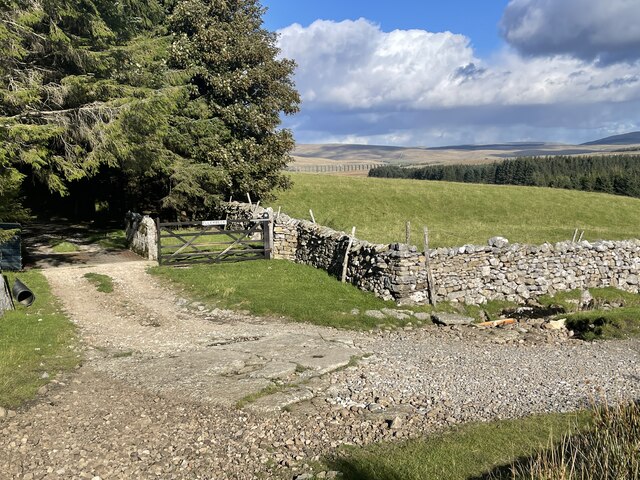
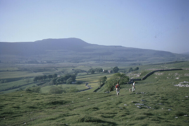
Twisleton Pasture is a picturesque area located in the Yorkshire Dales National Park in Yorkshire, England. It is nestled amidst the stunning Yorkshire Downs and Moorland, offering visitors breathtaking views of the surrounding landscape.

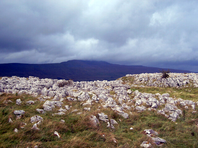
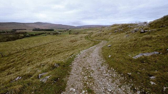
Covering a vast expanse of rolling hills and open grasslands, Twisleton Pasture is a haven for nature lovers and outdoor enthusiasts. The area is renowned for its diverse flora and fauna, with an abundance of wildflowers, heather, and grasses dotting the landscape. Visitors can also spot various species of birds, including skylarks and meadow pipits, soaring above the moorland.

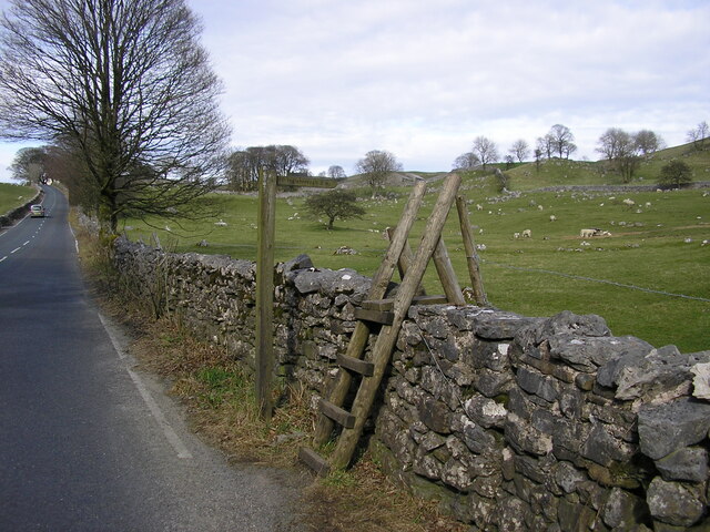
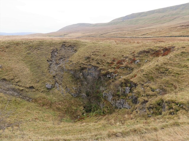
The terrain of Twisleton Pasture is characterized by its undulating hills and rocky outcrops, providing an ideal setting for hiking and walking. Numerous well-marked trails crisscross the area, allowing visitors to explore the stunning scenery at their own pace. One of the most popular routes is the Twisleton Scars, a dramatic limestone gorge formed by the meltwater from the last Ice Age.

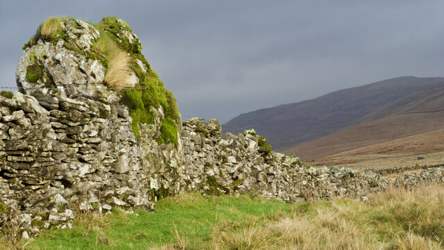
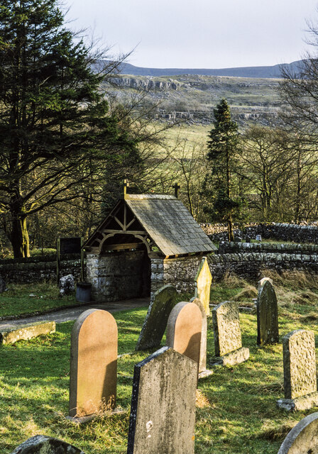
Aside from its natural beauty, Twisleton Pasture is also steeped in history and culture. The area is dotted with ancient ruins, including a stone circle believed to date back to the Bronze Age. These remnants offer a glimpse into the region's rich heritage.

Overall, Twisleton Pasture in Yorkshire offers a serene and idyllic escape for those seeking to immerse themselves in the beauty of nature. Whether it's hiking through the moorland, admiring the wildflowers, or simply enjoying the tranquility of the Yorkshire countryside, this area is a must-visit for anyone exploring the Yorkshire Dales National Park.

If you have any feedback on the listing, please let us know in the comments section below.

Twisleton Pasture Images

Images are sourced within 2km of 54.185432/-2.4245768 or Grid Reference SD7276. Thanks to Geograph Open Source API. All images are credited.

Looking towards Whernside from Southerscales, Ingleborough
St Leonard's Church, Chapel-le-Dale The Church of St Leonard. It was used as a burial plot for the navvies, and their family members, who died whilst constructing the nearby Ribblehead Viaduct between 1869 and 1876. In all, over 200 people died during the construction from accidents and outbreaks of smallpox. 

<span class="nowrap"><a title="https://en.wikipedia.org/wiki/Chapel-le-Dale" rel="nofollow ugc noopener" href="https://en.wikipedia.org/wiki/Chapel-le-Dale">Link</a><img style="margin-left:2px;" alt="External link" title="External link - shift click to open in new window" src="https://s1.geograph.org.uk/img/external.png" width="10" height="10"/></span>
St Leonard's Church, Chapel-le-Dale
The Church of St Leonard. It was used as a burial plot for the navvies, and their family members, who died whilst constructing the nearby Ribblehead Viaduct between 1869 and 1876. In all, over 200 people died during the construction from accidents and outbreaks of smallpox. LinkExternal link
St. Leonard's Church Sign, Chapel-le-Dale
Wooden Ladder Stile & Finger Post at Chapel le Dale This was on the B6255 Low Sleights Road, almost opposite the end of Roman Road which leads to St. Leonard's Church. This image was taken in April 2010. Google Street View from April 2011 shows the stile still there, but it had been replaced with a stone stile by August 2016. The finger post points to Ingleborough 2 miles.
Wooden Ladder Stile & Finger Post at Chapel le Dale
This was on the B6255 Low Sleights Road, almost opposite the end of Roman Road which leads to St. Leonard's Church. This image was taken in April 2010. Google Street View from April 2011 shows the stile still there, but it had been replaced with a stone stile by August 2016. The finger post points to Ingleborough 2 miles.
Old milestone Another of the West Riding CC milestones set up in 1893/94 on this section of the Lancaster to Richmond route which was in the West Riding prior to 1974.   It has succumbed to the Pennine weather and, although not Listed, it deserves repainting.   The foundry name is in the long rectangle on the bevel.   William Towler, Globe Foundry, Leeds.
Old milestone
Another of the West Riding CC milestones set up in 1893/94 on this section of the Lancaster to Richmond route which was in the West Riding prior to 1974. It has succumbed to the Pennine weather and, although not Listed, it deserves repainting. The foundry name is in the long rectangle on the bevel. William Towler, Globe Foundry, Leeds.
Ellerbeck Ford This ford is found at Ellerbeck looking towards Ribblehead Viaduct.
Ellerbeck Ford
This ford is found at Ellerbeck looking towards Ribblehead Viaduct.
Heading down the Southerscales track Familiar to many cavers as the route to and from Meregill Hole, Black Shiver Pot, Roaring Hole and several other potholes, the track gives easy going for walkers, and somewhat more challenging progress for a Cave Rescue Landrover (usually in the dark with heavy rain - and after the pub). By the time you are here on the way down, the difficulties are largely behind you.
Heading down the Southerscales track
Familiar to many cavers as the route to and from Meregill Hole, Black Shiver Pot, Roaring Hole and several other potholes, the track gives easy going for walkers, and somewhat more challenging progress for a Cave Rescue Landrover (usually in the dark with heavy rain - and after the pub). By the time you are here on the way down, the difficulties are largely behind you.
Dry-stone wall built around boulder
Whernside from Souther Scales, 1967 Descending from Ingleborough towards the Hill Inn on a fine day for the Three Peaks walk.
Whernside from Souther Scales, 1967
Descending from Ingleborough towards the Hill Inn on a fine day for the Three Peaks walk.
Lych gate at St. Leonard's Church The gate with gravestones and a path leading to St. Leonard's Church in Chapel-le-Dale.
Lych gate at St. Leonard's Church
The gate with gravestones and a path leading to St. Leonard's Church in Chapel-le-Dale.
Braithwaite Wife Hole
Dale House Dale House with Twisleton Scars as a backdrop.
Dale House
Dale House with Twisleton Scars as a backdrop.
Raven Scar Limestone scars above the date through which a former Roman road passes which is now the route of the B6255.
Raven Scar
Limestone scars above the date through which a former Roman road passes which is now the route of the B6255.
Looking over Braithwaite Wife Hole The hole is an enormous shakehole, the largest on Ingleborough (and probably the Yorkshire Dales/England/UK?). The vehicle belongs to the Yorkshire Wildlife Trust who were doing some work nearby. Above and beyond is Whernside - the highest mountain in the national park (without a doubt).
Looking over Braithwaite Wife Hole
The hole is an enormous shakehole, the largest on Ingleborough (and probably the Yorkshire Dales/England/UK?). The vehicle belongs to the Yorkshire Wildlife Trust who were doing some work nearby. Above and beyond is Whernside - the highest mountain in the national park (without a doubt).
Swaledale sheep on West Fell Looking across the great trench of Chapel-le-Dale to Ingleborough rising above the horizontal layers of Great Scar Limestone that form the scars and pavements on both sides of the valley.
Swaledale sheep on West Fell
Looking across the great trench of Chapel-le-Dale to Ingleborough rising above the horizontal layers of Great Scar Limestone that form the scars and pavements on both sides of the valley.
Is this a burial cairn on West Fell? All around is grass and the stones are perched on the edge of a steepening of the ridge with a far-reaching view. Is there a better place to bury the chief? I found another potential clue that this might be a prehistoric cairn but I'm not telling - you'll have to go and look yourself.
Is this a burial cairn on West Fell?
All around is grass and the stones are perched on the edge of a steepening of the ridge with a far-reaching view. Is there a better place to bury the chief? I found another potential clue that this might be a prehistoric cairn but I'm not telling - you'll have to go and look yourself.
Walls on West Fell Looking towards the foot of Kingsdale.
Walls on West Fell
Looking towards the foot of Kingsdale.
Sheep on West Fell End Moss
Show me another place!

Twisleton Pasture is located at Grid Ref: SD7276 (Lat: 54.185432, Lng: -2.4245768)

Division: West Riding

Administrative County: North Yorkshire

District: Craven

Police Authority: North Yorkshire

What 3 Words

///defining.suitably.required. Near Ingleton, North Yorkshire

Related Wikis

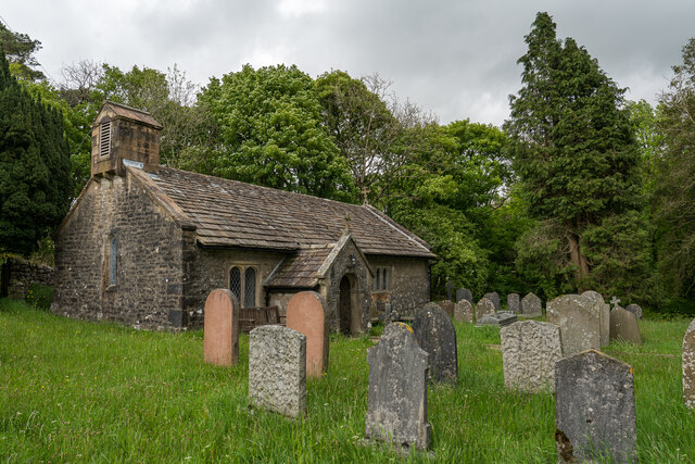
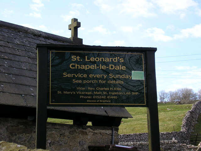
Chapel-le-Dale (valley)

Chapel-le-Dale is west-facing valley in the Yorkshire Dales, England. The U-shaped valley of Chapel-le-Dale is one of the few which drain westwards towards...

Chapel-le-Dale

Chapel-le-Dale is a hamlet in the civil parish of Ingleton, North Yorkshire, England. It is in the Yorkshire Dales National Park in a valley of the same...
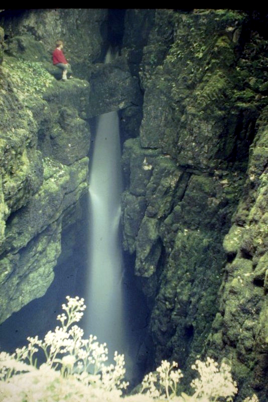
Weathercote Cave

Weathercote Cave is a natural solutional cave in Chapel-le-Dale, North Yorkshire, England. It has been renowned as a natural curiosity since the eighteenth...
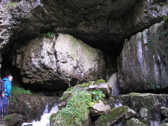
Great Douk Cave

Great Douk Cave is a shallow cave system lying beneath the limestone bench of Ingleborough in Chapel-le-Dale, North Yorkshire, England. It is popular with...

Nearby Amenities

Located within 500m of 54.185432,-2.4245768
Scales Moor
Natural: moor
Source: NPE
Lat/Long: 54.1875471/-2.430351
Barrier: cattle_grid
Lat/Long: 54.1827098/-2.4211643
Power: pole
Lat/Long: 54.1810554/-2.4255356
Power: pole
Lat/Long: 54.18157/-2.4243268
Power: pole
Lat/Long: 54.1820052/-2.4233327
Power: pole
Lat/Long: 54.1824438/-2.4223065
Power: pole
Lat/Long: 54.1828669/-2.4213105
Power: pole
Lat/Long: 54.183269/-2.4203747
Power: pole
Lat/Long: 54.1837274/-2.4193203
Power: pole
Lat/Long: 54.1842375/-2.4181135
The data included in this document is from www.openstreetmap.org. The data is made available under ODbL.

Have you been to Twisleton Pasture?

Leave your review of Twisleton Pasture below (or comments, questions and feedback).