Warmingham Moss

Downs, Moorland in Cheshire

England

Warmingham Moss

Hole House underground gas storage plant Minshull Vernon. View from footpath towards Hole House underground gas storage plant. This is a new feature not yet shown on the OS map - and quite a surprise to find such a modern industrial installation in the middle of a little-walked area of footpaths and farmland. Needless to say the concept of nderground gas storage - as here and at Byley and Lostock Gralam not far away -is proving controversial locally. A lot of protests, but apparently no suggestions as to cost-effective alternative ways of providing the protesters with their energy needs.
Hole House underground gas storage plant Credit: Mike Harris

Warmingham Moss is a picturesque area located in Cheshire, England. Situated amidst the tranquil countryside, it is known for its diverse landscape which includes downs and moorland. The moss is nestled between the villages of Warmingham and Brereton, offering a serene escape from the bustling city life.

The area is characterized by its open and expansive downs, which are vast stretches of rolling grasslands. These downs provide a stunning backdrop of lush greenery and offer panoramic views of the surrounding countryside. The undulating terrain adds to its charm, making it an ideal spot for nature lovers and hikers.

Warmingham Moss also features areas of beautiful moorland, which are covered in heather and bracken. This type of habitat supports a variety of wildlife, including birds such as curlews, lapwings, and skylarks. Moorland plants, like cotton grass and bilberry, thrive in this environment, adding bursts of color to the landscape.

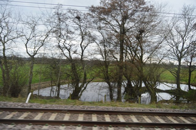
The moss is intersected by small streams and brooks, which contribute to the overall beauty and tranquility of the area. These water features serve as habitats for various aquatic plants and animals, enhancing the biodiversity of Warmingham Moss.

Visitors to Warmingham Moss can enjoy leisurely walks, picnics, and birdwatching in this idyllic setting. The area offers a peaceful and serene atmosphere, providing a welcome escape from the demands of everyday life. With its diverse landscape and natural beauty, Warmingham Moss is a true gem in the heart of Cheshire.

If you have any feedback on the listing, please let us know in the comments section below.

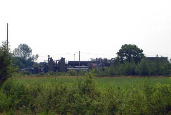
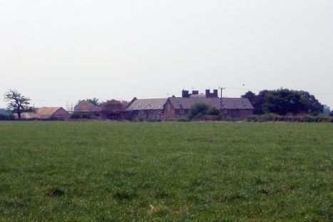
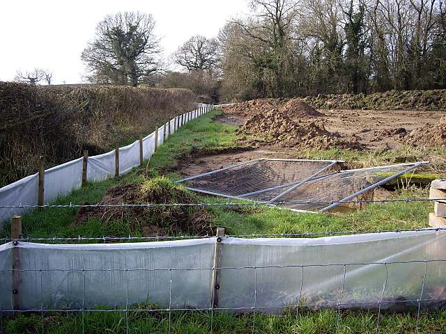
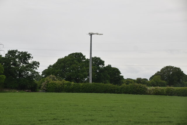
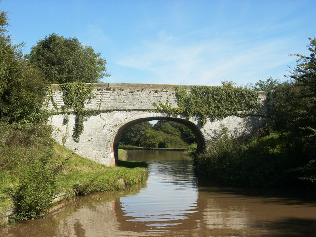
Warmingham Moss Images

Images are sourced within 2km of 53.136244/-2.451315 or Grid Reference SJ6959. Thanks to Geograph Open Source API. All images are credited.

Hole House underground gas storage plant Minshull Vernon. View from footpath towards Hole House underground gas storage plant. This is a new feature not yet shown on the OS map - and quite a surprise to find such a modern industrial installation in the middle of a little-walked area of footpaths and farmland. Needless to say the concept of nderground gas storage - as here and at Byley and Lostock Gralam not far away -is proving controversial locally. A lot of protests, but apparently no suggestions as to cost-effective alternative ways of providing the protesters with their energy needs.
Hole House underground gas storage plant
Minshull Vernon. View from footpath towards Hole House underground gas storage plant. This is a new feature not yet shown on the OS map - and quite a surprise to find such a modern industrial installation in the middle of a little-walked area of footpaths and farmland. Needless to say the concept of nderground gas storage - as here and at Byley and Lostock Gralam not far away -is proving controversial locally. A lot of protests, but apparently no suggestions as to cost-effective alternative ways of providing the protesters with their energy needs.
Dairy Farm, Minshull Vernon Minshull Vernon. View from Crewe & Nantwich Circular Walk towards Dairy Farm. This farm is unimaginatively, but very appropriately, named! In the middle of flat dairy farming countryside north of Crewe.
Dairy Farm, Minshull Vernon
Minshull Vernon. View from Crewe & Nantwich Circular Walk towards Dairy Farm. This farm is unimaginatively, but very appropriately, named! In the middle of flat dairy farming countryside north of Crewe.
footpath near Old Hough An obscure footpath, somewhat overgrown, leads towards the solitary oak in the distance.
footpath near Old Hough
An obscure footpath, somewhat overgrown, leads towards the solitary oak in the distance.
Warmingham: brine well-head Warmingham: brine well pump-head between Hole House and Hill Top Farm. This is probably part of the British Salt Hole House brinefield, similar to the much larger brinefields further north, nearer to Northwich, belonging to Ineos Chlor (formerly ICI). The whole area has underlying Triassic rock salt deposits, solution mined by pumping water down and brine up. This one is right beside the public footpath west of the village.
Warmingham: brine well-head
Warmingham: brine well pump-head between Hole House and Hill Top Farm. This is probably part of the British Salt Hole House brinefield, similar to the much larger brinefields further north, nearer to Northwich, belonging to Ineos Chlor (formerly ICI). The whole area has underlying Triassic rock salt deposits, solution mined by pumping water down and brine up. This one is right beside the public footpath west of the village.
Footbridge in Worsley Covert Footbridge on Minshull Vernon footpath 7 in Worsley Covert. At present (30 September 2007) this footpath is closed due to the planned installation of an underground gas pipeline either side of the covert.
Footbridge in Worsley Covert
Footbridge on Minshull Vernon footpath 7 in Worsley Covert. At present (30 September 2007) this footpath is closed due to the planned installation of an underground gas pipeline either side of the covert.
Parkfield Bridge, Minshull Vernon Tractor bridge carrying Minshull Vernon footpath 8 across the main Liverpool to London railway line. Finding your way through Parkfield Farm is a challenge!
Parkfield Bridge, Minshull Vernon
Tractor bridge carrying Minshull Vernon footpath 8 across the main Liverpool to London railway line. Finding your way through Parkfield Farm is a challenge!
Park Hall Farm, Minshull Vernon Park Hall Farm outbuildings and silo seen from Minshull Vernon footpath 8.
Park Hall Farm, Minshull Vernon
Park Hall Farm outbuildings and silo seen from Minshull Vernon footpath 8.
Obstruction on walk You cannot walk this part of the Crewe and Nantwich Circular walk until July 2008 due to some works going on in this field. 

It would have been nice if the local council had put the closure sign up earlier in the route. This would have saved me from having to walk down and cross the busy and dangerous A530 twice.
Obstruction on walk
You cannot walk this part of the Crewe and Nantwich Circular walk until July 2008 due to some works going on in this field. It would have been nice if the local council had put the closure sign up earlier in the route. This would have saved me from having to walk down and cross the busy and dangerous A530 twice.
Moat House Farm, Minshull Vernon Moat House Farm on the busy A530 in Minshull Vernon is typical of the farmhouses in this area. The farm is presumably named for the medieval double moat at SJ689602. The Crewe and Nantwich Circular Walk goes through the farm
Moat House Farm, Minshull Vernon
Moat House Farm on the busy A530 in Minshull Vernon is typical of the farmhouses in this area. The farm is presumably named for the medieval double moat at SJ689602. The Crewe and Nantwich Circular Walk goes through the farm
Ambulance on the A530 in Minshull Vernon The busy A530 is peppered with accident statistics signs. Ambulances frequently race along this stretch to Leighton Hospital immediately to the south. Moat House Farm is on the right of this view
Ambulance on the A530 in Minshull Vernon
The busy A530 is peppered with accident statistics signs. Ambulances frequently race along this stretch to Leighton Hospital immediately to the south. Moat House Farm is on the right of this view
Crewe and Nantwich Circular Walk stile on the A530 A short section of the Crewe and Nantwich Circular Walk follows the busy A530 in Minshull Vernon. The footpath leaves the road again at Moat House Farm (in trees on right). The line of thicker brown grass marks the path of a small unnamed brook, a tributary of the larger brook that runs through Worsley Covert (left). The flat pasture shown here is typical of this grid square
Crewe and Nantwich Circular Walk stile on the A530
A short section of the Crewe and Nantwich Circular Walk follows the busy A530 in Minshull Vernon. The footpath leaves the road again at Moat House Farm (in trees on right). The line of thicker brown grass marks the path of a small unnamed brook, a tributary of the larger brook that runs through Worsley Covert (left). The flat pasture shown here is typical of this grid square
Farmland north of Crewe
Pylon, Spring Farm
Pylon, Spring Farm
Wind Turbine
Wind Turbine
Wind Turbine
Wind Turbine
Grazing land
Grazing land
Spot the Roman Road
Spot the Roman Road
Trackside pond
Trackside pond
Show me another place!

Warmingham Moss is located at Grid Ref: SJ6959 (Lat: 53.136244, Lng: -2.451315)

Unitary Authority: Cheshire East

Police Authority: Cheshire

What 3 Words

///cycles.printers.absorbing. Near Crewe, Cheshire

Nearby Locations

Warmingham Moss

Related Wikis

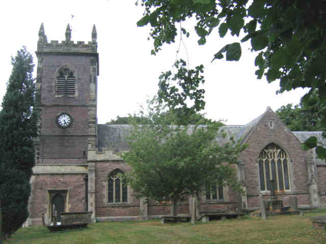
St Leonard's Church, Warmingham

St Leonard's Church is in the village of Warmingham, Cheshire, England. The church is recorded in the National Heritage List for England as a designated...

Minshull Vernon

Minshull Vernon is a hamlet and civil parish in the unitary authority of Cheshire East and the ceremonial county of Cheshire, England. The hamlet lies...

Occlestone Green

Occlestone Green is a small rural settlement in the civil parish of Stanthorne and Wimboldsley, the unitary authority of Cheshire West and Chester and...

St Peter's Church, Minshull Vernon

St Peter's Church is in Middlewich Road, Minshull Vernon, Cheshire, England. It is an active Anglican parish church in the deanery of Nantwich, the archdeaconry...

Nearby Amenities

Located within 500m of 53.136244,-2.451315
Power: tower
Lat/Long: 53.134698/-2.4567701
Power: tower
Lat/Long: 53.1369063/-2.4549237
Power: tower
Lat/Long: 53.13945/-2.4527657
Five Oaks Farm helipad
Aeroway: helipad
Surface: concrete
Lat/Long: 53.1343898/-2.4488026
The data included in this document is from www.openstreetmap.org. The data is made available under ODbL.

Have you been to Warmingham Moss?

Leave your review of Warmingham Moss below (or comments, questions and feedback).