Bell's Braes

Downs, Moorland in Northumberland

England

Bell's Braes

Rural power lines Power lines cutting through an unplanted gap in a large plantation between the isolated settlements around Butterburn.
Rural power lines Credit: Graham Robson

Bell's Braes is a picturesque region located in Northumberland, England. It is characterized by its rolling downs and vast moorland, offering visitors a unique and diverse landscape to explore. The area is known for its natural beauty, offering breathtaking panoramic views and a tranquil atmosphere.

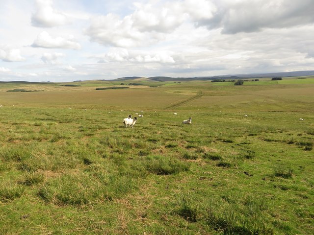
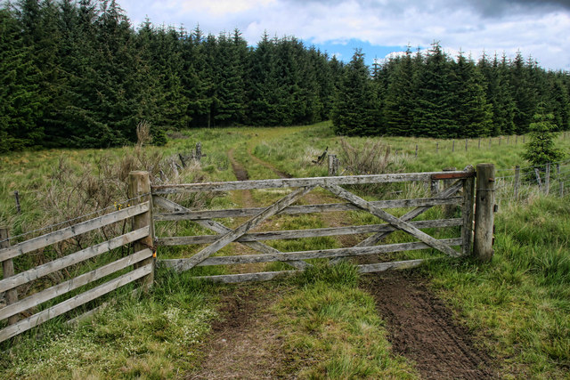
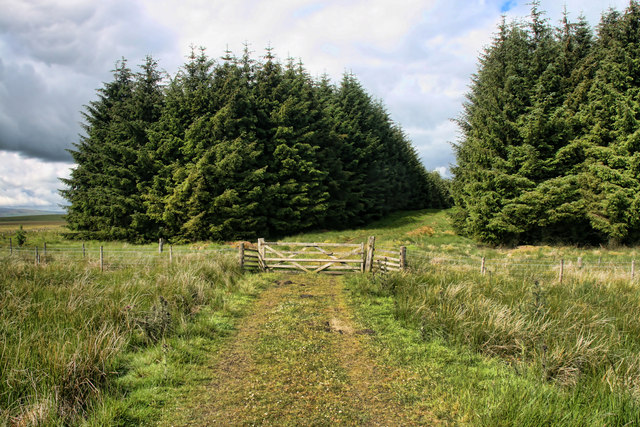
The downs of Bell's Braes are characterized by their gentle slopes and lush green meadows. These downs provide an ideal setting for leisurely walks, picnics, and enjoying the stunning vistas. The area is dotted with charming villages and hamlets, adding to its charm and appeal.

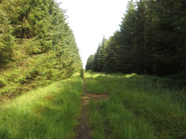
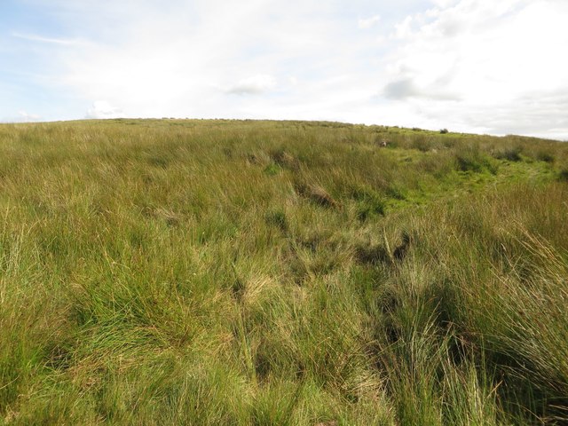
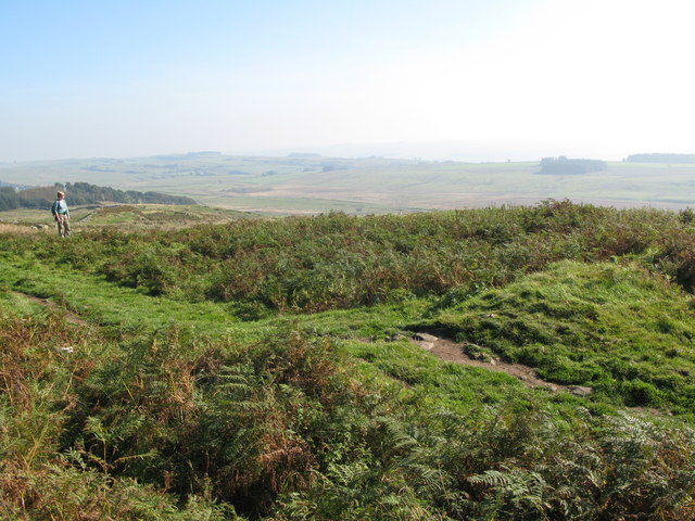
The moorland in Bell's Braes is a striking contrast to the downs. It is characterized by its rugged terrain, heather-covered hills, and barren landscapes. The moorland is home to an array of wildlife, including birds of prey, like the majestic red kite, as well as various species of deer. Nature enthusiasts can enjoy birdwatching, wildlife photography, and hiking through the moorland's trails.

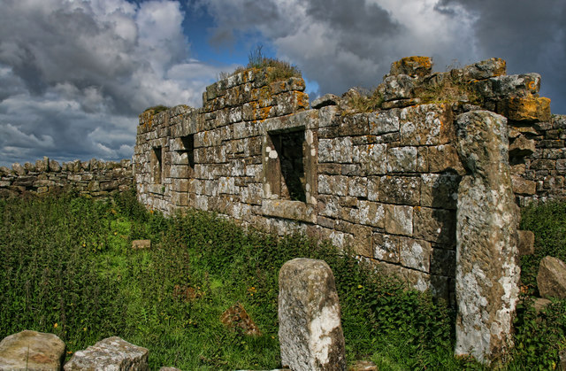
Bell's Braes is also known for its rich history and cultural heritage. Visitors can explore historic sites, such as medieval castles and ancient ruins, which provide a glimpse into the region's past. The area is also known for its traditional farming practices, with many farms still operating in the surrounding countryside.

Overall, Bell's Braes is a captivating region in Northumberland, offering visitors a harmonious blend of natural beauty, rich history, and cultural significance. Whether it's exploring the downs, traversing the moorland, or delving into the area's history, Bell's Braes provides a memorable experience for all who visit.

If you have any feedback on the listing, please let us know in the comments section below.

Bell's Braes Images

Images are sourced within 2km of 55.039206/-2.4845745 or Grid Reference NY6971. Thanks to Geograph Open Source API. All images are credited.

Rural power lines Power lines cutting through an unplanted gap in a large plantation between the isolated settlements around Butterburn.
Rural power lines
Power lines cutting through an unplanted gap in a large plantation between the isolated settlements around Butterburn.
The River Irthing Looking downstream along the River Irthing from its south bank close to the derelict buildings at Rotheryhaugh.
The River Irthing
Looking downstream along the River Irthing from its south bank close to the derelict buildings at Rotheryhaugh.
Derelict farm at Rotheryhaugh The derelict and decaying remains of the farm steading at Rotheryhaugh. The buildings stand close to the River Irthing.
Derelict farm at Rotheryhaugh
The derelict and decaying remains of the farm steading at Rotheryhaugh. The buildings stand close to the River Irthing.
Bridleway at Rotheryhaugh The bridleway just south of Rotheryhaugh. Passage requires one to pick their way through a variety of tussocks and patches of boggy ground.
Bridleway at Rotheryhaugh
The bridleway just south of Rotheryhaugh. Passage requires one to pick their way through a variety of tussocks and patches of boggy ground.
Bridleway between trees The bridleway picks its way between dense blocks of coniferous plantation.
Bridleway between trees
The bridleway picks its way between dense blocks of coniferous plantation.
Path and forest riding A nearby bridleway heads through the block of mature trees on the left, however much safer, easier and quicker progress is made by following the ride between the blocks of trees.
Path and forest riding
A nearby bridleway heads through the block of mature trees on the left, however much safer, easier and quicker progress is made by following the ride between the blocks of trees.
Forest track and public bridleway A forest track used to access a deeper part of the plantation.
Forest track and public bridleway
A forest track used to access a deeper part of the plantation.
Path on Burn Divot A path approaching the top of Burn Divot from the north west where it meets the boundary of a never ending coniferous plantation known as Wark Forest.
Path on Burn Divot
A path approaching the top of Burn Divot from the north west where it meets the boundary of a never ending coniferous plantation known as Wark Forest.
Sheep grazing on Burn Divot The upland pasture around Burn Divot is grazed by a number of sheep which are spread out across the landscape.
Sheep grazing on Burn Divot
The upland pasture around Burn Divot is grazed by a number of sheep which are spread out across the landscape.
Rough Sike Fairly dry at present, but flowing into the upper River Irthing.
Rough Sike
Fairly dry at present, but flowing into the upper River Irthing.
Burn Divot The derelict cottage at Burn Divot.
Burn Divot
The derelict cottage at Burn Divot.
Thirlwall Common (North Side) Looking across Thirlwall Common from near Burn Divot.
Thirlwall Common (North Side)
Looking across Thirlwall Common from near Burn Divot.
Rotheryhaugh The abandoned farm at Rotheryhaugh.
Rotheryhaugh
The abandoned farm at Rotheryhaugh.
Rotheryhaugh The abandoned farm at Rotheryhaugh.
Rotheryhaugh
The abandoned farm at Rotheryhaugh.
Rotheryhaugh The kitchen at Rotheryhaugh.
Rotheryhaugh
The kitchen at Rotheryhaugh.
Lamb Rigg Gate at the edge of the forest beneath Lamb Rigg.
Lamb Rigg
Gate at the edge of the forest beneath Lamb Rigg.
Cross Rigg Track leading into the forest at Cross Rigg.
Cross Rigg
Track leading into the forest at Cross Rigg.
Rotheryhaugh Derelict oitbuildings at Rotheryhaugh.
Rotheryhaugh
Derelict oitbuildings at Rotheryhaugh.
Show me another place!

Bell's Braes is located at Grid Ref: NY6971 (Lat: 55.039206, Lng: -2.4845745)

Unitary Authority: Northumberland

Police Authority: Northumbria

What 3 Words

///dissolves.metals.chucks. Near Haltwhistle, Northumberland

Nearby Locations

Bell's Braes Hugh's Hill

Related Wikis

Northumbria

Northumbria (; Old English: Norþanhymbra rīċe [ˈnorˠðɑnˌhymbrɑ ˈriːt͡ʃe]; Latin: Regnum Northanhymbrorum) was an early medieval Anglo-Saxon kingdom in...

Milecastle 44

Milecastle 44 (Allolee) was a milecastle on Hadrian's Wall (grid reference NY68886694). == Description == Milecastle 44 is located about 1.5 kilometres...

Allolee to Walltown

Allolee to Walltown is the name given to a Site of Special Scientific Interest (SSSI) in Northumberland, England. The site, which follows the path of a...

Milecastle 43

Milecastle 43 (Great Chesters) was a milecastle on Hadrian's Wall (grid reference NY70356684). It was obliterated when the fort at Great Chesters (Aesica...

Nearby Amenities

Located within 500m of 55.039206,-2.4845745
Bell's Braes
Place: locality
Lat/Long: 55.0379646/-2.4874104
The data included in this document is from www.openstreetmap.org. The data is made available under ODbL.

Have you been to Bell's Braes?

Leave your review of Bell's Braes below (or comments, questions and feedback).