Birkett Moor

Downs, Moorland in Yorkshire Ribble Valley

England

Birkett Moor

Barns at Foulscales On the road to Cow Ark.
Barns at Foulscales Credit: philandju

Birkett Moor is a vast expanse of moorland located in the county of Yorkshire, England. Situated in the northern part of the county, it forms part of the larger North York Moors National Park. The moorland stretches across an area of approximately 12 square miles, offering a diverse landscape and a unique natural habitat.

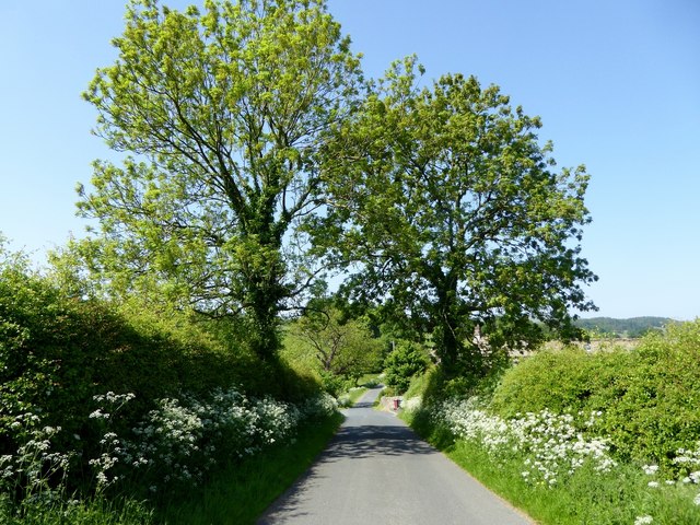
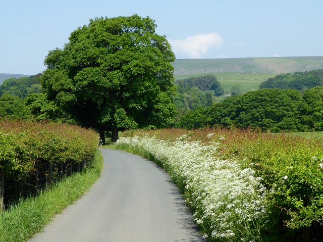
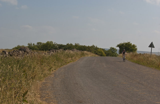
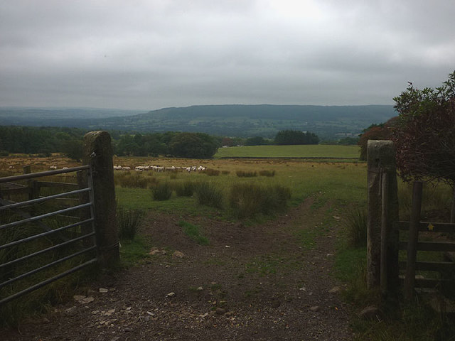
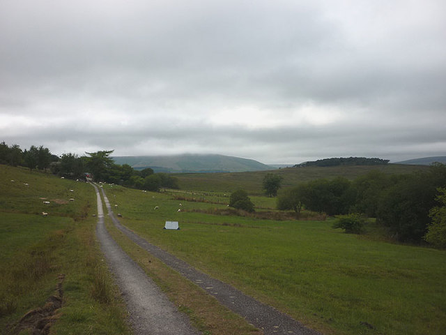
Characterized by its rolling hills, heather-covered moors, and scattered woodlands, Birkett Moor showcases the typical features of the Yorkshire countryside. The moorland is mostly uninhabited, allowing visitors to immerse themselves in the tranquility and solitude of the surroundings. It is a popular destination for outdoor enthusiasts, including hikers, birdwatchers, and nature lovers.

The moorland is home to a variety of wildlife, with several rare species finding refuge in its diverse ecosystem. Visitors may spot indigenous birds such as curlews, lapwings, and grouse, as well as other animals including hares, foxes, and deer. The region's rich biodiversity is also reflected in its plant life, with extensive areas of heather, bilberries, and cotton grass blanketing the moorland.

Birkett Moor offers numerous walking trails and paths, allowing visitors to explore its picturesque landscapes and experience the beauty of the Yorkshire countryside. The moorland is also intersected by several streams and rivers, providing opportunities for anglers and water enthusiasts.

With its stunning vistas, peaceful atmosphere, and abundant wildlife, Birkett Moor is a true gem of Yorkshire's natural landscape, attracting visitors from far and wide to experience the beauty and tranquility it has to offer.

If you have any feedback on the listing, please let us know in the comments section below.

Birkett Moor Images

Images are sourced within 2km of 53.924883/-2.4831126 or Grid Reference SD6847. Thanks to Geograph Open Source API. All images are credited.

Barns at Foulscales On the road to Cow Ark.
Barns at Foulscales
On the road to Cow Ark.
Barn at Crag House On the road to Cow Ark.
Barn at Crag House
On the road to Cow Ark.
The one that got away A sheep on the wrong side of the fence.
The one that got away
A sheep on the wrong side of the fence.
Foulscales farm A grade II listed farmhouse by Foulscales Brook.
Foulscales farm
A grade II listed farmhouse by Foulscales Brook.
View to the North East near  Spire Farm Trig Point
Spire Farm Trig Point Flush Bracket S4665
Country view at Marl Hill Looking east across rough pasture towards Crag Wood with the small outcrop of Crag Stones on the hillside beyond. Much of this area between the Ribble and the Forest of Bowland is rather poor quality land owing to the underlying geology of shales and grits.
Country view at Marl Hill
Looking east across rough pasture towards Crag Wood with the small outcrop of Crag Stones on the hillside beyond. Much of this area between the Ribble and the Forest of Bowland is rather poor quality land owing to the underlying geology of shales and grits.
Spire Trig Pillar Looking NE towards Waddington Fell.
Spire Trig Pillar
Looking NE towards Waddington Fell.
Country lane at Foulscales One of a myriad of lanes connecting Chipping, Dunsop Bridge, Newton in Bowland and other villages in the Forest of Bowland.
Country lane at Foulscales
One of a myriad of lanes connecting Chipping, Dunsop Bridge, Newton in Bowland and other villages in the Forest of Bowland.
Cow parsley verge A private road, but public footpath.
Cow parsley verge
A private road, but public footpath.
Footbridge over the Hodder The bridge sways and bounces alarmingly as one ventures across.
Footbridge over the Hodder
The bridge sways and bounces alarmingly as one ventures across.
It's all downhill now
Gateway north of Browsholme Hall On the footpath to Spire Farm.
Gateway north of Browsholme Hall
On the footpath to Spire Farm.
Derelict outbuilding near Spire Farm Perhaps it was to pump water up to this exposed location on top of a hill?
Derelict outbuilding near Spire Farm
Perhaps it was to pump water up to this exposed location on top of a hill?
The 'spire' at Spire Farm A curious structure (definitely not a spire) which looks to have been recently repointed, possibly to take the telecoms dishes?
The 'spire' at Spire Farm
A curious structure (definitely not a spire) which looks to have been recently repointed, possibly to take the telecoms dishes?
The track to Crimpton Part of the footpath heading towards Whitewell and the Hodder Valley ahead.
The track to Crimpton
Part of the footpath heading towards Whitewell and the Hodder Valley ahead.
Ordnance Survey Cut Mark This OS cut mark can be found on the gatepost SE side of the road. It marks a point 214.561m above mean sea level.
Ordnance Survey Cut Mark
This OS cut mark can be found on the gatepost SE side of the road. It marks a point 214.561m above mean sea level.
Sheep Sheep near Ing Barn Crag Stones on the horizon
Sheep
Sheep near Ing Barn Crag Stones on the horizon
Show me another place!

Birkett Moor is located at Grid Ref: SD6847 (Lat: 53.924883, Lng: -2.4831126)

Division: West Riding

Administrative County: Lancashire

District: Ribble Valley

Police Authority: Lancashire

What 3 Words

///thrillers.vanilla.grading. Near Waddington, Lancashire

Nearby Locations

Birkett Moor

Related Wikis

Bowland Rural District

Bowland was a rural district in the West Riding of Yorkshire from 1894 to 1974. It was named after the Forest of Bowland, which it included. It was formed...

Bowland Forest Low

Bowland Forest Low is a civil parish in the Ribble Valley district of Lancashire, England, covering some 5,500 acres (22 km2) of the Forest of Bowland...

Browsholme Hall

Browsholme Hall is a privately owned Tudor house in the parish of Bowland Forest Low in the borough of Ribble Valley, Lancashire (although historically...

Whitewell Hotel

Whitewell Hotel is an historic building in the English parish of Bowland Forest Low, Lancashire. It is Grade II listed, built in 1836, and is in sandstone...

Nearby Amenities

Located within 500m of 53.924883,-2.4831126
Barrier: cattle_grid
Lat/Long: 53.9254873/-2.4801496
The data included in this document is from www.openstreetmap.org. The data is made available under ODbL.

Have you been to Birkett Moor?

Leave your review of Birkett Moor below (or comments, questions and feedback).