Birch Braes

Downs, Moorland in Aberdeenshire

Scotland

Birch Braes

White Hill Looking towards the hill from just outside the steading at Mains of Carnousie.
White Hill Credit: Anne Burgess

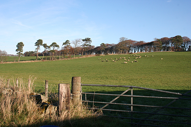
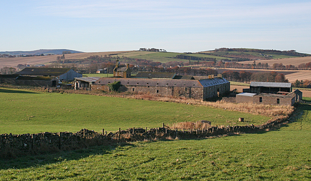
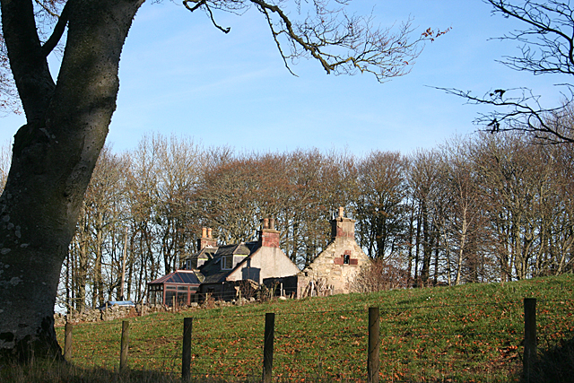
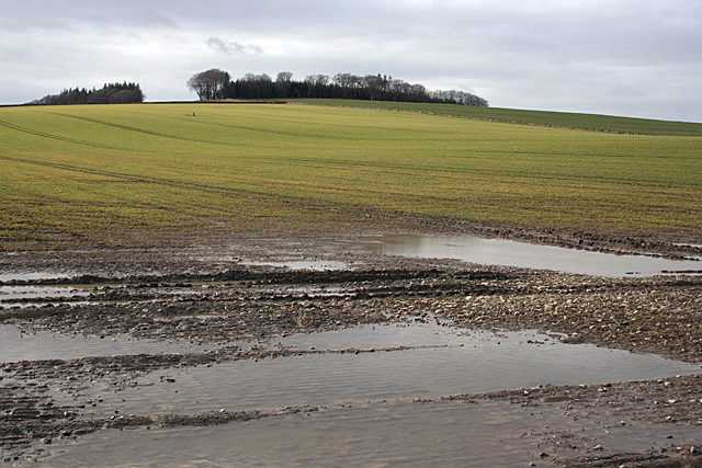
Birch Braes is a picturesque area located in Aberdeenshire, Scotland. Situated amidst the enchanting Downs and Moorland, this region is known for its breathtaking natural beauty and diverse wildlife.

The area is characterized by rolling hills covered in a lush carpet of vibrant green grass, interspersed with patches of heather and gorse. Birch trees, after which the region is named, are scattered across the landscape, adding to its charm. The tranquil and serene atmosphere of Birch Braes makes it an ideal destination for nature lovers and outdoor enthusiasts.

The Downs in Birch Braes offer stunning panoramic views of the surrounding countryside, with its undulating hillsides stretching far into the distance. The Moorland, on the other hand, is a vast expanse of open land, covered in heather and home to a variety of bird species including grouse and curlews. Visitors can enjoy long walks or hikes, immersing themselves in the unspoiled beauty of this natural haven.

The area is also rich in history, with several ancient landmarks and archaeological sites dotting the landscape. The remnants of stone circles and burial mounds, dating back thousands of years, serve as a testament to the region's intriguing past.

Birch Braes, Aberdeenshire, truly offers a glimpse into the untouched beauty of the Scottish countryside. Its Downs and Moorland provide a haven for those seeking solace in nature, with its stunning vistas, diverse flora and fauna, and a rich historical heritage.

If you have any feedback on the listing, please let us know in the comments section below.
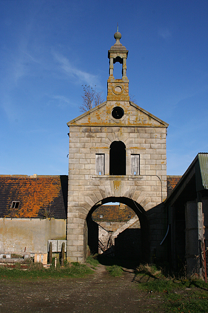
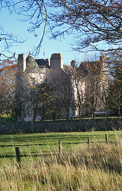
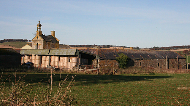
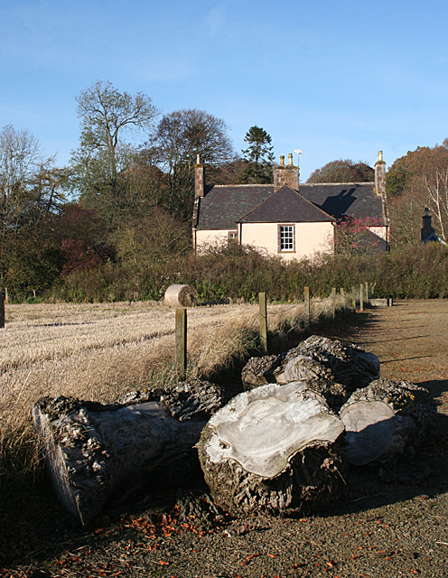
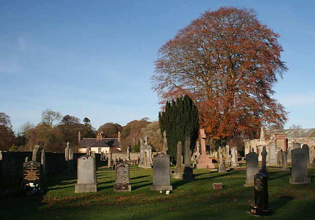
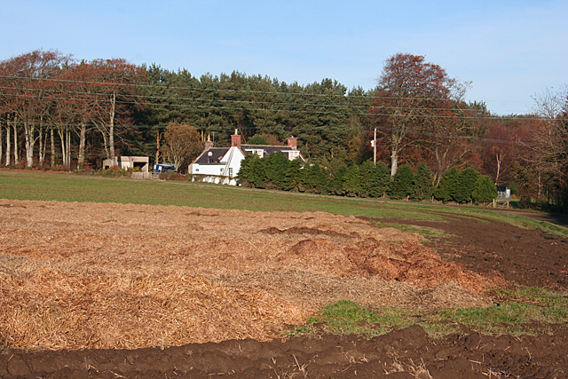
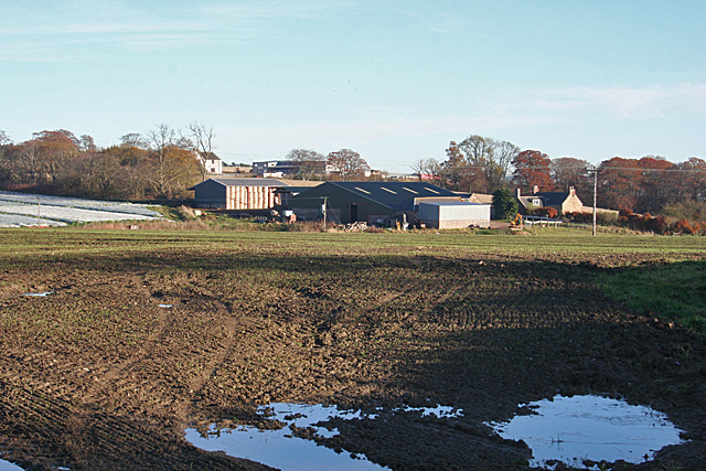
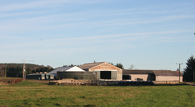
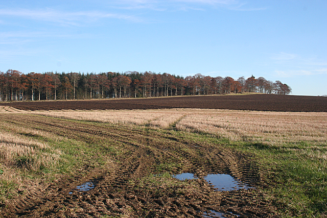
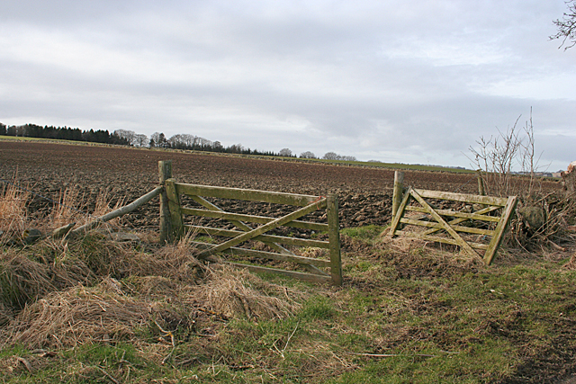
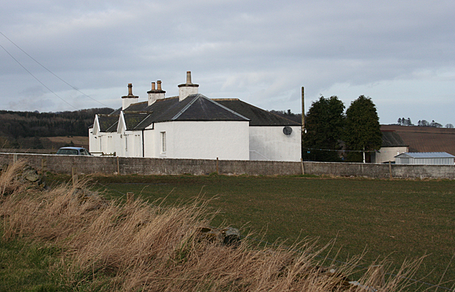
Birch Braes Images

Images are sourced within 2km of 57.533962/-2.5403802 or Grid Reference NJ6749. Thanks to Geograph Open Source API. All images are credited.

White Hill Looking towards the hill from just outside the steading at Mains of Carnousie.
White Hill
Looking towards the hill from just outside the steading at Mains of Carnousie.
Mains of Carnousie The steading here is exceptionally fine, built in a square with arches to north and south. This is the decorative tower above the south arch. Sadly, the whole steading appears to be disused.
Mains of Carnousie
The steading here is exceptionally fine, built in a square with arches to north and south. This is the decorative tower above the south arch. Sadly, the whole steading appears to be disused.
Carnousie Castle Nigel Tranter, describing Carnousie in 1970, lamented the fact that the building was abandoned and had deteriorated sadly, part of it being used as a piggery. Since then it has been fully restored as an inhabited house, though the screen of trees makes it difficult to appreciate its features. It was probably built by Walter Ogilvy of Carnousie, because he sold his newly constructed fortalice in 1583 to his brother Ogilvy of Dunlugas. It was subsequently sold to the Gordons of Park. It is a Z-plan, with a circular tower to the north-west of the main block and a square tower to the south-east.
Carnousie Castle
Nigel Tranter, describing Carnousie in 1970, lamented the fact that the building was abandoned and had deteriorated sadly, part of it being used as a piggery. Since then it has been fully restored as an inhabited house, though the screen of trees makes it difficult to appreciate its features. It was probably built by Walter Ogilvy of Carnousie, because he sold his newly constructed fortalice in 1583 to his brother Ogilvy of Dunlugas. It was subsequently sold to the Gordons of Park. It is a Z-plan, with a circular tower to the north-west of the main block and a square tower to the south-east.
Mains of Carnousie The steading here is exceptionally fine, built in a square with arches to north and south, the latter crowned with an elaborate tower. The south elevation is largely obscured by a modern lean-to for storing straw, but the east elevation gives an idea of how it originally appeared.
Mains of Carnousie
The steading here is exceptionally fine, built in a square with arches to north and south, the latter crowned with an elaborate tower. The south elevation is largely obscured by a modern lean-to for storing straw, but the east elevation gives an idea of how it originally appeared.
Mains of Carnousie From here you can see the square of the original steading, with the roofs of additional buildings inside the square and a motley collection of modern structures outside it.
Mains of Carnousie
From here you can see the square of the original steading, with the roofs of additional buildings inside the square and a motley collection of modern structures outside it.
Cottages near White Hill One cottage in good repair, the other reduced to just its walls.
Cottages near White Hill
One cottage in good repair, the other reduced to just its walls.
Williamson's Machinery Centre This is part of a family-run enterprise which also has a garden centre, a pedal go-cart track, a tearoom and a huge indoor soft play area for children. It's not exactly on the beaten track, but is well patronised by those in the know.
Williamson's Machinery Centre
This is part of a family-run enterprise which also has a garden centre, a pedal go-cart track, a tearoom and a huge indoor soft play area for children. It's not exactly on the beaten track, but is well patronised by those in the know.
Silverstripe An old building at Silverstripe is in process of renovation.
Silverstripe
An old building at Silverstripe is in process of renovation.
Kirklands of Forglen The 1:50,000 map shows an ancient church down a track off the B9025. Lured by this, I found myself in the car park beside Forglen Kirkyard, where there is this view towards what I am sure must originally have been the manse, now renamed Kirklands. I do not know what type of wood the logs are, but my brother, who knows about wood, says they are probably elm.
Kirklands of Forglen
The 1:50,000 map shows an ancient church down a track off the B9025. Lured by this, I found myself in the car park beside Forglen Kirkyard, where there is this view towards what I am sure must originally have been the manse, now renamed Kirklands. I do not know what type of wood the logs are, but my brother, who knows about wood, says they are probably elm.
Forglen Cemetery The old kirkayrd has been extended towards the river bank, providing plenty of space for future burials.
Forglen Cemetery
The old kirkayrd has been extended towards the river bank, providing plenty of space for future burials.
Cottage near Ribrae There are men working on the roof of this cottage beside the minor road to Meikle Ribrae. The straw in the foreground is probably protecting a crop of carrots from frost or animals.
Cottage near Ribrae
There are men working on the roof of this cottage beside the minor road to Meikle Ribrae. The straw in the foreground is probably protecting a crop of carrots from frost or animals.
Little Ribrae From beside the minor road at Meikle Ribrae. Beyond Little Ribrae is some sort of industrial enterprise, the full scale of which has not yet reached the maps.
Little Ribrae
From beside the minor road at Meikle Ribrae. Beyond Little Ribrae is some sort of industrial enterprise, the full scale of which has not yet reached the maps.
Meikle Ribrae The farm buildings at Meikle Ribrae house large numbers of pigs, and the absence of any fences round about suggests that they are permanently kept inside.
Meikle Ribrae
The farm buildings at Meikle Ribrae house large numbers of pigs, and the absence of any fences round about suggests that they are permanently kept inside.
Near Meikle Ribrae Looking up across recently ploughed land to the shelter belt on the crest of the hill.
Near Meikle Ribrae
Looking up across recently ploughed land to the shelter belt on the crest of the hill.
Gates at Laithers A double gate into a field beside the road to Mains of Laithers.
Gates at Laithers
A double gate into a field beside the road to Mains of Laithers.
Cottages near Mains of Laithers A pair of whitewashed cottages beside the road to Mains of Laithers.
Cottages near Mains of Laithers
A pair of whitewashed cottages beside the road to Mains of Laithers.
Looking towards Hill of Laithers The standing stone part way up the field is in the next square.
Looking towards Hill of Laithers
The standing stone part way up the field is in the next square.
Milnbank I had hoped to get down to the corner of the field, but as you can see the ground is very wet and boggy, so I had to make do with a view through the trees.
Milnbank
I had hoped to get down to the corner of the field, but as you can see the ground is very wet and boggy, so I had to make do with a view through the trees.
Show me another place!

Birch Braes is located at Grid Ref: NJ6749 (Lat: 57.533962, Lng: -2.5403802)

Unitary Authority: Aberdeenshire

Police Authority: North East

What 3 Words

///owners.astounded.twinge. Near Turriff, Aberdeenshire

Related Wikis

Bogton

Bogton is a rural area in Aberdeenshire, Scotland. To the south is Whitehill Wood and megalithic circle. == References ==

Whitehill Wood, Aberdeenshire

Whitehill Wood is a wood and megalithic stone circle in Aberdeenshire, Scotland, located off the B9025 road between Aberchirder and Turriff and between...
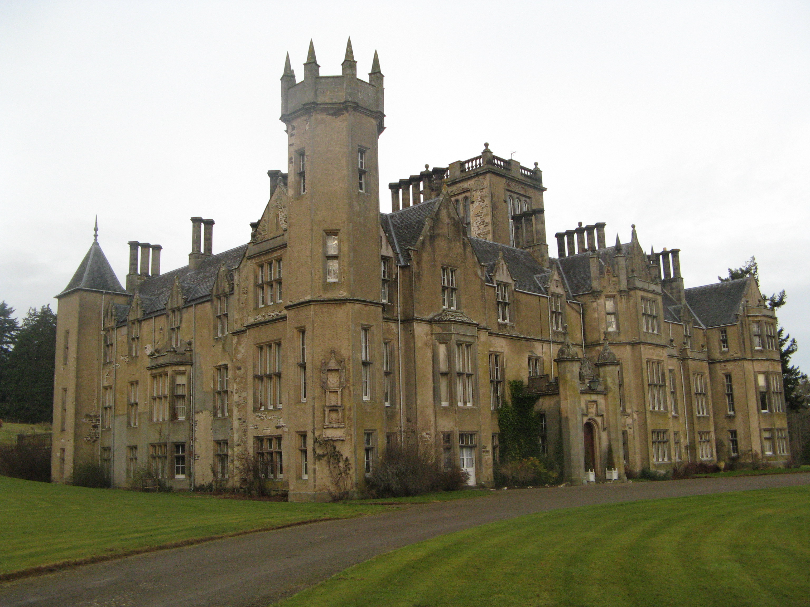
Forglen House

Forglen House is a mansion house that forms the centrepiece of the Forglen estate in the parish of Forglen, north-west of Turriff, Aberdeenshire, in the...

Dorlaithers Castle

Dorlaithers Castle was a castle about 2.5 miles (4.0 km) south-west of Turriff, Aberdeenshire, Scotland at Dorlaithers, south of the burn of Gask. It may...

Turriff United F.C.

Turriff United Football Club are a senior football club currently playing in the Highland Football League in Scotland. They play their matches at The Haughs...
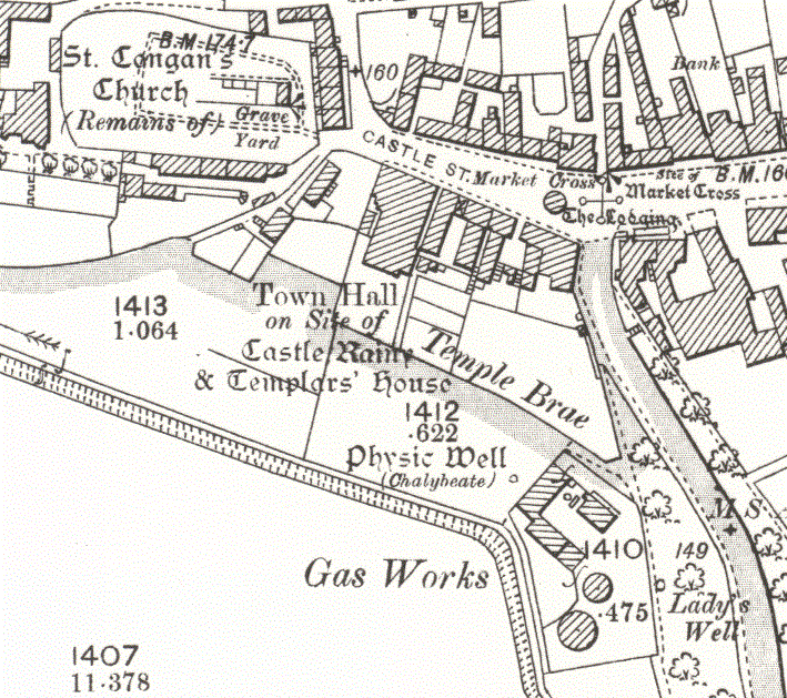
Turriff Castle

Turriff Castle was a tower house, on Castlegate, Turriff, north of Idoch Water, Aberdeenshire, Scotland. The castle was also called Tower of Torrey of...

Turriff railway station

Turriff railway station was a railway station in Turriff, Aberdeenshire, Scotland. It was opened in 1857 by the Banff Macduff & Turriff Junction Railway...

Turriff Academy

Turriff Academy is a non denominational comprehensive co-educational secondary school located in Turriff, Aberdeenshire, Scotland. It serves a large catchment...

Nearby Amenities

Located within 500m of 57.533962,-2.5403802
Power: pole
Lat/Long: 57.5370996/-2.5420486
Power: pole
Lat/Long: 57.5374696/-2.5423757
Power: pole
Lat/Long: 57.5378355/-2.5427263
Power: pole
Lat/Long: 57.5372436/-2.5449827
Power: pole
Lat/Long: 57.5375432/-2.5438623
Power: pole
Lat/Long: 57.5384399/-2.5403799
Power: pole
Lat/Long: 57.538277/-2.5393105
Power: pole
Lat/Long: 57.5381372/-2.5381177
Power: pole
Lat/Long: 57.5380079/-2.5369542
Power: pole
Lat/Long: 57.5379879/-2.5367133
Power: pole
Lat/Long: 57.5322825/-2.5420664
Power: pole
Lat/Long: 57.5318913/-2.5414943
Power: pole
Lat/Long: 57.5315095/-2.5405163
Power: pole
Lat/Long: 57.5315605/-2.5396249
Power: pole
Lat/Long: 57.531607/-2.5385719
Power: pole
Lat/Long: 57.5316485/-2.5375499
Power: pole
Lat/Long: 57.5317157/-2.5365093
Power: pole
Lat/Long: 57.5321275/-2.5352228
Power: pole
Lat/Long: 57.5324958/-2.5341116
Power: pole
Lat/Long: 57.5326987/-2.5334879
Power: pole
Lat/Long: 57.5329321/-2.5327698
Power: pole
Lat/Long: 57.5346069/-2.5450881
Power: pole
Lat/Long: 57.5350403/-2.5441191
Power: pole
Lat/Long: 57.5354516/-2.5431794
Power: pole
Lat/Long: 57.5357688/-2.5424767
Power: pole
Lat/Long: 57.5364577/-2.5422534
Power: pole
Lat/Long: 57.5311165/-2.5360349
Power: pole
Lat/Long: 57.5304589/-2.5355315
The data included in this document is from www.openstreetmap.org. The data is made available under ODbL.

Have you been to Birch Braes?

Leave your review of Birch Braes below (or comments, questions and feedback).