Barbon High Fell

Downs, Moorland in Westmorland South Lakeland

England

Barbon High Fell

Footbridge on Barkin Beck Described as 'new' in 2013 <a href="https://www.geograph.org.uk/photo/3350976">SD6683 : New footbridge over Barkin Beck</a>.
Footbridge on Barkin Beck Credit: Stephen Craven

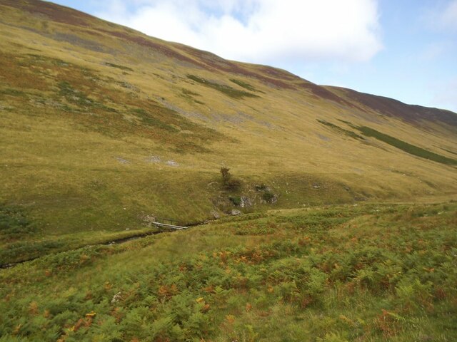
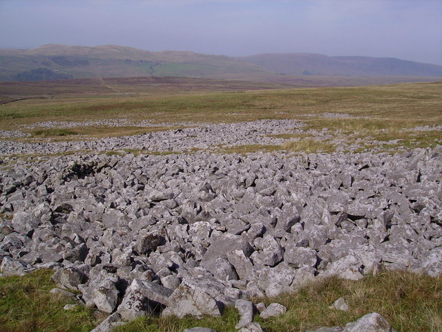
Barbon High Fell is a captivating area located in Westmorland, England. It is a region adorned with picturesque landscapes, characterized by rolling hills, dramatic peaks, and sprawling moorland. Situated in the northern part of the county, Barbon High Fell offers visitors a chance to immerse themselves in the natural beauty of the region.

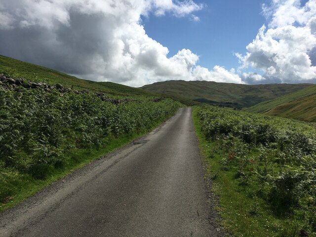
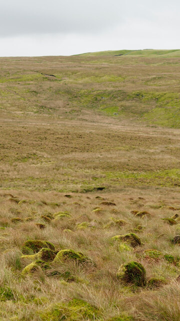
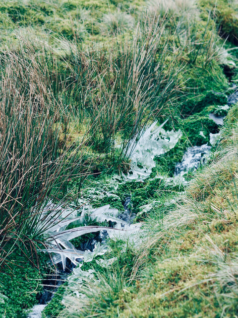
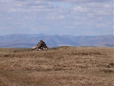
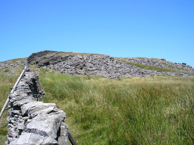
The high fell is known for its stunning views, with vistas stretching as far as the eye can see. The undulating terrain provides the perfect setting for hiking enthusiasts, who can traverse the numerous footpaths and trails that crisscross the area. As visitors wander through the moorland, they are likely to encounter an array of wildlife, including birds of prey, sheep, and even the occasional red deer.

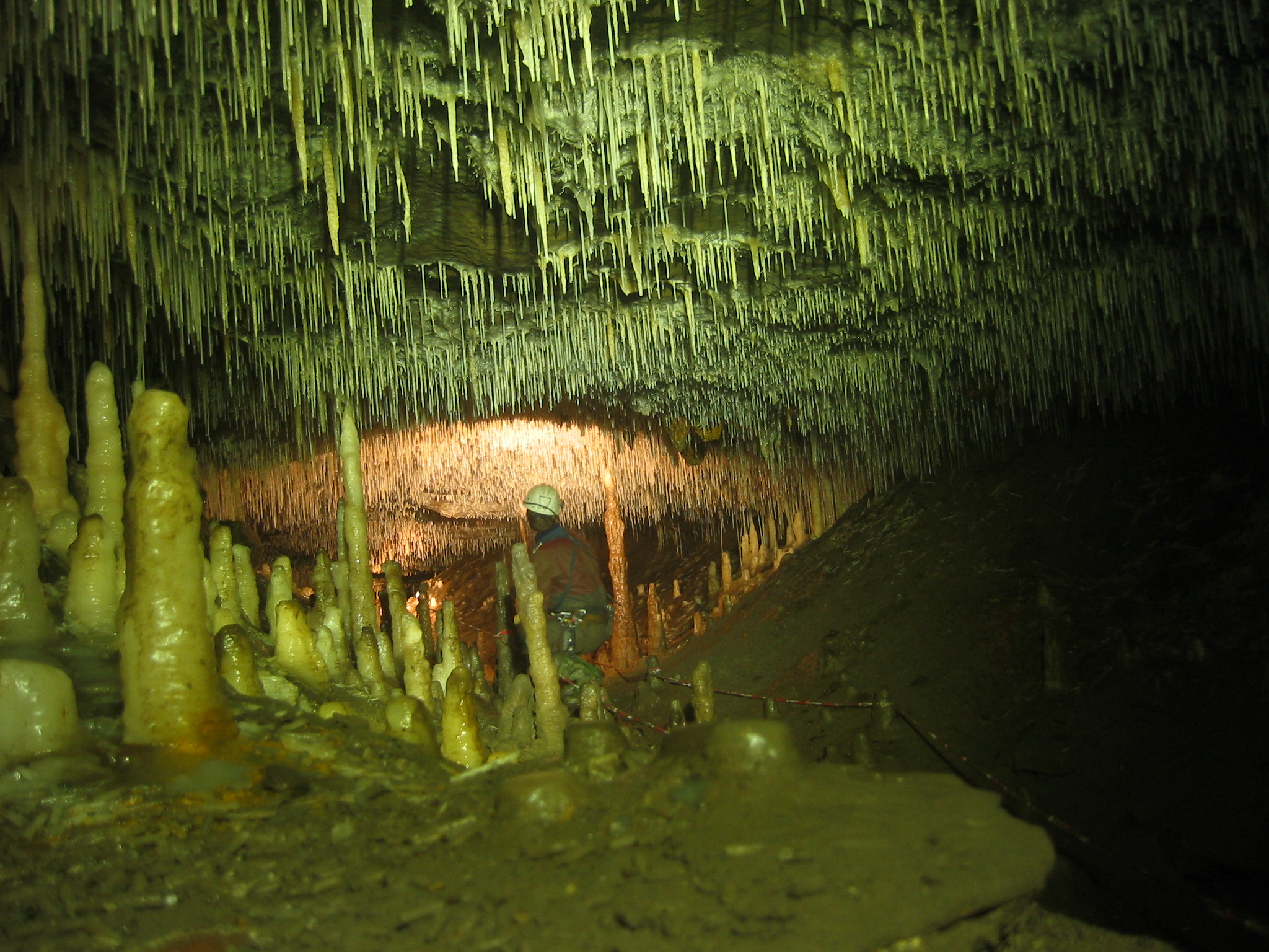
Barbon High Fell also boasts an interesting geological history. The area is rich in limestone, which has led to the formation of unique features such as caves, swallow holes, and sinkholes. These natural phenomena attract geology enthusiasts who are keen to explore the fascinating underground world.

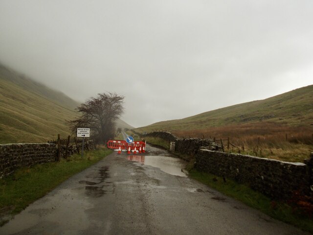
In addition to its natural splendor, Barbon High Fell is home to several charming hamlets and villages. The quaint stone cottages and traditional farmhouses add to the area's rustic charm, providing a glimpse into the local way of life.

Overall, Barbon High Fell is a captivating destination that offers visitors a chance to escape the hustle and bustle of modern life. Whether it's hiking through the moorland, exploring the underground wonders, or simply enjoying the breathtaking views, this hidden gem in Westmorland provides a truly unforgettable experience.

If you have any feedback on the listing, please let us know in the comments section below.

Barbon High Fell Images

Images are sourced within 2km of 54.244386/-2.4981955 or Grid Reference SD6783. Thanks to Geograph Open Source API. All images are credited.

Footbridge on Barkin Beck Described as 'new' in 2013 <a href="https://www.geograph.org.uk/photo/3350976">SD6683 : New footbridge over Barkin Beck</a>.
Footbridge on Barkin Beck
Described as 'new' in 2013 SD6683 : New footbridge over Barkin Beck.
Cattle grid, Barbondale The grid has collapsed and is awaiting repair so all traffic goes the way of animals
Cattle grid, Barbondale
The grid has collapsed and is awaiting repair so all traffic goes the way of animals
Minor road through Barbondale
Limekilns beside Aygill The limekilns together form a grade II listed building and are reckoned to date from the eighteenth century. They're on the south side of Aygill below the confluence of Great and Little Aygill and are viewed across the stream.
Limekilns beside Aygill
The limekilns together form a grade II listed building and are reckoned to date from the eighteenth century. They're on the south side of Aygill below the confluence of Great and Little Aygill and are viewed across the stream.
Walls and trig pillar on Crag Hill No views up here today.
Walls and trig pillar on Crag Hill
No views up here today.
Richard Man (pile of stones) Views beginning to open up as we descend.
Richard Man (pile of stones)
Views beginning to open up as we descend.
Tufts of moss, Hazle Gill Combe
Stream, Cragside
Stream, Cragside
Foot of the waterfall, Aygill Cool, shady and damp - a place where plants thrive at the foot of a waterfall in Aygill.
Foot of the waterfall, Aygill
Cool, shady and damp - a place where plants thrive at the foot of a waterfall in Aygill.
The entrance to Aygill Hole Although dwarfed by the ramifications of the nearby Lancaster - Easegill system, Aygill is a fascinating cave developed at several levels within the Dent Fault zone. It has been connected to Bull Pot of the Witches, just south of Bullpot Farm, by cave divers.
The entrance to Aygill Hole
Although dwarfed by the ramifications of the nearby Lancaster - Easegill system, Aygill is a fascinating cave developed at several levels within the Dent Fault zone. It has been connected to Bull Pot of the Witches, just south of Bullpot Farm, by cave divers.
Excavated entrance near Aygill Hole This is just upstream of the old lime kilns in Aygill and probably connects with nearby Aygill Hole.
Excavated entrance near Aygill Hole
This is just upstream of the old lime kilns in Aygill and probably connects with nearby Aygill Hole.
Trig point of Crag Hill The trig point on Crag Hill lies some distance from the main hill summit on which it's located - that would be at Great Coum which lies away to the left out of the image. There's a minor rise at Crag Hill and there has to be some doubt as to whether the pillar is even at the high point there, which is more likely to be beside the distant wall. (Of course there's no need for a trig point to be at a local high point and many are not.)
Ingleborough is the distant hill which lies almost to the south.
Trig point of Crag Hill
The trig point on Crag Hill lies some distance from the main hill summit on which it's located - that would be at Great Coum which lies away to the left out of the image. There's a minor rise at Crag Hill and there has to be some doubt as to whether the pillar is even at the high point there, which is more likely to be beside the distant wall. (Of course there's no need for a trig point to be at a local high point and many are not.) Ingleborough is the distant hill which lies almost to the south.
Benchmark on rock slab on ascent to Calf Top from Barbondale Ordnance Survey pivot benchmark described on the Bench Mark Database at <span class="nowrap"><a title="https://www.bench-marks.org.uk/bm102177" rel="nofollow ugc noopener" href="https://www.bench-marks.org.uk/bm102177">Link</a><img style="margin-left:2px;" alt="External link" title="External link - shift click to open in new window" src="https://s1.geograph.org.uk/img/external.png" width="10" height="10"/></span>
Benchmark on rock slab on ascent to Calf Top from Barbondale
Ordnance Survey pivot benchmark described on the Bench Mark Database at LinkExternal link
Rock slab beside wall above Barbondale There is an OS benchmark <a href="https://www.geograph.org.uk/photo/5987980">SD6684 : Benchmark on rock slab on ascent to Calf Top from Barbondale</a> at the top left hand corner of the slab
Rock slab beside wall above Barbondale
There is an OS benchmark SD6684 : Benchmark on rock slab on ascent to Calf Top from Barbondale at the top left hand corner of the slab
View along Barbondale from the flank of Calf Top
Old Boundary Marker by Barbondale Road, Barbon Parish Parish Boundary Marker by the UC road, in parish of Barbon (South Lakeland District), Barbondale, by Short Gill Bridge next to cattle grid, East side of road.

Inscription reads:-
DENT
BARBON

Grade II listed. List Entry Number: 1137367
<span class="nowrap"><a title="https://historicengland.org.uk/listing/the-list/list-entry/1137367" rel="nofollow ugc noopener" href="https://historicengland.org.uk/listing/the-list/list-entry/1137367">Link</a><img style="margin-left:2px;" alt="External link" title="External link - shift click to open in new window" src="https://s1.geograph.org.uk/img/external.png" width="10" height="10"/></span>

Surveyed

Milestone Society National ID: YW_DENBAR01pb
Old Boundary Marker by Barbondale Road, Barbon Parish
Parish Boundary Marker by the UC road, in parish of Barbon (South Lakeland District), Barbondale, by Short Gill Bridge next to cattle grid, East side of road. Inscription reads:- DENT BARBON Grade II listed. List Entry Number: 1137367 LinkExternal link Surveyed Milestone Society National ID: YW_DENBAR01pb
Crag Hill Trig Point - View to Calf Top
Barbondale near Fell House
Show me another place!

Barbon High Fell is located at Grid Ref: SD6783 (Lat: 54.244386, Lng: -2.4981955)

Administrative County: Cumbria

District: South Lakeland

Police Authority: Cumbria

What 3 Words

///magazines.declares.iceberg. Near Kirkby Lonsdale, Cumbria

Nearby Locations

Barbon High Fell

Related Wikis

Crag Hill (Yorkshire Dales)

Crag Hill is on the western edge of the Yorkshire Dales in northern England, not to be confused with the higher Crag Hill elsewhere in the county of Cumbria...

Great Coum

Great Coum is a hill in the Yorkshire Dales, but is located in the South Lakeland district of Cumbria. The highest point is in Dent parish, but the boundary...

Calf Top

Calf Top is a mountain in the western part of the Yorkshire Dales, England. It is located in the county of Cumbria, although Lancashire and North Yorkshire...

Ease Gill Caverns

The Ease Gill Cave System is the longest, and most complex cave system in Britain as of 2011, with around 41 miles (66 km) of passages, including connections...

Green Hill (Lancashire)

Green Hill is a mountain or fell in north west England. Its summit is 628 metres (2,060 ft) above sea level. It is located above Cowan Bridge, Lancashire...

Leck Fell

Leck Fell is a Site of Special Scientific Interest in Lancashire, England. An area of typically heavily grazed open moorland of rough grass and remnant...

Gragareth

Gragareth is a mountain straddling the border between Lancashire and North Yorkshire in England. At 627 metres (2,057 ft), its summit is the second highest...

Long Drop Cave

Long Drop Cave is a cave on Leck Fell, in Lancashire, England. It leads into Death's Head Hole, and is part of the Three Counties System, an 87-kilometre...

Nearby Amenities

Located within 500m of 54.244386,-2.4981955
Hunting Stand
Hunting Stand: grouse_butt
Lat/Long: 54.2468266/-2.5045374
Hunting Stand
Hunting Stand: grouse_butt
Lat/Long: 54.2465957/-2.5036739
Natural: sinkhole
Sinkhole: ponor
Lat/Long: 54.2469851/-2.5036471
The data included in this document is from www.openstreetmap.org. The data is made available under ODbL.

Have you been to Barbon High Fell?

Leave your review of Barbon High Fell below (or comments, questions and feedback).