Bromyard Downs

Downs, Moorland in Herefordshire

England

Bromyard Downs

Ewe in hollow tree stump I couldn't resist photographing this ewe sitting inside a hollow tree stump when I saw it on the Brockhampton estate.
Ewe in hollow tree stump Credit: Philip Halling

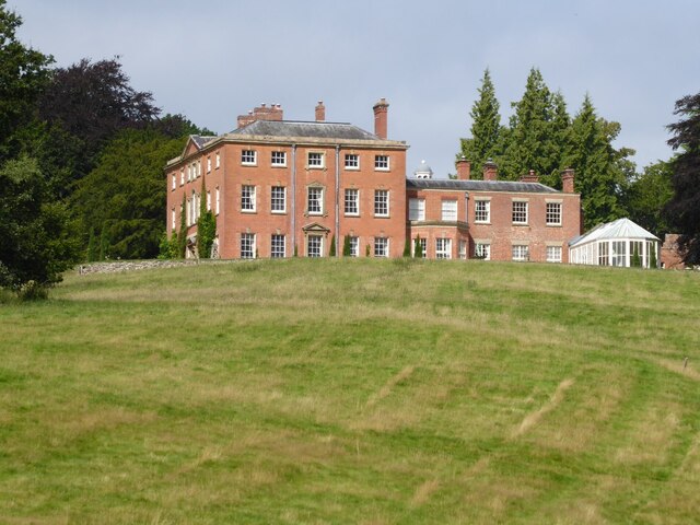
Bromyard Downs is a picturesque area located in Herefordshire, England. Covering an expanse of moorland, the Downs offer a unique and diverse landscape for nature lovers and outdoor enthusiasts. Situated just outside the town of Bromyard, the area is easily accessible and attracts visitors from both near and far.

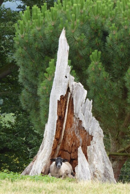
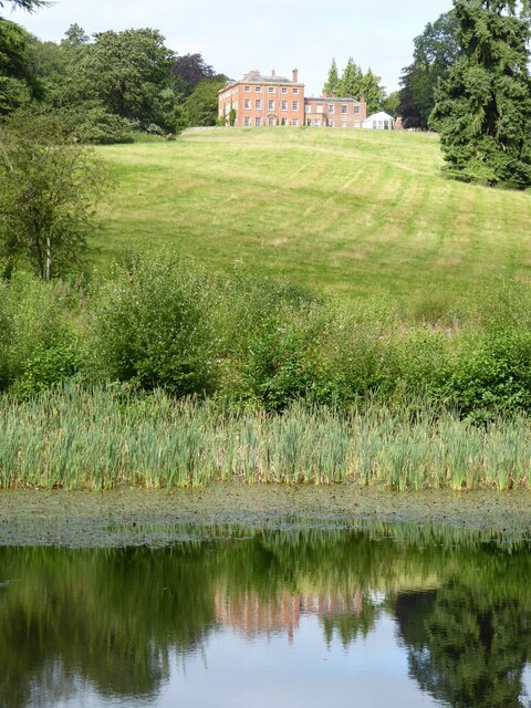
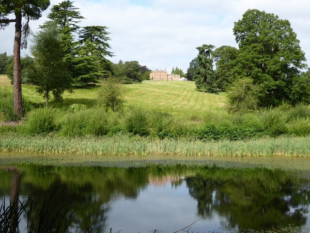
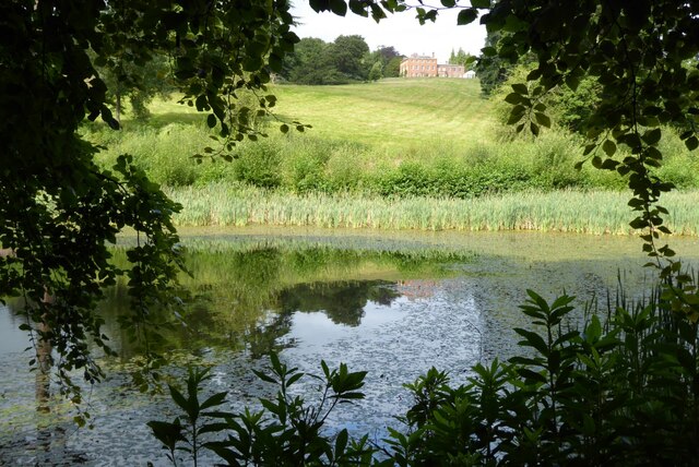
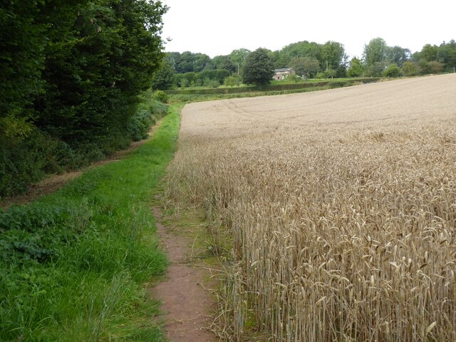
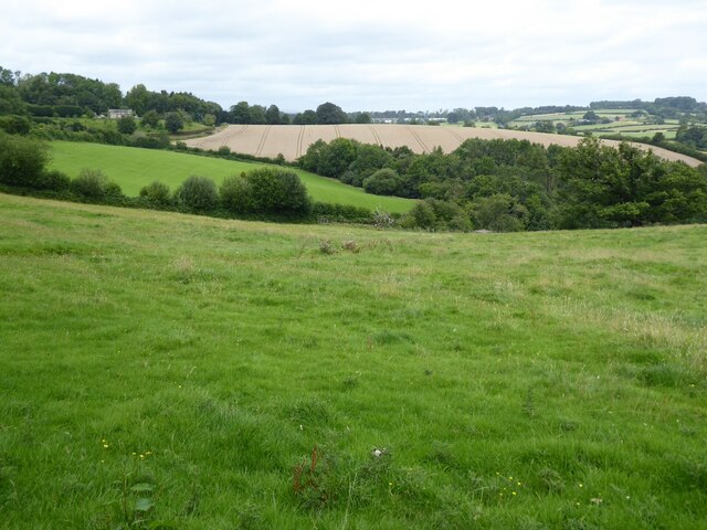
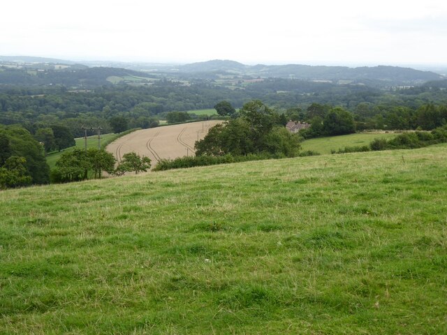
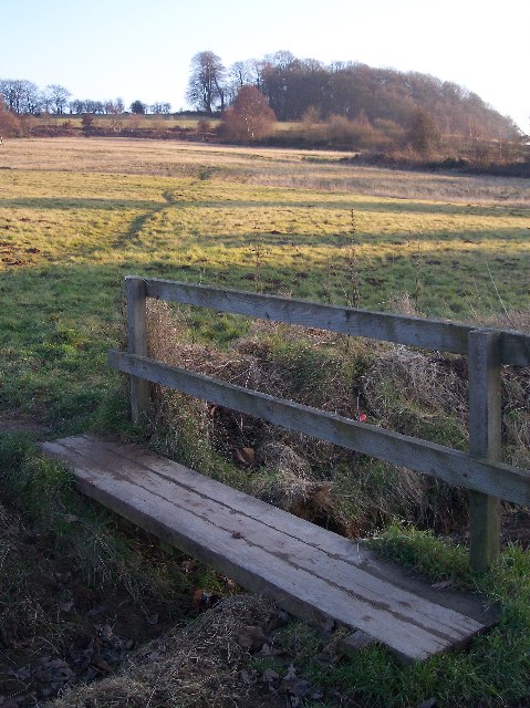
The Downs are characterized by rolling hills, open grasslands, and heathland, creating a stunning panoramic view that stretches for miles. The area is known for its rich biodiversity, with a wide variety of plant and animal species calling it home. Visitors can expect to observe an array of wildflowers, including heather, gorse, and cowslips, which add vibrant splashes of color to the landscape.

For wildlife enthusiasts, Bromyard Downs offer an excellent opportunity to spot various species such as buzzards, kestrels, and skylarks, which are commonly seen soaring above the open spaces. The area also provides habitat for mammals like rabbits, foxes, and badgers, adding to its natural charm.

The Downs are a popular destination for walkers and hikers, with a network of footpaths and trails crisscrossing the area, allowing visitors to explore the stunning scenery at their leisure. The paths vary in difficulty, catering to both casual strollers and more seasoned hikers. Along the way, walkers can enjoy breathtaking views of the surrounding countryside, including the Malvern Hills and the Welsh mountains in the distance.

In summary, Bromyard Downs in Herefordshire is a captivating area of moorland, offering a diverse and breathtaking landscape. With its rich biodiversity, stunning views, and numerous walking trails, it is a haven for nature enthusiasts and a must-visit destination for those seeking a tranquil escape in the heart of the English countryside.

If you have any feedback on the listing, please let us know in the comments section below.

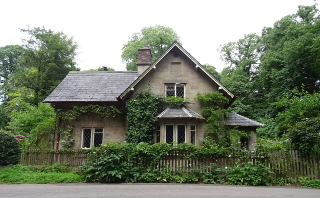
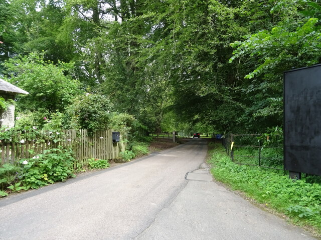
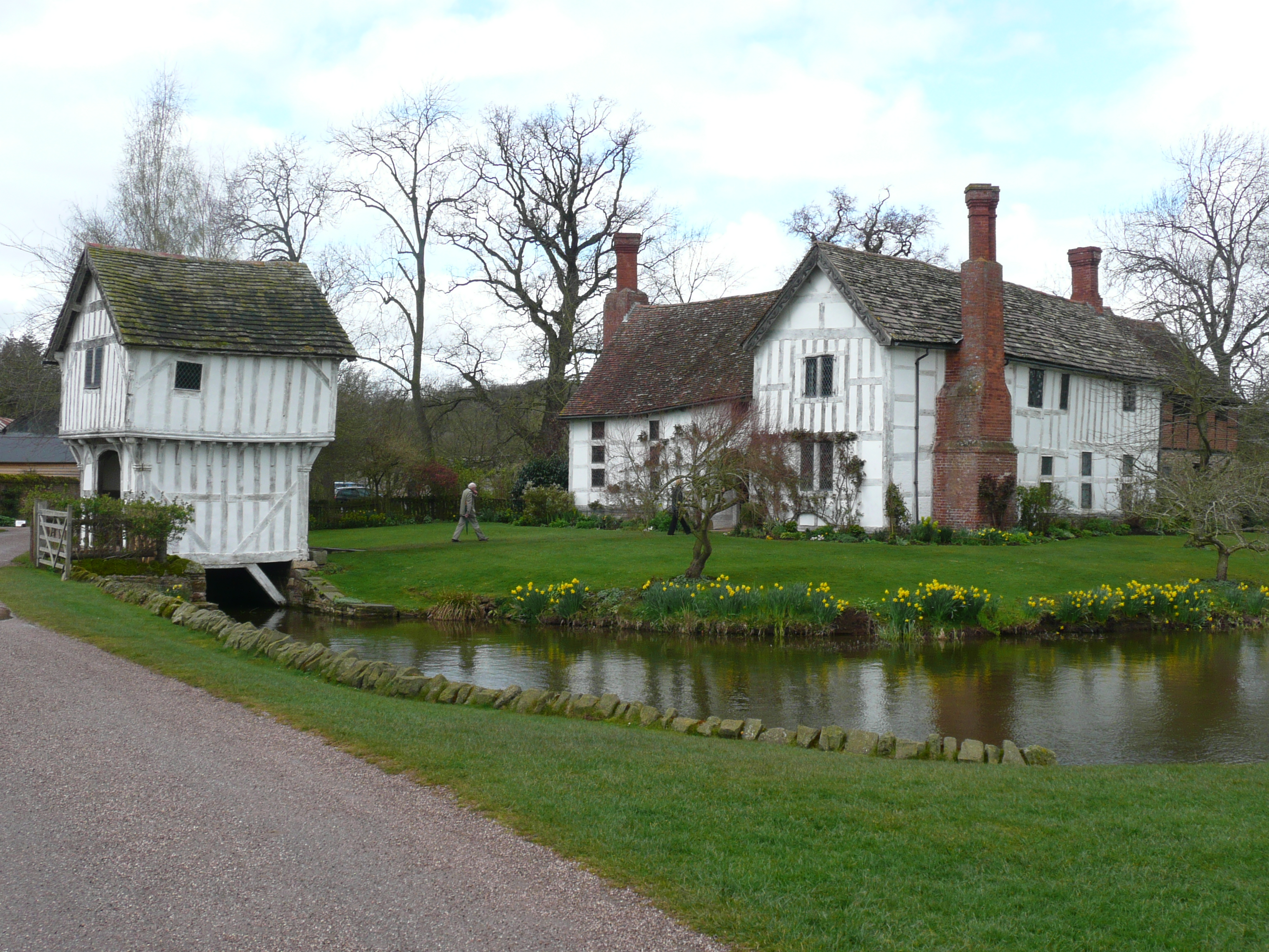
Bromyard Downs Images

Images are sourced within 2km of 52.187307/-2.477813 or Grid Reference SO6754. Thanks to Geograph Open Source API. All images are credited.

Ewe in hollow tree stump I couldn't resist photographing this ewe sitting inside a hollow tree stump when I saw it on the Brockhampton estate.
Ewe in hollow tree stump
I couldn't resist photographing this ewe sitting inside a hollow tree stump when I saw it on the Brockhampton estate.
Brockhampton House reflected in Lawn Pool Brockhampton House reflected in Lawn Pool on the Brockhampton Estate.
Brockhampton House reflected in Lawn Pool
Brockhampton House reflected in Lawn Pool on the Brockhampton Estate.
Lawn Pool, Brockhampton Brockhampton House reflected in Lawn Pool on the Brockhampton estate.
Lawn Pool, Brockhampton
Brockhampton House reflected in Lawn Pool on the Brockhampton estate.
Lawn Pool, Brockhampton rockhampton House reflected in Lawn Pool on the Brockhampton estate.
Lawn Pool, Brockhampton
rockhampton House reflected in Lawn Pool on the Brockhampton estate.
Brockhampton Park Brockhampton Park is a mid-18th century red-brick Georgian house, here it is viewed from Lawn Pool.  The house is Grade II* listed, see: <span class="nowrap"><a title="https://historicengland.org.uk/listing/the-list/list-entry/1176659" rel="nofollow ugc noopener" href="https://historicengland.org.uk/listing/the-list/list-entry/1176659">Link</a><img style="margin-left:2px;" alt="External link" title="External link - shift click to open in new window" src="https://s1.geograph.org.uk/img/external.png" width="10" height="10"/></span> The house is private amidst National Trust owned parkland.
Brockhampton Park
Brockhampton Park is a mid-18th century red-brick Georgian house, here it is viewed from Lawn Pool. The house is Grade II* listed, see: LinkExternal link The house is private amidst National Trust owned parkland.
Permissive footpath Permissive footpath in a field of wheat approaching a cottage on the edge of the Bromyard Downs.
Permissive footpath
Permissive footpath in a field of wheat approaching a cottage on the edge of the Bromyard Downs.
Farmland on the Bromyard Downs Farmland to the north of Hill House Farm on the Bromyard Downs.
Farmland on the Bromyard Downs
Farmland to the north of Hill House Farm on the Bromyard Downs.
View over Brockhampton View over Brockhampton to the Teme valley.
View over Brockhampton
View over Brockhampton to the Teme valley.
The Hop Pole Hotel, Bromyard On Market Square.
The Hop Pole Hotel, Bromyard
On Market Square.
Worcester 14 Miles The A44 from Bromyard.
Worcester 14 Miles
The A44 from Bromyard.
Fishing Pond, Linton
A44, Linton Towards Worcester.
A44, Linton
Towards Worcester.
Old Milestone beside the A44, Washcroft, Brockhampton Inscription reads:-
TO BROMYARD 1 MILE

Milestone Society National ID: HF_BYWO01.

See <a href="https://www.geograph.org.uk/photo/5295288">SO6754 : Old Milestone by the A44, Washcroft, Brockhampton,</a>
Old Milestone beside the A44, Washcroft, Brockhampton
Inscription reads:- TO BROMYARD 1 MILE Milestone Society National ID: HF_BYWO01. See SO6754 : Old Milestone by the A44, Washcroft, Brockhampton,
Malvern Road (B4220) Junction with the A44.
Malvern Road (B4220)
Junction with the A44.
A44 towards Worcester Heading east.
A44 towards Worcester
Heading east.
Bracken and woodland beside the A44
Bromyard Lodge West lodge to Brockhampton Park off the A44.
Bromyard Lodge
West lodge to Brockhampton Park off the A44.
Entrance to Brockhampton Park
Show me another place!

Bromyard Downs is located at Grid Ref: SO6754 (Lat: 52.187307, Lng: -2.477813)

Unitary Authority: County of Herefordshire

Police Authority: West Mercia

What 3 Words

///throwaway.trio.dubbing. Near Bromyard, Herefordshire

Nearby Locations

Bromyard Downs

Related Wikis

Brockhampton (near Bromyard)

Brockhampton is a civil parish in Herefordshire, England, about 4 km (2 mi) east of Bromyard. The parish comprises the National Trust property of Brockhampton...

Bromyard Downs

Bromyard Downs is an area of registered common land, and a scattered settlement, just outside the town of Bromyard in Herefordshire, England. The 114 hectares...

Norton, Herefordshire

Norton is a civil parish in north-east Herefordshire, England, and is approximately 14 miles (23 km) north-east from the city and county town of Hereford...

Linton (near Bromyard)

Linton is a civil parish in north-east of Herefordshire, England, and is approximately 14 miles (23 km) north-east from the city and county town of Hereford...

Nearby Amenities

Located within 500m of 52.187307,-2.477813
Bus Stop
Caravan Club
Bus: yes
Naptan AtcoCode: 2090A0106104
Naptan Bearing: NE
Naptan CommonName: Caravan Club
Naptan Indicator: opp
Naptan Landmark: Caravan Site
Naptan NaptanCode: heratgdj
Naptan Street: A44
Public Transport: platform
Shelter: no
Source: naptan_import
Lat/Long: 52.1873235/-2.4706878
Bus Stop
Malvern Turn
Bus: yes
Naptan AtcoCode: 2090A123500
Naptan Bearing: E
Naptan CommonName: Malvern Turn
Naptan Indicator: opp.
Naptan Landmark: Junction A44/B4220
Naptan NaptanCode: heradtpw
Naptan Street: A44
Public Transport: platform
Source: naptan_import
Lat/Long: 52.185359/-2.480235
Bus Stop
Malvern Turn
Bus: yes
Naptan AtcoCode: 2090A18238
Naptan Bearing: SW
Naptan CommonName: Malvern Turn
Naptan Indicator: adj
Naptan Landmark: Junction A44/B4220
Naptan NaptanCode: heragmam
Naptan Street: B4220
Naptan Verified: no
Public Transport: platform
Source: naptan_import
Lat/Long: 52.1852332/-2.480219
Bus Stop
Linton Court
Bus: yes
Naptan AtcoCode: 2090A20133
Naptan Bearing: W
Naptan CommonName: Linton Court
Naptan Indicator: adj
Naptan Landmark: Linton Court
Naptan NaptanCode: herapadw
Naptan Street: A44
Public Transport: platform
Shelter: yes
Source: naptan_import
Lat/Long: 52.1847537/-2.483261
Bus Stop
Linton Court
Bus: yes
Naptan AtcoCode: 2090A20135
Naptan Bearing: E
Naptan CommonName: Linton Court
Naptan Indicator: opp
Naptan Landmark: Linton Court
Naptan NaptanCode: herapaga
Naptan Street: A44
Public Transport: platform
Source: naptan_import
Lat/Long: 52.1849173/-2.4832685
Note: sign warning of sheep for 3 miles eastbound
Lat/Long: 52.184847/-2.4837214
Post Box
Brand: Royal Mail
Brand Wikidata: Q638098
Collection Times: Mo-Sa 08:00
Mail 2nd Class: yes
Operator: Royal Mail
Operator Wikidata: Q638098
Post Box Type: lamp
Ref: HR7 412
Royal Cypher: EIIR
Royal Cypher Wikidata: Q33102113
Lat/Long: 52.1867644/-2.474433
Post Box
Brand: Royal Mail
Brand Wikidata: Q638098
Collection Times: Mo-Fr 16:00; Sa 07:00
Operator: Royal Mail
Operator Wikidata: Q638098
Post Box Type: lamp
Ref: HR7 445
Royal Cypher: EIIR
Royal Cypher Wikidata: Q33102113
Lat/Long: 52.1847899/-2.4832663
Entrance: main
Lat/Long: 52.1867776/-2.4735739
Note: slippery road for 1.5 miles eastbound
Lat/Long: 52.1852517/-2.4804914
Barrier: stile
Bicycle: no
Dog Gate: yes
Foot: yes
Horse: no
Material: wood
Motor Vehicle: no
Stile: stepover
Lat/Long: 52.1886003/-2.475718
Generator Method: photovoltaic
Generator Output Electricity: yes
Generator Source: solar
Generator Type: solar_photovoltaic_panel
Location: roof
Power: generator
Lat/Long: 52.1860119/-2.4813116
Hopcote Cottage
Power: pole
Transformer: distribution
Voltage Primary: 11000
Lat/Long: 52.1849759/-2.4835593
Power: pole
Lat/Long: 52.1855473/-2.4842016
Power: pole
Lat/Long: 52.1885575/-2.4823576
The Bowery
Power: pole
Transformer: distribution
Voltage Primary: 11000
Lat/Long: 52.1892822/-2.4823248
Power: pole
Lat/Long: 52.1876822/-2.4824005
Down House
Power: pole
Transformer: distribution
Voltage Primary: 11000
Lat/Long: 52.1874713/-2.4826433
Power: pole
Lat/Long: 52.186844/-2.4833849
Power: pole
Lat/Long: 52.1862915/-2.4835512
Power: pole
Lat/Long: 52.1863449/-2.4821672
Power: pole
Lat/Long: 52.1863729/-2.4811942
Worcester Road
Power: pole
Transformer: distribution
Voltage Primary: 11000
Lat/Long: 52.1860637/-2.4804264
Power: pole
Lat/Long: 52.1858598/-2.4799249
Power: pole
Lat/Long: 52.1853475/-2.4795266
Power: pole
Lat/Long: 52.1845475/-2.4789043
Location Transition: yes
Power: pole
Lat/Long: 52.1867009/-2.4724388
Bromyard Booster Station
Power: pole
Transformer: distribution
Voltage Primary: 11000
Lat/Long: 52.1868489/-2.4724522
Power: pole
Lat/Long: 52.1863992/-2.4724455
Power: pole
Lat/Long: 52.1854725/-2.4727111
Power: pole
Lat/Long: 52.1849397/-2.4735519
Power: pole
Lat/Long: 52.1858935/-2.47241
Power: pole
Lat/Long: 52.1850429/-2.4730182
Stonehouse
Power: pole
Transformer: distribution
Voltage Primary: 11000
Lat/Long: 52.1842013/-2.4731697
Power: pole
Lat/Long: 52.1848238/-2.4741541
Power: pole
Lat/Long: 52.1846001/-2.4752645
Power: pole
Lat/Long: 52.1841429/-2.4760008
Linton Council Houses South
Power: pole
Transformer: distribution
Voltage Primary: 11000
Lat/Long: 52.1834933/-2.4757192
Power: pole
Lat/Long: 52.1844283/-2.4761148
Power: pole
Lat/Long: 52.1840944/-2.477822
Power: pole
Lat/Long: 52.1840221/-2.4782002
Linton Malvern Road
Power: pole
Transformer: distribution
Voltage Primary: 11000
Lat/Long: 52.1834975/-2.4775109
Power: pole
Lat/Long: 52.1828997/-2.4767169
Power: pole
Lat/Long: 52.1914227/-2.4752149
The data included in this document is from www.openstreetmap.org. The data is made available under ODbL.

Have you been to Bromyard Downs?

Leave your review of Bromyard Downs below (or comments, questions and feedback).