Avon Valley Country Park

Downs, Moorland in Somerset

England

Avon Valley Country Park

The Swan, Swineford The Swan <span class="nowrap"><a title="https://www.swanswineford.co.uk/" rel="nofollow ugc noopener" href="https://www.swanswineford.co.uk/">Link</a><img style="margin-left:2px;" alt="External link" title="External link - shift click to open in new window" src="https://s1.geograph.org.uk/img/external.png" width="10" height="10"/></span> is described as a 'Country inn with muted modern interiors and a menu of pub classics given a contemporary twist', a description which would fit many pubs in villages around Bath.  Looking further along the A431, the Leaping Lambs Nursery <span class="nowrap"><a title="https://swineford.leapinglambsnursery.co.uk/" rel="nofollow ugc noopener" href="https://swineford.leapinglambsnursery.co.uk/">Link</a><img style="margin-left:2px;" alt="External link" title="External link - shift click to open in new window" src="https://s1.geograph.org.uk/img/external.png" width="10" height="10"/></span> , housed in a former 'Tin Tabernacle' is just visible at the far end of the village.
The Swan, Swineford Credit: HelenK

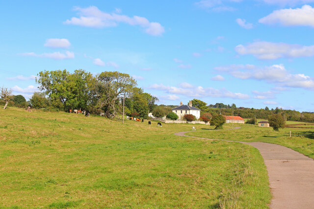
Avon Valley Country Park is a picturesque natural reserve located in Somerset, England. Situated amidst the stunning Downs and Moorland landscapes, the park covers a vast area and offers visitors a range of outdoor activities and attractions.

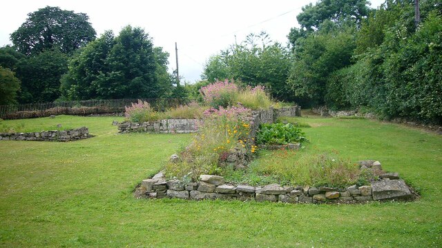
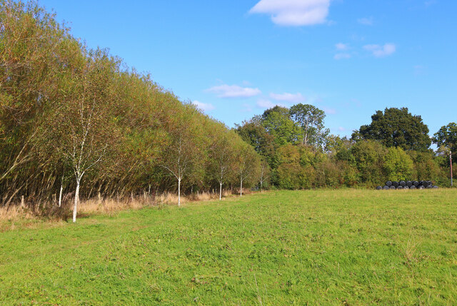
The park boasts diverse flora and fauna, making it a haven for nature enthusiasts. The rolling Downs provide a breathtaking backdrop for leisurely walks and hikes, with well-marked trails guiding visitors through the park's stunning scenery. The Moorland, with its vast open spaces and heather-covered hills, is a sight to behold and offers a unique opportunity to experience the beauty of the English countryside.

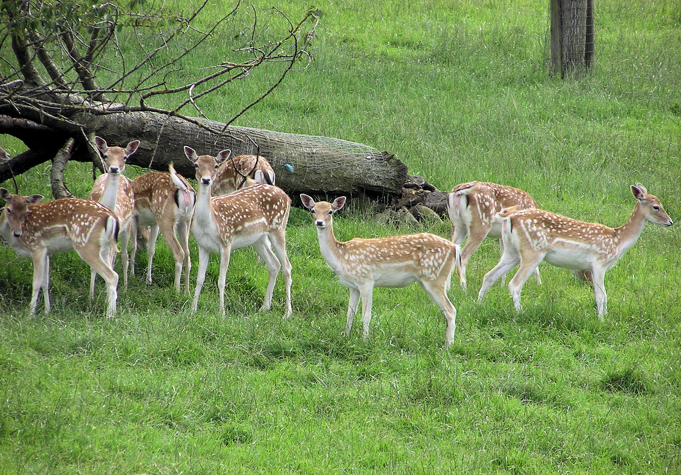
Avon Valley Country Park is also home to a variety of wildlife, including deer, rabbits, and a plethora of bird species. The park's tranquil atmosphere and peaceful surroundings make it an ideal spot for birdwatching and wildlife photography.

For those seeking more adventurous activities, the park offers a range of outdoor pursuits. Cycling enthusiasts can explore the park's extensive network of bike trails, while anglers can try their luck at fishing in the park's well-stocked lakes and rivers. Additionally, there are designated areas for camping and picnicking, allowing visitors to make the most of their time in the great outdoors.

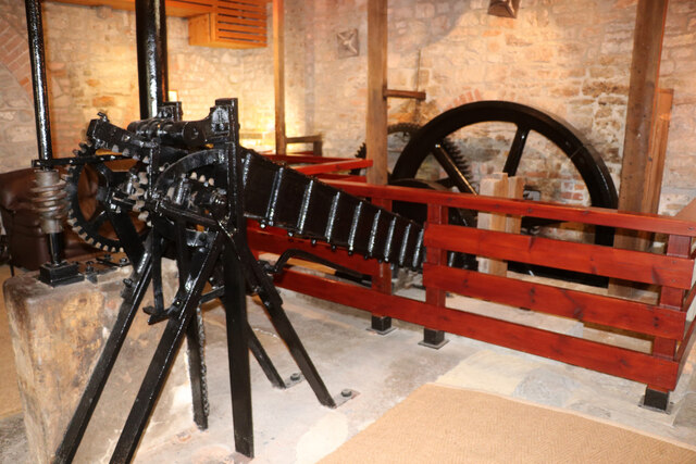
To enhance the visitor experience, Avon Valley Country Park also features a visitor center, where guests can find information about the park's history, wildlife, and activities. The center also houses a café and a gift shop, offering refreshments and souvenirs for visitors to enjoy.

Overall, Avon Valley Country Park is a hidden gem in Somerset, providing a unique opportunity to explore the natural beauty of the Downs and Moorland landscapes while engaging in a variety of outdoor activities.

If you have any feedback on the listing, please let us know in the comments section below.

Avon Valley Country Park Images

Images are sourced within 2km of 51.416293/-2.4718982 or Grid Reference ST6768. Thanks to Geograph Open Source API. All images are credited.

The Swan, Swineford The Swan <span class="nowrap"><a title="https://www.swanswineford.co.uk/" rel="nofollow ugc noopener" href="https://www.swanswineford.co.uk/">Link</a><img style="margin-left:2px;" alt="External link" title="External link - shift click to open in new window" src="https://s1.geograph.org.uk/img/external.png" width="10" height="10"/></span> is described as a 'Country inn with muted modern interiors and a menu of pub classics given a contemporary twist', a description which would fit many pubs in villages around Bath.  Looking further along the A431, the Leaping Lambs Nursery <span class="nowrap"><a title="https://swineford.leapinglambsnursery.co.uk/" rel="nofollow ugc noopener" href="https://swineford.leapinglambsnursery.co.uk/">Link</a><img style="margin-left:2px;" alt="External link" title="External link - shift click to open in new window" src="https://s1.geograph.org.uk/img/external.png" width="10" height="10"/></span> , housed in a former 'Tin Tabernacle' is just visible at the far end of the village.
The Swan, Swineford
The Swan LinkExternal link is described as a 'Country inn with muted modern interiors and a menu of pub classics given a contemporary twist', a description which would fit many pubs in villages around Bath. Looking further along the A431, the Leaping Lambs Nursery LinkExternal link , housed in a former 'Tin Tabernacle' is just visible at the far end of the village.
Bitton Railway Bridge over the River Avon The River Avon Trail uses this bridge to cross from the northern side of the river to the southern side but there is no obvious way down to the southern side with attempts to barricade any route.
Bitton Railway Bridge over the River Avon
The River Avon Trail uses this bridge to cross from the northern side of the river to the southern side but there is no obvious way down to the southern side with attempts to barricade any route.
Swineford Lock near Bitton
Saltford Manor The Saltford Manor is thought to be the oldest continuously occupied private house in England, and has been designated as a Grade II listed building.
The original Norman construction was by William Fitz Robert, 2nd Earl of Gloucester, and was built on an estate owned at the time of the Domesday Book by Geoffrey de Montbray the Bishop of Coutances. It is contemporary with nearby Horton Court which was a prebendary house, therefore it is likely that Saltford had an association with Keynsham Abbey, and has long been associated with St Mary's Church in Saltford. (source Wikipedia)
Saltford Manor
The Saltford Manor is thought to be the oldest continuously occupied private house in England, and has been designated as a Grade II listed building. The original Norman construction was by William Fitz Robert, 2nd Earl of Gloucester, and was built on an estate owned at the time of the Domesday Book by Geoffrey de Montbray the Bishop of Coutances. It is contemporary with nearby Horton Court which was a prebendary house, therefore it is likely that Saltford had an association with Keynsham Abbey, and has long been associated with St Mary's Church in Saltford. (source Wikipedia)
The A431 between Swineford and Bitton Looking north-west towards Bitton from a layby which always seems to have a parked vehicle or two in it.  The straightness of this stretch of road betrays its Roman origins.  The A431 is in general more winding than other roads between Bristol and Bath, which works to its advantage as a route because it is not used by lorries.
The A431 between Swineford and Bitton
Looking north-west towards Bitton from a layby which always seems to have a parked vehicle or two in it. The straightness of this stretch of road betrays its Roman origins. The A431 is in general more winding than other roads between Bristol and Bath, which works to its advantage as a route because it is not used by lorries.
Keynsham Abbey Remains <span class="nowrap"><a title="https://historicengland.org.uk/listing/the-list/list-entry/1384577?section=official-listing" rel="nofollow ugc noopener" href="https://historicengland.org.uk/listing/the-list/list-entry/1384577?section=official-listing">Link</a><img style="margin-left:2px;" alt="External link" title="External link - shift click to open in new window" src="https://s1.geograph.org.uk/img/external.png" width="10" height="10"/></span>
Keynsham Abbey Remains
Direction Sign – Signpost on the B3116 in Keynsham Located on the southwest side of the junction of the B3116 Wellsway and Chewton Road in Keynsham parish. 2 arms and restored pyramid finial. See also <a title="https://www.geograph.org.uk/photo/6094137" href="https://www.geograph.org.uk/photo/6094137">Link</a>.

Milestone Society National ID: SO_ST6567A
Direction Sign – Signpost on the B3116 in Keynsham
Located on the southwest side of the junction of the B3116 Wellsway and Chewton Road in Keynsham parish. 2 arms and restored pyramid finial. See also Link. Milestone Society National ID: SO_ST6567A
Direction Sign – Signpost on the B3116 in Keynsham Located at the northern corner of a grass triangle in the centre of the junction of the B3116 Wellsway and Manor Road in Keynsham parish. 2 arms and pyramid finial. See also <a title="https://www.geograph.org.uk/photo/6049840" href="https://www.geograph.org.uk/photo/6049840">Link</a> and <span class="nowrap"><a title="https://www.flickr.com/photos/13171205@N08/8370994413" rel="nofollow ugc noopener" href="https://www.flickr.com/photos/13171205@N08/8370994413">Link</a><img style="margin-left:2px;" alt="External link" title="External link - shift click to open in new window" src="https://s1.geograph.org.uk/img/external.png" width="10" height="10"/></span>.

Milestone Society National ID: SO_ST6567B
Direction Sign – Signpost on the B3116 in Keynsham
Located at the northern corner of a grass triangle in the centre of the junction of the B3116 Wellsway and Manor Road in Keynsham parish. 2 arms and pyramid finial. See also Link and LinkExternal link. Milestone Society National ID: SO_ST6567B
Field on the edge of Swineford The 'Tin Tabernacle' (behind the photographer) was constructed a little apart from the village of Swineford, with this field in between.  The Tabernacle is now the 'Leaping Lambs' nursery <span class="nowrap"><a title="https://swineford.leapinglambsnursery.co.uk/" rel="nofollow ugc noopener" href="https://swineford.leapinglambsnursery.co.uk/">Link</a><img style="margin-left:2px;" alt="External link" title="External link - shift click to open in new window" src="https://s1.geograph.org.uk/img/external.png" width="10" height="10"/></span> but the animals in the field today were cattle.
Field on the edge of Swineford
The 'Tin Tabernacle' (behind the photographer) was constructed a little apart from the village of Swineford, with this field in between. The Tabernacle is now the 'Leaping Lambs' nursery LinkExternal link but the animals in the field today were cattle.
Broadmead Lane Railway bridge in Keynsham.
Broadmead Lane
Railway bridge in Keynsham.
Avon Valley Farm Field near Keynsham.
Avon Valley Farm
Field near Keynsham.
Bath Road Impressive building on Bath Road, in Keynsham.
Bath Road
Impressive building on Bath Road, in Keynsham.
Footpath near Keynsham Animals grazing by a footpath.
Footpath near Keynsham
Animals grazing by a footpath.
Meadow Wood Trees on Monarch's Way near Bitton.
Meadow Wood
Trees on Monarch's Way near Bitton.
Somerville Way Residential road in Bitton.
Somerville Way
Residential road in Bitton.
St Mary's Church Church in the village of Bitton.
St Mary's Church
Church in the village of Bitton.
Albert Mill, Keynsham Now converted to housing with several adjoining new buildings. The old core has been retained and was open for Heritage Open Days. The mill has had a variety of uses but was latterly used for grinding woods for use in natural dyes. These included logwood that produces the dye haematoxylin that is still is used in cellular pathology laboratories the world over and provides the purple colour in the classic H & E stain. The mill has a very long history and was recorded in the Domesday Book. The current incarnation is a rebuilding following a fire in 1873. It ceased production in 1964 and was converted to accommodation in 1992.
Albert Mill, Keynsham
Now converted to housing with several adjoining new buildings. The old core has been retained and was open for Heritage Open Days. The mill has had a variety of uses but was latterly used for grinding woods for use in natural dyes. These included logwood that produces the dye haematoxylin that is still is used in cellular pathology laboratories the world over and provides the purple colour in the classic H & E stain. The mill has a very long history and was recorded in the Domesday Book. The current incarnation is a rebuilding following a fire in 1873. It ceased production in 1964 and was converted to accommodation in 1992.
Albert Mill, Keynsham - wood chipper This water wheel powered device may well be unique. The sloping device on the left receives woods used in dye production and uses a rack driven plunger to force them against a revolving disc carrying four blades that slice slivers of the end of the wood. The disc is driven by step-up gearing from a large external waterwheel. A flywheel provides momentum in the system. One of the woods that was chipped is logwood that is used to produce the purple dye haematoxylin. This is used in cellular pathology laboratories around the world as a nuclear stain. The mill is now accommodation but retains some machinery and was open for Heritage Open Days.
Albert Mill, Keynsham - wood chipper
This water wheel powered device may well be unique. The sloping device on the left receives woods used in dye production and uses a rack driven plunger to force them against a revolving disc carrying four blades that slice slivers of the end of the wood. The disc is driven by step-up gearing from a large external waterwheel. A flywheel provides momentum in the system. One of the woods that was chipped is logwood that is used to produce the purple dye haematoxylin. This is used in cellular pathology laboratories around the world as a nuclear stain. The mill is now accommodation but retains some machinery and was open for Heritage Open Days.
Show me another place!

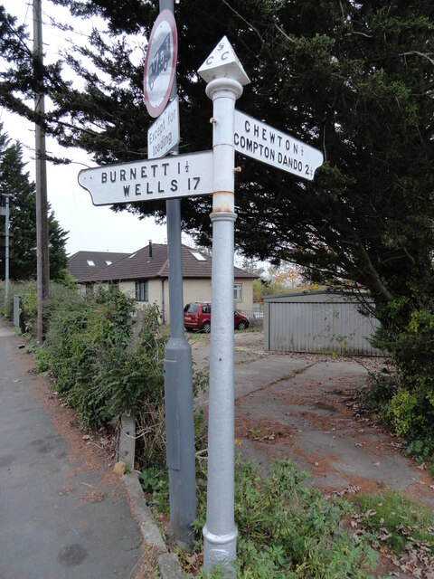
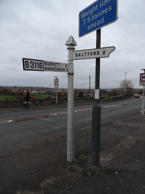
Avon Valley Country Park is located at Grid Ref: ST6768 (Lat: 51.416293, Lng: -2.4718982)

Unitary Authority: Bath and North East Somerset

Police Authority: Avon and Somerset

What 3 Words

///held.fired.rested. Near Bitton, Gloucestershire

Nearby Locations

Avon Valley Country Park

Related Wikis

Avon Valley Country Park

Avon Valley Country Park is a 50-acre (20 ha) country park in Keynsham, Somerset, England. The park offers a variety of rides for children including Chair...

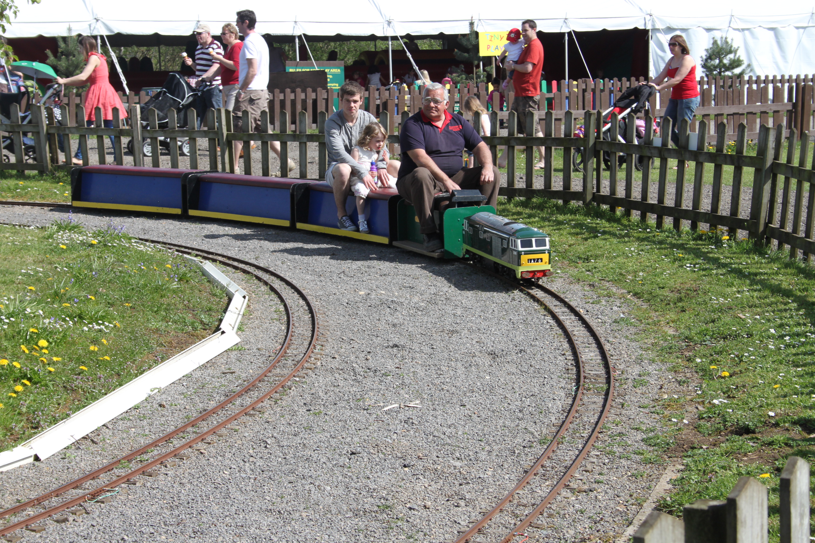
Strawberry Line (Miniature Railway)

The Strawberry Line is a 0.75-mile (1.21 km) length of 7+1⁄2 in (190.5 mm) gauge railway inside Avon Valley Country Park (near Keynsham). It was Britain...

River Boyd

The River Boyd is a river of some 7 miles (11 km) in length which rises near Dodington in South Gloucestershire, England. It is a tributary of the Bristol...

Avon Riverside railway station

Avon Riverside is the newest station (and current terminus) of the Avon Valley Railway. It opened on 1 May 2004.Unlike the other two stations on the railway...

Nearby Amenities

Located within 500m of 51.416293,-2.4718982
Barrier: kissing_gate
Lat/Long: 51.4183808/-2.4741463
Barrier: kissing_gate
Lat/Long: 51.416582/-2.4682227
Cafe
The Woodland Cafe
Addr City: Bristol
Addr Postcode: BS31 1TP
Fhrs Id: 898319
Lat/Long: 51.4157443/-2.4742739
Toilets
Access: customers
Unisex: yes
Lat/Long: 51.4158329/-2.4740522
The data included in this document is from www.openstreetmap.org. The data is made available under ODbL.

Have you been to Avon Valley Country Park?

Leave your review of Avon Valley Country Park below (or comments, questions and feedback).