Casterton Fell

Downs, Moorland in Westmorland South Lakeland

England

Casterton Fell

Snow on the Fells An early morning view towards Brownthwaite and Casterton Fell from Whoop Hall. Overnight snow has changed the scene.
Snow on the Fells Credit: David Dixon

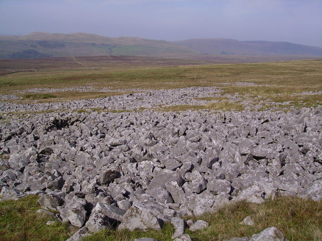
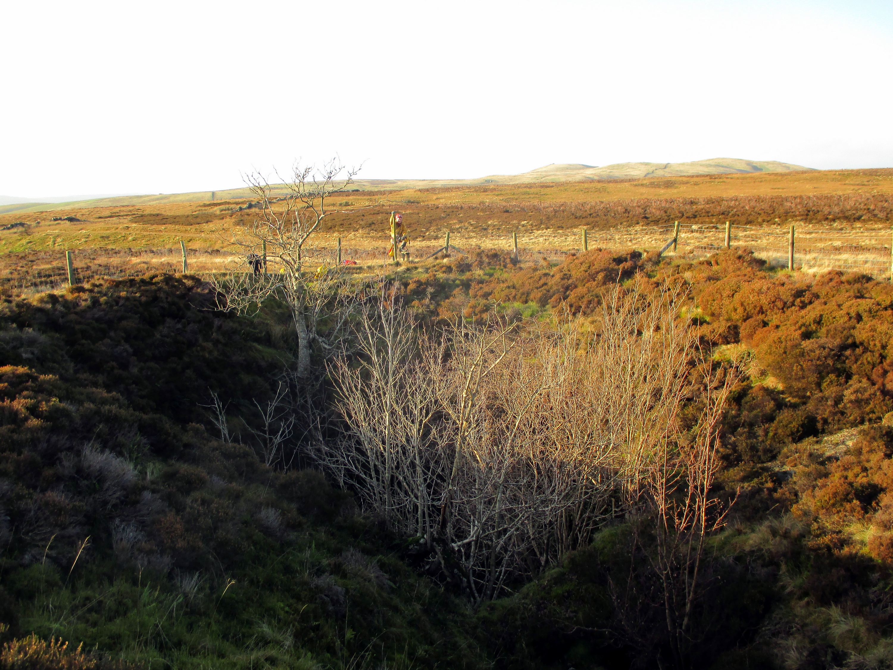
Casterton Fell is a scenic area located in the county of Westmorland, England. It is a diverse landscape that encompasses downs, moorland, and rolling hills, offering breathtaking views and a rich natural habitat. Covering an area of approximately 10 square miles, Casterton Fell is situated in the southern part of the Lake District National Park.

The fell is characterized by its undulating terrain, with a maximum elevation of around 1,000 feet at its highest point. The landscape is predominantly covered in heather and grasses, giving it a distinctive purple hue in late summer. This provides a perfect habitat for a variety of wildlife, including birds such as curlews and lapwings, as well as small mammals like rabbits and voles.

The area is crisscrossed by numerous footpaths and bridleways, making it a popular destination for hikers, walkers, and horse riders. These paths offer visitors the opportunity to explore the diverse terrain and enjoy the panoramic views of the surrounding countryside. The fell also boasts several ancient monuments, including burial mounds and standing stones, which provide a glimpse into the area's rich history.

Casterton Fell is a place of tranquility and natural beauty, offering visitors a chance to escape the hustle and bustle of everyday life. With its stunning vistas, diverse flora and fauna, and rich cultural heritage, it is a must-visit destination for nature enthusiasts and those seeking a peaceful retreat in the heart of Westmorland.

If you have any feedback on the listing, please let us know in the comments section below.

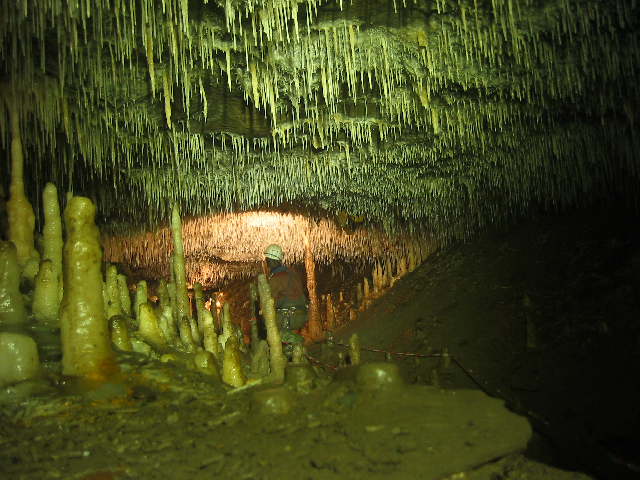
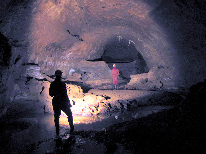
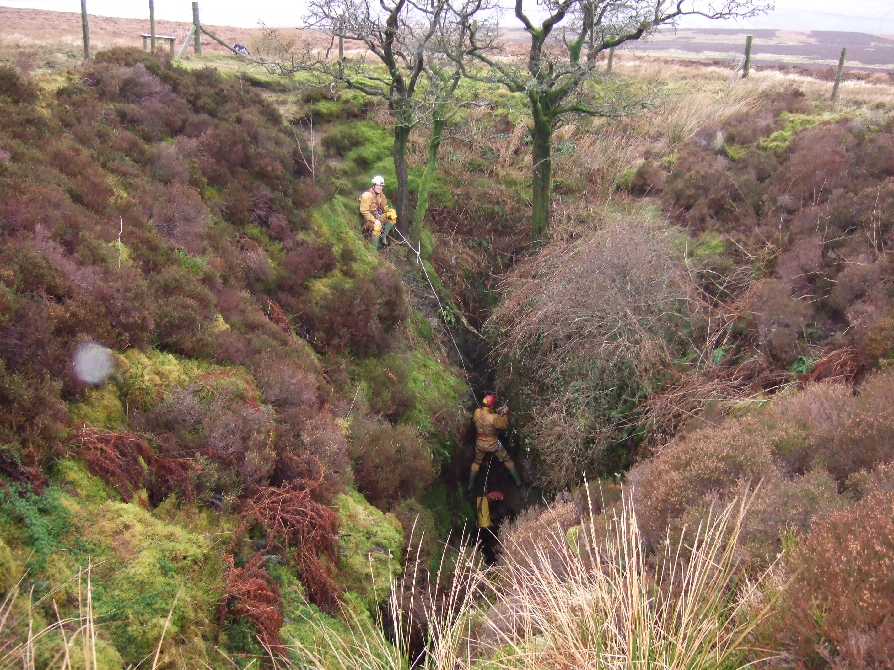
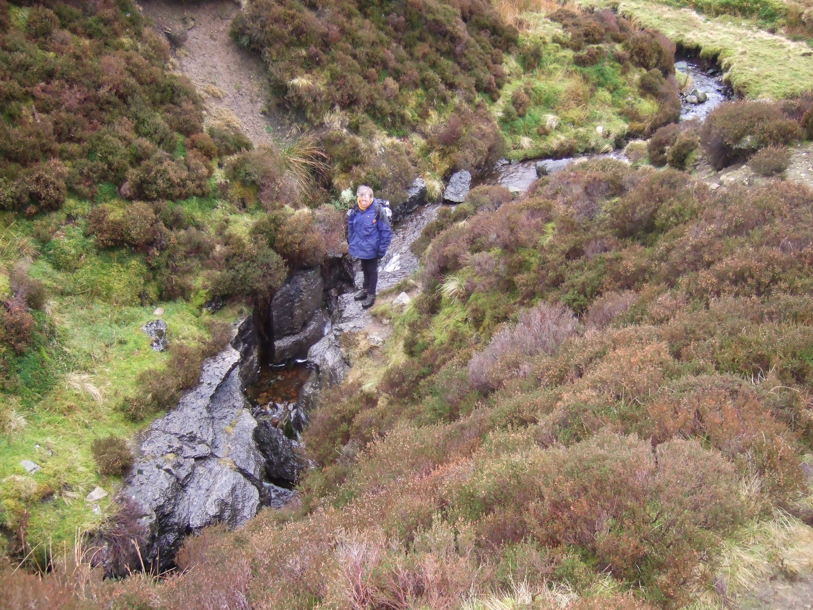
Casterton Fell Images

Images are sourced within 2km of 54.222926/-2.5127376 or Grid Reference SD6680. Thanks to Geograph Open Source API. All images are credited.

Snow on the Fells An early morning view towards Brownthwaite and Casterton Fell from Whoop Hall. Overnight snow has changed the scene.
Snow on the Fells
An early morning view towards Brownthwaite and Casterton Fell from Whoop Hall. Overnight snow has changed the scene.
Barbon High and Low fells from Scout Hill Looking across Kirkby Lonsdale valley
Barbon High and Low fells from Scout Hill
Looking across Kirkby Lonsdale valley
The lane from Bullpot The lane from Bullpot continues beyond the gate as an unfenced public bridleway to Blindbeck Bridge.
In the background beyond Barbondale are Castle Knott and Calf Top.
The lane from Bullpot
The lane from Bullpot continues beyond the gate as an unfenced public bridleway to Blindbeck Bridge. In the background beyond Barbondale are Castle Knott and Calf Top.
Path to the summit, Brownthwaite The path from Gale Garth leading to the white painted trigonometrical column (trig point) on Brownthwaite.
Path to the summit, Brownthwaite
The path from Gale Garth leading to the white painted trigonometrical column (trig point) on Brownthwaite.
Benchmark, Brownthwaite Detail of the flush bracket benchmark on the concrete Ordnance Survey triangulation pillar on Brownthwaite. The flush bracket, benchmark number S5344, is on the southeast face of the pillar and marks a height of 436.9613m above mean sea level (Ordnance Datum Newlyn), last verified in 1953 (location photograph <a href="https://www.geograph.org.uk/photo/7342770">SD6580 : Triangulation Pillar, Brownthwaite</a>).
Benchmark, Brownthwaite
Detail of the flush bracket benchmark on the concrete Ordnance Survey triangulation pillar on Brownthwaite. The flush bracket, benchmark number S5344, is on the southeast face of the pillar and marks a height of 436.9613m above mean sea level (Ordnance Datum Newlyn), last verified in 1953 (location photograph SD6580 : Triangulation Pillar, Brownthwaite).
Triangulation Pillar, Brownthwaite The concrete Ordnance Survey triangulation pillar on the summit of Casterton Fell northeast of Brownthwaite Moss.
The pillar was constructed in 1949. The flush bracket benchmark number S5344 on the southeast face of the pillar marks a height of 436.9613m above mean sea level (Ordnance Datum Newlyn) last verified in 1953 (detail photograph <a href="https://www.geograph.org.uk/photo/7342742">SD6580 : Benchmark, Brownthwaite</a>).
Triangulation Pillar, Brownthwaite
The concrete Ordnance Survey triangulation pillar on the summit of Casterton Fell northeast of Brownthwaite Moss. The pillar was constructed in 1949. The flush bracket benchmark number S5344 on the southeast face of the pillar marks a height of 436.9613m above mean sea level (Ordnance Datum Newlyn) last verified in 1953 (detail photograph SD6580 : Benchmark, Brownthwaite).
Brownthwaite Moss The highest point on Brownthwaite (and Barbon Low Fell) is about 600m NE of Brownthwaite Pike. The trig point is just visible. Brownthwaite Moss is between.
Brownthwaite Moss
The highest point on Brownthwaite (and Barbon Low Fell) is about 600m NE of Brownthwaite Pike. The trig point is just visible. Brownthwaite Moss is between.
Trig Point, Brownthwaite The highest point on Brownthwaite (437m). Middleton Fell is in the background, with the highest point at Calf Top (609m).
Trig Point, Brownthwaite
The highest point on Brownthwaite (437m). Middleton Fell is in the background, with the highest point at Calf Top (609m).
Gateway, Brownthwaite On the SE side of Brownthwaite, looking towards Casterton Fell (in sunlight).
Gateway, Brownthwaite
On the SE side of Brownthwaite, looking towards Casterton Fell (in sunlight).
Limekilns beside Aygill The limekilns together form a grade II listed building and are reckoned to date from the eighteenth century. They're on the south side of Aygill below the confluence of Great and Little Aygill and are viewed across the stream.
Limekilns beside Aygill
The limekilns together form a grade II listed building and are reckoned to date from the eighteenth century. They're on the south side of Aygill below the confluence of Great and Little Aygill and are viewed across the stream.
Ease Gill at Ease Gill Kirk Dried-up river bed.
Ease Gill at Ease Gill Kirk
Dried-up river bed.
Waterworn limestone in Ease Gill Just above the little waterfall.
Waterworn limestone in Ease Gill
Just above the little waterfall.
Casterton Moor Lots of blooming heather on the moorland.
Casterton Moor
Lots of blooming heather on the moorland.
Casterton Fell Near Swallow Hole.
Casterton Fell
Near Swallow Hole.
Looking down the track on the southwest side of Crag Hill towards Barbon Low Fell/Brownthwaite
Foot of the waterfall, Aygill Cool, shady and damp - a place where plants thrive at the foot of a waterfall in Aygill.
Foot of the waterfall, Aygill
Cool, shady and damp - a place where plants thrive at the foot of a waterfall in Aygill.
The entrance to Aygill Hole Although dwarfed by the ramifications of the nearby Lancaster - Easegill system, Aygill is a fascinating cave developed at several levels within the Dent Fault zone. It has been connected to Bull Pot of the Witches, just south of Bullpot Farm, by cave divers.
The entrance to Aygill Hole
Although dwarfed by the ramifications of the nearby Lancaster - Easegill system, Aygill is a fascinating cave developed at several levels within the Dent Fault zone. It has been connected to Bull Pot of the Witches, just south of Bullpot Farm, by cave divers.
Excavated entrance near Aygill Hole This is just upstream of the old lime kilns in Aygill and probably connects with nearby Aygill Hole.
Excavated entrance near Aygill Hole
This is just upstream of the old lime kilns in Aygill and probably connects with nearby Aygill Hole.
Show me another place!

Casterton Fell is located at Grid Ref: SD6680 (Lat: 54.222926, Lng: -2.5127376)

Administrative County: Cumbria

District: South Lakeland

Police Authority: Cumbria

What 3 Words

///unstated.dripping.entry. Near Kirkby Lonsdale, Cumbria

Nearby Locations

Casterton Fell

Related Wikis

Ease Gill Caverns

The Ease Gill Cave System is the longest, and most complex cave system in Britain as of 2011, with around 41 miles (66 km) of passages, including connections...

Leck Fell

Leck Fell is a Site of Special Scientific Interest in Lancashire, England. An area of typically heavily grazed open moorland of rough grass and remnant...

Death's Head Hole

Death's Head Hole is a cave on Leck Fell, in Lancashire, England. Its entrance is a 64-metre (210 ft) deep shaft. It leads into Lost Johns' Cave and is...

Long Drop Cave

Long Drop Cave is a cave on Leck Fell, in Lancashire, England. It leads into Death's Head Hole, and is part of the Three Counties System, an 87-kilometre...

Three Counties System

The Three Counties System is a set of inter-connected limestone solutional cave systems spanning the borders of Cumbria, Lancashire and North Yorkshire...

Rumbling Hole

Rumbling Hole is a cave on Leck Fell, in Lancashire, England. Its entrance is a 50-metre (160 ft) deep fenced shaft, and it rapidly descends a series of...

Short Drop Cave - Gavel Pot System

Short Drop Cave and Gavel Pot are different entrances into the same cave system on Leck Fell, in Lancashire, England. The main top entrance, Short Drop...

Lost Johns' Cave

Lost Johns' Cave is an extensive cave system on Leck Fell, Lancashire, England. With its three major vertical routes (Dome Route, Centipede Route and...

Nearby Amenities

Located within 500m of 54.222926,-2.5127376
Lancaster Hole
Access: permit
Fee: no
Natural: cave_entrance
Source: survey
Lat/Long: 54.2210687/-2.516764
Cow Pot
Natural: cave_entrance
Source: OS 1:25k
Lat/Long: 54.2223141/-2.5162662
Ford: yes
Lat/Long: 54.224089/-2.5201435
The data included in this document is from www.openstreetmap.org. The data is made available under ODbL.

Have you been to Casterton Fell?

Leave your review of Casterton Fell below (or comments, questions and feedback).