Beatrix Fell
Downs, Moorland in Yorkshire Ribble Valley
England
Beatrix Fell
Beatrix Fell is a picturesque village nestled in the heart of Yorkshire, England. It is located in the region known for its stunning landscapes, including the Yorkshire Downs and Moorland. The village itself is small, with a population of around 500 residents.
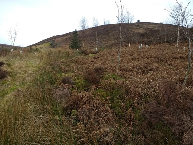
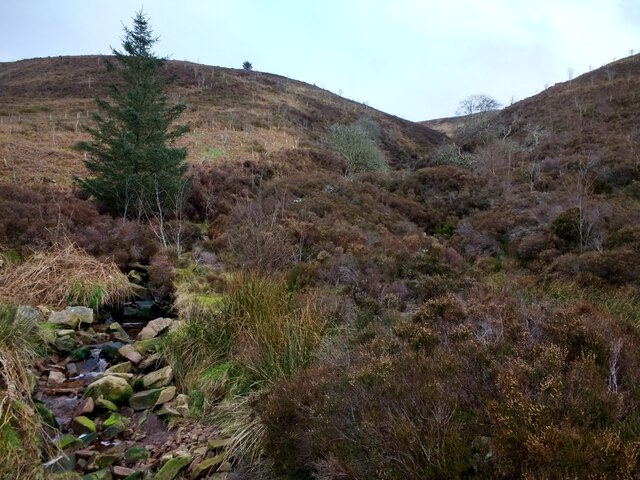
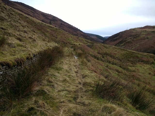
The beauty of Beatrix Fell lies in its natural surroundings. The Yorkshire Downs, with their rolling hills and green pastures, provide a breathtaking backdrop to the village. The moorland, characterized by its vast stretches of open land and heather-covered hills, offers a unique charm that attracts visitors from far and wide.
The village is known for its quaint and charming architecture, with stone cottages and traditional buildings lining the narrow streets. The local community takes great pride in preserving the historical character of Beatrix Fell, ensuring that any new developments blend seamlessly with the existing landscape.
Despite its small size, Beatrix Fell offers a range of amenities for both residents and visitors. There are a few local shops and a cozy village pub where locals gather to socialize. The village also boasts a primary school and a community center, which host various events throughout the year.
Outdoor enthusiasts will find plenty to do in Beatrix Fell. The surrounding countryside offers excellent opportunities for hiking, cycling, and horseback riding. The nearby moorland is a haven for birdwatchers and nature lovers, with its rich biodiversity and stunning vistas.
In summary, Beatrix Fell is a charming village nestled in the Yorkshire Downs and Moorland. With its stunning natural beauty, quaint architecture, and range of amenities, it is a destination that offers a peaceful retreat and a taste of rural English life.
If you have any feedback on the listing, please let us know in the comments section below.
Beatrix Fell Images
Images are sourced within 2km of 53.96869/-2.5134212 or Grid Reference SD6652. Thanks to Geograph Open Source API. All images are credited.


Beatrix Fell is located at Grid Ref: SD6652 (Lat: 53.96869, Lng: -2.5134212)
Division: West Riding
Administrative County: Lancashire
District: Ribble Valley
Police Authority: Lancashire
What 3 Words
///chap.ordering.cabin. Near Waddington, Lancashire
Nearby Locations
Related Wikis

Bowland Forest High
Bowland Forest High is a civil parish in the Ribble Valley district of Lancashire, England, covering some 20,000 acres (80 km2) of the Forest of Bowland...

Dunsop Bridge
Dunsop Bridge is a village in the civil parish of Bowland Forest High, in the borough of Ribble Valley, Lancashire, England, 9 miles (14 km) north-west...

Dunsop Bridge (structure)
Dunsop Bridge is a bridge in the English village of the same name. The structure, which dates to the early 19th century, crosses the River Dunsop. A Grade...

River Dunsop
The River Dunsop is a river in the Forest of Bowland in Northern England. It flows into the River Hodder at Dunsop Bridge.It begins at the confluence of...

Bowland Forest High milestone
The Bowland Forest High milestone is an historic milestone marker in the English parish of Bowland Forest High, in the Trough of Bowland, Lancashire. A...

Sykes Smelt Mill
Sykes Smelt Mill was a mediaeval mill located between Sykes and Hareden in Bowland Forest High, Lancashire, England. It stood on the banks of Langden Brook...

Langden Brook
Langden Brook is a watercourse in the Trough of Bowland, Lancashire, England. A tributary of the River Hodder, its source is near the summit of Hawthornthwaite...

Geography of the United Kingdom
The United Kingdom is a sovereign state located off the north-western coast of continental Europe. With a total area of approximately 248,532 square kilometres...
Nearby Amenities
Located within 500m of 53.96869,-2.5134212Have you been to Beatrix Fell?
Leave your review of Beatrix Fell below (or comments, questions and feedback).