Nanslope Moss
Downs, Moorland in Westmorland South Lakeland
England
Nanslope Moss

Nanslope Moss is a picturesque region located in Westmorland, England. It is characterized by its diverse terrain, consisting of both downs and moorland. Covering an area of approximately 200 acres, Nanslope Moss is a haven for nature enthusiasts and offers a unique experience for visitors.
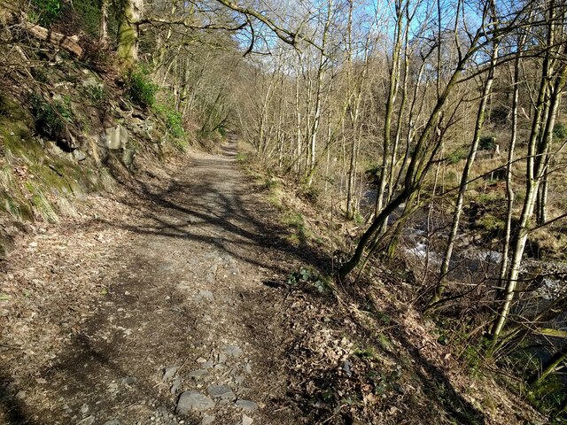
The downs of Nanslope Moss present a stunning landscape with gently rolling hills and expansive grasslands. This area is known for its rich biodiversity, supporting a variety of plant and animal species. Wildflowers such as cowslips, harebells, and heather dot the downs, creating a vibrant tapestry of colors during the summer months. The open spaces provide ample opportunities for walking, hiking, and picnicking, offering visitors a chance to immerse themselves in the tranquility of nature.
The moorland of Nanslope Moss presents a stark contrast to the downs, with its rugged and wild terrain. Heather dominates the landscape, creating a striking purple hue that stretches as far as the eye can see. This area is home to various bird species, including the iconic red grouse and skylark. The moorland also boasts small pools and streams, adding to the charm and diversity of the region.
Nanslope Moss is a popular destination for outdoor enthusiasts, offering a range of activities such as birdwatching, photography, and nature walks. Its unique combination of downs and moorland provides a captivating experience for visitors, allowing them to appreciate the beauty and tranquility of this remarkable region in Westmorland.
If you have any feedback on the listing, please let us know in the comments section below.
Nanslope Moss Images
Images are sourced within 2km of 54.227312/-2.5372885 or Grid Reference SD6581. Thanks to Geograph Open Source API. All images are credited.


Nanslope Moss is located at Grid Ref: SD6581 (Lat: 54.227312, Lng: -2.5372885)
Administrative County: Cumbria
District: South Lakeland
Police Authority: Cumbria
What 3 Words
///cheerful.grades.relations. Near Kirkby Lonsdale, Cumbria
Nearby Locations
Related Wikis
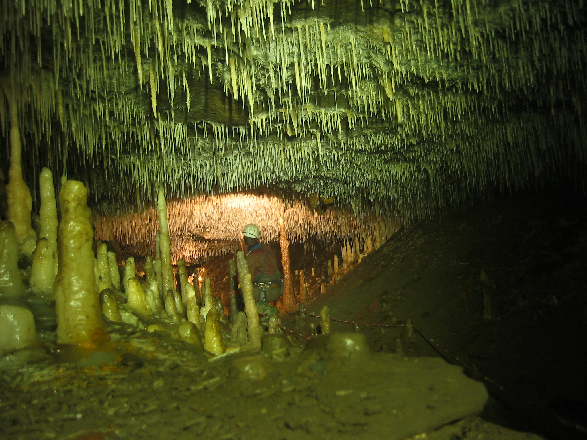
Ease Gill Caverns
The Ease Gill Cave System is the longest, and most complex cave system in Britain as of 2011, with around 41 miles (66 km) of passages, including connections...

Barbon
Barbon is a village and civil parish in Westmorland and Furness, England. According to the 2001 census it had a population of 263, reducing to 236 at...

St Bartholomew's Church, Barbon
St Bartholomew's Church is in the village of Barbon, Cumbria, England. It is an active Anglican parish church in the deanery of Kendal, the archdeaconry...

Barbon railway station
Barbon railway station was located in Westmorland (now part of Cumbria), England, serving the town and locale of Barbon on the Ingleton Branch Line....
Nearby Amenities
Located within 500m of 54.227312,-2.5372885Have you been to Nanslope Moss?
Leave your review of Nanslope Moss below (or comments, questions and feedback).