Black Coppice

Downs, Moorland in Lancashire Chorley

England

Black Coppice

Narrow Footpath on Wheelton Moor This footpath is not recorded on the map.
It leads down the northern flanks of Great Hill, and heads for the stile seen in the photograph. It then follows the fence for a mile or two in a straight line in the direction of Brinscall
Narrow Footpath on Wheelton Moor Credit: Chris Heaton

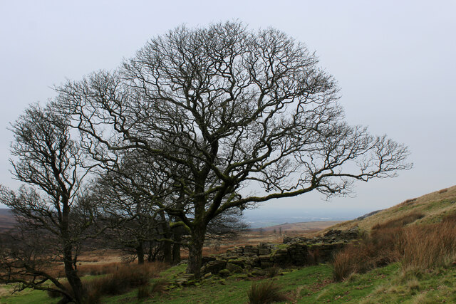
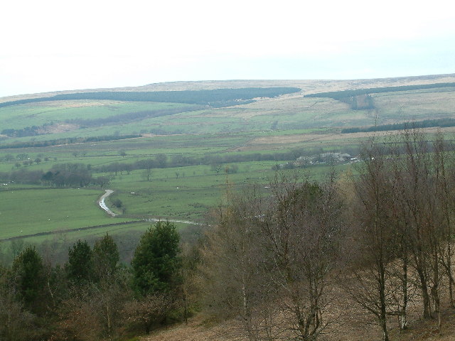
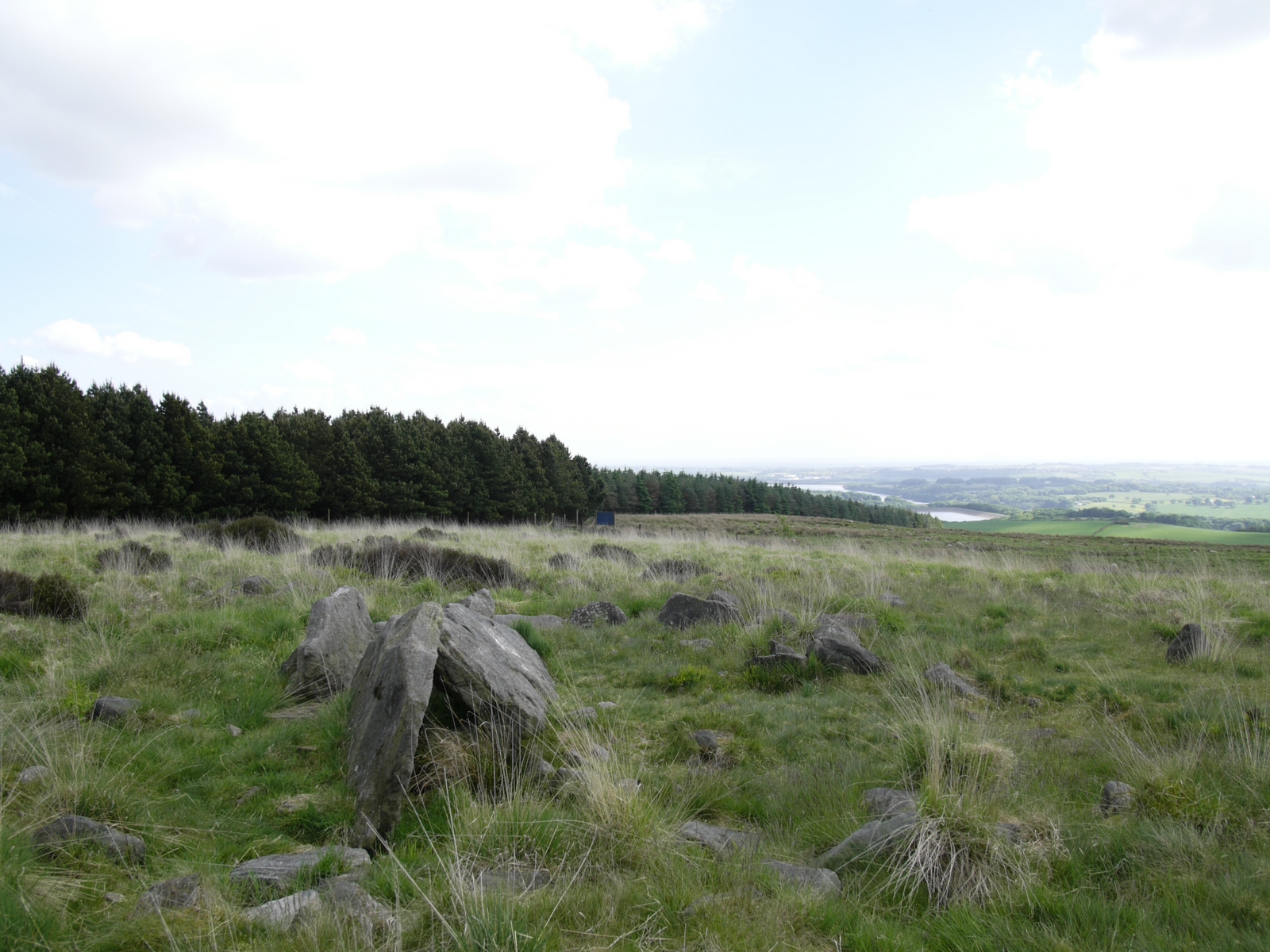
Black Coppice is a strikingly beautiful and culturally significant area located in the county of Lancashire, England. Situated on the fringes of the West Pennine Moors, it is known for its diverse landscape that encompasses both downs and moorland.

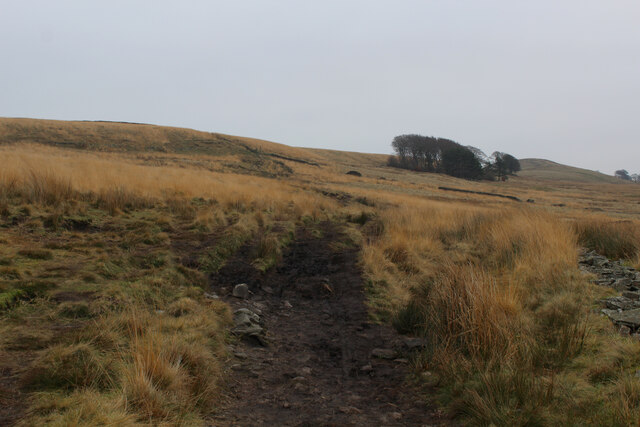
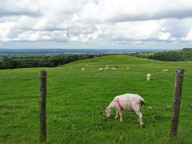
At an elevation of approximately 400 meters, Black Coppice offers breathtaking panoramic views of the surrounding countryside. The area is characterized by its rolling hills, rugged terrain, and vast stretches of heather-covered moorland. This unique blend of landscapes creates a picturesque setting that attracts both nature enthusiasts and artists alike.

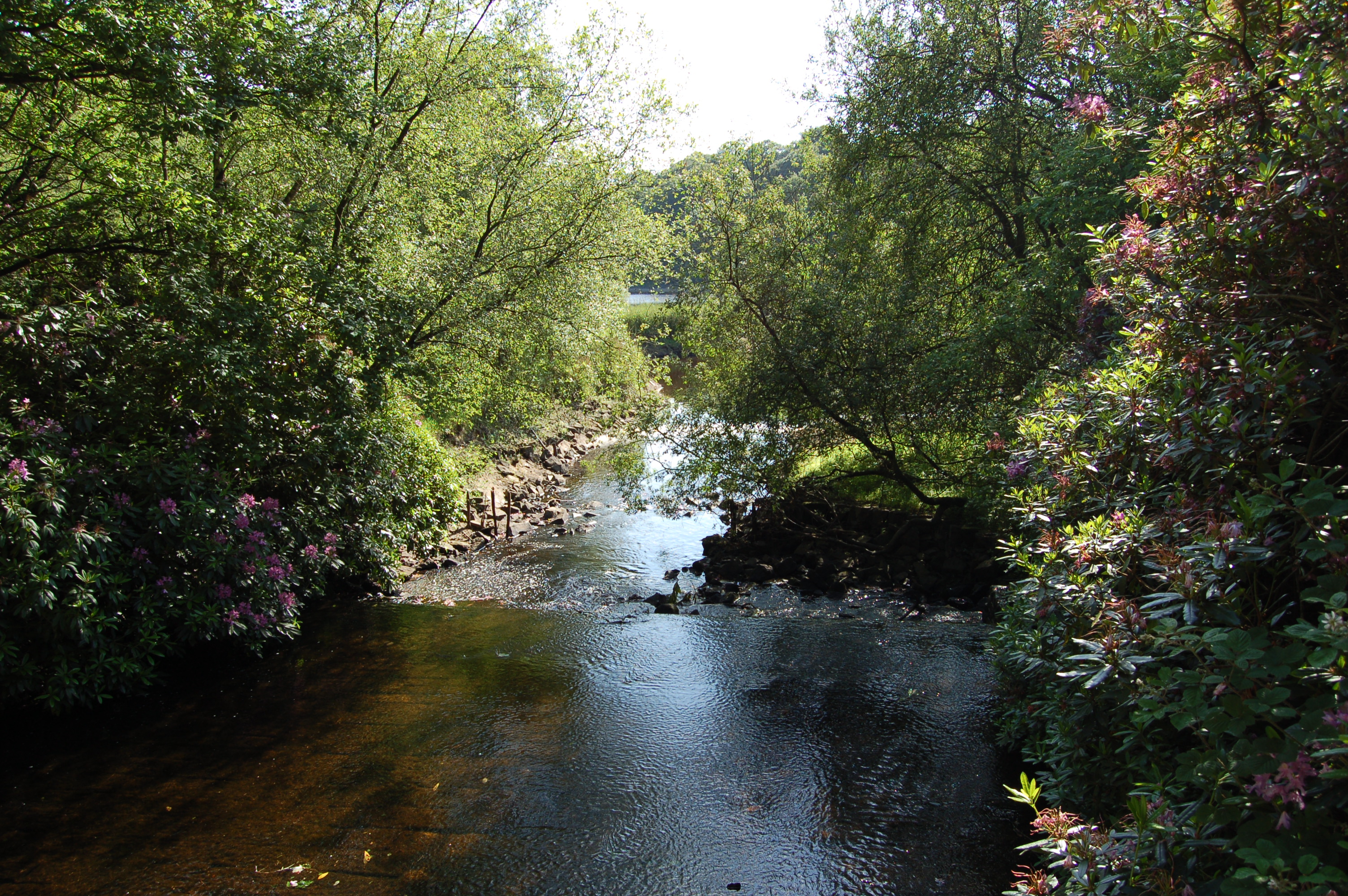
Flora and fauna thrive in the diverse ecosystem of Black Coppice. The moorland is home to a variety of species, including curlews, lapwings, and golden plovers, which can be observed by avid birdwatchers. Additionally, the area is rich in plant life, with heather dominating the moorland and mosses and ferns flourishing in the damp, shaded areas.

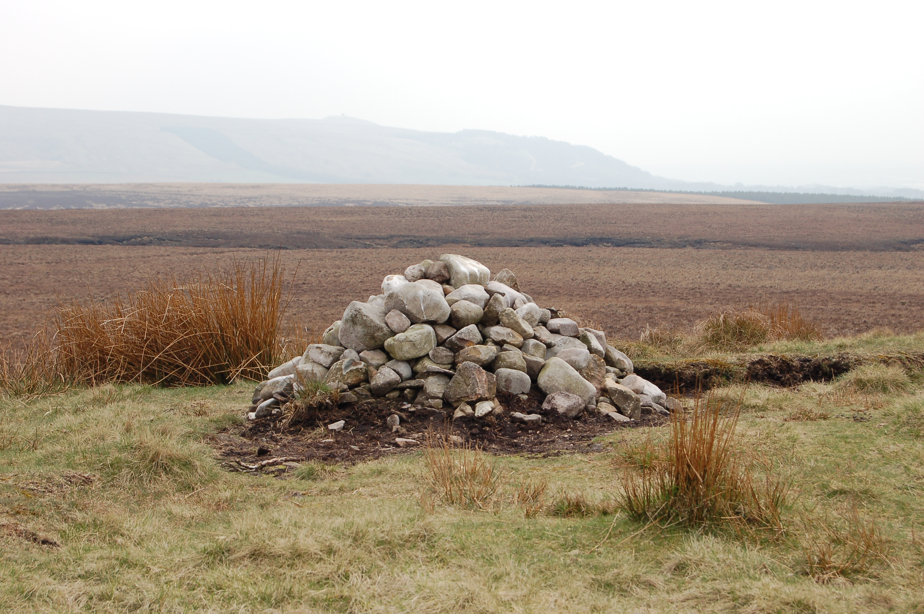
In addition to its natural beauty, Black Coppice holds historical and cultural significance. The area has been utilized for centuries, with evidence of human activity dating back to the Bronze Age. The remnants of old mining operations and charcoal production can still be seen, providing a glimpse into the area's industrial past.

Today, Black Coppice is a popular destination for hikers, nature lovers, and those seeking solitude in nature. Its accessibility and tranquil surroundings make it the perfect place for outdoor activities such as walking, picnicking, and wildlife spotting. Whether exploring the open downs or immersing oneself in the rugged moorland, Black Coppice offers a truly enriching experience for all who visit.

If you have any feedback on the listing, please let us know in the comments section below.

Black Coppice Images

Images are sourced within 2km of 53.663436/-2.5714015 or Grid Reference SD6218. Thanks to Geograph Open Source API. All images are credited.

Narrow Footpath on Wheelton Moor This footpath is not recorded on the map.
It leads down the northern flanks of Great Hill, and heads for the stile seen in the photograph. It then follows the fence for a mile or two in a straight line in the direction of Brinscall
Narrow Footpath on Wheelton Moor
This footpath is not recorded on the map. It leads down the northern flanks of Great Hill, and heads for the stile seen in the photograph. It then follows the fence for a mile or two in a straight line in the direction of Brinscall
Ruins of Great Hill Farm The farm is marked on the map, although there is very little remaining.
Ruins of Great Hill Farm
The farm is marked on the map, although there is very little remaining.
Ruins of Great Hill Farm from the West There are several farms like this in the vicinity - ruins almost reduced down to the foundations
Ruins of Great Hill Farm from the West
There are several farms like this in the vicinity - ruins almost reduced down to the foundations
On a Faint Path above Dean Black Brook It winds about through rough pasture, joining the main path near the ruins of Drinkwater
On a Faint Path above Dean Black Brook
It winds about through rough pasture, joining the main path near the ruins of Drinkwater
Path heading East to the Ruins of Great Hill Farm
On Wheelton Moor Long soggy trudge over Wheelton Moor towards Great Hill
On Wheelton Moor
Long soggy trudge over Wheelton Moor towards Great Hill
Ruins of Drinkwaters Farm One of many ruined farms that dot the landscape on the edge of Wheelton Moor and the West Pennines.
This one is on the path to Great Hill, approaching from the west.
Ruins of Drinkwaters Farm
One of many ruined farms that dot the landscape on the edge of Wheelton Moor and the West Pennines. This one is on the path to Great Hill, approaching from the west.
On the Path between White Coppice and Great Hill Summit The path becomes ever wider and eroded as walkers avoid the soggy bits
On the Path between White Coppice and Great Hill Summit
The path becomes ever wider and eroded as walkers avoid the soggy bits
Footpath beside the Ruins of Coppice Stile House Yet another ruin on these moors. This one is Coppice Stile House, of which very little remains.
Footpath beside the Ruins of Coppice Stile House
Yet another ruin on these moors. This one is Coppice Stile House, of which very little remains.
Descending to White Coppice Descending off the moors towards White Coppice, with green hill of The Lowe directly ahead
Descending to White Coppice
Descending off the moors towards White Coppice, with green hill of The Lowe directly ahead
Concessionary Path beside The Goit Follows a channel that transports drinking water between reservoirs around the base of the West Pennine Moors
Concessionary Path beside The Goit
Follows a channel that transports drinking water between reservoirs around the base of the West Pennine Moors
Bridge across Dean Black Brook
Dean Black Brook The lower limits of the brook are channelled between stone walls, towards The Goit where the waters flow into the reservoirs of Anglezarke and Rivington.
Dean Black Brook
The lower limits of the brook are channelled between stone walls, towards The Goit where the waters flow into the reservoirs of Anglezarke and Rivington.
White Coppice Cricket Ground in December Empty seats overlook an empty ground, patiently awaiting for the summer months to return.
White Coppice Cricket Ground in December
Empty seats overlook an empty ground, patiently awaiting for the summer months to return.
Tootals Farm
Tootals Farm
Sheep at pasture The rounded mound is Spen Cob.
Sheep at pasture
The rounded mound is Spen Cob.
Moor Road, Anglezarke At the northern head of Anglezarke Reservoir.
Moor Road, Anglezarke
At the northern head of Anglezarke Reservoir.
Approaching Cliffs Farm On Moor Road in Anglezarke. The name Anglezarke is thought to be derived from Anlaf, a Norse given name, and erg from the same language meaning hill pasture.
Approaching Cliffs Farm
On Moor Road in Anglezarke. The name Anglezarke is thought to be derived from Anlaf, a Norse given name, and erg from the same language meaning hill pasture.
Show me another place!

Black Coppice is located at Grid Ref: SD6218 (Lat: 53.663436, Lng: -2.5714015)

Administrative County: Lancashire

District: Chorley

Police Authority: Lancashire

What 3 Words

///sometime.canine.morphing. Near Brinscall, Lancashire

Related Wikis

Grain Pole Hill

Grain Pole Hill is a location on Anglezarke Moor, near Chorley, within the West Pennine Moors of Lancashire, England. With a height of 285 metres (935...

White Coppice

White Coppice is a hamlet near Chorley, Lancashire, England. It was the most populated part of the township of Anglezarke in the 19th century. Close to...

The Goit

The Goit (sometimes written The Goyt) (see Oxford English Dictionary - Gote - a watercourse; any channel for water; a stream. Chiefly northern dialect...

Hurst Hill

Hurst Hill is a location on Anglezarke Moor, within the West Pennine Moors of Lancashire, England. With a height of 317 metres (1,040 feet), the summit...

Round Loaf

Round Loaf is a late-Neolithic or Bronze Age tumulus on Anglezarke Moor in the West Pennine Moors near Chorley in Lancashire, England. The bowl barrow...

Pikestones

Pikestones is the remains of a Neolithic Burial Cairn, located on Anglezarke moor in Lancashire, England. The site is approximately 150 feet (45 metres...

Anglezarke

Anglezarke is a sparsely populated civil parish in the Borough of Chorley in Lancashire, England. It is an agricultural area used for sheep farming and...

Heapey railway station

Heapey railway station served the village of Heapey, in Lancashire, England. == History == The station was opened by the Lancashire and Yorkshire Railway...

Nearby Amenities

Located within 500m of 53.663436,-2.5714015
Parking
White Coppice Cricket Club
Access: private
Capacity: 15
Fee: no
Operator: White Coppice Cricket Club
Parking: surface
Smoothness: intermediate
Surface: compacted
Lat/Long: 53.666191/-2.5766909
The data included in this document is from www.openstreetmap.org. The data is made available under ODbL.

Have you been to Black Coppice?

Leave your review of Black Coppice below (or comments, questions and feedback).