Renwick Fell

Downs, Moorland in Cumberland Eden

England

Renwick Fell

Gateway in dry stone wall The enclosure into which the way leads is mapped as access land. That on the right side of the wall isn't access land - unaccountably, as it's quite uncultivated moorland!
Gateway in dry stone wall Credit: Trevor Littlewood

Renwick Fell is located in the county of Cumberland, in the northern region of England. It is a picturesque area that encompasses both downs and moorland landscapes, offering a diverse and stunning natural environment. The fell is situated within the North Pennines Area of Outstanding Natural Beauty, further emphasizing its exceptional beauty and significance.

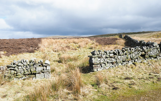
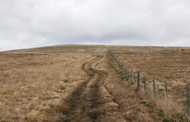
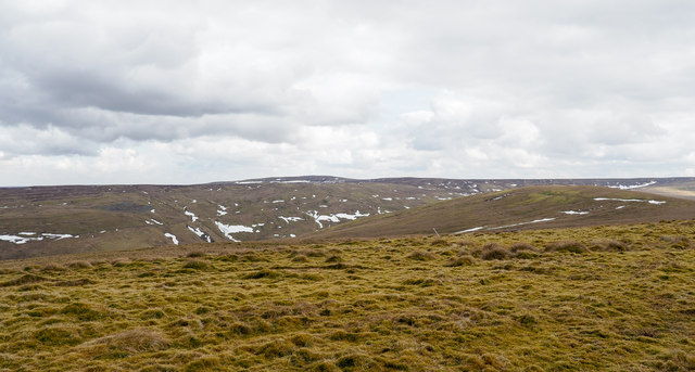
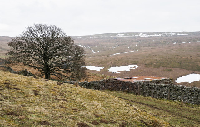
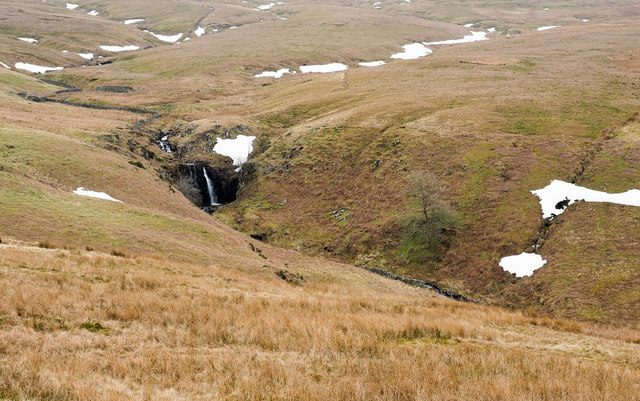
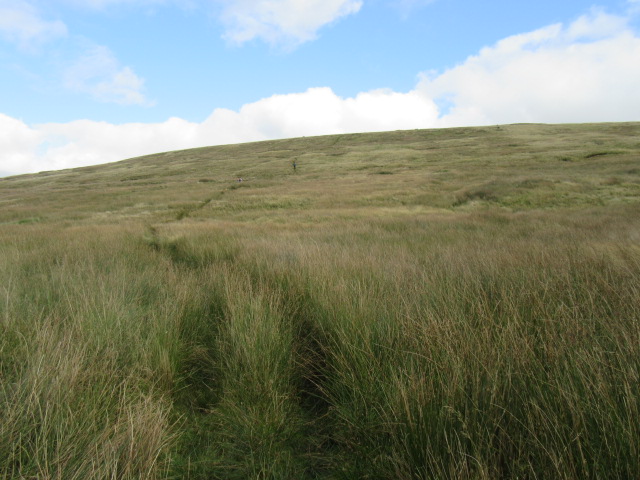
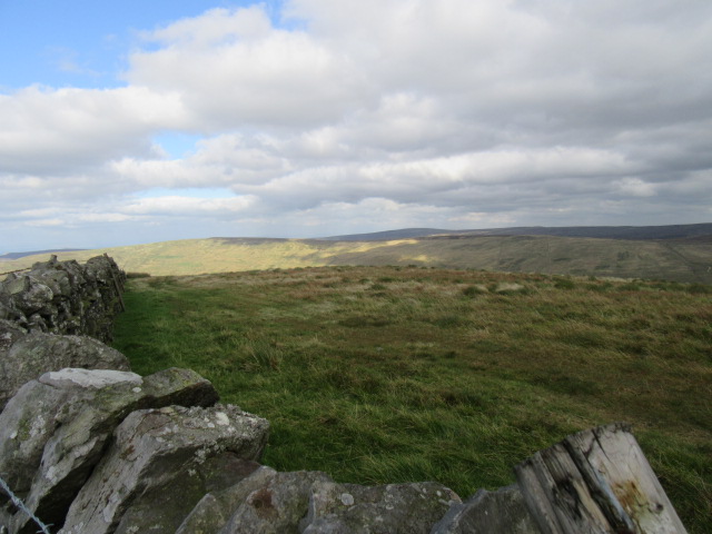
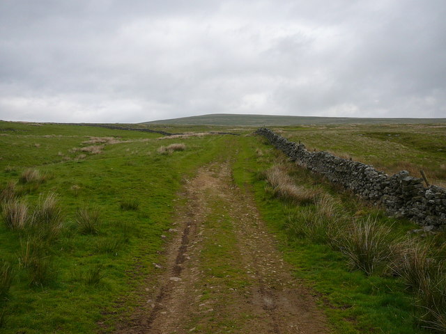
The downs of Renwick Fell are characterized by gently rolling hills and open grasslands, providing a peaceful and idyllic setting. These downs are interspersed with patches of woodland, adding to the overall charm of the area. The moorland, on the other hand, offers a more rugged and wild terrain, with heather-covered hills and rocky outcrops. The moors are home to a variety of wildlife, including birds of prey such as buzzards and kestrels, as well as grouse and other upland species.

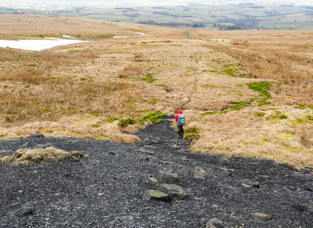
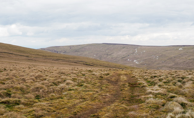
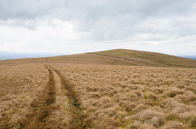
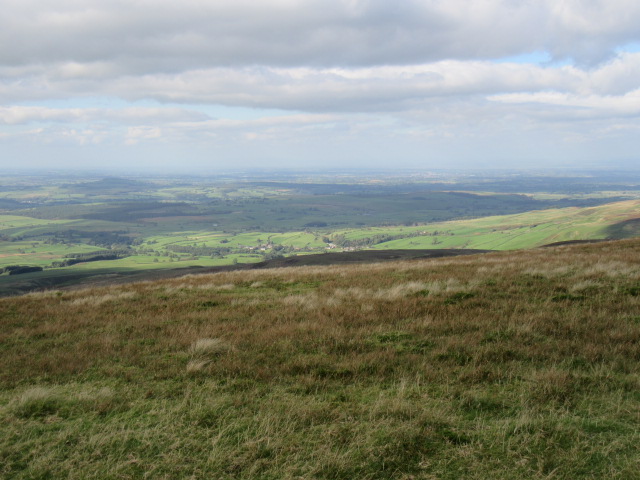
Renwick Fell is a popular destination for outdoor enthusiasts and nature lovers, offering ample opportunities for walking, hiking, and wildlife spotting. There are several well-marked trails that traverse the area, allowing visitors to explore its beauty at their own pace. The panoramic views from the higher points of the fell are simply breathtaking, showcasing the stunning landscapes of the surrounding countryside.

In addition to its natural attractions, Renwick Fell also boasts a rich history, with remnants of ancient settlements and prehistoric sites scattered throughout the area. These archaeological remains provide a glimpse into the past, allowing visitors to connect with the long and fascinating history of the region.

Overall, Renwick Fell in Cumberland is a truly remarkable and enchanting place, offering a unique blend of downs and moorland landscapes, rich biodiversity, and historical significance. It is a haven for those seeking tranquility, natural beauty, and a connection with the natural world.

If you have any feedback on the listing, please let us know in the comments section below.
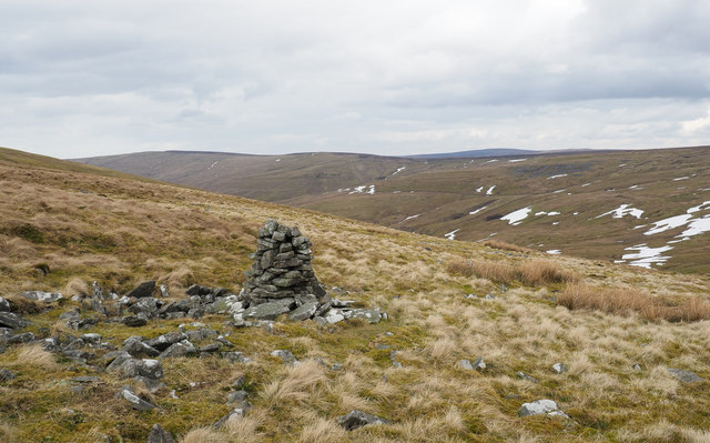
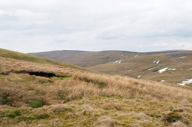
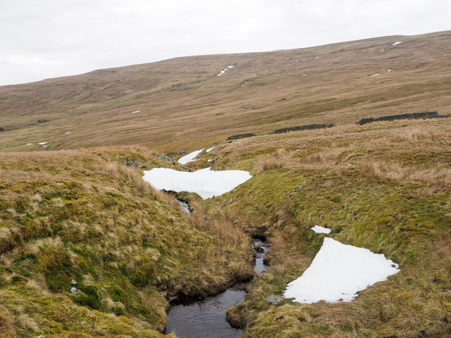
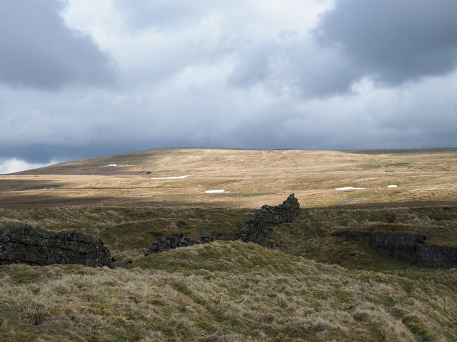
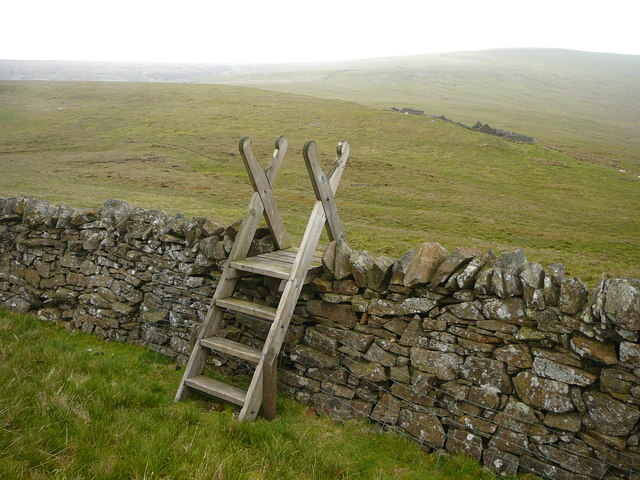
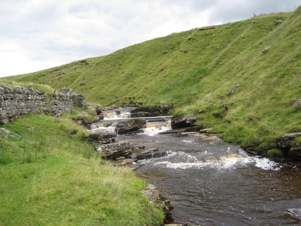
Renwick Fell Images

Images are sourced within 2km of 54.804058/-2.5941062 or Grid Reference NY6145. Thanks to Geograph Open Source API. All images are credited.

Gateway in dry stone wall The enclosure into which the way leads is mapped as access land. That on the right side of the wall isn't access land - unaccountably, as it's quite uncultivated moorland!
Gateway in dry stone wall
The enclosure into which the way leads is mapped as access land. That on the right side of the wall isn't access land - unaccountably, as it's quite uncultivated moorland!
Shaley mine tip There's little spoil at this site and so it's suspected that the mine was simply a trial, one where an exploratory level was driven into the hill slope in the hope of discovering something worth mining. The shaley nature of the spoil suggests (perhaps) that coal was being sought.
Shaley mine tip
There's little spoil at this site and so it's suspected that the mine was simply a trial, one where an exploratory level was driven into the hill slope in the hope of discovering something worth mining. The shaley nature of the spoil suggests (perhaps) that coal was being sought.
Track rising beside fence The track is rising towards the summit at Thack Moor which will be on the horizon. The route is surely used for access by quad bike but is also that of a public footpath.
Track rising beside fence
The track is rising towards the summit at Thack Moor which will be on the horizon. The route is surely used for access by quad bike but is also that of a public footpath.
Mossy summit area of Thack Moor The dominant vegetation on the north side of the wall crossing the high point of Thack Moor is moss of one or several species. At the centre-skyline is Grey Nag and nearer, to the right, is Watch Hill.
Mossy summit area of Thack Moor
The dominant vegetation on the north side of the wall crossing the high point of Thack Moor is moss of one or several species. At the centre-skyline is Grey Nag and nearer, to the right, is Watch Hill.
Tree beside wall and hill road The road and public footpath is on the south side of Renwick Fell where the wall bounds the southern limit of access land. The valley below the wall is that of Raven Beck and the distant moorland upland is Black Fell.
Tree beside wall and hill road
The road and public footpath is on the south side of Renwick Fell where the wall bounds the southern limit of access land. The valley below the wall is that of Raven Beck and the distant moorland upland is Black Fell.
Waterfall on Raven Beck Streams draining the hill slopes of Renwick Fell, Watch Hill and Black Fell amalgamate finally to form Raven Beck. The landscape is generally unremarkable with grassy slopes dominating until the waterfall is reached.
Waterfall on Raven Beck
Streams draining the hill slopes of Renwick Fell, Watch Hill and Black Fell amalgamate finally to form Raven Beck. The landscape is generally unremarkable with grassy slopes dominating until the waterfall is reached.
Vehicle track on ridge west of Watch Hill The track has been created through the bruising of moorland vegetation by multiple passes of low impact vehicles, presumably quad bikes. Croglin Fell is the distant hill.
Vehicle track on ridge west of Watch Hill
The track has been created through the bruising of moorland vegetation by multiple passes of low impact vehicles, presumably quad bikes. Croglin Fell is the distant hill.
Vehicle track reaching Watch Hill The track, created presumably by multiple passes of light vehicles such as quad bikes, is one of a number on the hill, the high point of which is behind the camera position. The distant hill is Thack Moor.
Vehicle track reaching Watch Hill
The track, created presumably by multiple passes of light vehicles such as quad bikes, is one of a number on the hill, the high point of which is behind the camera position. The distant hill is Thack Moor.
Cairn east of Watch Hill, NY 63437 45963 The cairn was located when searching for a 'currick' marked on OS maps at NY 63375 46004. When the cairn in the image was reached it was thought to be that one but  a check of the GPS receiver suggested otherwise. No other nearby cairn/currick was seen. There's probably an error somewhere, but there's certainty with the photographer that the GPS co-ordinates used in the Geograph submission both for the cairn and camera locations were recorded correctly.
Cairn east of Watch Hill, NY 63437 45963
The cairn was located when searching for a 'currick' marked on OS maps at NY 63375 46004. When the cairn in the image was reached it was thought to be that one but a check of the GPS receiver suggested otherwise. No other nearby cairn/currick was seen. There's probably an error somewhere, but there's certainty with the photographer that the GPS co-ordinates used in the Geograph submission both for the cairn and camera locations were recorded correctly.
Moorland west of Watch Hill Watch Hill is a location along the broad ridge connecting Thack Moor with Black Fell. The location in the image is to the north of the ridge crest with a view across the valley of Croglin Water.
Moorland west of Watch Hill
Watch Hill is a location along the broad ridge connecting Thack Moor with Black Fell. The location in the image is to the north of the ridge crest with a view across the valley of Croglin Water.
Snow patches along course of Longtongue Beck Longtongue Beck drains the west side of Black Fell. The rising slope in the image reaches the summits of Thack Moor and Watch Hill.
Snow patches along course of Longtongue Beck
Longtongue Beck drains the west side of Black Fell. The rising slope in the image reaches the summits of Thack Moor and Watch Hill.
Ruined wall and quarry edge A small quarry, just part of it in view with a wall crossing on grassy moorland; there's a collapsed lime kiln nearby so presumably limestone was dug for 'burning'.
The sunlit slopes rise to Thack Moor.
Ruined wall and quarry edge
A small quarry, just part of it in view with a wall crossing on grassy moorland; there's a collapsed lime kiln nearby so presumably limestone was dug for 'burning'. The sunlit slopes rise to Thack Moor.
Path up Thack Moor Looking NE from the tip.
Path up Thack Moor
Looking NE from the tip.
Thack Moor Looking north.
Thack Moor
Looking north.
Summit of Thack Moor Looking NW from the summit of Thack Moor.
Summit of Thack Moor
Looking NW from the summit of Thack Moor.
Track leading up to Thack Moor
Ladder stile over wall between Graystone Edge and Black Fell There is a faint path with ladder stiles which crosses the moor between Thack Moor via Graystone Edge to Black Fell and is fairly firm underfoot throughout.
Ladder stile over wall between Graystone Edge and Black Fell
There is a faint path with ladder stiles which crosses the moor between Thack Moor via Graystone Edge to Black Fell and is fairly firm underfoot throughout.
Croglin Water
Croglin Water
Show me another place!

Renwick Fell is located at Grid Ref: NY6145 (Lat: 54.804058, Lng: -2.5941062)

Administrative County: Cumbria

District: Eden

Police Authority: Cumbria

What 3 Words

///tries.breakfast.ribcage. Near Alston, Cumbria

Nearby Locations

Renwick Fell

Related Wikis

Renwick, Cumbria

Renwick, formerly known as Ravenwick, is a small village and former civil parish, now in the parish of Kirkoswald, in the Eden district, in the county...

Black Fell (Pennines)

Black Fell is a hill in the North Pennines, England. It is located just north of the A686 road, west of Alston and is one of the most northerly parts of...

Busk, Cumbria

Busk is a hamlet in Cumbria, England. It is located 3.7 miles (6.0 km) by road to the east of Kirkoswald. == See also == List of places in Cumbria ��2...

Croglin

Croglin is the name of a village, former civil parish, beck (stream), and grange now in the parish of Ainstable, in the Westmorland and Furness district...

Nearby Amenities

Located within 500m of 54.804058,-2.5941062
Renwick Fell
Place: locality
Lat/Long: 54.8041556/-2.5954121
Abandoned: yes
Man Made: mineshaft
Lat/Long: 54.8021461/-2.5881795
Abandoned: yes
Man Made: mineshaft
Lat/Long: 54.8005586/-2.5904646
The data included in this document is from www.openstreetmap.org. The data is made available under ODbL.

Have you been to Renwick Fell?

Leave your review of Renwick Fell below (or comments, questions and feedback).