Blackhills Moss

Downs, Moorland in Banffshire

Scotland

Blackhills Moss

View north from the Hill of Maunderlea Looking north from the Hill of Maunderlea towards Weachyburn.
View north from the Hill of Maunderlea Credit: Scott Cormie

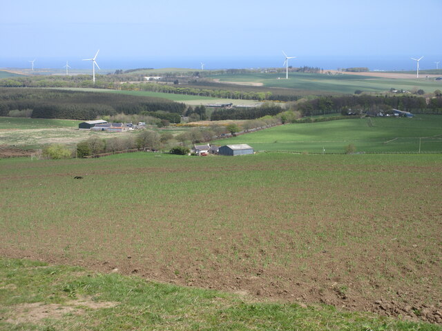
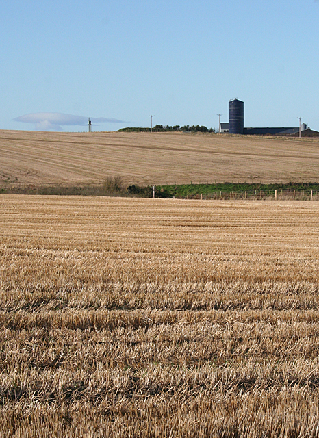
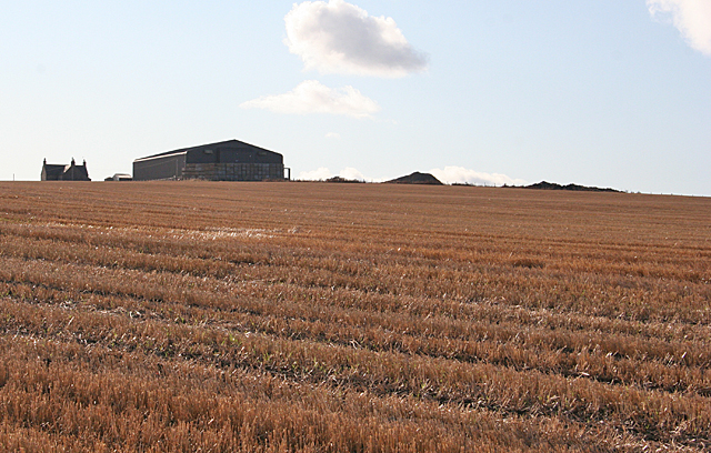
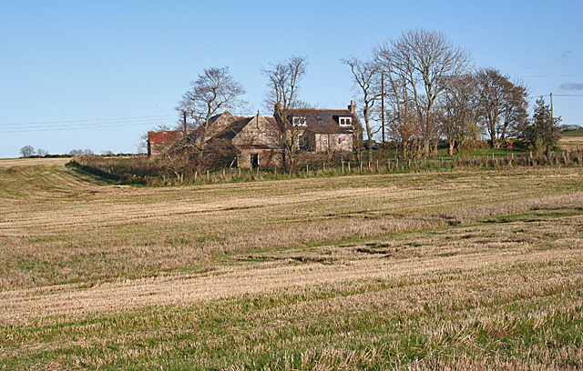
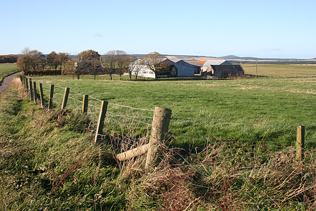
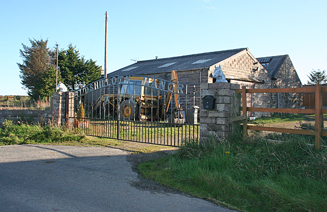
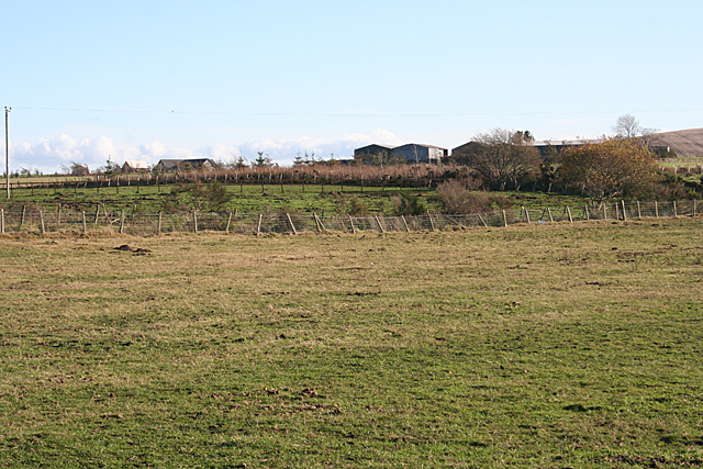
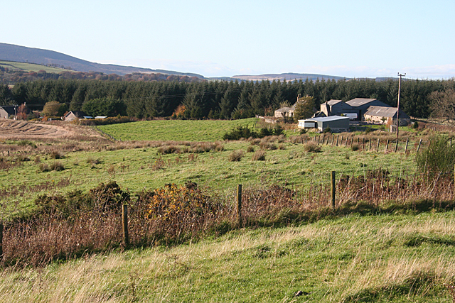
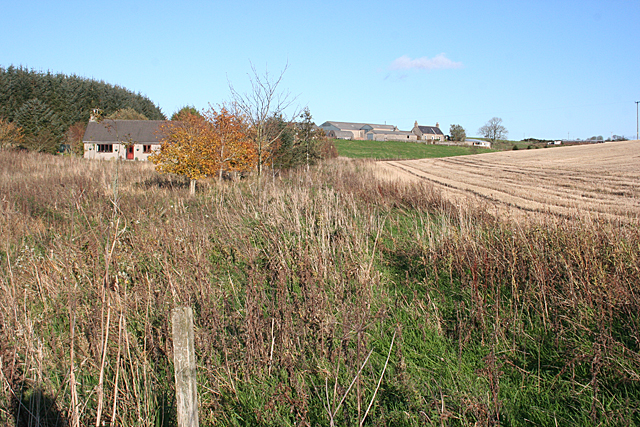
Blackhills Moss is a vast expanse of land located in Banffshire, Scotland. It is a prominent feature of the region, known for its distinctive downs and moorland characteristics. Spanning over an area of several square miles, Blackhills Moss is characterized by its unique landscape and diverse vegetation.

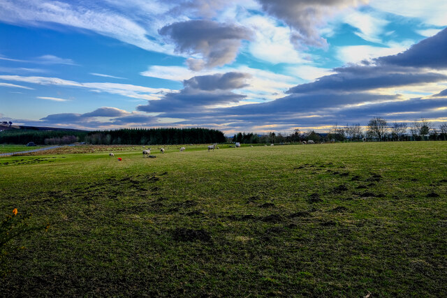
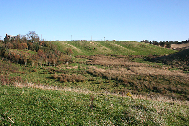
The downs of Blackhills Moss are characterized by rolling hills with gentle slopes, covered in lush green grasses and scattered with wildflowers. These downs provide a picturesque view and are often frequented by hikers and nature enthusiasts. The moorland, on the other hand, is a vast open space covered in heather, moss, and peat, giving it a rugged and untamed appearance. This area is home to a variety of bird species, including grouse and birds of prey, which adds to its natural charm.

Blackhills Moss is also known for its rich biodiversity. It is home to a wide range of plant species, including various types of mosses, lichens, and ferns that thrive in this damp and cool environment. The mosses, in particular, create a unique carpet-like covering on the ground, adding to the distinctive appearance of the area.

The area is also rich in archaeological and historical significance, with numerous ancient sites and ruins scattered across the landscape. These sites provide insights into the region's past and attract history enthusiasts and researchers.

Overall, Blackhills Moss is a captivating natural landscape with its downs and moorland, offering visitors an opportunity to explore the beauty of Banffshire's unique environment.

If you have any feedback on the listing, please let us know in the comments section below.

Blackhills Moss Images

Images are sourced within 2km of 57.605973/-2.6442977 or Grid Reference NJ6157. Thanks to Geograph Open Source API. All images are credited.

View north from the Hill of Maunderlea Looking north from the Hill of Maunderlea towards Weachyburn.
View north from the Hill of Maunderlea
Looking north from the Hill of Maunderlea towards Weachyburn.
Fishermans Moss Sheep Sheep in this interesting named area
Fishermans Moss Sheep
Sheep in this interesting named area
Upper Blairmaud The large farm of Upper Blairmaud stands on a ridge which runs north to south across this square, partly hidden from here by the lie of the land. The green in the middle is the bank on one side of the Den of Denniston, a dip eroded by a headwater of the Burn of Boyndie.
Upper Blairmaud
The large farm of Upper Blairmaud stands on a ridge which runs north to south across this square, partly hidden from here by the lie of the land. The green in the middle is the bank on one side of the Den of Denniston, a dip eroded by a headwater of the Burn of Boyndie.
Looking towards Cairns of Ord The farm buildings are in the next square, but the stubble field is in this square.
Looking towards Cairns of Ord
The farm buildings are in the next square, but the stubble field is in this square.
West Rothen One of several small crofts and holdings along the minor road at Rothen.
West Rothen
One of several small crofts and holdings along the minor road at Rothen.
Rothen This seems to be the principal of several farms and crofts in Rothen or Rothin.
Rothen
This seems to be the principal of several farms and crofts in Rothen or Rothin.
Upper Culphin As its name suggests, this farm stands almost on the highest point in the square, exposed to winds from all directions. Seen from the minor road near Rothen.
Upper Culphin
As its name suggests, this farm stands almost on the highest point in the square, exposed to winds from all directions. Seen from the minor road near Rothen.
Cattle at Headtown They are beef cattle, but I am not sure what breed.
Cattle at Headtown
They are beef cattle, but I am not sure what breed.
Former School This building, now a private house, caught my eye because its distinctive architecture marks it as a former school. It was known, rather curiously, as Headrooms School, and it operated from 1924 until 1962. Beside it is a rare example of the Arcon Mk V pre-fabricated houses built after the Second World War. Compare with <a href="https://www.geograph.org.uk/photo/6669077">NJ5025 : A Pre-fab</a> and see <span class="nowrap"><a title="https://www.prefabmuseum.uk/content/history/one-arcon-story" rel="nofollow ugc noopener" href="https://www.prefabmuseum.uk/content/history/one-arcon-story">Link</a><img style="margin-left:2px;" alt="External link" title="External link - shift click to open in new window" src="https://s1.geograph.org.uk/img/external.png" width="10" height="10"/></span>
Former School
This building, now a private house, caught my eye because its distinctive architecture marks it as a former school. It was known, rather curiously, as Headrooms School, and it operated from 1924 until 1962. Beside it is a rare example of the Arcon Mk V pre-fabricated houses built after the Second World War. Compare with NJ5025 : A Pre-fab and see LinkExternal link
A Curious Name The map names this as Culburnie, but according to its own sign it has this rather unusual name. In fact a look at the first edition of the six-inch Ordnance Survey map <span class="nowrap"><a title="https://maps.nls.uk/geo/explore/#zoom=16&lat=57.6155&lon=-2.6397&layers=5&b=1" rel="nofollow ugc noopener" href="https://maps.nls.uk/geo/explore/#zoom=16&lat=57.6155&lon=-2.6397&layers=5&b=1">Link</a><img style="margin-left:2px;" alt="External link" title="External link - shift click to open in new window" src="https://s1.geograph.org.uk/img/external.png" width="10" height="10"/></span> names an area close by as Headrooms.
A Curious Name
The map names this as Culburnie, but according to its own sign it has this rather unusual name. In fact a look at the first edition of the six-inch Ordnance Survey map LinkExternal link names an area close by as Headrooms.
Cairns of Ord A large mixed farm surrounded by stubble fields.
Cairns of Ord
A large mixed farm surrounded by stubble fields.
Todshillock Todshillock boasts a fine wrought iron gate reading 'Todshillock Manor'.
Todshillock
Todshillock boasts a fine wrought iron gate reading 'Todshillock Manor'.
Looking towards Sheriffseat Partly obscured by trees, Sheriffseat is on the higher land in this square.
Looking towards Sheriffseat
Partly obscured by trees, Sheriffseat is on the higher land in this square.
Glacial Meltwater Channel This has all the classic hallmarks of a glacial meltwater channel - a wide sinuous valley far too big to have been created by the stream it contains. The boggy ground in the valley floor is also a common feature. The house at top left is Upper Peterden.
Glacial Meltwater Channel
This has all the classic hallmarks of a glacial meltwater channel - a wide sinuous valley far too big to have been created by the stream it contains. The boggy ground in the valley floor is also a common feature. The house at top left is Upper Peterden.
Cormackhillock The sign here reads Cormackhillock, and the map says Cormickhillock. The road winds through the farm between the house and the steading. Cormickhillick Cottage is at right.
Cormackhillock
The sign here reads Cormackhillock, and the map says Cormickhillock. The road winds through the farm between the house and the steading. Cormickhillick Cottage is at right.
Cormickhillock The farm is at the top of this view and the cottage is at left. The map says Cormickhillock, but both signs read Cormackhillock.
Cormickhillock
The farm is at the top of this view and the cottage is at left. The map says Cormickhillock, but both signs read Cormackhillock.
Cormackhillock Cottage The cottage, quite a modern building, is just beside the minor road, with a wild scrubby damp area just outside the neatly tended garden.
Cormackhillock Cottage
The cottage, quite a modern building, is just beside the minor road, with a wild scrubby damp area just outside the neatly tended garden.
Forest Gate My plans to walk through the forest to photograph the open part of this square underwent rapid revision when I reached the gate and saw the state of what the map suggests might be a track!
Forest Gate
My plans to walk through the forest to photograph the open part of this square underwent rapid revision when I reached the gate and saw the state of what the map suggests might be a track!
Show me another place!

Blackhills Moss is located at Grid Ref: NJ6157 (Lat: 57.605973, Lng: -2.6442977)

Unitary Authority: Aberdeenshire

Police Authority: North East

What 3 Words

///clincher.monument.flaunting. Near Aberchirder, Aberdeenshire

Nearby Locations

Blackhills Moss

Related Wikis

Castle of Park (Aberdeenshire)

Park or Castle of Park, is an A-listed rambling baronial mansion incorporating a 16th-century tower house. It is 4 miles (6.4 km) north-west of Aberchirder...

Cornhill, Aberdeenshire

Cornhill (Scottish Gaelic: Cnoc an Arbhair) is a small village close to Banff, Aberdeenshire, Scotland. It lies 5 miles (8.0 km) to the south of Portsoy...

Cornhill railway station

Cornhill railway station was an intermediate stop situated on the Great North of Scotland Railway (GNoSR) line from Cairnie Junction to Tillynaught. There...

Tillynaught railway station

Tillynaught railway station or Tillynaught Junction was a junction railway station in what is now Aberdeenshire, Parish of Fordyce, 6 miles south-west...

Nearby Amenities

Located within 500m of 57.605973,-2.6442977
Blackhill Moss
Place: locality
Lat/Long: 57.6063701/-2.6409763
Power: pole
Lat/Long: 57.602387/-2.6395847
Power: pole
Lat/Long: 57.6027246/-2.6395059
Power: pole
Lat/Long: 57.6031203/-2.6395588
Power: pole
Lat/Long: 57.6034209/-2.639115
Power: pole
Lat/Long: 57.603745/-2.6387007
Power: pole
Lat/Long: 57.6041644/-2.6382469
Power: pole
Lat/Long: 57.6030686/-2.6405759
Power: pole
Lat/Long: 57.603245/-2.6414072
Power: pole
Lat/Long: 57.6034328/-2.6422456
Power: pole
Lat/Long: 57.6035986/-2.6430879
Power: pole
Lat/Long: 57.6037972/-2.6439313
Power: pole
Lat/Long: 57.6033389/-2.6414213
Power: pole
Lat/Long: 57.6036337/-2.6423009
Power: pole
Lat/Long: 57.603926/-2.6431992
Power: pole
Lat/Long: 57.6042045/-2.6440881
Power: pole
Lat/Long: 57.6043821/-2.6453486
Power: pole
Lat/Long: 57.6045648/-2.6466397
Power: pole
Lat/Long: 57.6047362/-2.6479073
Power: pole
Lat/Long: 57.6048861/-2.6489561
Power: pole
Lat/Long: 57.6050008/-2.6497698
Power: pole
Lat/Long: 57.6051381/-2.6507716
Power: pole
Lat/Long: 57.6052855/-2.6518393
Power: pole
Lat/Long: 57.6047815/-2.6520603
Power: pole
Lat/Long: 57.6031959/-2.6495166
Power: pole
Lat/Long: 57.6037261/-2.6488738
Power: pole
Lat/Long: 57.6042606/-2.6482075
Power: pole
Lat/Long: 57.6053462/-2.6475
Power: pole
Lat/Long: 57.6059509/-2.6470904
Power: pole
Lat/Long: 57.6065431/-2.6467083
Power: pole
Lat/Long: 57.607151/-2.6462889
Power: pole
Lat/Long: 57.607763/-2.645895
Power: pole
Lat/Long: 57.6083132/-2.6452698
Power: pole
Lat/Long: 57.6087068/-2.6448289
Power: pole
Lat/Long: 57.6092118/-2.6442665
Power: pole
Lat/Long: 57.6096727/-2.6437511
Power: pole
Lat/Long: 57.610101/-2.6432709
Power: pole
Lat/Long: 57.6091058/-2.6387087
Power: pole
Lat/Long: 57.6089137/-2.6400432
Power: pole
Lat/Long: 57.6087404/-2.6412014
Power: pole
Lat/Long: 57.6089042/-2.6422127
Power: pole
Lat/Long: 57.609068/-2.6432435
Power: pole
Lat/Long: 57.6093714/-2.6452503
Power: pole
Lat/Long: 57.6095257/-2.6462399
Power: pole
Lat/Long: 57.6096716/-2.6472021
Power: pole
Lat/Long: 57.6098333/-2.6483251
Power: pole
Lat/Long: 57.6081714/-2.6407527
Power: pole
Lat/Long: 57.6075209/-2.6402188
Power: pole
Lat/Long: 57.6067691/-2.6396649
Generator Method: wind_turbine
Generator Output Electricity: yes
Generator Source: wind
Generator Type: horizontal_axis
Power: generator
Lat/Long: 57.6058201/-2.6405717
The data included in this document is from www.openstreetmap.org. The data is made available under ODbL.

Have you been to Blackhills Moss?

Leave your review of Blackhills Moss below (or comments, questions and feedback).