Low Moor

Downs, Moorland in Westmorland Eden

England

Low Moor

Bins, Tebay East Services, M6
Bins, Tebay East Services, M6 Credit: habiloid

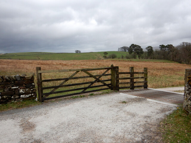
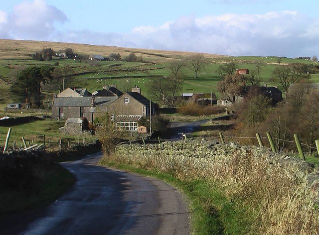
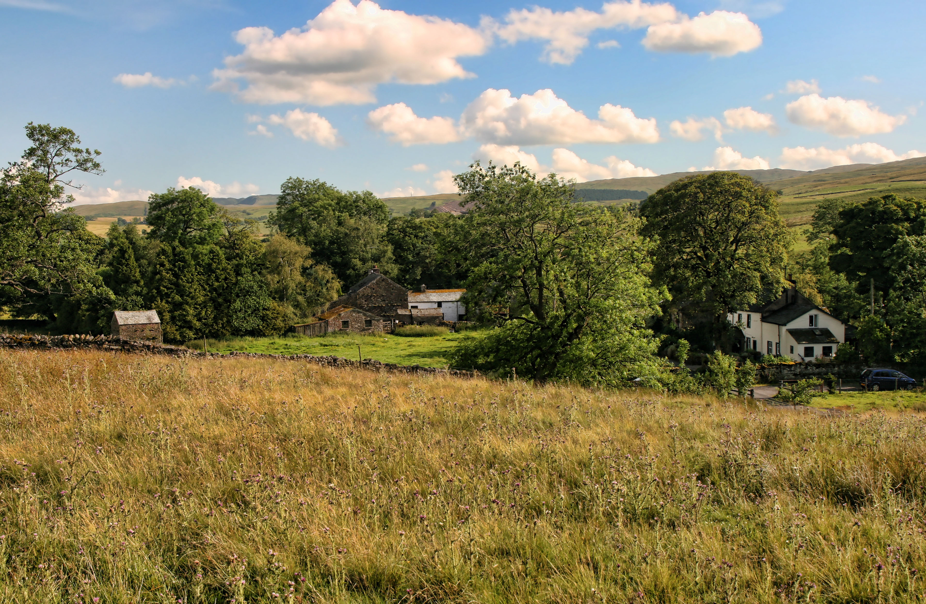
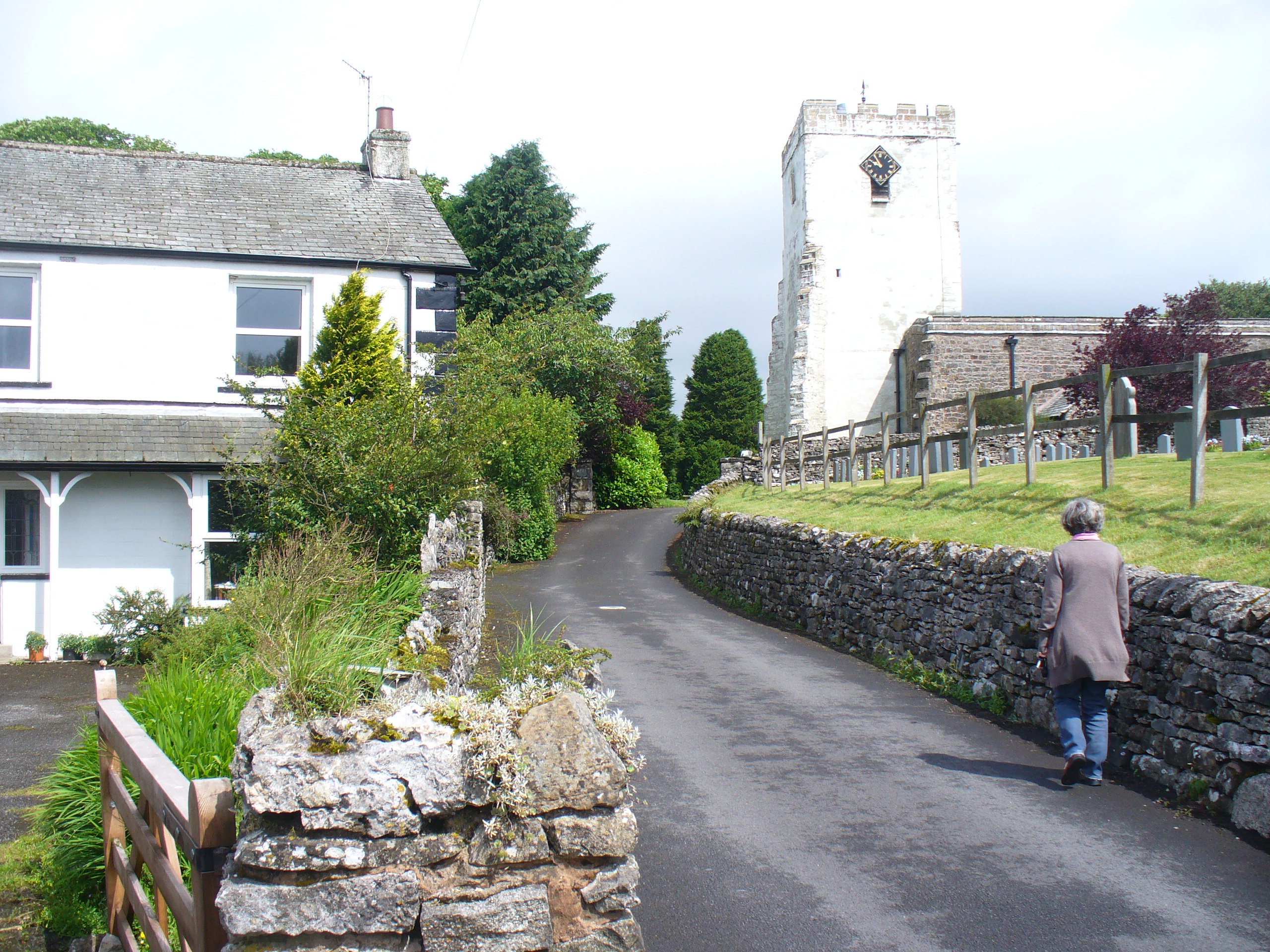
Low Moor, Westmorland is a picturesque region located in the county of Cumbria, England. Situated amidst the stunning landscape of the Lake District National Park, this area is known for its rolling hills, vast moorlands, and breathtaking views.

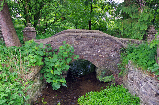
Low Moor is characterized by its tranquil and untouched beauty, providing visitors with a peaceful and idyllic escape. The region is primarily composed of open grasslands, heather-covered moors, and scattered woodlands. The diverse natural habitats found here support a wide array of flora and fauna, including rare and protected species.

The area is a haven for outdoor enthusiasts, offering numerous opportunities for hiking, walking, and cycling. There are several well-marked trails and paths that wind through the region, allowing visitors to immerse themselves in the stunning surroundings and discover hidden gems along the way. The peaceful atmosphere and stunning vistas make Low Moor a popular destination for landscape photographers and nature lovers alike.

In addition to its natural beauty, Low Moor is also home to a small community of residents who cherish the tranquility and charm of the area. The nearby villages provide a glimpse into traditional rural life, with quaint cottages, local pubs, and welcoming community events.

Overall, Low Moor, Westmorland is a captivating destination for those seeking a serene and unspoiled natural environment. With its rolling hills, expansive moorlands, and rich biodiversity, this region offers a unique and enchanting experience for visitors of all ages.

If you have any feedback on the listing, please let us know in the comments section below.

Low Moor Images

Images are sourced within 2km of 54.451608/-2.6001712 or Grid Reference NY6106. Thanks to Geograph Open Source API. All images are credited.

Bins, Tebay East Services, M6
View from Tebay East Services, M6
Tebay East Services, M6 The M6 motorway runs from junction 19 of the M1 at the Catthorpe Interchange, near Rugby to the Gretna junction (J45). Here it becomes the A74(M) and M74 which continues to Glasgow.

The M6 is the longest motorway in the United Kingdom (232 miles) and one of the busiest. It incorporates the first length of motorway opened in the UK (the Preston bypass in 1958) and forms part of a motorway "Backbone of Britain", running north-south between London and Glasgow via the industrial north of England. It is also part of the east-west route between the Midlands and the east coast ports.
Tebay East Services, M6
The M6 motorway runs from junction 19 of the M1 at the Catthorpe Interchange, near Rugby to the Gretna junction (J45). Here it becomes the A74(M) and M74 which continues to Glasgow. The M6 is the longest motorway in the United Kingdom (232 miles) and one of the busiest. It incorporates the first length of motorway opened in the UK (the Preston bypass in 1958) and forms part of a motorway "Backbone of Britain", running north-south between London and Glasgow via the industrial north of England. It is also part of the east-west route between the Midlands and the east coast ports.
Junction 38 signage  - M6 northbound
Junction 38 signage - M6 northbound
Tebay Services The original Westmorland services on the northbound carriageway.
Tebay Services
The original Westmorland services on the northbound carriageway.
Junction 38 Truckstop, Tebay
Car park at Tebay Services
Stile on Coatflatt footpath The stile seems quite substantial and robust, despite the adjacent wall being in a state of collapse - maybe undermined by those pesky moles ? The footpath itself is pretty faint on the ground but sticks to the flat grassy grazing land on the floodplain of Chapel Beck which flows on the left past the clump of conifers, on its way to meet the River Lune just before Tebay Bridge.
Stile on Coatflatt footpath
The stile seems quite substantial and robust, despite the adjacent wall being in a state of collapse - maybe undermined by those pesky moles ? The footpath itself is pretty faint on the ground but sticks to the flat grassy grazing land on the floodplain of Chapel Beck which flows on the left past the clump of conifers, on its way to meet the River Lune just before Tebay Bridge.
Chapel Beck flows past Coatflatt Mill Chapel Beck flows from Orton to join the River Lune just above Tebay Bridge, but the eponymous chapel seems to have been away from any village, and adjacent to the ancient feature of Lady Well, just over a kilometre upstream of where the photographer was standing. The public footpath (which is to the right of the drystone wall over which the shot was taken and which is not visible) passes to the right of the Mill and continues only to the minor road just beyond it.
Chapel Beck flows past Coatflatt Mill
Chapel Beck flows from Orton to join the River Lune just above Tebay Bridge, but the eponymous chapel seems to have been away from any village, and adjacent to the ancient feature of Lady Well, just over a kilometre upstream of where the photographer was standing. The public footpath (which is to the right of the drystone wall over which the shot was taken and which is not visible) passes to the right of the Mill and continues only to the minor road just beyond it.
Start of track to Coatflatt Hall The track is not a public right of way, but the owners of the land where the public footpath leaves it to head south for Tebay bridge have made the gate so difficult to open that I gave up and walked to the road here, thus gaining a square I hadn't intended to visit.
Start of track to Coatflatt Hall
The track is not a public right of way, but the owners of the land where the public footpath leaves it to head south for Tebay bridge have made the gate so difficult to open that I gave up and walked to the road here, thus gaining a square I hadn't intended to visit.
Farmland, Sproat Ghyll Farm A copse and recently mown fields.
Farmland, Sproat Ghyll Farm
A copse and recently mown fields.
Footbridge, Orton Hall A stone footbridge over an ornamental stream in Orton Hall gardens. Chapel Beck splits into 2 streams at the B6261 road bridge <a href="https://www.geograph.org.uk/photo/2221034">NY6208 : Bridge in Orton</a>. The stream on the right (south) flows under both bridges and  through the gardens.
Footbridge, Orton Hall
A stone footbridge over an ornamental stream in Orton Hall gardens. Chapel Beck splits into 2 streams at the B6261 road bridge NY6208 : Bridge in Orton. The stream on the right (south) flows under both bridges and through the gardens.
 Pond at Tebay Services Southbound services on the M6.
Pond at Tebay Services
Southbound services on the M6.
Ornamental lake at Tebay West Services
Tebay Motorway Services  The M6 motorway runs from junction 19 of the M1 at the Catthorpe Interchange, near Rugby to the Gretna junction (J45). Here it becomes the A74(M) and M74 which continues to Glasgow.

The M6 is the longest motorway in the United Kingdom (232 miles) and one of the busiest. It incorporates the first length of motorway opened in the UK (the Preston bypass in 1958) and forms part of a motorway "Backbone of Britain", running north-south between London and Glasgow via the industrial north of England. It is also part of the east-west route between the Midlands and the east coast ports.
Tebay Motorway Services
The M6 motorway runs from junction 19 of the M1 at the Catthorpe Interchange, near Rugby to the Gretna junction (J45). Here it becomes the A74(M) and M74 which continues to Glasgow. The M6 is the longest motorway in the United Kingdom (232 miles) and one of the busiest. It incorporates the first length of motorway opened in the UK (the Preston bypass in 1958) and forms part of a motorway "Backbone of Britain", running north-south between London and Glasgow via the industrial north of England. It is also part of the east-west route between the Midlands and the east coast ports.
Waterfowl on the pond at Tebay Services
Tebay Motorway Services The restaurant overlooking the pond in this attractive service area
Tebay Motorway Services
The restaurant overlooking the pond in this attractive service area
Show me another place!

Low Moor is located at Grid Ref: NY6106 (Lat: 54.451608, Lng: -2.6001712)

Administrative County: Cumbria

District: Eden

Police Authority: Cumbria

What 3 Words

///dairies.commander.sweeping. Near Shap, Cumbria

Nearby Locations

Low Moor

Related Wikis

Tebay Services

Tebay Services are motorway service stations on the M6 motorway in the Westmorland and Furness district of Cumbria, England. The northbound opened in 1972...

Greenholme

Greenholme is a hamlet in Cumbria, England.The Greenholme Gala and Agricultural Show is held there annually.Greenholme Bridge crosses the Birk Beck in...

Birk Beck

Birk Beck is a minor river in Cumbria.Rising on the fells near Shap, Birk Beck runs south-by-south east, picking up Wasdale Beck (running east and draining...

Tebay

Tebay is a village and civil parish in Cumbria, England, within the historic borders of Westmorland. It lies in the upper Lune Valley, at the head of the...

Scout Green

Scout Green is a hamlet and small area of farm land near the village of Tebay in Cumbria, England. == History == It is best known among railway enthusiasts...

Orton, Westmorland and Furness

Orton is a village and civil parish in Cumbria, England. It lies 15 miles (24 km) south of Penrith, 8 miles (13 km) from Appleby-in-Westmorland and 1.5...

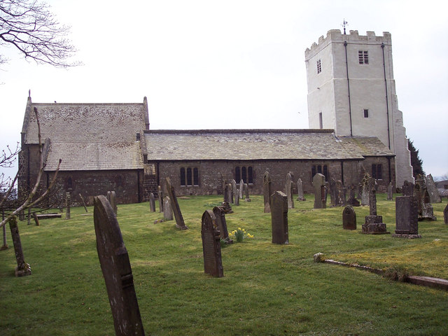
All Saints Church, Orton

All Saints Church is in the village of Orton, Cumbria, England. It is an active Anglican parish church in the deanery of Appleby, the archdeaconry of Carlisle...

Birkbeck Fells

Birkbeck Fells is a township located in part of the parishes of Crosby Ravensworth, Orton and Shap in the historic county of Westmorland. It is a large...

Nearby Amenities

Located within 500m of 54.451608,-2.6001712
Post Box
Collection Times: Mo-Fr 09:00; Sa 07:00
Post Box Type: lamp
Ref: CA10 301
Royal Cypher: EIIR
Royal Cypher Wikidata: Q33102113
Lat/Long: 54.4526581/-2.605825
Crossing
Crossing: marked
Lat/Long: 54.4531198/-2.6064498
Cafe
Kitchen
Addr City: Orton
Addr Postcode: CA10 3SB
Check Date: 2024-05-01
Fhrs Id: 307355
Opening Hours: Mo-Su 07:15-21:00
Lat/Long: 54.4525674/-2.6052878
Farm Shop
Addr City: Orton
Addr Postcode: CA10 3SB
Check Date: 2024-05-01
Fhrs Id: 307537
Opening Hours: Mo-Su 07:00-22:45
Shop: farm
Lat/Long: 54.452759/-2.6055115
Toilets
Check Date: 2024-05-01
Fee: no
Shower: yes
Wheelchair: yes
Lat/Long: 54.4525004/-2.6055883
Phone
Emergency: phone
Lat/Long: 54.4477276/-2.600815
Phone
Emergency: phone
Lat/Long: 54.448082/-2.599493
Entrance: yes
Lat/Long: 54.4526746/-2.6057321
Crossing
Crossing: marked
Lat/Long: 54.4524087/-2.606433
Crossing
Crossing: marked
Lat/Long: 54.45252/-2.6063217
Bus Stop
Tebay Services
Bus: yes
Naptan AtcoCode: 090074643941
Naptan Bearing: SE
Naptan BusStopType: CUS
Naptan CommonName: Services
Naptan Indicator: near
Naptan Landmark: filling station
Naptan LocalityCode: E0044856
Naptan NaptanCode: cumdpdpa
Naptan Street: M6
Naptan Verified: no
Public Transport: platform
Ref: cumdpdpa
Source: naptan_import
Lat/Long: 54.4519483/-2.6063233
Tebay Services
Bus: yes
Public Transport: stop_position
Lat/Long: 54.4519483/-2.6062847
Charging Station
Penrith Southbound Supercharger
Access: customers
Brand: Tesla Supercharger
Brand Wikidata: Q17089620
Capacity: 8
Fee: yes
Opening Hours: 24/7
Operator: Tesla, Inc.
Socket Tesla Supercharger: 8
Socket Tesla Supercharger Output: 150 kW
Socket Tesla Supercharger Ccs: 8
Socket Tesla Supercharger Ccs Output: 150 kW
Website: https://www.tesla.com/findus/location/supercharger/penrithsouthsupercharger
Lat/Long: 54.4536259/-2.606176
Material: wood
Power: pole
Lat/Long: 54.4529023/-2.6048943
Material: wood
Power: pole
Lat/Long: 54.4539704/-2.6052162
Power: pole
Lat/Long: 54.4548187/-2.6055193
Crossing
Crossing: marked
Lat/Long: 54.4529802/-2.6062229
Give Way
Direction: forward
Lat/Long: 54.4516633/-2.6060447
Give Way
Direction: forward
Lat/Long: 54.4522696/-2.6062175
Give Way
Direction: forward
Lat/Long: 54.4524067/-2.6061393
Fast Food
The Shed
Cuisine: ice_cream;hot_drinks;cold_drinks;coffee_shop;hot_snacks
Lat/Long: 54.4525893/-2.6058237
Vending Machine
Check Date: 2024-05-01
Payment Apple Pay: yes
Payment Cash: no
Payment Credit Cards: yes
Payment Debit Cards: yes
Payment Google Pay: yes
Vending: coffee
Lat/Long: 54.4526077/-2.6055147
The data included in this document is from www.openstreetmap.org. The data is made available under ODbL.

Have you been to Low Moor?

Leave your review of Low Moor below (or comments, questions and feedback).