Shortwood Common

Downs, Moorland in Somerset

England

Shortwood Common

Meadow in the sun This image in the Hollow Marsh Nature Reserve was taken 15 years after, but one month earlier than, the image in <a href="https://www.geograph.org.uk/photo/501821">ST6156 : A summer meadow</a>. The sun is shining, but the obvious flowers here are spotted orchids and buttercups.
Meadow in the sun Credit: Neville Goodman

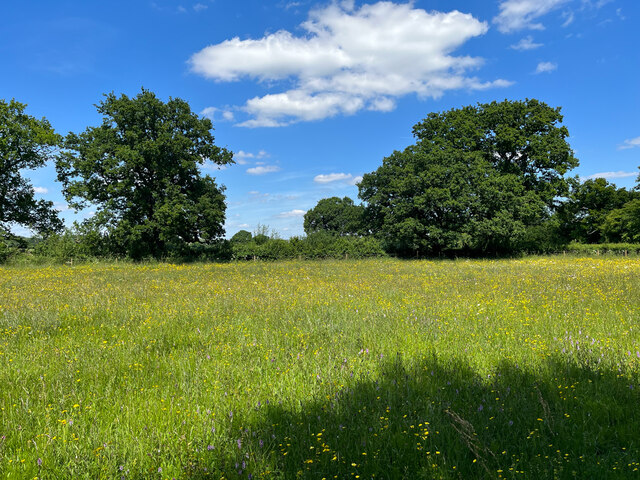
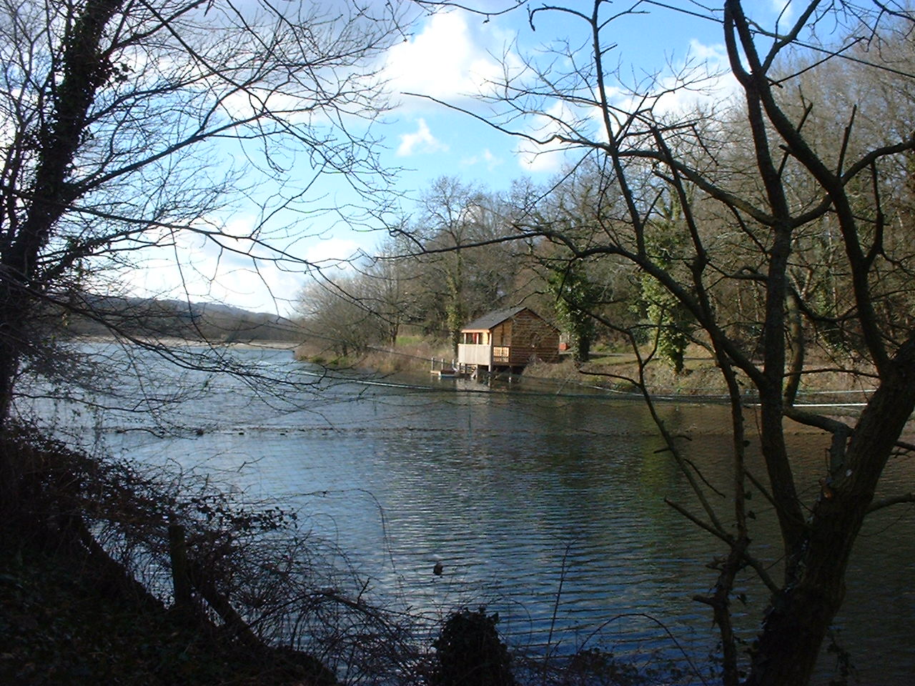
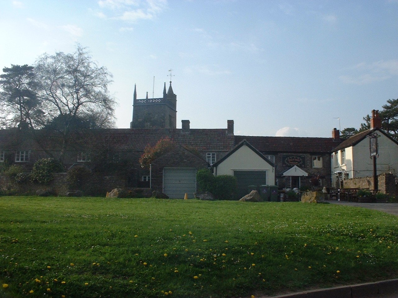
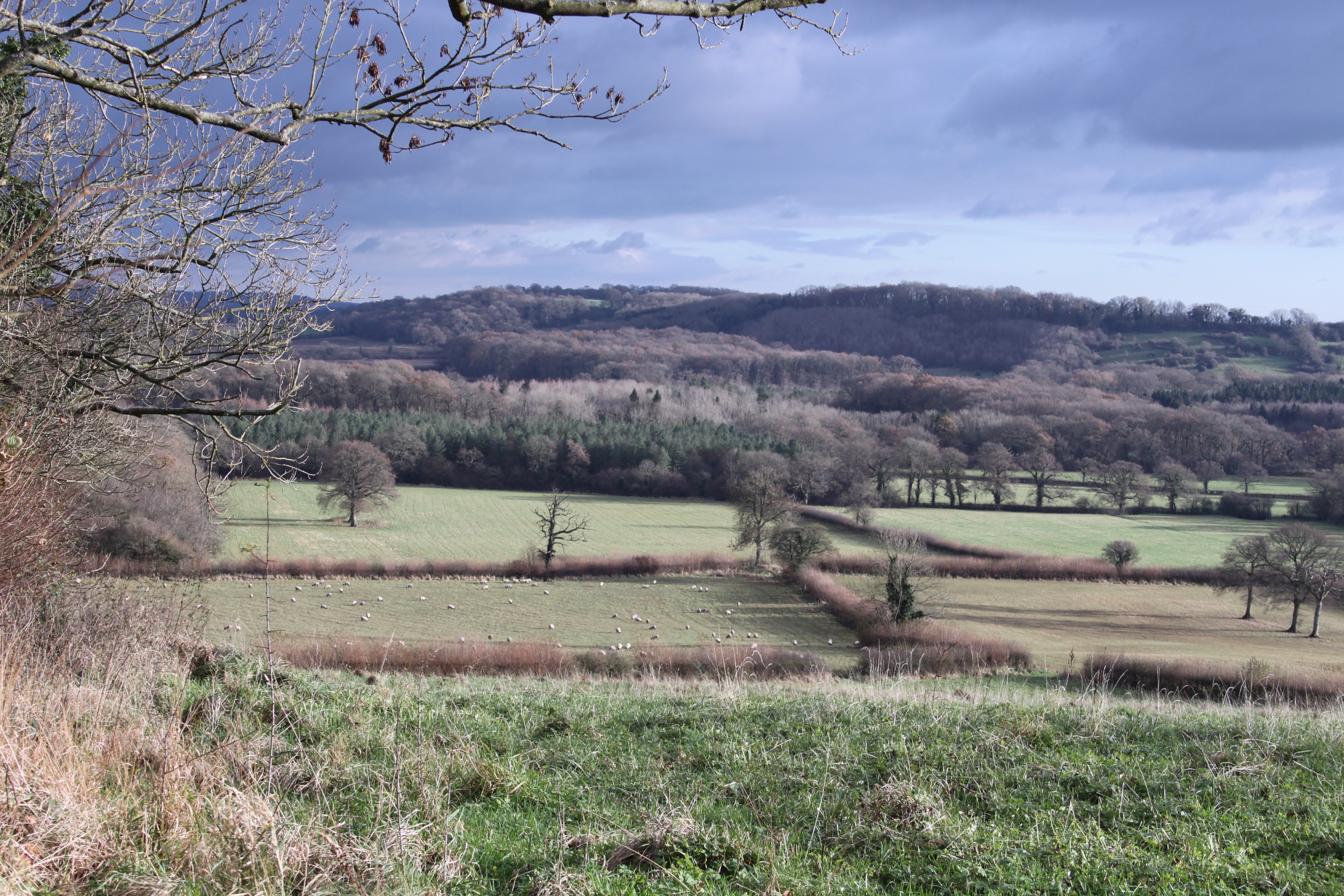
Shortwood Common is a picturesque area located in Somerset, England. Situated between the Somerset Downs and Moorland, this common is known for its stunning natural beauty and rich biodiversity. Spanning over a vast area, Shortwood Common boasts a diverse landscape that includes rolling hills, wooded areas, and open meadows.

The common is known for its abundance of wildlife, making it a popular destination for nature enthusiasts and birdwatchers. Visitors can spot a wide range of bird species, including skylarks, lapwings, and kestrels. Additionally, the common is home to various mammals such as badgers, foxes, and rabbits.

The landscape of Shortwood Common is a patchwork of different habitats, creating a unique blend of flora and fauna. The grassy meadows are adorned with vibrant wildflowers during the spring and summer months, attracting butterflies and bees. The ancient woodlands provide a tranquil retreat, offering a haven for woodland flowers, mosses, and ferns.

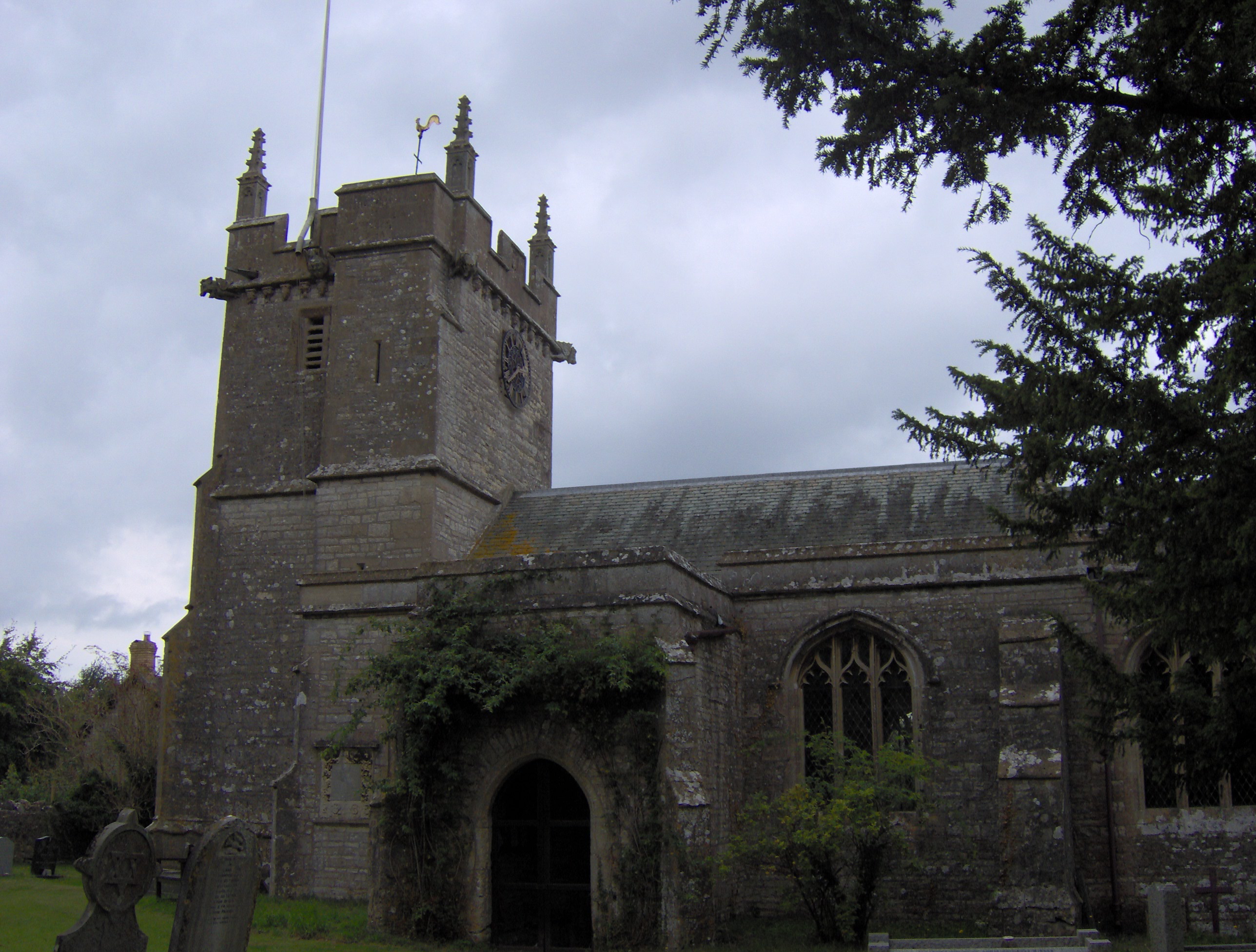
The common is also known for its historical significance. Evidence of human activity dating back to the Neolithic period has been discovered in the area, including burial mounds and ancient trackways. These archaeological features add to the charm and intrigue of Shortwood Common.

Visitors can explore the common through a network of footpaths and bridleways, allowing them to appreciate its natural beauty up close. With its diverse landscape and rich wildlife, Shortwood Common is a true gem of Somerset, offering a peaceful and enchanting escape for all who visit.

If you have any feedback on the listing, please let us know in the comments section below.

Shortwood Common Images

Images are sourced within 2km of 51.29539/-2.5800159 or Grid Reference ST5955. Thanks to Geograph Open Source API. All images are credited.

Meadow in the sun This image in the Hollow Marsh Nature Reserve was taken 15 years after, but one month earlier than, the image in <a href="https://www.geograph.org.uk/photo/501821">ST6156 : A summer meadow</a>. The sun is shining, but the obvious flowers here are spotted orchids and buttercups.
Meadow in the sun
This image in the Hollow Marsh Nature Reserve was taken 15 years after, but one month earlier than, the image in ST6156 : A summer meadow. The sun is shining, but the obvious flowers here are spotted orchids and buttercups.
The obstacle remains The fallen tree that was across the path through Chewton Wood in 2007 <a href="https://www.geograph.org.uk/photo/501830">ST6155 : An obstacle</a> is still there.
The obstacle remains
The fallen tree that was across the path through Chewton Wood in 2007 ST6155 : An obstacle is still there.
Widcombe Cottage
Widcombe Cottage
Gate at west end of Pitway Lane No public access for vehicles beyond here; public footpath only according to the Ordnance Survey, despite the presence of a bridleway gate.
Gate at west end of Pitway Lane
No public access for vehicles beyond here; public footpath only according to the Ordnance Survey, despite the presence of a bridleway gate.
The road in Chewton Wood After the tarmac ends, the road continues for a few hundred metres northwards but is unsurfaced.  This view is from the crossroads where the public bridleway, public footpath/permissive bridleway and road meet.
The road in Chewton Wood
After the tarmac ends, the road continues for a few hundred metres northwards but is unsurfaced. This view is from the crossroads where the public bridleway, public footpath/permissive bridleway and road meet.
Bridleway in Chewton Wood Looking uphill in a southerly direction - the public bridleway that descends from the A39, just north of Turnpike Corner, has a rocky surface.
Bridleway in Chewton Wood
Looking uphill in a southerly direction - the public bridleway that descends from the A39, just north of Turnpike Corner, has a rocky surface.
Permissive Bridleway in Chewton Wood The route beyond the gate is a public footpath and is signed as a permissive bridleway.  The vehicle gate is locked and the sign confirms no motorised vehicles beyond this point.
Permissive Bridleway in Chewton Wood
The route beyond the gate is a public footpath and is signed as a permissive bridleway. The vehicle gate is locked and the sign confirms no motorised vehicles beyond this point.
The road enters Chewton Wood The surface is old tarmac up to this point.
The road enters Chewton Wood
The surface is old tarmac up to this point.
The end of the road The road into Chewton Wood ends at this field gate.  Although on the map the track continues to the right of the gate, there is a barrier preventing any further progress except on foot.
The end of the road
The road into Chewton Wood ends at this field gate. Although on the map the track continues to the right of the gate, there is a barrier preventing any further progress except on foot.
A39 approaching staggered junction Near Turnpike Corner.
A39 approaching staggered junction
Near Turnpike Corner.
Ring O Bells Pub, Hinton Blewitt
Field Looking Towards Eastwood Manor Taken from the B3114
Field Looking Towards Eastwood Manor
Taken from the B3114
Lower Litton Reservoir Belonging to Bristol Water
Weblink: <span class="nowrap"><a title="www.bristol-water.co.uk/pdf/fishing/litton05.pdf" rel="nofollow ugc noopener" href="http://www.bristol-water.co.uk/pdf/fishing/litton05.pdf">Link</a><img style="margin-left:2px;" alt="External link" title="External link - shift click to open in new window" src="https://s1.geograph.org.uk/img/external.png" width="10" height="10"/></span>
Lower Litton Reservoir
Belonging to Bristol Water Weblink: LinkExternal link
Upper Litton Reservoir weblink: <span class="nowrap"><a title="www.bristol-water.co.uk/pdf/fishing/litton05.pdf" rel="nofollow ugc noopener" href="http://www.bristol-water.co.uk/pdf/fishing/litton05.pdf">Link</a><img style="margin-left:2px;" alt="External link" title="External link - shift click to open in new window" src="https://s1.geograph.org.uk/img/external.png" width="10" height="10"/></span>
Upper Litton Reservoir
weblink: LinkExternal link
Stream Near Coley
Stream Near Coley
Road Junction, Hinton Blewett The village was known in the Domesday Book as Hantone, the Blewett part of the name coming from the Bluet family in the fourteenth century.
Road Junction, Hinton Blewett
The village was known in the Domesday Book as Hantone, the Blewett part of the name coming from the Bluet family in the fourteenth century.
Country Lane on the Mendips
Show me another place!

Shortwood Common is located at Grid Ref: ST5955 (Lat: 51.29539, Lng: -2.5800159)

Unitary Authority: Bath and North East Somerset

Police Authority: Avon and Somerset

What 3 Words

///duplicate.tortoises.precautions. Near Cameley, Somerset

Related Wikis

Litton Reservoirs

Litton Reservoirs (also known as Coley Reservoirs) (grid reference ST590553) are two reservoirs near the village of Litton, Somerset, England. They are...

Litton, Somerset

Litton (grid reference ST593546) is a small village and civil parish between Chewton Mendip and West Harptree in the Mendip Hills, Somerset, England. The...

Hinton Blewett

Hinton Blewett is a village and civil parish in Somerset, England, 5 miles (8.0 km) north of Wells and 15 miles (24.1 km) south of Bristol on the northern...

Long Dole Wood and Meadows SSSI

Long Dole Wood and Meadows SSSI (grid reference ST610562) is a 9.8 hectares (24 acres) biological Site of Special Scientific Interest (SSSI) between the...

Nearby Amenities

Located within 500m of 51.29539,-2.5800159
Barrier: block
Lat/Long: 51.294337/-2.5762011
Ele: 152
Natural: peak
Lat/Long: 51.2968016/-2.5827398
Barrier: stile
Lat/Long: 51.2934841/-2.5822542
Barrier: stile
Lat/Long: 51.2937968/-2.5818769
Barrier: stile
Lat/Long: 51.2927481/-2.5754388
Barrier: stile
Lat/Long: 51.2927239/-2.5755015
Power: pole
Lat/Long: 51.2911185/-2.5817737
Power: pole
Lat/Long: 51.2910464/-2.5802448
Power: pole
Lat/Long: 51.2909743/-2.5787321
The data included in this document is from www.openstreetmap.org. The data is made available under ODbL.

Have you been to Shortwood Common?

Leave your review of Shortwood Common below (or comments, questions and feedback).