Side Fell

Downs, Moorland in Cumberland Carlisle

England

Side Fell

Farm track near Tower Brae
Farm track near Tower Brae Credit: Andrew Curtis

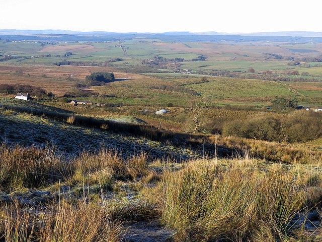
Side Fell is a picturesque area located in the county of Cumberland, England. It forms part of the famous North Pennines, known for its stunning landscapes and natural beauty. The Fell is situated in the western region of the Pennines, near the town of Alston.

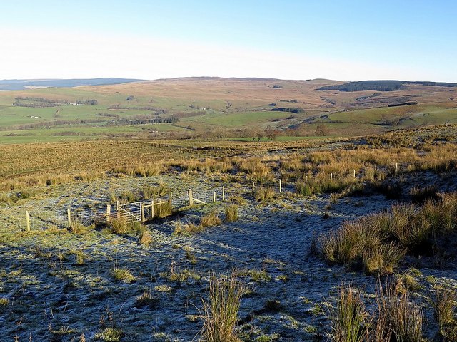
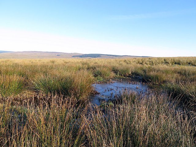
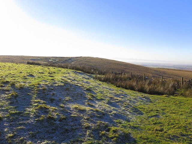
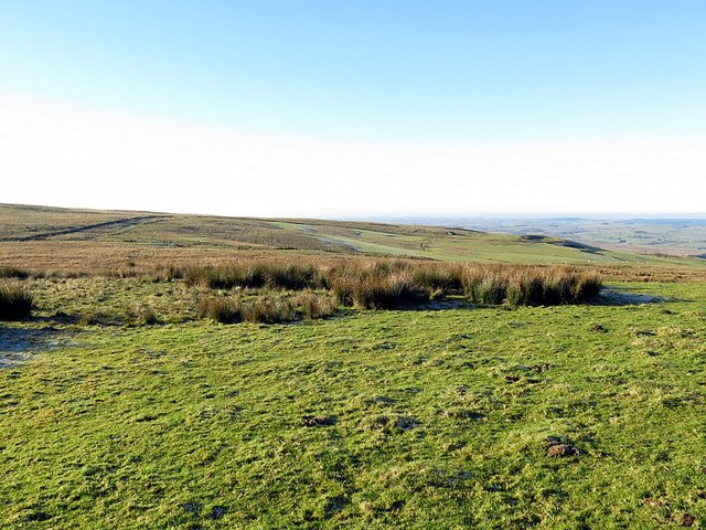
Side Fell is characterized by its rugged and wild terrain, consisting of rolling hills, moorlands, and downs. The landscape is predominantly covered in heather, grasses, and scattered shrubs, giving it a distinct and vibrant appearance throughout the year. The area is also home to numerous streams and small rivers that flow through the valleys, adding to the charm and tranquility of the surroundings.

The Fell offers fantastic opportunities for outdoor enthusiasts, with many walking trails and hiking routes for visitors to explore. Its elevated position provides breathtaking views of the surrounding countryside, including the nearby Nent Valley and the impressive Cross Fell, the highest peak in the Pennines.

Wildlife enthusiasts will also be delighted by the diverse range of flora and fauna found in Side Fell. The moorland habitat supports a variety of bird species, including red grouse, curlews, and golden plovers. Additionally, the Fell is home to several species of butterflies, such as the common blue and orange tip.

Side Fell is a haven for those seeking solace in nature, offering a peaceful and idyllic retreat away from the hustle and bustle of urban life. Its unspoiled landscapes and rich biodiversity make it a must-visit destination for nature lovers and outdoor adventurers alike.

If you have any feedback on the listing, please let us know in the comments section below.

Side Fell Images

Images are sourced within 2km of 55.054007/-2.6469081 or Grid Reference NY5873. Thanks to Geograph Open Source API. All images are credited.

Farm track near Tower Brae
Track at Herd Hill Taken with the sudden realisation that I had missed the bridleway that had turned off (un-signed) at Tower Brae. The farm in the distance is Woodhead <a href="https://www.geograph.org.uk/photo/1945265">NY5773 : Woodhead</a>
Track at Herd Hill
Taken with the sudden realisation that I had missed the bridleway that had turned off (un-signed) at Tower Brae. The farm in the distance is Woodhead NY5773 : Woodhead
Tower Brae
Tower Brae
Old track above Tower Brae
Tower Brae near Espy Well
Gate at Espy Bank
Gate at Espy Bank
Boggy plateau above Tower Brae
North of The Beacon
North of The Beacon
The Butt near Gillalees Beacon Also known as 'Robin Hood's Butt' (a possible reference to Robin Hood's Well nearby) this feature is known to be the remains of a Roman Signal Station, situated on the west side of the Maiden Way Roman Road between Birdoswald and Bewcastle.  It survives as a turf-covered mound, 13 m across and up to 1.9 m high, in the top of which can be seen traces of the structure of the tower. Estimates of the volume of tumbled stone around the tower suggest that it may have stood to a height of 6.1 m.

Traces of a ditch surrounding the mound on the north and east sides are difficult to see on the ground, as is the Roman Road.

It was suggested that signals from here "could be seen at Birdoswald or on the Wall, but not by the enemy to the north, so that a surprise move could be prepared in terrain well adapted to ambush". It is not in line of sight to the Roman Fort at Birdoswald but it is now thought that signals could have been relayed from another Signal Station on Barron's Pike <a href="https://www.geograph.org.uk/gridref/NY5975">NY5975</a>
Pastscape: <span class="nowrap"><a title="http://www.pastscape.org.uk/hob.aspx?hob_id=12986" rel="nofollow ugc noopener" href="http://www.pastscape.org.uk/hob.aspx?hob_id=12986">Link</a><img style="margin-left:2px;" alt="External link" title="External link - shift click to open in new window" src="https://s1.geograph.org.uk/img/external.png" width="10" height="10"/></span> <span class="nowrap"><a title="https://web.archive.org/web/20170222081919/http://www.pastscape.org.uk/hob.aspx?hob_id=12986" rel="nofollow ugc noopener" href="https://web.archive.org/web/20170222081919/http://www.pastscape.org.uk/hob.aspx?hob_id=12986">Archive Link</a><img style="margin-left:2px;" alt="External link" title="External link - shift click to open in new window" src="https://s1.geograph.org.uk/img/external.png" width="10" height="10"/></span>
The Butt near Gillalees Beacon
Also known as 'Robin Hood's Butt' (a possible reference to Robin Hood's Well nearby) this feature is known to be the remains of a Roman Signal Station, situated on the west side of the Maiden Way Roman Road between Birdoswald and Bewcastle. It survives as a turf-covered mound, 13 m across and up to 1.9 m high, in the top of which can be seen traces of the structure of the tower. Estimates of the volume of tumbled stone around the tower suggest that it may have stood to a height of 6.1 m. Traces of a ditch surrounding the mound on the north and east sides are difficult to see on the ground, as is the Roman Road. It was suggested that signals from here "could be seen at Birdoswald or on the Wall, but not by the enemy to the north, so that a surprise move could be prepared in terrain well adapted to ambush". It is not in line of sight to the Roman Fort at Birdoswald but it is now thought that signals could have been relayed from another Signal Station on Barron's Pike NY5975 Pastscape: LinkExternal link Archive LinkExternal link
North-east from The Butt A featureless boggy moorland area called Caudbeck Flow, bounded on the east side by the forest plantations that hide the Spadeadam military site. There is a description of The Butt here <a href="https://www.geograph.org.uk/photo/5208930">NY5771 : The Butt near Gillalees Beacon</a>
North-east from The Butt
A featureless boggy moorland area called Caudbeck Flow, bounded on the east side by the forest plantations that hide the Spadeadam military site. There is a description of The Butt here NY5771 : The Butt near Gillalees Beacon
Heading for Side Fell via Green Knoll There is the odd track here and it even manages to go in my direction for some of the time. Off the track it is wet and difficult ground and a long way to the distant forest where I have decided to go.
Heading for Side Fell via Green Knoll
There is the odd track here and it even manages to go in my direction for some of the time. Off the track it is wet and difficult ground and a long way to the distant forest where I have decided to go.
Green Knowe
Green Knowe
Bushley Bank from the south A ruined farm above Bewcastle.
Bushley Bank from the south
A ruined farm above Bewcastle.
Side Fell towards Spadeadam
Pond on Green's Burn
Moorland near Gilbert's Hill
Crags near Barron's Pike
Large boulder at Barron's Pike Runic inscriptions were described on rock faces on Hazelgill Crag and Barron's Pike and the locations are still shown on modern maps. They were supposed to have been discovered by a shepherd, in 1872 and 1864 respectively. They were revealed in 1929 to be forgeries of the mid-19th century.

On Barron's Pike at grid reference NY59647508, close to the location shown here, there are said to be four rows of runic characters carved on the west face of a massive outcrop boulder. However, I could see nothing clearly resembling artificial markings on any of the faces of this large boulder, or on other smaller rocks in the vicinity.

The west face of the boulder <a href="https://www.geograph.org.uk/photo/5209139">NY5975 : Is this the inscribed rock at Barron's Pike?</a>, just below a major horizontal crack, does appear to be naturally 'ruled' into four equal lines, although if this location is correct, the runes themselves have disappeared, possibly through weathering.

Pastscape Monument No. 12868: <span class="nowrap"><a title="http://www.pastscape.org.uk/hob.aspx?hob_id=12868" rel="nofollow ugc noopener" href="http://www.pastscape.org.uk/hob.aspx?hob_id=12868">Link</a><img style="margin-left:2px;" alt="External link" title="External link - shift click to open in new window" src="https://s1.geograph.org.uk/img/external.png" width="10" height="10"/></span> <span class="nowrap"><a title="https://web.archive.org/web/20170223161225/http://www.pastscape.org.uk/hob.aspx?hob_id=12868" rel="nofollow ugc noopener" href="https://web.archive.org/web/20170223161225/http://www.pastscape.org.uk/hob.aspx?hob_id=12868">Archive Link</a><img style="margin-left:2px;" alt="External link" title="External link - shift click to open in new window" src="https://s1.geograph.org.uk/img/external.png" width="10" height="10"/></span>

The Runes of Bewcastle: <span class="nowrap"><a title="http://heddonhistory.weebly.com/blog/the-runes-of-bewcastle" rel="nofollow ugc noopener" href="http://heddonhistory.weebly.com/blog/the-runes-of-bewcastle">Link</a><img style="margin-left:2px;" alt="External link" title="External link - shift click to open in new window" src="https://s1.geograph.org.uk/img/external.png" width="10" height="10"/></span>
Large boulder at Barron's Pike
Runic inscriptions were described on rock faces on Hazelgill Crag and Barron's Pike and the locations are still shown on modern maps. They were supposed to have been discovered by a shepherd, in 1872 and 1864 respectively. They were revealed in 1929 to be forgeries of the mid-19th century. On Barron's Pike at grid reference NY59647508, close to the location shown here, there are said to be four rows of runic characters carved on the west face of a massive outcrop boulder. However, I could see nothing clearly resembling artificial markings on any of the faces of this large boulder, or on other smaller rocks in the vicinity. The west face of the boulder NY5975 : Is this the inscribed rock at Barron's Pike?, just below a major horizontal crack, does appear to be naturally 'ruled' into four equal lines, although if this location is correct, the runes themselves have disappeared, possibly through weathering. Pastscape Monument No. 12868: LinkExternal link Archive LinkExternal link The Runes of Bewcastle: LinkExternal link
Show me another place!

Side Fell is located at Grid Ref: NY5873 (Lat: 55.054007, Lng: -2.6469081)

Administrative County: Cumbria

District: Carlisle

Police Authority: Cumbria

What 3 Words

///compounds.crank.forge. Near Greenhead, Northumberland

Nearby Locations

Side Fell

Related Wikis

Kingwater

Kingwater is a civil parish in City of Carlisle district, Cumbria, England. At the 2011 census it had a population of 170. The parish is bordered to the...
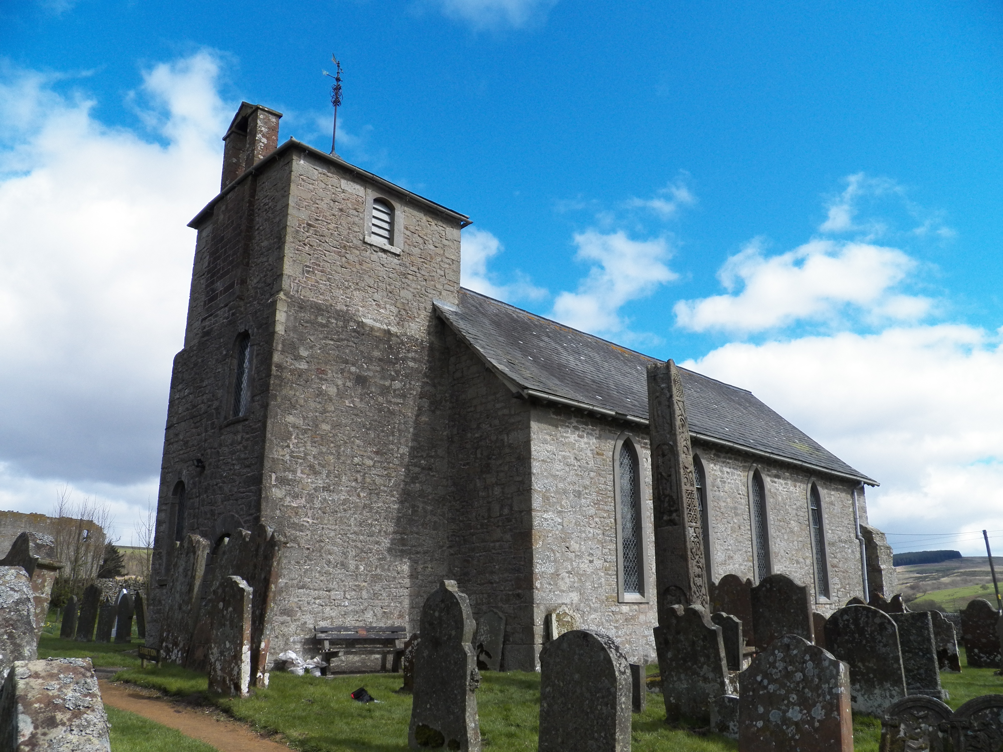
Bewcastle Cross

The Bewcastle Cross is an Anglo-Saxon cross which is still in its original position within the churchyard of St Cuthbert's church at Bewcastle, in the...

Bewcastle

Bewcastle is a large civil parish in the Cumberland unitary authority area of Cumbria, England. It is in the historic county of Cumberland. According to...

Bewcastle Castle

Bewcastle Castle is a ruined castle in the parish of Bewcastle in the English county of Cumbria, a few miles from the Scottish border. == History == The...

Have you been to Side Fell?

Leave your review of Side Fell below (or comments, questions and feedback).