Bretherdale Common

Downs, Moorland in Westmorland Eden

England

Bretherdale Common

Dyke on Birk Knott Roundthwaite Common.
Dyke on Birk Knott Credit: Richard Webb

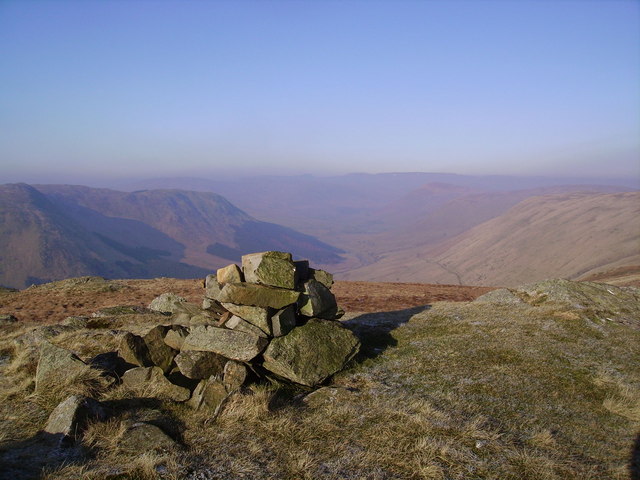
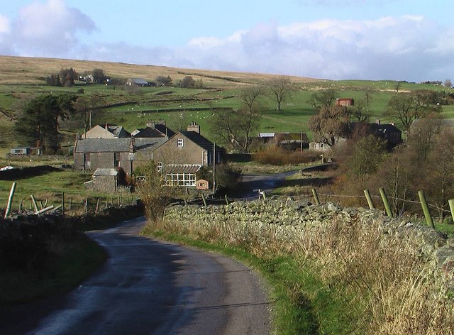
Bretherdale Common is a captivating landscape located in the district of Westmorland, England. Situated amidst the pristine countryside, it encompasses a mix of downs and moorland, offering a diverse and picturesque environment. Spanning over a significant area, it is renowned for its awe-inspiring natural beauty and rich biodiversity.

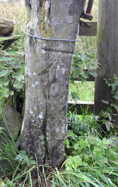
The common is characterized by its gently rolling hills and undulating terrain, which are covered with lush green grasslands and heather moorland. The downs provide a delightful contrast, featuring wide expanses of open grassy areas, dotted with scattered trees and shrubs. The moorland, on the other hand, presents a wilder and more rugged aspect, with its heathery slopes and rocky outcrops.

Bretherdale Common is home to a wide range of flora and fauna. The grasslands support a variety of plant species, including wildflowers, sedges, and grasses. The moorland, with its acidic soil, nurtures heather, bilberry, and cotton grass. These habitats provide a haven for numerous bird species, such as curlews, lapwings, and skylarks, as well as mammals like red deer and brown hares.

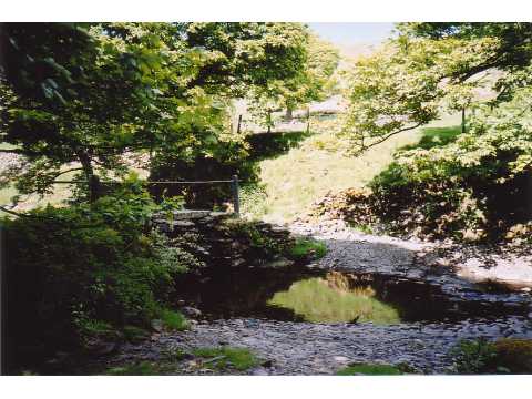
The common also boasts several walking trails and paths, allowing visitors to explore its natural wonders. Whether it is a leisurely stroll through the downs or a more adventurous hike across the moorland, the common offers an enchanting experience for outdoor enthusiasts and nature lovers alike.

Overall, Bretherdale Common is a captivating landscape that showcases the beauty of downs and moorland. Its diverse habitats and abundant wildlife make it a truly remarkable destination for anyone seeking a connection with nature in Westmorland.

If you have any feedback on the listing, please let us know in the comments section below.

Bretherdale Common Images

Images are sourced within 2km of 54.426204/-2.6450071 or Grid Reference NY5803. Thanks to Geograph Open Source API. All images are credited.

Dyke on Birk Knott Roundthwaite Common.
Dyke on Birk Knott
Roundthwaite Common.
Newly planted woodland, Roundthwaite Very recent tree planting on enclosed farmland.
Newly planted woodland, Roundthwaite
Very recent tree planting on enclosed farmland.
Frost, Roundthwaite A track to or from Borrowdale.
Frost, Roundthwaite
A track to or from Borrowdale.
Dyke, Birk Knott The land to the right had just been planted with trees.
Dyke, Birk Knott
The land to the right had just been planted with trees.
Borrow Beck Apart from the occasional short boulder garden and one cattle fence (just round a blind bend), this stretch is fairly typical of the run down Borrow Beck from the put-in at High Borrow Bridge by the A6 (perhaps easiest at the stepping stones where <a href="https://www.geograph.org.uk/photo/6853810">NY5503 : The Breasthigh road crosses Borrow Beck</a>). Despite the low cloud and persistent drizzle, there's not really enough water to paddle this section today, but a kilometre and a quarter downstream from here the river starts to cut down a little, making the channel narrower, and the paddling more interesting and there's just about enough to bounce down the bottom 2½ kilometres.
Borrow Beck
Apart from the occasional short boulder garden and one cattle fence (just round a blind bend), this stretch is fairly typical of the run down Borrow Beck from the put-in at High Borrow Bridge by the A6 (perhaps easiest at the stepping stones where NY5503 : The Breasthigh road crosses Borrow Beck). Despite the low cloud and persistent drizzle, there's not really enough water to paddle this section today, but a kilometre and a quarter downstream from here the river starts to cut down a little, making the channel narrower, and the paddling more interesting and there's just about enough to bounce down the bottom 2½ kilometres.
The summit of Winterscleugh Looking WNW along upper Borrowdale.  (Note: this is the other, lesser-known Borrowdale.)

Winterscleugh was added to the popular Fellranger list of Lake District hills when the border of the Lake District National Park was moved east.
The summit of Winterscleugh
Looking WNW along upper Borrowdale. (Note: this is the other, lesser-known Borrowdale.) Winterscleugh was added to the popular Fellranger list of Lake District hills when the border of the Lake District National Park was moved east.
Puddles and a waterlogged field
Public Bridleway to High Borrowdale
Ovine Obstacle
Ovine Obstacle
Tebay from Roundthwaite Common
On Birk Knott
On Birk Knott
Benchmark on stone in wall north of High Whinhowe Ordnance Survey benchmark described on the Bench Mark Database at <span class="nowrap"><a title="http://www.bench-marks.org.uk/bm69620" rel="nofollow ugc noopener" href="http://www.bench-marks.org.uk/bm69620">Link</a><img style="margin-left:2px;" alt="External link" title="External link - shift click to open in new window" src="https://s1.geograph.org.uk/img/external.png" width="10" height="10"/></span>
Benchmark on stone in wall north of High Whinhowe
Ordnance Survey benchmark described on the Bench Mark Database at LinkExternal link
Dry stone wall beside minor road north of High Whinhowe There is an OS benchmark <a href="https://www.geograph.org.uk/photo/4646987">NY5805 : Benchmark on stone in wall north of High Whinhowe</a> on a stone in front of the wall near the right hand side of the image
Dry stone wall beside minor road north of High Whinhowe
There is an OS benchmark NY5805 : Benchmark on stone in wall north of High Whinhowe on a stone in front of the wall near the right hand side of the image
Ruined farm buildings at High Whinhowe
Benchmark on gatepost between High Whinhowe and Low Whinhowe Ordnance Survey cut mark benchmark described on the Bench Mark Database at <span class="nowrap"><a title="http://www.bench-marks.org.uk/bm69780" rel="nofollow ugc noopener" href="http://www.bench-marks.org.uk/bm69780">Link</a><img style="margin-left:2px;" alt="External link" title="External link - shift click to open in new window" src="https://s1.geograph.org.uk/img/external.png" width="10" height="10"/></span>
Benchmark on gatepost between High Whinhowe and Low Whinhowe
Ordnance Survey cut mark benchmark described on the Bench Mark Database at LinkExternal link
Gateway on path from High Whinhowe to Low Whinhowe There is an OS benchmark <a href="https://www.geograph.org.uk/photo/4647035">NY5905 : Benchmark on gatepost between High Whinhowe and Low Whinhowe</a> on the stone gatepost
Gateway on path from High Whinhowe to Low Whinhowe
There is an OS benchmark NY5905 : Benchmark on gatepost between High Whinhowe and Low Whinhowe on the stone gatepost
Benchmark on gatepost on path near High Whinhowe Ordnance Survey cut mark benchmark described on the Bench Mark Database at <span class="nowrap"><a title="http://www.bench-marks.org.uk/bm69782" rel="nofollow ugc noopener" href="http://www.bench-marks.org.uk/bm69782">Link</a><img style="margin-left:2px;" alt="External link" title="External link - shift click to open in new window" src="https://s1.geograph.org.uk/img/external.png" width="10" height="10"/></span>
Benchmark on gatepost on path near High Whinhowe
Ordnance Survey cut mark benchmark described on the Bench Mark Database at LinkExternal link
Gateway across track from High Whinhowe There is an OS benchmark <a href="https://www.geograph.org.uk/photo/4647232">NY5805 : Benchmark on gatepost on path near High Whinhowe</a> on the left hand gatepost
Gateway across track from High Whinhowe
There is an OS benchmark NY5805 : Benchmark on gatepost on path near High Whinhowe on the left hand gatepost
Show me another place!

Bretherdale Common is located at Grid Ref: NY5803 (Lat: 54.426204, Lng: -2.6450071)

Administrative County: Cumbria

District: Eden

Police Authority: Cumbria

What 3 Words

///shredder.soap.loft. Near Burneside, Cumbria

Nearby Locations

Bretherdale Common

Related Wikis

Winterscleugh

Winterscleugh is a hill of 464 metres (1,522 ft) in Cumbria, England, to the east of the Lake District. It is in the far east of the Lake District National...

Borrowdale, Westmorland

Borrowdale is a valley in the English Lake District. It is located in the county of Westmorland, and is sometimes referred to as Westmorland Borrowdale...

Bretherdale Head

Bretherdale Head is a hamlet in Cumbria, England. Meaning "Valley of the Brother", it was referred to as Britherdal in the 12th century. == References ==

Birkbeck Fells

Birkbeck Fells is a township located in part of the parishes of Crosby Ravensworth, Orton and Shap in the historic county of Westmorland. It is a large...

Greenholme

Greenholme is a hamlet in Cumbria, England.The Greenholme Gala and Agricultural Show is held there annually.Greenholme Bridge crosses the Birk Beck in...

Roundthwaite

Roundthwaite is a small village in Cumbria, England. It is located about a mile south west of Tebay, is part of the Tebay parish, and the majority of its...

Birk Beck

Birk Beck is a minor river in Cumbria.Rising on the fells near Shap, Birk Beck runs south-by-south east, picking up Wasdale Beck (running east and draining...

Tebay railway station

Tebay railway station was situated on the Lancaster and Carlisle Railway (L&CR) (part of the West Coast Main Line) between Lancaster and Penrith. It served...

Nearby Amenities

Located within 500m of 54.426204,-2.6450071
Bretherdale Common
Is In County: Cumbria
Is In Region: Lake District
Place: locality
Source: npe
Lat/Long: 54.4258977/-2.6416731
The data included in this document is from www.openstreetmap.org. The data is made available under ODbL.

Have you been to Bretherdale Common?

Leave your review of Bretherdale Common below (or comments, questions and feedback).