Birkbeck Fells Common

Downs, Moorland in Westmorland Eden

England

Birkbeck Fells Common

Moorland by Wasdale Beck From the A6 as it descends from Shap
Moorland by Wasdale Beck Credit: Eirian Evans

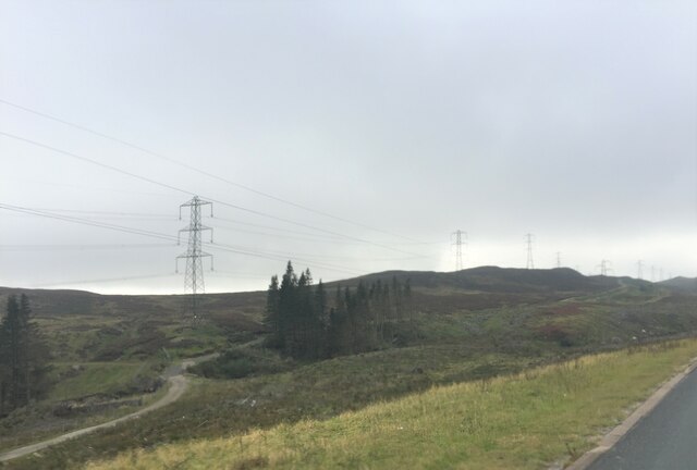
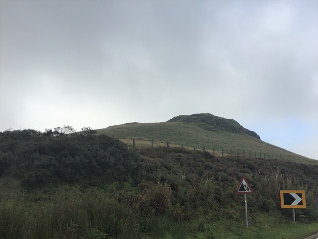
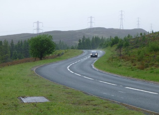
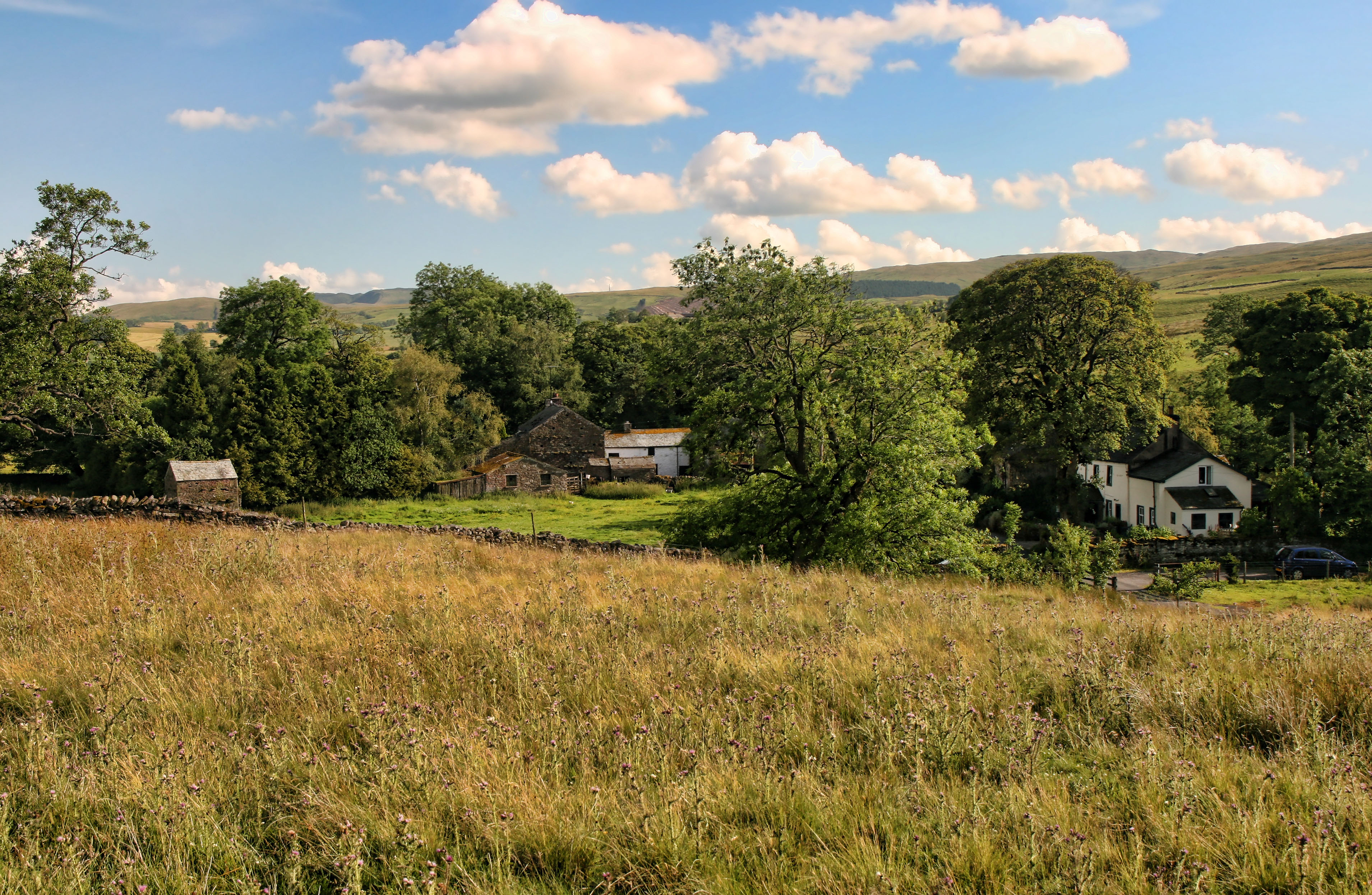
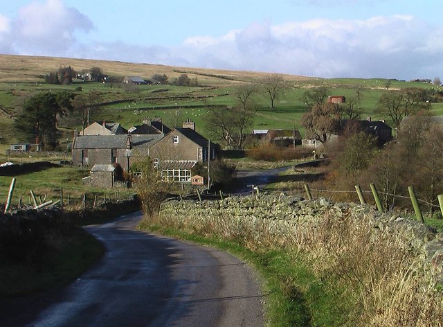
Birkbeck Fells Common is a vast expanse of land located in Westmorland, a historic county in the northwest of England. The common is characterized by its picturesque combination of downs and moorland, creating a diverse and unique landscape. Spanning an area of several square miles, Birkbeck Fells Common is known for its breathtaking natural beauty and is a popular destination for nature enthusiasts and hikers.

The downs in Birkbeck Fells Common are characterized by their gentle slopes and open grasslands, providing stunning panoramic views of the surrounding countryside. These areas are often carpeted with a variety of wildflowers during the spring and summer months, creating a vibrant and colorful display. The downs are also home to a diverse range of wildlife, including birds such as skylarks and meadow pipits.

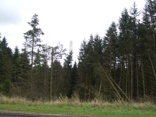
The moorland of Birkbeck Fells Common offers a stark contrast to the downs, with its rugged and wild terrain. Here, visitors can explore vast expanses of heather-covered moors, punctuated by rocky outcrops and peat bogs. The moorland is a haven for a variety of bird species, including red grouse and curlews, which thrive in this unique habitat.

In addition to its natural beauty, Birkbeck Fells Common also holds historical significance. The area has been used for grazing livestock for centuries and still retains traces of ancient settlements, such as abandoned farmsteads and stone walls. These remnants serve as a reminder of the area's rich cultural heritage.

Overall, Birkbeck Fells Common offers a captivating blend of downs and moorland, providing visitors with an opportunity to immerse themselves in the beauty of the Westmorland countryside while enjoying its rich wildlife and historical charm.

If you have any feedback on the listing, please let us know in the comments section below.

Birkbeck Fells Common Images

Images are sourced within 2km of 54.457979/-2.6606853 or Grid Reference NY5707. Thanks to Geograph Open Source API. All images are credited.

Moorland by Wasdale Beck From the A6 as it descends from Shap
Moorland by Wasdale Beck
From the A6 as it descends from Shap
Packhorse Hill On a drover's route from Salterworth to Shap
Packhorse Hill
On a drover's route from Salterworth to Shap
Shap Pink Quarry Granite quarry above the M6.
Shap Pink Quarry
Granite quarry above the M6.
Stonygill
Stonygill
View towards Shap Pink Quarry With the A6 in the foreground.
View towards Shap Pink Quarry
With the A6 in the foreground.
Moorland, Demings Moss East of the A6.
Moorland, Demings Moss
East of the A6.
Moorland beside the A6 The A6 is one of the main historic north south roads in England. At 299 miles long it is the fourth longest road in the country. It currently runs from Luton in Bedfordshire to Carlisle in Cumbria, although it formerly started at a junction with the A1 at Barnet.
Wikipedia: <span class="nowrap"><a title="http://en.wikipedia.org/wiki/A6_road_(England)" rel="nofollow ugc noopener" href="http://en.wikipedia.org/wiki/A6_road_(England)">Link</a><img style="margin-left:2px;" alt="External link" title="External link - shift click to open in new window" src="https://s1.geograph.org.uk/img/external.png" width="10" height="10"/></span> 
See also <span class="nowrap"><a title="http://www.sabre-roads.org.uk/wiki/index.php?title=A6" rel="nofollow ugc noopener" href="http://www.sabre-roads.org.uk/wiki/index.php?title=A6">Link</a><img style="margin-left:2px;" alt="External link" title="External link - shift click to open in new window" src="https://s1.geograph.org.uk/img/external.png" width="10" height="10"/></span> for more route detail.
Moorland beside the A6
The A6 is one of the main historic north south roads in England. At 299 miles long it is the fourth longest road in the country. It currently runs from Luton in Bedfordshire to Carlisle in Cumbria, although it formerly started at a junction with the A1 at Barnet. Wikipedia: LinkExternal link See also LinkExternal link for more route detail.
A6 towards Shap Looking north east.
A6 towards Shap
Looking north east.
Wasdale View towards Shap Pink Quarry.
Wasdale
View towards Shap Pink Quarry.
Bend in the A6, Packhorse Hill Heading north east towards Shap.
Bend in the A6, Packhorse Hill
Heading north east towards Shap.
Woodland beside the A6 The A6 is one of the main historic north south roads in England. At 299 miles long it is the fourth longest road in the country. It currently runs from Luton in Bedfordshire to Carlisle in Cumbria, although it formerly started at a junction with the A1 at Barnet.
Wikipedia: <span class="nowrap"><a title="http://en.wikipedia.org/wiki/A6_road_(England)" rel="nofollow ugc noopener" href="http://en.wikipedia.org/wiki/A6_road_(England)">Link</a><img style="margin-left:2px;" alt="External link" title="External link - shift click to open in new window" src="https://s1.geograph.org.uk/img/external.png" width="10" height="10"/></span> 
See also <span class="nowrap"><a title="http://www.sabre-roads.org.uk/wiki/index.php?title=A6" rel="nofollow ugc noopener" href="http://www.sabre-roads.org.uk/wiki/index.php?title=A6">Link</a><img style="margin-left:2px;" alt="External link" title="External link - shift click to open in new window" src="https://s1.geograph.org.uk/img/external.png" width="10" height="10"/></span> for more route detail.
Woodland beside the A6
The A6 is one of the main historic north south roads in England. At 299 miles long it is the fourth longest road in the country. It currently runs from Luton in Bedfordshire to Carlisle in Cumbria, although it formerly started at a junction with the A1 at Barnet. Wikipedia: LinkExternal link See also LinkExternal link for more route detail.
View across Wasdale Towards Shap Pink Quarry.
View across Wasdale
Towards Shap Pink Quarry.
Shap Pink Quarry View across Wasdale.
Shap Pink Quarry
View across Wasdale.
Former woodland off the A6 The A6 is one of the main historic north south roads in England. At 299 miles long it is the fourth longest road in the country. It currently runs from Luton in Bedfordshire to Carlisle in Cumbria, although it formerly started at a junction with the A1 at Barnet.
Wikipedia: <span class="nowrap"><a title="http://en.wikipedia.org/wiki/A6_road_(England)" rel="nofollow ugc noopener" href="http://en.wikipedia.org/wiki/A6_road_(England)">Link</a><img style="margin-left:2px;" alt="External link" title="External link - shift click to open in new window" src="https://s1.geograph.org.uk/img/external.png" width="10" height="10"/></span> 
See also <span class="nowrap"><a title="http://www.sabre-roads.org.uk/wiki/index.php?title=A6" rel="nofollow ugc noopener" href="http://www.sabre-roads.org.uk/wiki/index.php?title=A6">Link</a><img style="margin-left:2px;" alt="External link" title="External link - shift click to open in new window" src="https://s1.geograph.org.uk/img/external.png" width="10" height="10"/></span> for more route detail.
Former woodland off the A6
The A6 is one of the main historic north south roads in England. At 299 miles long it is the fourth longest road in the country. It currently runs from Luton in Bedfordshire to Carlisle in Cumbria, although it formerly started at a junction with the A1 at Barnet. Wikipedia: LinkExternal link See also LinkExternal link for more route detail.
Woodland beside the A6 The A6 is one of the main historic north south roads in England. At 299 miles long it is the fourth longest road in the country. It currently runs from Luton in Bedfordshire to Carlisle in Cumbria, although it formerly started at a junction with the A1 at Barnet.
Wikipedia: <span class="nowrap"><a title="http://en.wikipedia.org/wiki/A6_road_(England)" rel="nofollow ugc noopener" href="http://en.wikipedia.org/wiki/A6_road_(England)">Link</a><img style="margin-left:2px;" alt="External link" title="External link - shift click to open in new window" src="https://s1.geograph.org.uk/img/external.png" width="10" height="10"/></span> 
See also <span class="nowrap"><a title="http://www.sabre-roads.org.uk/wiki/index.php?title=A6" rel="nofollow ugc noopener" href="http://www.sabre-roads.org.uk/wiki/index.php?title=A6">Link</a><img style="margin-left:2px;" alt="External link" title="External link - shift click to open in new window" src="https://s1.geograph.org.uk/img/external.png" width="10" height="10"/></span> for more route detail.
Woodland beside the A6
The A6 is one of the main historic north south roads in England. At 299 miles long it is the fourth longest road in the country. It currently runs from Luton in Bedfordshire to Carlisle in Cumbria, although it formerly started at a junction with the A1 at Barnet. Wikipedia: LinkExternal link See also LinkExternal link for more route detail.
A6 towards Shap Looking north east.
A6 towards Shap
Looking north east.
The A6 south of Shap With the pylons following the course of the road.
The A6 south of Shap
With the pylons following the course of the road.
Old Milestone by the A6, Shap summit, Orton parish Carved stone post by the A6, in parish of ORTON (EDEN District), Gargill, Shap summit, Old Road South of Shap, 50m along footpath opposite Repeater Station, on East side of road. Old Shap stone, erected by the Heronsyke & Eamont Bridge turnpike trust in the 18th century. 

Inscription reads:-
10

Milestone Society National ID: WE_KDSP10.
Old Milestone by the A6, Shap summit, Orton parish
Carved stone post by the A6, in parish of ORTON (EDEN District), Gargill, Shap summit, Old Road South of Shap, 50m along footpath opposite Repeater Station, on East side of road. Old Shap stone, erected by the Heronsyke & Eamont Bridge turnpike trust in the 18th century. Inscription reads:- 10 Milestone Society National ID: WE_KDSP10.
Show me another place!

Birkbeck Fells Common is located at Grid Ref: NY5707 (Lat: 54.457979, Lng: -2.6606853)

Administrative County: Cumbria

District: Eden

Police Authority: Cumbria

What 3 Words

///left.cubed.groups. Near Shap, Cumbria

Nearby Locations

Birkbeck Fells Common

Related Wikis

Birkbeck Fells

Birkbeck Fells is a township located in part of the parishes of Crosby Ravensworth, Orton and Shap in the historic county of Westmorland. It is a large...

Bretherdale Head

Bretherdale Head is a hamlet in Cumbria, England. Meaning "Valley of the Brother", it was referred to as Britherdal in the 12th century. == References ==

Scout Green

Scout Green is a hamlet and small area of farm land near the village of Tebay in Cumbria, England. == History == It is best known among railway enthusiasts...

Wasdale Horseshoe

The Wasdale Horseshoe is a group of hills on the eastern fringe of the English Lake District, to the west of the A6, south of Shap, Cumbria. They surround...

Greenholme

Greenholme is a hamlet in Cumbria, England.The Greenholme Gala and Agricultural Show is held there annually.Greenholme Bridge crosses the Birk Beck in...

Tebay Services

Tebay Services are motorway service stations on the M6 motorway in the Westmorland and Furness district of Cumbria, England. The northbound opened in 1972...

Borrowdale, Westmorland

Borrowdale is a valley in the English Lake District. It is located in the county of Westmorland, and is sometimes referred to as Westmorland Borrowdale...

Crookdale Horseshoe

The Crookdale Horseshoe is a group of hills on the eastern edge of the English Lake District, in Cumbria, west of the A6 road. They are the subject of...

Have you been to Birkbeck Fells Common?

Leave your review of Birkbeck Fells Common below (or comments, questions and feedback).