Ashstead Fell

Downs, Moorland in Westmorland South Lakeland

England

Ashstead Fell

The A6 descending to Borrowdale The A6 is Britain's fourth longest road and one of the main historic north-south roads in England. It currently runs for 299 miles from Luton in Bedfordshire to Carlisle in Cumbria, although it formerly started at a junction with the A1 at Barnet.

Running north west from Luton, the road travels through Bedford, bypasses Rushden, Kettering and Market Harborough, continues through Leicester, Loughborough, Derby and Matlock before going through the Peak District to Bakewell, Buxton, Stockport, Manchester, Salford, Pendleton, Irlams o' th' Height, Pendlebury, Swinton, Walkden, Little Hulton, Bolton, Chorley, Preston, Lancaster, Kendal and Penrith before reaching Carlisle.

See <span class="nowrap"><a title="http://en.wikipedia.org/wiki/A6_road_(England)" rel="nofollow ugc noopener" href="http://en.wikipedia.org/wiki/A6_road_(England)">Link</a><img style="margin-left:2px;" alt="External link" title="External link - shift click to open in new window" src="https://s1.geograph.org.uk/img/external.png" width="10" height="10"/></span> (Wikipedia) and <span class="nowrap"><a title="http://www.sabre-roads.org.uk/wiki/index.php?title=A6" rel="nofollow ugc noopener" href="http://www.sabre-roads.org.uk/wiki/index.php?title=A6">Link</a><img style="margin-left:2px;" alt="External link" title="External link - shift click to open in new window" src="https://s1.geograph.org.uk/img/external.png" width="10" height="10"/></span> (SABRE) for more information.
The A6 descending to Borrowdale Credit: Eirian Evans

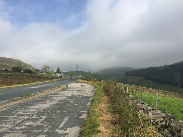
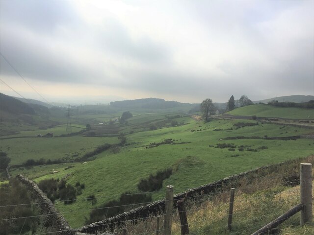
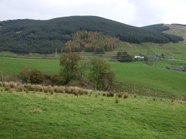
Ashstead Fell is a picturesque area located in the county of Westmorland, England. Situated on the edge of the Lake District National Park, it encompasses a diverse landscape of downs and moorland. Spanning an area of approximately 10 square miles, Ashstead Fell offers visitors an opportunity to immerse themselves in the untouched beauty of the countryside.

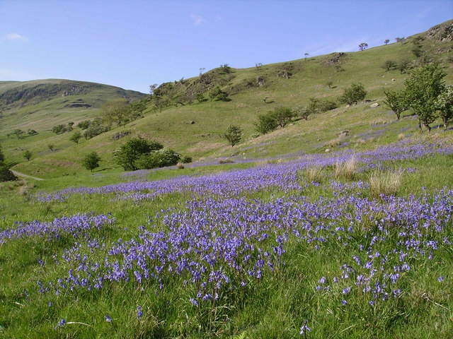
The downs of Ashstead Fell are characterized by gently rolling hills and expansive grasslands. Here, visitors can enjoy leisurely walks, taking in the panoramic views of the surrounding countryside. The open expanse of the downs provides ample space for outdoor activities such as picnicking, kite flying, and even horseback riding.

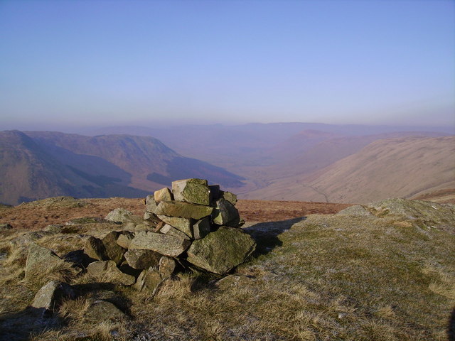
In contrast, the moorland of Ashstead Fell offers a more rugged and wild terrain. Covered in heather and scattered with rocky outcrops, this area is a haven for nature enthusiasts and wildlife lovers. Keen-eyed visitors may spot various bird species, including grouse and curlew, as well as small mammals such as hares and rabbits.

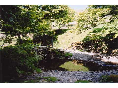
Ashstead Fell is also home to several walking trails, ranging from easy strolls to more challenging hikes. These trails provide an opportunity to explore the diverse flora and fauna of the area, as well as discover ancient ruins and historic landmarks dotted throughout.

With its scenic beauty, diverse landscapes, and abundance of wildlife, Ashstead Fell is a gem for nature lovers and outdoor enthusiasts seeking a tranquil escape in the heart of Westmorland.

If you have any feedback on the listing, please let us know in the comments section below.

Ashstead Fell Images

Images are sourced within 2km of 54.419456/-2.6807776 or Grid Reference NY5502. Thanks to Geograph Open Source API. All images are credited.

The A6 descending to Borrowdale The A6 is Britain's fourth longest road and one of the main historic north-south roads in England. It currently runs for 299 miles from Luton in Bedfordshire to Carlisle in Cumbria, although it formerly started at a junction with the A1 at Barnet.

Running north west from Luton, the road travels through Bedford, bypasses Rushden, Kettering and Market Harborough, continues through Leicester, Loughborough, Derby and Matlock before going through the Peak District to Bakewell, Buxton, Stockport, Manchester, Salford, Pendleton, Irlams o' th' Height, Pendlebury, Swinton, Walkden, Little Hulton, Bolton, Chorley, Preston, Lancaster, Kendal and Penrith before reaching Carlisle.

See <span class="nowrap"><a title="http://en.wikipedia.org/wiki/A6_road_(England)" rel="nofollow ugc noopener" href="http://en.wikipedia.org/wiki/A6_road_(England)">Link</a><img style="margin-left:2px;" alt="External link" title="External link - shift click to open in new window" src="https://s1.geograph.org.uk/img/external.png" width="10" height="10"/></span> (Wikipedia) and <span class="nowrap"><a title="http://www.sabre-roads.org.uk/wiki/index.php?title=A6" rel="nofollow ugc noopener" href="http://www.sabre-roads.org.uk/wiki/index.php?title=A6">Link</a><img style="margin-left:2px;" alt="External link" title="External link - shift click to open in new window" src="https://s1.geograph.org.uk/img/external.png" width="10" height="10"/></span> (SABRE) for more information.
The A6 descending to Borrowdale
The A6 is Britain's fourth longest road and one of the main historic north-south roads in England. It currently runs for 299 miles from Luton in Bedfordshire to Carlisle in Cumbria, although it formerly started at a junction with the A1 at Barnet. Running north west from Luton, the road travels through Bedford, bypasses Rushden, Kettering and Market Harborough, continues through Leicester, Loughborough, Derby and Matlock before going through the Peak District to Bakewell, Buxton, Stockport, Manchester, Salford, Pendleton, Irlams o' th' Height, Pendlebury, Swinton, Walkden, Little Hulton, Bolton, Chorley, Preston, Lancaster, Kendal and Penrith before reaching Carlisle. See LinkExternal link (Wikipedia) and LinkExternal link (SABRE) for more information.
Borrow Beck at Huck's Bridge Ashstead Fell on the horizon
Borrow Beck at Huck's Bridge
Ashstead Fell on the horizon
Newly planted trees On the lower slopes of Ashstead Fell
Newly planted trees
On the lower slopes of Ashstead Fell
Breasthigh Road A mountain track from Borrowdale, crossing Borrow Beck at a ford and climbing to Bretherdale Head
Breasthigh Road
A mountain track from Borrowdale, crossing Borrow Beck at a ford and climbing to Bretherdale Head
Lay-by on the A6 Between Martclose Farm and Hollowgate Farm
Lay-by on the A6
Between Martclose Farm and Hollowgate Farm
Ashstead Beck valley Rough grazing up here
Ashstead Beck valley
Rough grazing up here
Old Boundary Marker on the A6 Parish Boundary Marker against a drystone wall on the northwest side of the A6 south of Hucks Bridge. Fawcett Forest parish became part of Selside and Fawcett Forest parish in 2020. See also <span class="nowrap"><a title="http://www.geog.port.ac.uk/webmap/thelakes/photos/bnk42.jpg" rel="nofollow ugc noopener" href="http://www.geog.port.ac.uk/webmap/thelakes/photos/bnk42.jpg">Link</a><img style="margin-left:2px;" alt="External link" title="External link - shift click to open in new window" src="https://s1.geograph.org.uk/img/external.png" width="10" height="10"/></span>. In 2009 the stone was reported to have been knocked over in a collision, see <span class="nowrap"><a title="https://www.lakesguides.co.uk/html/lgaz/LK13914.htm" rel="nofollow ugc noopener" href="https://www.lakesguides.co.uk/html/lgaz/LK13914.htm">Link</a><img style="margin-left:2px;" alt="External link" title="External link - shift click to open in new window" src="https://s1.geograph.org.uk/img/external.png" width="10" height="10"/></span>.

Milestone Society National ID: WE_KDSP08pb
Old Boundary Marker on the A6
Parish Boundary Marker against a drystone wall on the northwest side of the A6 south of Hucks Bridge. Fawcett Forest parish became part of Selside and Fawcett Forest parish in 2020. See also LinkExternal link. In 2009 the stone was reported to have been knocked over in a collision, see LinkExternal link. Milestone Society National ID: WE_KDSP08pb
The summit of Winterscleugh Looking WNW along upper Borrowdale.  (Note: this is the other, lesser-known Borrowdale.)

Winterscleugh was added to the popular Fellranger list of Lake District hills when the border of the Lake District National Park was moved east.
The summit of Winterscleugh
Looking WNW along upper Borrowdale. (Note: this is the other, lesser-known Borrowdale.) Winterscleugh was added to the popular Fellranger list of Lake District hills when the border of the Lake District National Park was moved east.
Lonely phone box In the A6 road lay-by south of Huck's Bridge
Lonely phone box
In the A6 road lay-by south of Huck's Bridge
Farm track off the A6 The A6 is one of the main historic north south roads in England. At 299 miles long it is the fourth longest road in the country. It currently runs from Luton in Bedfordshire to Carlisle in Cumbria, although it formerly started at a junction with the A1 at Barnet.
Wikipedia: <span class="nowrap"><a title="http://en.wikipedia.org/wiki/A6_road_(England)" rel="nofollow ugc noopener" href="http://en.wikipedia.org/wiki/A6_road_(England)">Link</a><img style="margin-left:2px;" alt="External link" title="External link - shift click to open in new window" src="https://s1.geograph.org.uk/img/external.png" width="10" height="10"/></span> 
See also <span class="nowrap"><a title="http://www.sabre-roads.org.uk/wiki/index.php?title=A6" rel="nofollow ugc noopener" href="http://www.sabre-roads.org.uk/wiki/index.php?title=A6">Link</a><img style="margin-left:2px;" alt="External link" title="External link - shift click to open in new window" src="https://s1.geograph.org.uk/img/external.png" width="10" height="10"/></span> for more route detail.
Farm track off the A6
The A6 is one of the main historic north south roads in England. At 299 miles long it is the fourth longest road in the country. It currently runs from Luton in Bedfordshire to Carlisle in Cumbria, although it formerly started at a junction with the A1 at Barnet. Wikipedia: LinkExternal link See also LinkExternal link for more route detail.
Grazing and pylon, Grisdale View from the A6.
Grazing and pylon, Grisdale
View from the A6.
A6 heading north Towards Shap.
A6 heading north
Towards Shap.
Hillside grazing towards Wolf Howe
Grazing and woodland View across the valley.
Grazing and woodland
View across the valley.
A6 towards Shap Looking north.
A6 towards Shap
Looking north.
Hollowgate
Hollowgate
Cottages, Hollowgate
A6, Hollowgate Looking north.
A6, Hollowgate
Looking north.
Show me another place!

Ashstead Fell is located at Grid Ref: NY5502 (Lat: 54.419456, Lng: -2.6807776)

Administrative County: Cumbria

District: South Lakeland

Police Authority: Cumbria

What 3 Words

///extensive.book.standards. Near Burneside, Cumbria

Nearby Locations

Combs Hollow Ashstead Fell

Related Wikis

Borrowdale, Westmorland

Borrowdale is a valley in the English Lake District. It is located in the county of Westmorland, and is sometimes referred to as Westmorland Borrowdale...

Winterscleugh

Winterscleugh is a hill of 464 metres (1,522 ft) in Cumbria, England, to the east of the Lake District. It is in the far east of the Lake District National...

Fawcett Forest

Fawcett Forest is a former civil parish, now in the parish of Selside and Fawcett Forest, in the South Lakeland district of the English county of Cumbria...

Bretherdale Head

Bretherdale Head is a hamlet in Cumbria, England. Meaning "Valley of the Brother", it was referred to as Britherdal in the 12th century. == References ==

Lowbridge Estate

The Lowbridge Estate is a country estate of approximately 2000 acres in the Lake District region of England that was in the continuous ownership of the...
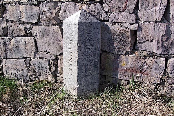
Whinfell Beacon

Whinfell Beacon is a hill of 472 metres (1,549 ft) in South Lakeland, Cumbria, England, to the east of the Lake District. It is in the far east of the...

Bannisdale Horseshoe

The Bannisdale Horseshoe is an upland area in Cumbria, England, near the eastern boundary of the Lake District National Park, surrounding the valley of...

Crookdale Horseshoe

The Crookdale Horseshoe is a group of hills on the eastern edge of the English Lake District, in Cumbria, west of the A6 road. They are the subject of...

Nearby Amenities

Located within 500m of 54.419456,-2.6807776
Ashstead Fell
Ele: 469
Natural: peak
Lat/Long: 54.4181712/-2.6801894
Combs Hollow
Place: locality
Lat/Long: 54.4204198/-2.6770757
Ele: 455
Natural: peak
Lat/Long: 54.4211842/-2.6831124
Man Made: cairn
Lat/Long: 54.4211611/-2.6831035
The data included in this document is from www.openstreetmap.org. The data is made available under ODbL.

Have you been to Ashstead Fell?

Leave your review of Ashstead Fell below (or comments, questions and feedback).