Fishwick Bottoms

Downs, Moorland in Lancashire Preston

England

Fishwick Bottoms

West View Leisure Centre West View sports a very good climbing wall
West View Leisure Centre Credit: Keith Wright

Fishwick Bottoms is a picturesque area located in Lancashire, England. Situated in the southern part of the county, it is known for its stunning landscape comprising of downs and moorland. Spanning approximately 200 hectares, Fishwick Bottoms is a designated Site of Special Scientific Interest (SSSI) due to its rich biodiversity and unique ecological features.

The area is characterized by gently rolling hills, interspersed with small streams and pockets of woodland. The downs, with their lush green grasslands, offer breathtaking panoramic views of the surrounding countryside. The moorland, on the other hand, presents a more rugged terrain, with heather-covered hills and peat bogs.

Fishwick Bottoms is home to a diverse range of flora and fauna. The grasslands support a variety of wildflowers, such as cowslips, harebells, and orchids, attracting butterflies and bees. The moorland is inhabited by hardy species like grouse, curlew, and skylarks, which thrive in this unique habitat.

The area is also of historical significance, with evidence of human activity dating back centuries. Ancient burial mounds and stone circles can be found within Fishwick Bottoms, providing insights into the lives of the people who once inhabited the area.

Fishwick Bottoms offers numerous opportunities for outdoor enthusiasts. Walking trails and bridleways crisscross the landscape, making it a popular destination for hikers, cyclists, and horse riders. The tranquility and natural beauty of Fishwick Bottoms make it an ideal place for nature lovers and those seeking a peaceful retreat amidst the stunning Lancashire countryside.

If you have any feedback on the listing, please let us know in the comments section below.

Fishwick Bottoms Images

Images are sourced within 2km of 53.753792/-2.6707068 or Grid Reference SD5528. Thanks to Geograph Open Source API. All images are credited.

West View Leisure Centre West View sports a very good climbing wall
West View Leisure Centre
West View sports a very good climbing wall
Hesketh Arms This pub stands at the junction of New Hall Lane and Blackpool Road, opposite the gates of Preston Cemetery.
Hesketh Arms
This pub stands at the junction of New Hall Lane and Blackpool Road, opposite the gates of Preston Cemetery.
Maitland Street, Preston
St Joseph's Roman Catholic Church, Preston
St Joseph's Roman Catholic Church, Preston, Doorway
One wayer and this is not the entrance The one way part of Geoffrey Street, the other part is two ways
One wayer and this is not the entrance
The one way part of Geoffrey Street, the other part is two ways
The Derby Inn, Ribbleton Lane, Preston
Bridge House (St Luke's Church) Now converted in to housing
Bridge House (St Luke's Church)
Now converted in to housing
Bridge House (St Luke's Church), Doorway
Bridge House (St Luke's Church), Porch
Bridge House (St Luke's Church)
Fox & Grapes, Ribbleton Lane, Preston
The Skeffington, Ribbleton Lane, Preston
The New Deepdale, St Georges Road, Preston
Deepdale Mill Street level crossing Mid-19th-century changes to the railway layout in northern Preston left the original terminus of the Preston & Longridge Railway on a short branch, where it survived as a coal yard until the 1990s.  Although the line has since been disused, the rails still remain in situ for most of the way and are seen here crossing Deepdale Mill Street on the level.  The later extension to Maudlands passed under this road just to the right of the picture and ran between the mosque and the terraced housing in the background.
Deepdale Mill Street level crossing
Mid-19th-century changes to the railway layout in northern Preston left the original terminus of the Preston & Longridge Railway on a short branch, where it survived as a coal yard until the 1990s. Although the line has since been disused, the rails still remain in situ for most of the way and are seen here crossing Deepdale Mill Street on the level. The later extension to Maudlands passed under this road just to the right of the picture and ran between the mosque and the terraced housing in the background.
Sunshine Children's Centre
Hesketh Arms
Hesketh Arms
Show me another place!

Fishwick Bottoms is located at Grid Ref: SD5528 (Lat: 53.753792, Lng: -2.6707068)

Administrative County: Lancashire

District: Preston

Police Authority: Lancashire

What 3 Words

///lush.brains.afford. Near Preston, Lancashire

Related Wikis

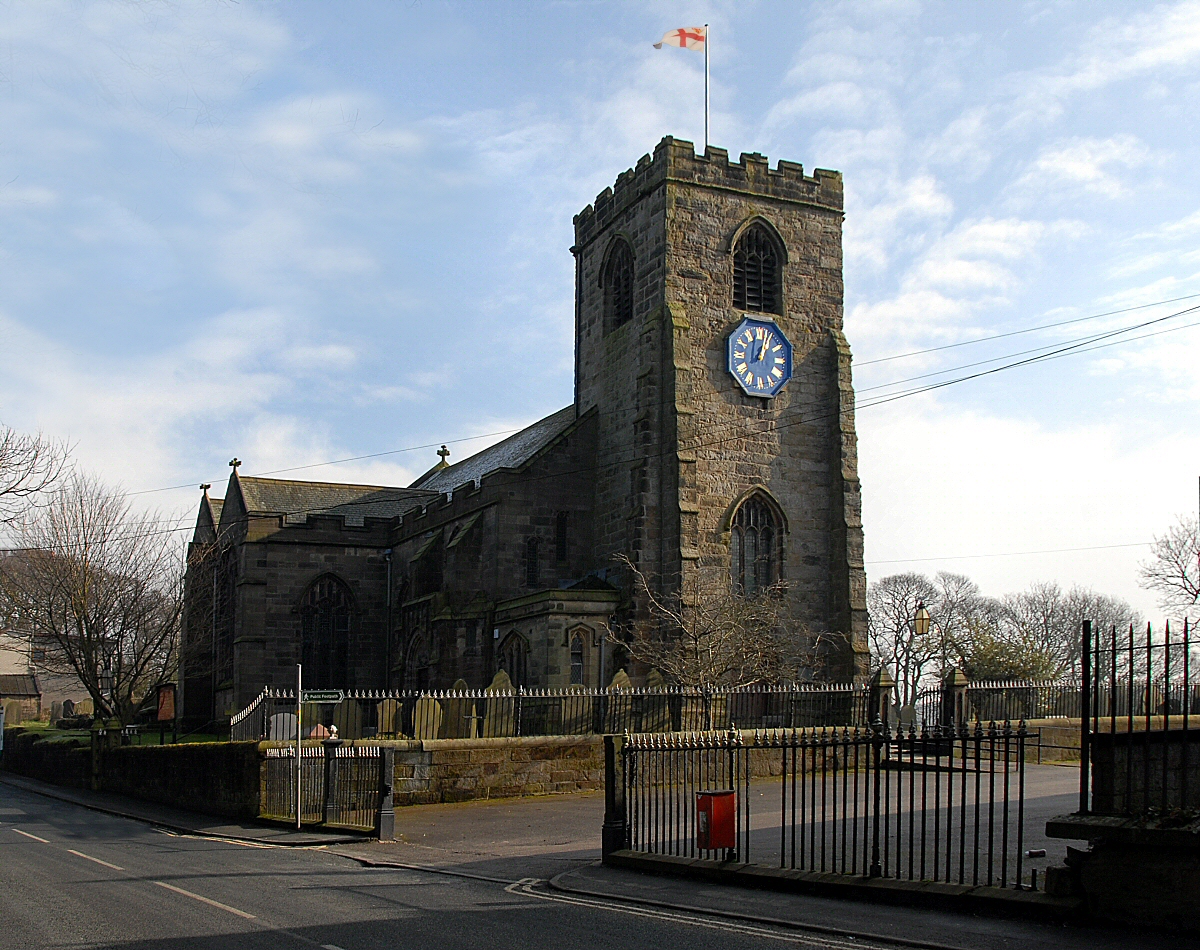
St Leonard's Church, Walton-le-Dale

St Leonard's Church is an Anglican church in Walton-le-Dale, Lancashire, England. It is an active parish church in the Diocese of Blackburn and the archdeaconry...

Walton-le-Dale

Walton-le-Dale is a large village in the borough of South Ribble, in Lancashire, England. It lies on the south bank of the River Ribble, opposite the city...

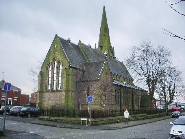
Madina Mosque (Preston)

Madina Mosque is a mosque in Preston, Lancashire, England.
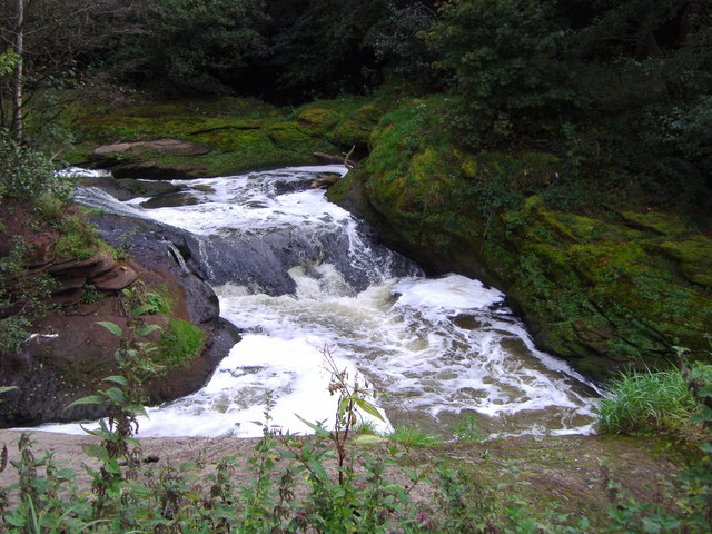
River Darwen

The River Darwen runs through Darwen and Blackburn in Lancashire, England, eventually joining the River Ribble at Walton le Dale south of Preston on its...

Nearby Amenities

Located within 500m of 53.753792,-2.6707068
Source: PGS
Lat/Long: 53.7517545/-2.6769356
Source: PGS
Lat/Long: 53.7519955/-2.6773218
Source: PGS
Lat/Long: 53.75233/-2.6778454
Source: PGS
Lat/Long: 53.7528628/-2.6774941
Source: PGS
Lat/Long: 53.7524695/-2.6769013
Source: PGS
Lat/Long: 53.7522792/-2.6766223
Source: PGS
Lat/Long: 53.7501477/-2.6747984
Source: PGS
Lat/Long: 53.7507648/-2.6756696
Source: PGS
Lat/Long: 53.7510059/-2.6760987
Source: PGS
Lat/Long: 53.7513104/-2.6764421
Source: PGS
Lat/Long: 53.7515388/-2.6766566
Source: PGS
Lat/Long: 53.7519113/-2.6760859
Source: PGS
Lat/Long: 53.7514672/-2.6756353
Source: PGS
Lat/Long: 53.7512388/-2.6753349
Created By: almien_coastlines
Source: PGS
Lat/Long: 53.7510759/-2.6751016
Source: PGS
Lat/Long: 53.7498558/-2.6726098
Source: PGS
Lat/Long: 53.7496528/-2.6719446
Traffic Signals
Lat/Long: 53.7502914/-2.6754424
Bicycle: yes
Crossing: traffic_signals
Foot: yes
Lat/Long: 53.7502221/-2.6752985
Source: PGS
Lat/Long: 53.7531531/-2.6781029
Bench
Backrest: yes
Colour: brown
Material: wood
Seats: 3
Lat/Long: 53.750507/-2.6755182
Bench
Backrest: yes
Colour: brown
Material: wood
Seats: 3
Lat/Long: 53.7504031/-2.6753989
Bench
Backrest: yes
Colour: brown
Material: wood
Seats: 3
Lat/Long: 53.7503333/-2.6752581
Waste Basket
Colour: blue
Material: metal
Operator: South Ribble Borough Council
Source: survey
Waste: trash;dog_excrement
Lat/Long: 53.7503698/-2.6753305
PMT
Material: wood
Operator: Electricity North West
Power: pole
Source: survey
Transformer: minor_distribution
Lat/Long: 53.7550752/-2.675529
The data included in this document is from www.openstreetmap.org. The data is made available under ODbL.

Have you been to Fishwick Bottoms?

Leave your review of Fishwick Bottoms below (or comments, questions and feedback).