Low Park

Downs, Moorland in Cumberland Carlisle

England

Low Park

The Beacon A list of beacons in Cumberland in the fifteenth century includes "Spadeadam Top, now known as Gillalees Beacon". Irregular traces of foundations were described in 1854 but nothing can be seen today. The OS triangulation pillar is set on top of a turf-covered earth and stone mound about 7.0m diameter and 0.6m maximum height and the medieval remains of the beacon may lie below.
Pastscape Monument No. 12969: <span class="nowrap"><a title="http://www.pastscape.org.uk/hob.aspx?hob_id=12969" rel="nofollow ugc noopener" href="http://www.pastscape.org.uk/hob.aspx?hob_id=12969">Link</a><img style="margin-left:2px;" alt="External link" title="External link - shift click to open in new window" src="https://s1.geograph.org.uk/img/external.png" width="10" height="10"/></span> <span class="nowrap"><a title="https://web.archive.org/web/20170221114929/http://www.pastscape.org.uk/hob.aspx?hob_id=12969" rel="nofollow ugc noopener" href="https://web.archive.org/web/20170221114929/http://www.pastscape.org.uk/hob.aspx?hob_id=12969">Archive Link</a><img style="margin-left:2px;" alt="External link" title="External link - shift click to open in new window" src="https://s1.geograph.org.uk/img/external.png" width="10" height="10"/></span>
The Beacon Credit: Andrew Curtis

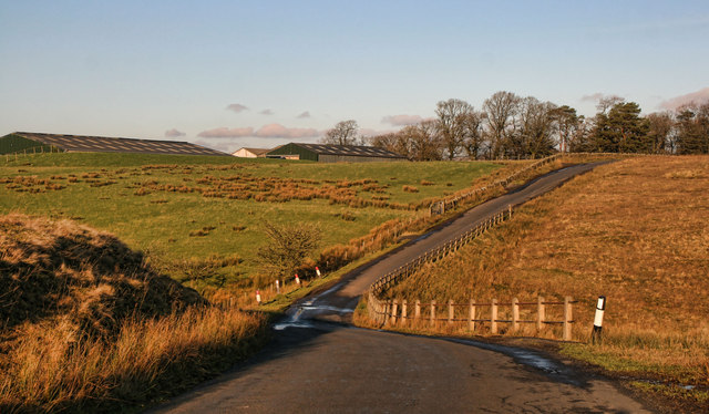
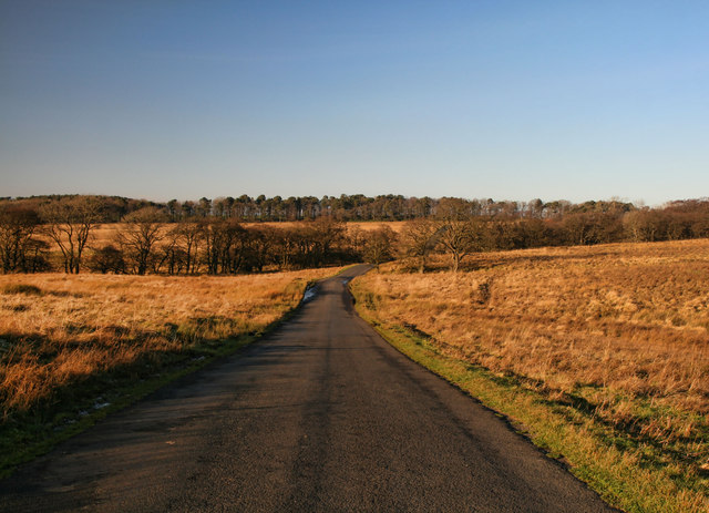
Low Park is a picturesque rural area nestled in the heart of Cumberland, located in the Downs and Moorland region of England. Spanning over acres of rolling hills and lush green fields, this idyllic countryside exudes tranquility and natural beauty.

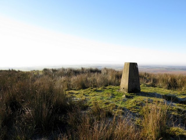
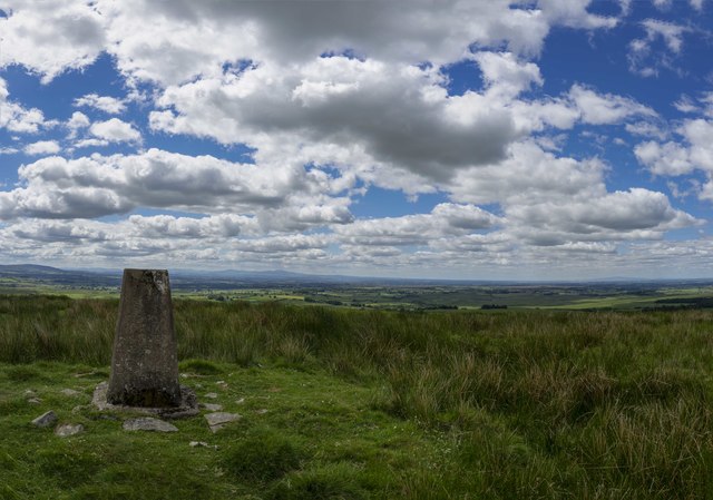
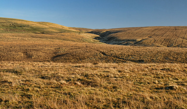
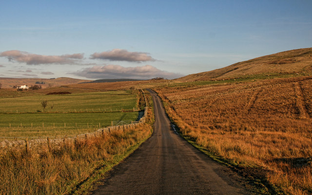
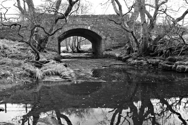
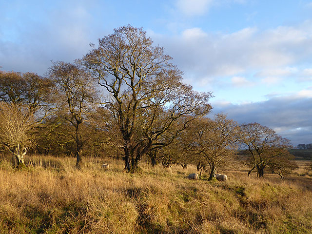
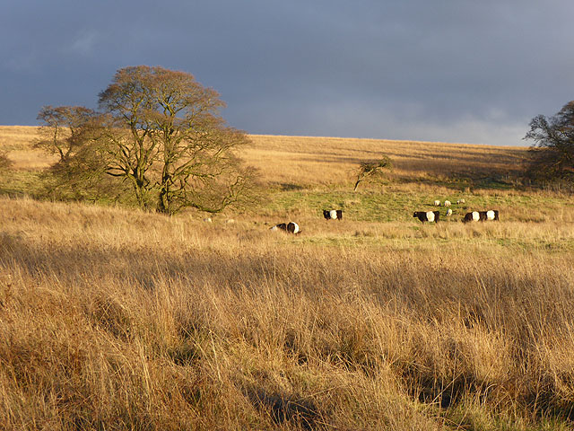
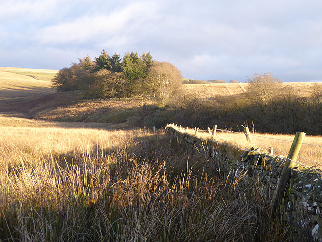
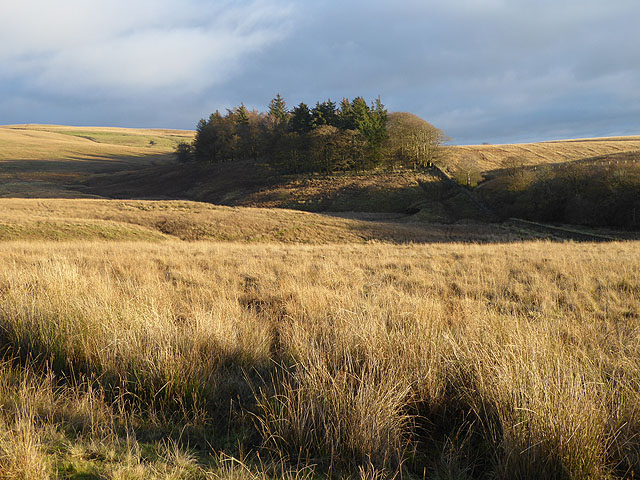
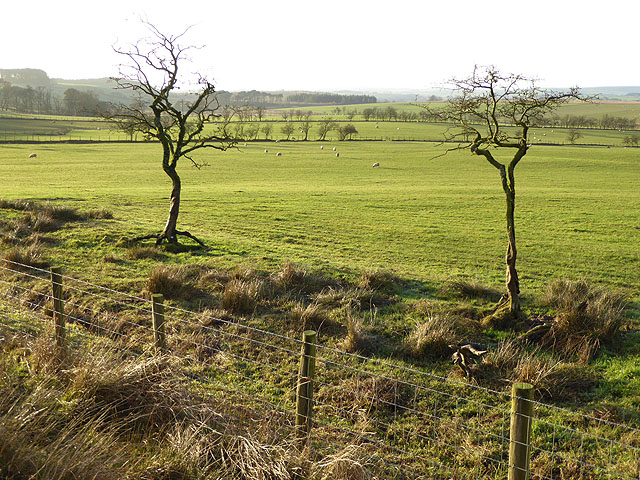
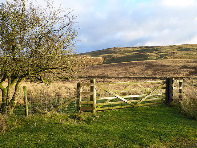
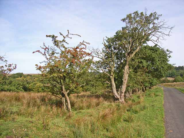
Characterized by its unspoiled landscapes, Low Park offers a diverse range of natural features. The Downs are marked by gentle slopes and expansive meadows, providing ample space for grazing livestock and agricultural activities. Moorland, on the other hand, boasts vast stretches of heather-covered hills and peat bogs, creating a unique and distinctive ecosystem.

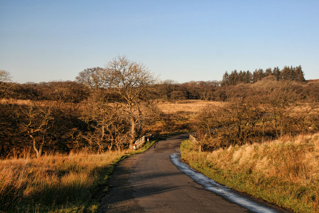
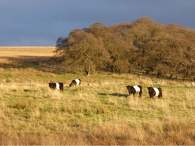
The area is home to a variety of wildlife, including indigenous species such as red deer, wild ponies, and rare bird species. Nature enthusiasts can explore the area's numerous walking trails and enjoy the breathtaking vistas that unfold at every turn.

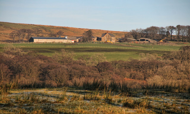
Historically, Low Park has been a hub of farming activity, with traditional farming practices still prominent today. The fertile soil and favorable climate make it an ideal location for agricultural pursuits, and the area is renowned for its high-quality produce, including dairy products and locally grown fruits and vegetables.

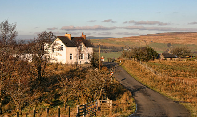
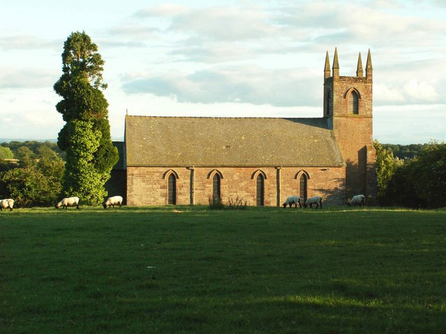
Low Park is also dotted with charming villages, each with its own distinct character. These close-knit communities offer a warm welcome to visitors, boasting traditional stone cottages, quaint shops, and cozy pubs where one can experience the local culture and hospitality.

Overall, Low Park, Cumberland, is a haven for nature lovers and those seeking an authentic rural experience. With its stunning landscapes, rich wildlife, and vibrant farming heritage, this area provides a perfect escape from the hustle and bustle of modern life.

If you have any feedback on the listing, please let us know in the comments section below.

Low Park Images

Images are sourced within 2km of 55.036051/-2.6991757 or Grid Reference NY5571. Thanks to Geograph Open Source API. All images are credited.

The Beacon A list of beacons in Cumberland in the fifteenth century includes "Spadeadam Top, now known as Gillalees Beacon". Irregular traces of foundations were described in 1854 but nothing can be seen today. The OS triangulation pillar is set on top of a turf-covered earth and stone mound about 7.0m diameter and 0.6m maximum height and the medieval remains of the beacon may lie below.
Pastscape Monument No. 12969: <span class="nowrap"><a title="http://www.pastscape.org.uk/hob.aspx?hob_id=12969" rel="nofollow ugc noopener" href="http://www.pastscape.org.uk/hob.aspx?hob_id=12969">Link</a><img style="margin-left:2px;" alt="External link" title="External link - shift click to open in new window" src="https://s1.geograph.org.uk/img/external.png" width="10" height="10"/></span> <span class="nowrap"><a title="https://web.archive.org/web/20170221114929/http://www.pastscape.org.uk/hob.aspx?hob_id=12969" rel="nofollow ugc noopener" href="https://web.archive.org/web/20170221114929/http://www.pastscape.org.uk/hob.aspx?hob_id=12969">Archive Link</a><img style="margin-left:2px;" alt="External link" title="External link - shift click to open in new window" src="https://s1.geograph.org.uk/img/external.png" width="10" height="10"/></span>
The Beacon
A list of beacons in Cumberland in the fifteenth century includes "Spadeadam Top, now known as Gillalees Beacon". Irregular traces of foundations were described in 1854 but nothing can be seen today. The OS triangulation pillar is set on top of a turf-covered earth and stone mound about 7.0m diameter and 0.6m maximum height and the medieval remains of the beacon may lie below. Pastscape Monument No. 12969: LinkExternal link Archive LinkExternal link
The Beacon Trig Point
The Beacon
Trig Point
Gillalees Gillallees Farm seen from near Parkgate Cottages.
Gillalees
Gillallees Farm seen from near Parkgate Cottages.
Parkgate Bridge Parkgate Bridge crossing Cam Beck.
Parkgate Bridge
Parkgate Bridge crossing Cam Beck.
Wintershields Wintershields Farm.
Wintershields
Wintershields Farm.
Low Park Bradford Beck at Low Park.
Low Park
Bradford Beck at Low Park.
Tower Brae Road alongside Tower Brae.
Tower Brae
Road alongside Tower Brae.
Luke's House Luke's House near Bewcastle.
Luke's House
Luke's House near Bewcastle.
High Park Road crossing Melefarm Beck at High Park.
High Park
Road crossing Melefarm Beck at High Park.
Parkgate Bridge The Cam Beck gently flows under parkgate bridge at Askerton park
Parkgate Bridge
The Cam Beck gently flows under parkgate bridge at Askerton park
Sheep on the edge of Mollen Wood In evening light.
Sheep on the edge of Mollen Wood
In evening light.
Belted Galloways at High Park Seen in evening light, Belted Galloways are a heritage beef breed of cattle, well suited to poor upland pasture.
Belted Galloways at High Park
Seen in evening light, Belted Galloways are a heritage beef breed of cattle, well suited to poor upland pasture.
Belted Galloways at High Park Seen in evening light, Belted Galloways are a heritage beef breed of cattle, well suited to poor upland pasture.
Belted Galloways at High Park
Seen in evening light, Belted Galloways are a heritage beef breed of cattle, well suited to poor upland pasture.
High Park Grass moor and a small copse seen in evening light.
High Park
Grass moor and a small copse seen in evening light.
High Park Grass moor and a small copse seen in evening light.
High Park
Grass moor and a small copse seen in evening light.
Fields below Tower Brae
Gate onto the moors at Tower Brae Opposite Luke's House. Seen in evening light.
Gate onto the moors at Tower Brae
Opposite Luke's House. Seen in evening light.
Roadside trees On the road between Askerton Castle and Bewcastle
Roadside trees
On the road between Askerton Castle and Bewcastle
Show me another place!

Low Park is located at Grid Ref: NY5571 (Lat: 55.036051, Lng: -2.6991757)

Administrative County: Cumbria

District: Carlisle

Police Authority: Cumbria

What 3 Words

///cobbled.insect.remotest. Near Brampton, Cumbria

Related Wikis

Askerton

Askerton is a civil parish in the City of Carlisle district of Cumbria, England. It has a population of 162 according to the 2001 census, decreasing to...

Askerton Castle

Askerton Castle is a medieval fortified manor house in Cumbria, England. == History == Askerton Castle was built in the parish of Askerton in Cumbria around...

Kingwater

Kingwater is a civil parish in City of Carlisle district, Cumbria, England. At the 2011 census it had a population of 170.The parish is bordered to the...

Bewcastle

Bewcastle is a large civil parish in the Cumberland unitary authority area of Cumbria, England. It is in the historic county of Cumberland. According to...

Bewcastle Roman Fort

Bewcastle Roman Fort was built to the north of Hadrian's Wall as an outpost fort possibly intended for scouting and intelligence. The remains of the fort...
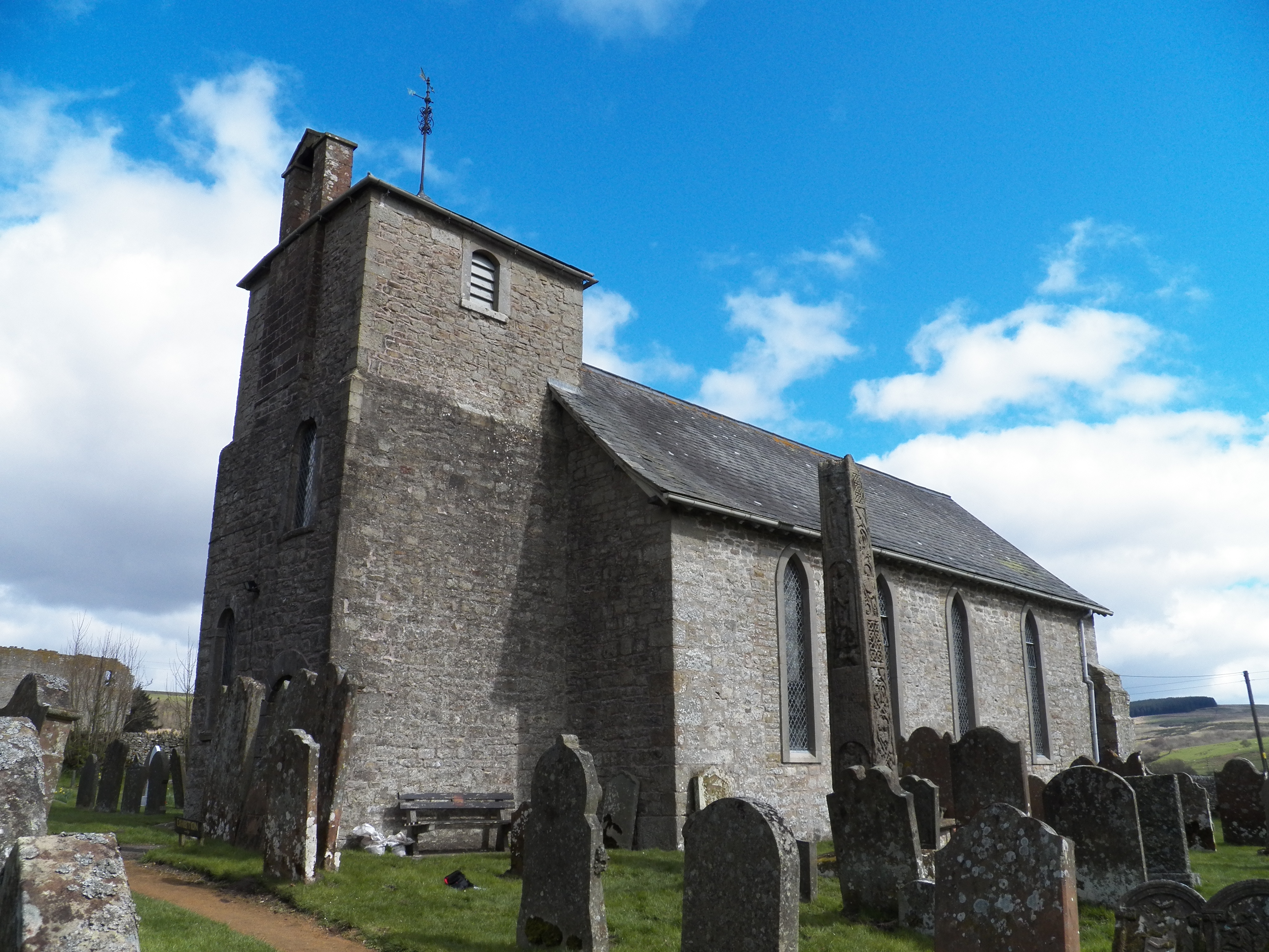
Bewcastle Cross

The Bewcastle Cross is an Anglo-Saxon cross which is still in its original position within the churchyard of St Cuthbert's church at Bewcastle, in the...

Bewcastle Castle

Bewcastle Castle is a ruined castle in the parish of Bewcastle in the English county of Cumbria, a few miles from the Scottish border. == History == The...

Stapleton, Cumbria

Stapleton is a village and civil parish in the City of Carlisle district, in the county of Cumbria, in the North West of England. It falls under the jurisdiction...

Nearby Amenities

Located within 500m of 55.036051,-2.6991757
Barrier: cattle_grid
Source: survey
Lat/Long: 55.0400023/-2.6966127
The data included in this document is from www.openstreetmap.org. The data is made available under ODbL.

Have you been to Low Park?

Leave your review of Low Park below (or comments, questions and feedback).