Hameringham

Settlement in Lincolnshire East Lindsey

England

Hameringham

Field of oilseed rape, Scrafield
Field of oilseed rape, Scrafield Credit: Jonathan Thacker

Hameringham is a quaint village located in the East Lindsey district of Lincolnshire, England. Situated approximately 6 miles east of the market town of Horncastle, it is nestled amidst the picturesque Lincolnshire Wolds, an Area of Outstanding Natural Beauty.

This rural village is home to a close-knit community of around 300 residents, who enjoy the tranquility and charm of their surroundings. Hameringham boasts a rich history, with evidence of occupation dating back to Roman times. The village is named after the Old English words "hamer" and "ingham," which mean "homestead of the hammer" – a nod to its historical blacksmithing heritage.

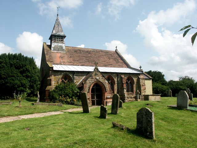
The heart of the village is its Grade II listed church, St. Andrew's, which dates back to the 13th century. This beautiful place of worship features stunning stained glass windows and a striking spire, making it a focal point for both locals and visitors. The village also has a small primary school, providing education for the younger residents.

Surrounded by rolling hills and lush farmland, Hameringham offers plenty of opportunities for outdoor enthusiasts. The area is renowned for its scenic walking and cycling routes, allowing visitors to explore the idyllic countryside and take in breathtaking views of the Wolds. Additionally, the nearby River Bain is a popular spot for fishing enthusiasts.

While Hameringham is primarily a residential village, its close proximity to Horncastle provides access to a wider range of amenities, including shops, supermarkets, and leisure facilities. The village is well-connected to other parts of Lincolnshire via road networks, making it an ideal base for those seeking a peaceful rural retreat.

If you have any feedback on the listing, please let us know in the comments section below.
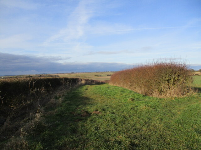
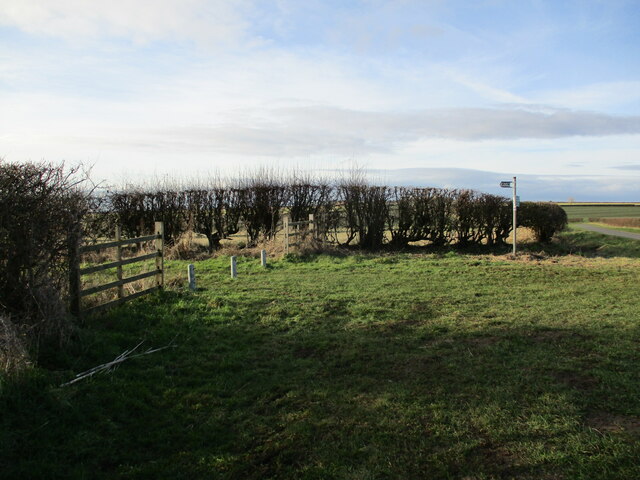
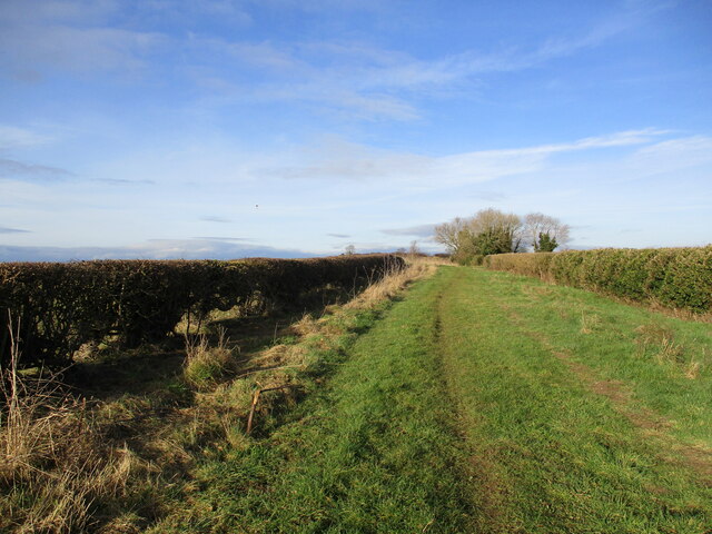
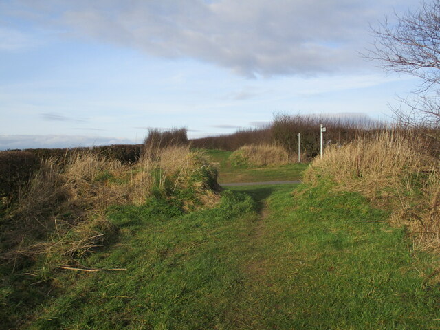
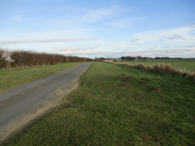
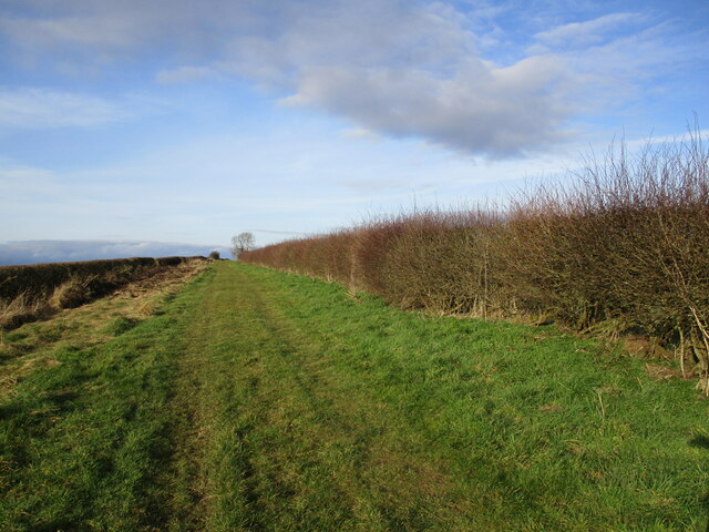
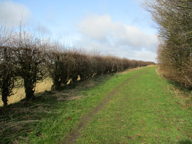
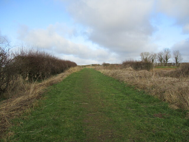
Hameringham Images

Images are sourced within 2km of 53.186277/-0.041651 or Grid Reference TF3067. Thanks to Geograph Open Source API. All images are credited.

Field of oilseed rape, Scrafield
Merebalk Lane A bridleway. This appears as Merebank Lane on some OS maps (though Merebalk on others). This is almost certainly incorrect. There is no evidence of a bank here. A balk in Lincolnshire dialect is a path between fields, which this is.
Merebalk Lane
A bridleway. This appears as Merebank Lane on some OS maps (though Merebalk on others). This is almost certainly incorrect. There is no evidence of a bank here. A balk in Lincolnshire dialect is a path between fields, which this is.
Ploughed field near Glebe Farm
The end of Holme Wood Lane
Little Merebalk Lane A bridleway.
Little Merebalk Lane
A bridleway.
Crossing the lane between Mareham on the Hill and Hameringham Taken from Little Merebalk Lane looking to Merebalk Lane on the other side of the road.
Merebalk Lane appears as Merebank Lane on some OS maps (though Merebalk on others). This is almost certainly incorrect. There is no evidence of a bank here. A balk in Lincolnshire dialect is a path between fields, which this is.
Crossing the lane between Mareham on the Hill and Hameringham
Taken from Little Merebalk Lane looking to Merebalk Lane on the other side of the road. Merebalk Lane appears as Merebank Lane on some OS maps (though Merebalk on others). This is almost certainly incorrect. There is no evidence of a bank here. A balk in Lincolnshire dialect is a path between fields, which this is.
Lane to Hameringham
Lane to Hameringham
Merebalk Lane This appears as Merebank Lane on some OS maps (though Merebalk on others). This is almost certainly incorrect. There is no evidence of a bank here. A balk in Lincolnshire dialect is a path between fields, which this is.
Merebalk Lane
This appears as Merebank Lane on some OS maps (though Merebalk on others). This is almost certainly incorrect. There is no evidence of a bank here. A balk in Lincolnshire dialect is a path between fields, which this is.
Autumn sown crop Mareham on the Hill in the distance.
Autumn sown crop
Mareham on the Hill in the distance.
Merebalk Lane approaching Scrafield Lane This appears as Merebank Lane on some OS maps (though Merebalk on others). This is almost certainly incorrect. There is no evidence of a bank here. A balk in Lincolnshire dialect is a path between fields, which this is.
Merebalk Lane approaching Scrafield Lane
This appears as Merebank Lane on some OS maps (though Merebalk on others). This is almost certainly incorrect. There is no evidence of a bank here. A balk in Lincolnshire dialect is a path between fields, which this is.
The north end of Merebalk Lane The sign prohibiting motor vehicles is facing the wrong way.
This appears as Merebank Lane on some OS maps (though Merebalk on others). This is almost certainly incorrect. There is no evidence of a bank here. A balk in Lincolnshire dialect is a path between fields, which this is.
The north end of Merebalk Lane
The sign prohibiting motor vehicles is facing the wrong way. This appears as Merebank Lane on some OS maps (though Merebalk on others). This is almost certainly incorrect. There is no evidence of a bank here. A balk in Lincolnshire dialect is a path between fields, which this is.
Soilmarks on a field at Scrafield: aerial 2022
Holme Wood Lane A bridleway.
Holme Wood Lane
A bridleway.
Holme Wood Lane A bridleway.
Holme Wood Lane
A bridleway.
Winceby sunset Dramatic Lincolnshire sunset from Winceby top
Winceby sunset
Dramatic Lincolnshire sunset from Winceby top
Asgarby: aerial 2017
B1195 towards Winceby
Wind pattern on a field SW of Asgarby: aerial 2018
Show me another place!

Hameringham is located at Grid Ref: TF3067 (Lat: 53.186277, Lng: -0.041651)

Division: Parts of Lindsey

Administrative County: Lincolnshire

District: East Lindsey

Police Authority: Lincolnshire

What 3 Words

///otter.ever.alike. Near Horncastle, Lincolnshire

Nearby Locations

Hameringham

Related Wikis

Hameringham

Hameringham is an extended village in the East Lindsey district of Lincolnshire, England. It is situated 4 miles (6.4 km) south-east from the town of Horncastle...

Winceby

Winceby is a village in the civil parish of Lusby with Winceby, in the East Lindsey district of Lincolnshire, England. It is in the Lincolnshire Wolds...

Scrafield

Scrafield is a hamlet and a deserted medieval village (DMV) in the civil parish of Mareham on the Hill, in the East Lindsey district, in the county of...
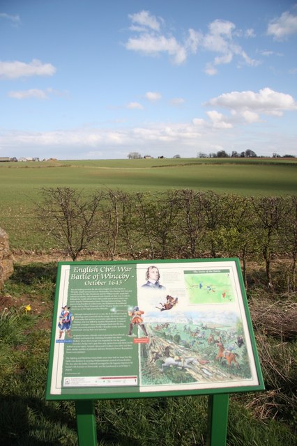
Battle of Winceby

The Battle of Winceby took place on 11 October 1643 during the First English Civil War near the village of Winceby, Lincolnshire. In the battle, a Royalist...

Nearby Amenities

Located within 500m of 53.186277,-0.041651
Hameringham
Is In: Lincolnshire, England, UK
Place: hamlet
Source: Bing
Lat/Long: 53.1856798/-0.0404391
Bus Stop
All Saint's Church
Naptan AtcoCode: 270000009084
Naptan Bearing: W
Naptan CommonName: All Saint's Church
Naptan Indicator: W - bound
Naptan Landmark: All Saint's Church
Naptan NaptanCode: lingwtda
Naptan Street: Hameringham
Naptan Verified: no
Source: naptan_import
Lat/Long: 53.1862341/-0.0417605
Bus Stop
All Saint's Church
Naptan AtcoCode: 270000009776
Naptan Bearing: E
Naptan CommonName: All Saint's Church
Naptan Indicator: E - bound
Naptan Landmark: All Saint's Church
Naptan NaptanCode: linjdwdw
Naptan Street: Hameringham
Naptan Verified: no
Source: naptan_import
Lat/Long: 53.1863497/-0.0416805
Bus Stop
Baytree Farm
Naptan AtcoCode: 270000009777
Naptan Bearing: W
Naptan CommonName: Baytree Farm
Naptan Indicator: W - bound
Naptan Landmark: Baytree Farm
Naptan NaptanCode: linjdwga
Naptan Street: Hameringham
Naptan Verified: no
Source: naptan_import
Lat/Long: 53.1852774/-0.0393495
Bus Stop
Baytree Farm
Naptan AtcoCode: 2700LH001584
Naptan Bearing: E
Naptan CommonName: Baytree Farm
Naptan Indicator: E - bound
Naptan Landmark: Baytree Farm
Naptan NaptanCode: linamdgt
Naptan Street: Hameringham
Naptan Verified: no
Source: naptan_import
Lat/Long: 53.1853483/-0.0392864
Power: pole
Source: Bing
Lat/Long: 53.1870135/-0.0483682
Power: pole
Source: Bing
Lat/Long: 53.1867882/-0.0473423
Power: pole
Source: Bing
Lat/Long: 53.1834845/-0.0460934
Power: pole
Source: Bing
Lat/Long: 53.1884042/-0.0414912
Power: pole
Source: Bing
Lat/Long: 53.1868396/-0.0430183
Power: pole
Source: Bing
Lat/Long: 53.1876472/-0.0422422
Power: pole
Source: Bing
Lat/Long: 53.1860127/-0.0437881
Power: pole
Source: Bing
Lat/Long: 53.185173/-0.0445556
Power: pole
Source: Bing
Lat/Long: 53.1826599/-0.0436553
Power: pole
Lat/Long: 53.186204/-0.0446736
Power: pole
Source: Bing
Lat/Long: 53.1843059/-0.0453294
Power: pole
Source: Bing
Lat/Long: 53.183073/-0.0448583
Power: pole
Lat/Long: 53.1865407/-0.0462078
Power: pole
Source: Bing
Lat/Long: 53.1864893/-0.0417929
The Beeches
Place: farm
Source: Bing
Lat/Long: 53.182168/-0.0426432
Power: pole
Source: Bing
Lat/Long: 53.1900957/-0.0398268
Power: pole
Source: Bing
Lat/Long: 53.189252/-0.0406569
Power: pole
Source: Bing
Lat/Long: 53.1890914/-0.0384844
Power: pole
Source: Bing
Lat/Long: 53.1891692/-0.0395988
Hall Farm
Place: farm
Source: Bing
Lat/Long: 53.1868243/-0.0445663
Baytree Farm
Place: farm
Source: Bing
Lat/Long: 53.18577/-0.0401232
Old Farmhouse/Old Ash
Fixme: name of building (but which one?)
Lat/Long: 53.1890149/-0.0376503
Old Farm
Place: farm
Source: Bing
Lat/Long: 53.1889472/-0.0378103
The data included in this document is from www.openstreetmap.org. The data is made available under ODbL.

Have you been to Hameringham?

Leave your review of Hameringham below (or comments, questions and feedback).