Hearty Moor

Downs, Moorland in Somerset Mendip

England

Hearty Moor

Stone Down Lane NCN3 Photograph of Stone Down Lane NCN3, taken looking uphill a little way past the turning off from Wick Lane.
The surface of this section of Stone Down Lane is gravel, with potholes and uneven areas, and will be muddy and potholed in wet weather.
The gradient is steep with 10% sections.
The lane becomes a metalled lane shortly before the junction with Basketfield Lane.
Stone Down Lane NCN3 Credit: Kevin Pearson

Hearty Moor is a picturesque and expansive area located in Somerset, England. Spanning across the rolling hills and valleys of the region, it encompasses both downs and moorland landscapes, offering a diverse and captivating scenery.

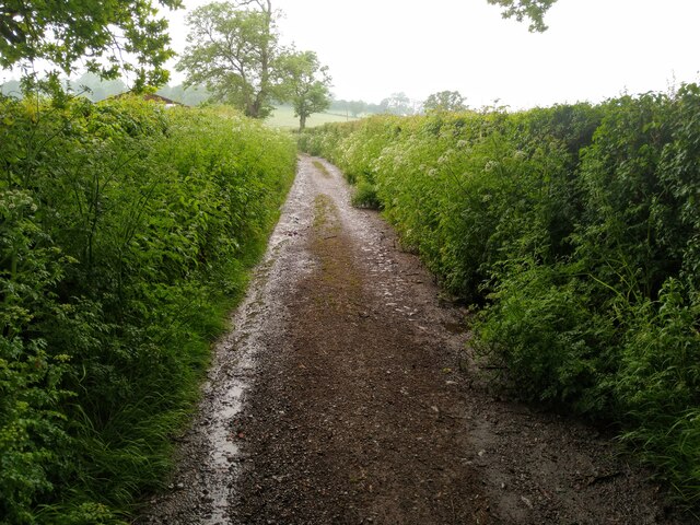
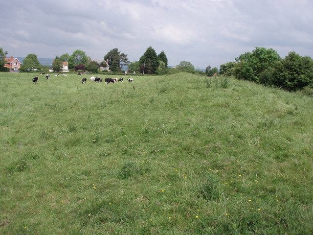
The downs of Hearty Moor are characterized by their gently sloping hills and lush green meadows. Dotted with grazing sheep and wildflowers, these downs provide a serene and idyllic setting for visitors to enjoy. The meandering paths that traverse through the downs offer ideal opportunities for leisurely walks and hikes, allowing visitors to immerse themselves in the beauty of the natural surroundings.

In contrast to the downs, the moorland of Hearty Moor boasts a more rugged and wild terrain. Characterized by its heather-covered hills and rocky outcrops, the moorland offers a sense of untamed wilderness. Its sprawling expanse is a haven for various species of birds and other wildlife, making it a popular spot for nature enthusiasts and birdwatchers.

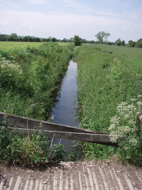
Hearty Moor also features several small streams and brooks that wind their way through the landscape, adding to its charm and providing a source of tranquility. These water bodies create picturesque scenes and offer opportunities for fishing or simply relaxing by the water's edge.

The overall beauty and tranquility of Hearty Moor make it a favored destination for locals and tourists alike. Whether it is for a leisurely stroll, a picnic amidst nature, or a more adventurous hike, Hearty Moor has something to offer for everyone seeking solace and connection with the natural world.

If you have any feedback on the listing, please let us know in the comments section below.
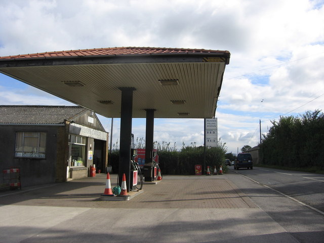
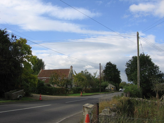
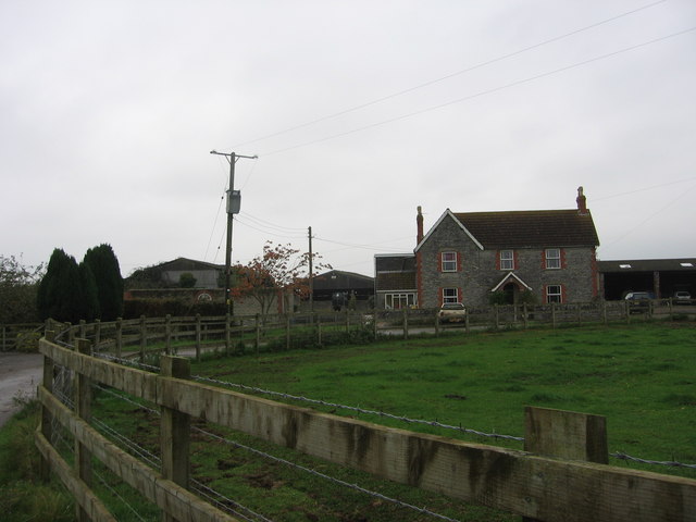
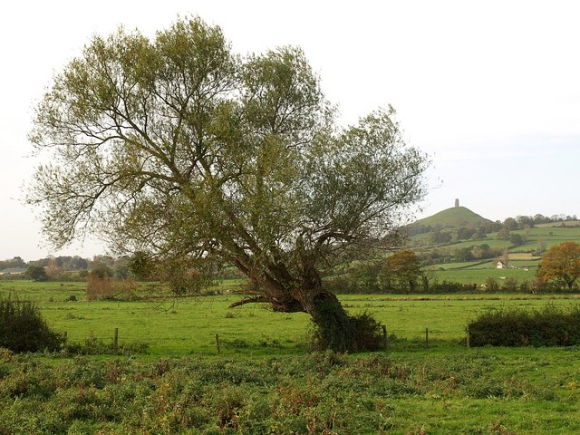
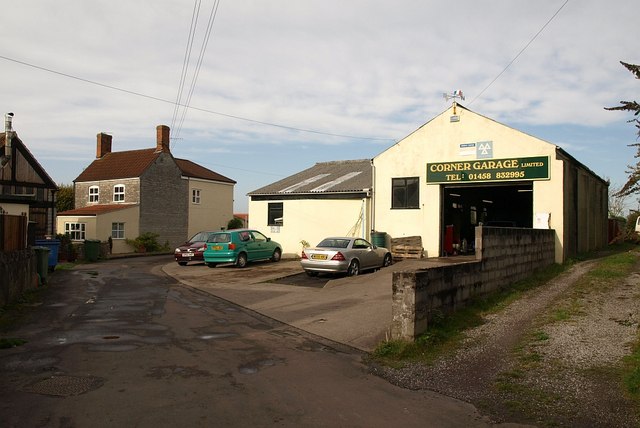
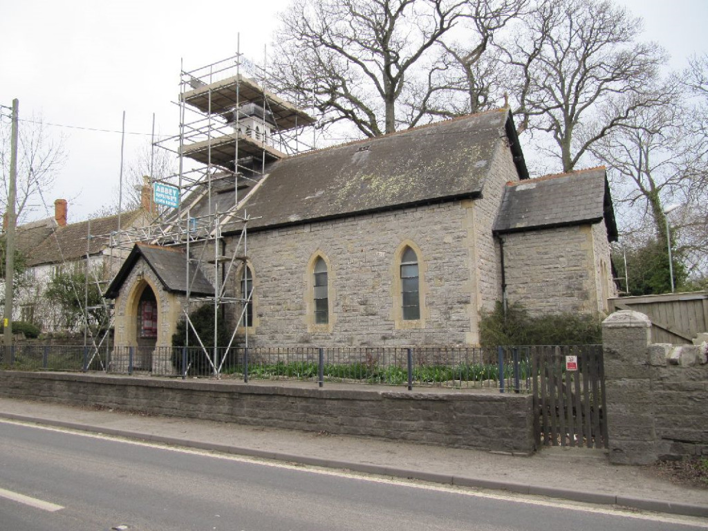
Hearty Moor Images

Images are sourced within 2km of 51.155903/-2.6602974 or Grid Reference ST5339. Thanks to Geograph Open Source API. All images are credited.

Stone Down Lane NCN3 Photograph of Stone Down Lane NCN3, taken looking uphill a little way past the turning off from Wick Lane.
The surface of this section of Stone Down Lane is gravel, with potholes and uneven areas, and will be muddy and potholed in wet weather.
The gradient is steep with 10% sections.
The lane becomes a metalled lane shortly before the junction with Basketfield Lane.
Stone Down Lane NCN3
Photograph of Stone Down Lane NCN3, taken looking uphill a little way past the turning off from Wick Lane. The surface of this section of Stone Down Lane is gravel, with potholes and uneven areas, and will be muddy and potholed in wet weather. The gradient is steep with 10% sections. The lane becomes a metalled lane shortly before the junction with Basketfield Lane.
A patch of ancient Avalon There are two ancient oak trees set amongst the fields around Glastonbury Tor. They are Gog and Magog, two trees that are amongst the oldest remaining in the county.
A patch of ancient Avalon
There are two ancient oak trees set amongst the fields around Glastonbury Tor. They are Gog and Magog, two trees that are amongst the oldest remaining in the county.
Ancient avenue of Avalon These two old oaks are Gog and Magog, surviving examples of the mystic lands of Avalon. That is, they had survived up until very recently in their lives whilst the low-lying land has become taken up with agriculture. Following the custom of leaving a votive offering which had included lit candles and sticks, the nearest tree caught fire and was killed. To protect them a substantial fence has been erected, all perhaps too late though.
Ancient avenue of Avalon
These two old oaks are Gog and Magog, surviving examples of the mystic lands of Avalon. That is, they had survived up until very recently in their lives whilst the low-lying land has become taken up with agriculture. Following the custom of leaving a votive offering which had included lit candles and sticks, the nearest tree caught fire and was killed. To protect them a substantial fence has been erected, all perhaps too late though.
A departed guardian This is Gog, one of two ancient oak trees that have remained after all that has happened. Along with Magog, they were part of what appears to have been an avenue of trees that are at least a thousand years old.

However, most of that line of trees was felled when the land was taken over for farming in 1906. It is believed that soil compaction brought about Gog's death in 2001. Then, with culture around Glastonbury returning to the more druidical, people often left trinkets and votive items here; a lit candle is thought to have caused a fire in 2017, causing the loss of limbs.

Although dead, the old oak still proivdes some shelter for various forms of life as well as being a beautiful sight for travellers.
A departed guardian
This is Gog, one of two ancient oak trees that have remained after all that has happened. Along with Magog, they were part of what appears to have been an avenue of trees that are at least a thousand years old. However, most of that line of trees was felled when the land was taken over for farming in 1906. It is believed that soil compaction brought about Gog's death in 2001. Then, with culture around Glastonbury returning to the more druidical, people often left trinkets and votive items here; a lit candle is thought to have caused a fire in 2017, causing the loss of limbs. Although dead, the old oak still proivdes some shelter for various forms of life as well as being a beautiful sight for travellers.
Wrinkled but living This is Magog, one of a pair of remaining oak trees from the times when Avalon was in full flourish. Thought to be part of a revered avenue of oaks, Magog is the last to live. Its only partner, Gog is sadly dead now - as of about 2001 - but Magog still produces leaves every year. And like its partner, the tree suffered from fire in 2009 when some worshipper left a lit candle; fortunately it did not succumb but has the scars to show for it.
Wrinkled but living
This is Magog, one of a pair of remaining oak trees from the times when Avalon was in full flourish. Thought to be part of a revered avenue of oaks, Magog is the last to live. Its only partner, Gog is sadly dead now - as of about 2001 - but Magog still produces leaves every year. And like its partner, the tree suffered from fire in 2009 when some worshipper left a lit candle; fortunately it did not succumb but has the scars to show for it.
History in every branch Magog is the last survivor of an ancient avenue of oaks whose histories may reach back two thousand years. It is said that the ceremonial avenue was the entry point to the Isle of Avalon and a route to the Tor. However, the lands were converted into a farm in 1906 and most of the trees were felled; one sentinel was measured at 3.5m (11ft) in diameter.
History in every branch
Magog is the last survivor of an ancient avenue of oaks whose histories may reach back two thousand years. It is said that the ceremonial avenue was the entry point to the Isle of Avalon and a route to the Tor. However, the lands were converted into a farm in 1906 and most of the trees were felled; one sentinel was measured at 3.5m (11ft) in diameter.
Norwood Farm
Norwood Farm
Overgrown footpath near Wick The footpaths in this area seemed poorly maintained and little walked. We were surprised to get so close to a deer.
Overgrown footpath near Wick
The footpaths in this area seemed poorly maintained and little walked. We were surprised to get so close to a deer.
across Ponter's Ball to Glastonbury Tor This shows the north end of Ponter's Ball earthwork, the overgrown footpath and Norwood Park on the RHS.
across Ponter's Ball to Glastonbury Tor
This shows the north end of Ponter's Ball earthwork, the overgrown footpath and Norwood Park on the RHS.
Twelve Foot Rhyne This drainage ditch is typical of the levels of Somerset.
Twelve Foot Rhyne
This drainage ditch is typical of the levels of Somerset.
across fields to Glastonbury Tor East Street in the foreground.
across fields to Glastonbury Tor
East Street in the foreground.
Piltown Filling Station An independent filling station with a pantiled canopy.  There is some history here: <span class="nowrap"><a title="http://www.patrick-graham.co.uk/piltown-filling-station/" rel="nofollow ugc noopener" href="http://www.patrick-graham.co.uk/piltown-filling-station/">Link</a><img style="margin-left:2px;" alt="External link" title="External link - shift click to open in new window" src="https://s1.geograph.org.uk/img/external.png" width="10" height="10"/></span>
Piltown Filling Station
An independent filling station with a pantiled canopy. There is some history here: LinkExternal link
The A361 and part of Manor Farm, Piltown How much is Piltown confused with Pilton, a short distance down the road?
The A361 and part of Manor Farm, Piltown
How much is Piltown confused with Pilton, a short distance down the road?
Middle East Street Farm This farm has diversified into B & B.
Middle East Street Farm
This farm has diversified into B & B.
Stone Down Lane The lane approaches Norwood Park Farm, where it meets Wick Lane.
Stone Down Lane
The lane approaches Norwood Park Farm, where it meets Wick Lane.
Willow near East Street Seen from footpath WS 14/58. In the distance is Glastonbury Tor.
Willow near East Street
Seen from footpath WS 14/58. In the distance is Glastonbury Tor.
Garage, West Pennard The Corner Garage is just a few metres away from the A361 up Laurel Street.
Garage, West Pennard
The Corner Garage is just a few metres away from the A361 up Laurel Street.
The Lion, West Pennard The pub is on the busy A361.
The Lion, West Pennard
The pub is on the busy A361.
Show me another place!

Hearty Moor is located at Grid Ref: ST5339 (Lat: 51.155903, Lng: -2.6602974)

Administrative County: Somerset

District: Mendip

Police Authority: Avon and Somerset

What 3 Words

///hides.store.genius. Near Glastonbury, Somerset

Nearby Locations

Hearty Moor

Related Wikis

West Pennard

West Pennard (or West Pennard Manor) is a village and civil parish east of Glastonbury, situated at the foot of Pennard Hill, in Somerset, England. The...

Oaks of Avalon

The Oaks of Avalon is the collective name given to a pair of ancient oak trees, Gog and Magog, that stand in Glastonbury in Somerset, South West England...

Ponter's Ball Dyke

Ponter's Ball Dyke is a linear earthwork located near Glastonbury in Somerset, England. It crosses, at right angles, an ancient road that continues on...

St Andrew's Church, Edgarley

St Andrew's Church is a former Church of England mission church in Edgarley, Somerset, England. It was built in 1897 and is now used as a private chapel...

West Pennard railway station

West Pennard railway station was a station on the Highbridge branch of the Somerset and Dorset Joint Railway. Opened on 3 February 1862, it was reduced...

West Pennard Court Barn

West Pennard Court Barn (which is also known as the Court Barn, West Bradley) is a late 14th or early 15th century tithe barn which was built for Glastonbury...
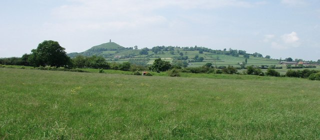
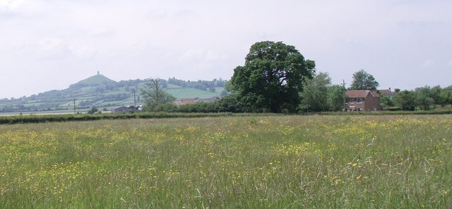
Glastonbury Tor

Glastonbury Tor is a tor near Glastonbury in the English county of Somerset, topped by the roofless St Michael's Tower, a Grade I listed building. The...

Church of St Peter, North Wootton

The Anglican Church of St Peter in North Wootton, Somerset, England was built in the 14th or 15th century. It is a Grade II* listed building. == History... ==

Have you been to Hearty Moor?

Leave your review of Hearty Moor below (or comments, questions and feedback).