Askham Fell

Downs, Moorland in Westmorland Eden

England

Askham Fell

Cattle, Riddingleys Top
Cattle, Riddingleys Top Credit: Ian Taylor

Askham Fell is a picturesque area located in Westmorland, a historic county in the northwest of England. This region is known for its stunning natural beauty, encompassing rolling downs, expansive moorland, and charming villages.

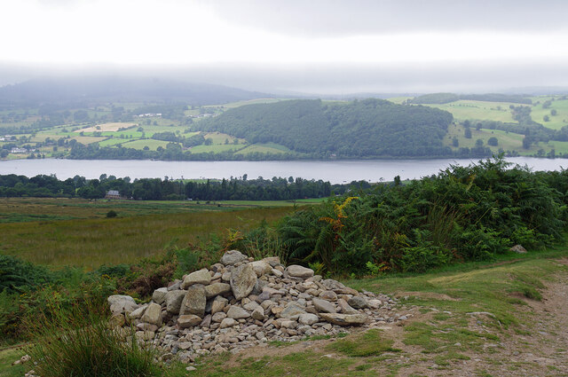
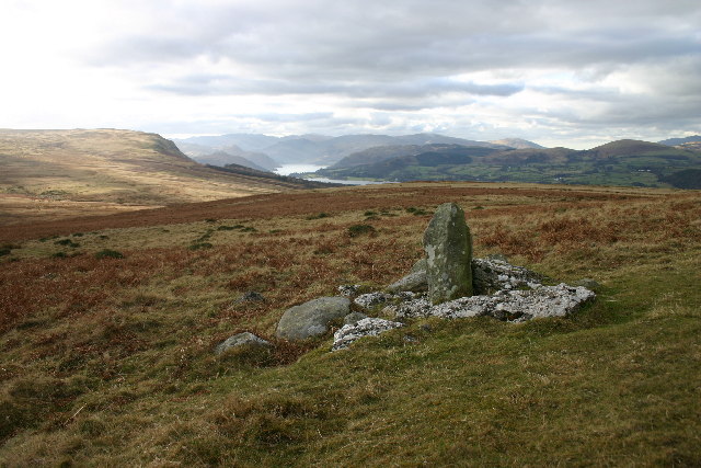
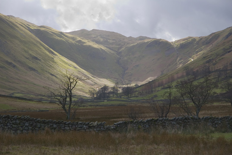
The fell is situated within the Lake District National Park, a UNESCO World Heritage Site renowned for its pristine landscapes and diverse wildlife. Askham Fell offers visitors a unique opportunity to experience the tranquility and grandeur of this protected area.

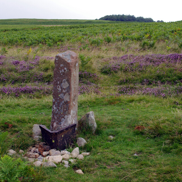
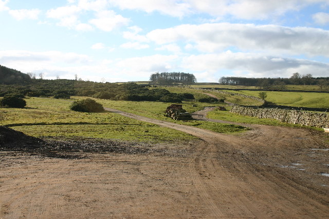
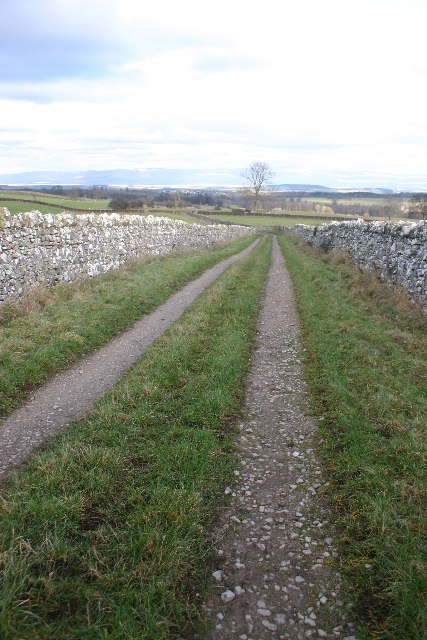
The fell is characterized by its undulating terrain, with gently sloping hills and wide open spaces. The landscape is dominated by heather-covered moorland, providing a vibrant burst of purple hues during the summer months. Visitors can enjoy leisurely walks or hikes along the numerous trails that crisscross the area, offering breathtaking views of the surrounding countryside.

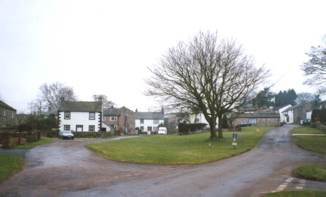
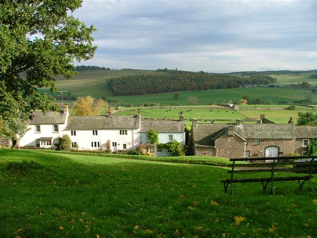
The village of Askham, located at the foot of the fell, is a charming and traditional Cumbrian village. It boasts a rich history, with many of its buildings dating back to the 17th and 18th centuries. Visitors can explore its narrow lanes, visit the local pub, or admire the picturesque St. Peter's Church.

Wildlife enthusiasts will also appreciate the diverse array of flora and fauna found on Askham Fell. The moorland provides a habitat for a variety of bird species, including curlews, red grouse, and skylarks. Additionally, the fell is home to a number of mammals, such as red deer and stoats, which can occasionally be spotted by lucky observers.

Overall, Askham Fell offers a serene and idyllic setting for those seeking to immerse themselves in the natural beauty of Westmorland.

If you have any feedback on the listing, please let us know in the comments section below.

Askham Fell Images

Images are sourced within 2km of 54.596733/-2.7850501 or Grid Reference NY4922. Thanks to Geograph Open Source API. All images are credited.

Cattle, Riddingleys Top
Finger post, Riddingleys Top
Fell ponies, Riddingleys Top
Boundary stone, Ketley Gate See <a href="https://www.geograph.org.uk/photo/6462500">NY4822 : Old Boundary Marker</a> for more information.
Boundary stone, Ketley Gate
See NY4822 : Old Boundary Marker for more information.
Cairn below Heughscar Hill
Cairn circle, Moor Divock
Cop Stone, Moor Divock
Old Boundary Marker on Heughscar Hill Parish Boundary Marker 150 metres south of the top of Heughscar Hill. On the boundary of Barton and Askham parishes. See also <a title="https://www.geograph.org.uk/photo/3191051" href="https://www.geograph.org.uk/photo/3191051">Link</a> and <a title="https://www.geograph.org.uk/photo/5906270" href="https://www.geograph.org.uk/photo/5906270">Link</a>.

Milestone Society National ID: WE_BART06pb
Old Boundary Marker on Heughscar Hill
Parish Boundary Marker 150 metres south of the top of Heughscar Hill. On the boundary of Barton and Askham parishes. See also Link and Link. Milestone Society National ID: WE_BART06pb
Old Boundary Marker at Threepow Raise Parish Boundary Marker at Threepow Raise, 720 metres southwest of Ketley Gate. On the boundary of Barton and Askham parishes. Inscribed L on its east face.

Milestone Society National ID: WE_BART10pb
Old Boundary Marker at Threepow Raise
Parish Boundary Marker at Threepow Raise, 720 metres southwest of Ketley Gate. On the boundary of Barton and Askham parishes. Inscribed L on its east face. Milestone Society National ID: WE_BART10pb
Upper Green, Askham Askham is noted for its large expanse of greens.  They are divided by the road from Penrith to Bampton, and the upper green is smaller and probably less well-known than the lower green, which is by the road leading to the church and Lowther.
Upper Green, Askham
Askham is noted for its large expanse of greens. They are divided by the road from Penrith to Bampton, and the upper green is smaller and probably less well-known than the lower green, which is by the road leading to the church and Lowther.
Heltonhead Looking down the unclassified road to Helton.
Heltonhead
Looking down the unclassified road to Helton.
Helton Village Green
Path Meeting above Askham The bridleway to the right leads onto Askham Fell.
Path Meeting above Askham
The bridleway to the right leads onto Askham Fell.
Mini Reservoir Shown as just a small square on the OS map, this is clearly constructed and has an outflow but none in - being on limestone it is probably a modified rising.
Mini Reservoir
Shown as just a small square on the OS map, this is clearly constructed and has an outflow but none in - being on limestone it is probably a modified rising.
Farmland Between Plantations Grazed by sheep. There are gamebird rearing pens in the woods to the right.
Farmland Between Plantations
Grazed by sheep. There are gamebird rearing pens in the woods to the right.
Mirebank Plantation On the open, wild fells above Askham, this straight-sided plantation looks very out-of-place.
Mirebank Plantation
On the open, wild fells above Askham, this straight-sided plantation looks very out-of-place.
Bridleway Looking over the Eden Valley towards the Pennines and Cross Fell
Bridleway
Looking over the Eden Valley towards the Pennines and Cross Fell
Show me another place!

Askham Fell is located at Grid Ref: NY4922 (Lat: 54.596733, Lng: -2.7850501)

Administrative County: Cumbria

District: Eden

Police Authority: Cumbria

What 3 Words

///gratuity.radiated.creatures. Near Penrith, Cumbria

Nearby Locations

Askham Fell

Related Wikis

Heughscar Hill

Heughscar Hill is a hill in the east of the English Lake District, east of Ullswater and north of High Street, Cumbria. It is the subject of a chapter...

Barton and Pooley Bridge

Barton and Pooley Bridge is a civil parish in Eden District, Cumbria, England. The parish is on the edge of the Lake District National Park, and had a...

Askham, Cumbria

Askham is a village and civil parish in the Eden district of Cumbria, England. It is in the historic county of Westmorland. According to the 2001 census...

Helton, Cumbria

Helton is a village in the Eden district, in the English county of Cumbria. It is about a mile south of the village of Askham. Circa 1870, it had a population...

Boredale Hause

Boredale Hause is a mountain pass between Place Fell and Angletarn Pikes in the east of the English Lake District. It links the Patterdale and Boredale...

Askham Hall

Askham Hall is a country house near Askham in Cumbria. It is a Grade I listed building. == History == A peel tower was built on the site during the 14th...

Ullswater Way

The Ullswater Way is a 20-mile (32 km) waymarked walking route around Ullswater in the English Lake District. It was created by a partnership which included...

Pooley Bridge

Pooley Bridge is a village in the Eden District of the northwestern English county of Cumbria, within the traditional borders of Westmorland. The village...

Nearby Amenities

Located within 500m of 54.596733,-2.7850501
Askham Fell
Place: locality
Lat/Long: 54.5947308/-2.7892184
Sinkholes
Fixme: Or/also barrow?
Natural: sinkhole
Note: Numerous natural sinkholes/Shake holes
Lat/Long: 54.5929167/-2.7880243
Sinkholes
Natural: sinkhole
Note: Numerous natural sinkholes/Shake holes
Lat/Long: 54.5936281/-2.7893972
Hag Stones
Historic: archaeological_site
Place: locality
Lat/Long: 54.5962352/-2.7882455
Riddingleys Top
Place: locality
Source Name: OS_OpenData_StreetView
Lat/Long: 54.5988999/-2.7799961
Archaeological Site: tumulus
Historic: archaeological_site
Wikidata: Q17643479
Lat/Long: 54.5988346/-2.785791
Archaeological Site: tumulus
Historic: archaeological_site
Wikidata: Q17643524
Lat/Long: 54.5923066/-2.7860132
Natural: sinkhole
Lat/Long: 54.5984366/-2.7921802
Natural: sinkhole
Lat/Long: 54.5983452/-2.7915532
Natural: sinkhole
Lat/Long: 54.5983853/-2.7913571
Natural: sinkhole
Lat/Long: 54.5980645/-2.7923176
Natural: sinkhole
Lat/Long: 54.5980552/-2.7921352
Natural: sinkhole
Lat/Long: 54.5984685/-2.7900216
Natural: sinkhole
Lat/Long: 54.598425/-2.7902523
Natural: sinkhole
Lat/Long: 54.5983783/-2.7906653
Natural: sinkhole
Lat/Long: 54.5983597/-2.7909872
Natural: sinkhole
Lat/Long: 54.5984374/-2.7897265
Natural: sinkhole
Lat/Long: 54.5988849/-2.7884284
The data included in this document is from www.openstreetmap.org. The data is made available under ODbL.

Have you been to Askham Fell?

Leave your review of Askham Fell below (or comments, questions and feedback).