Ham

Settlement in Caithness

Scotland

Ham

Bluebells at Brough
Bluebells at Brough Credit: sylvia duckworth

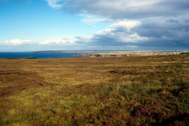
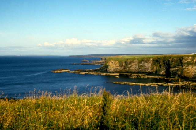
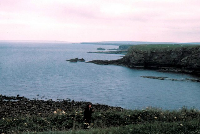
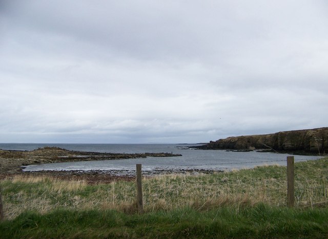
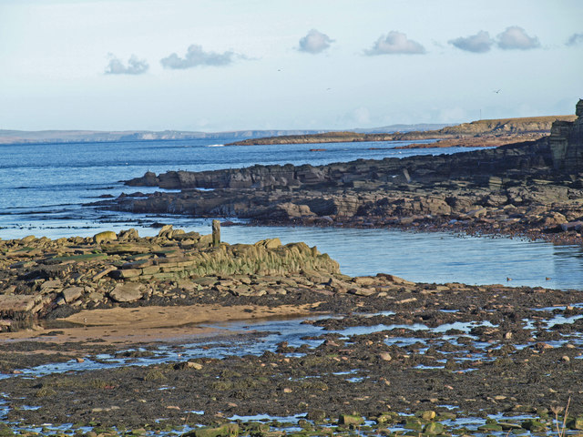
Ham is a small village located in Caithness, which is a historic county in the Highland region of Scotland. Situated on the northeastern coast of Scotland, Ham is surrounded by picturesque landscapes and offers stunning views of the North Sea. The village is part of the civil parish of Canisbay and is approximately 8 miles northeast of Wick, the largest town in the area.

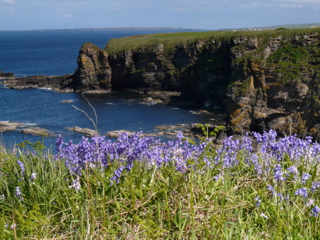
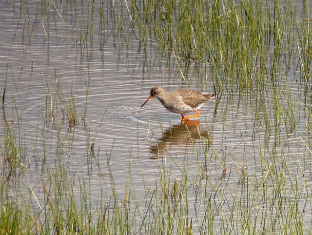
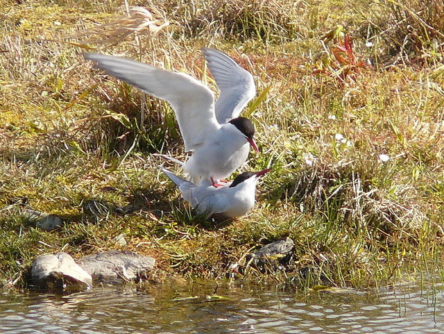
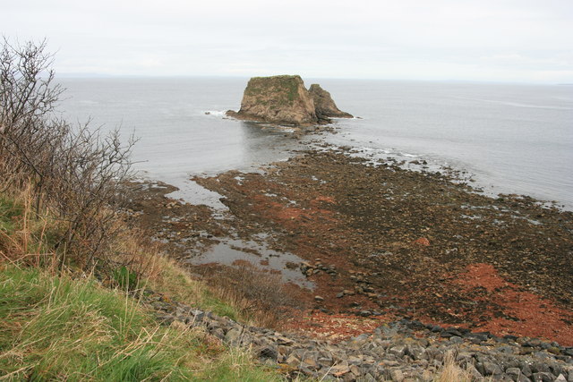
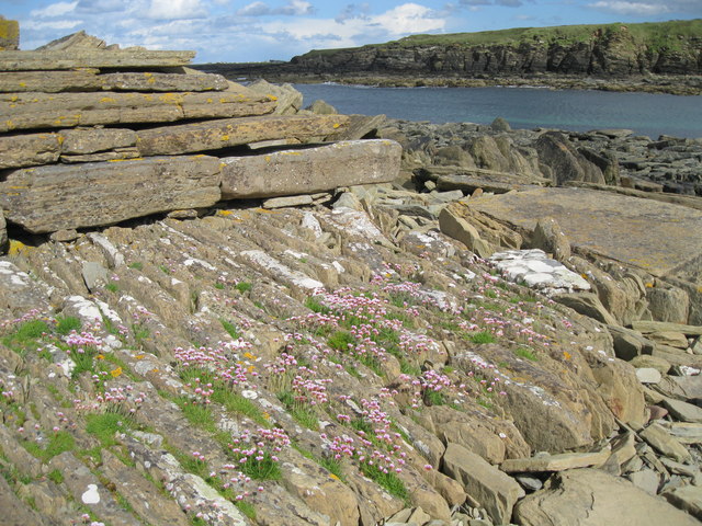
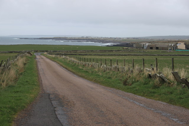
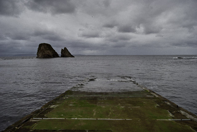
Ham is known for its tranquil and serene atmosphere, making it an ideal destination for those seeking a peaceful getaway. The village is characterized by its traditional Scottish charm, with picturesque cottages and a close-knit community. The area is rich in natural beauty, with rolling hills, rugged cliffs, and sandy beaches, providing ample opportunities for outdoor activities such as hiking, birdwatching, and fishing.

In terms of amenities, Ham offers limited facilities. However, nearby Wick provides a range of services, including shops, restaurants, and accommodation options. The village is well-connected to the rest of Caithness and the Highlands, with regular bus services and good road links.

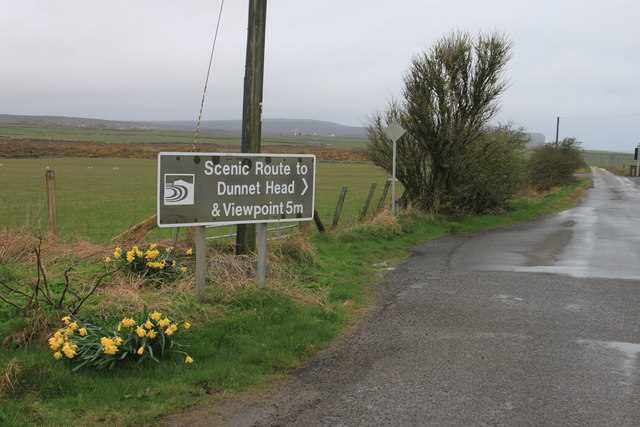
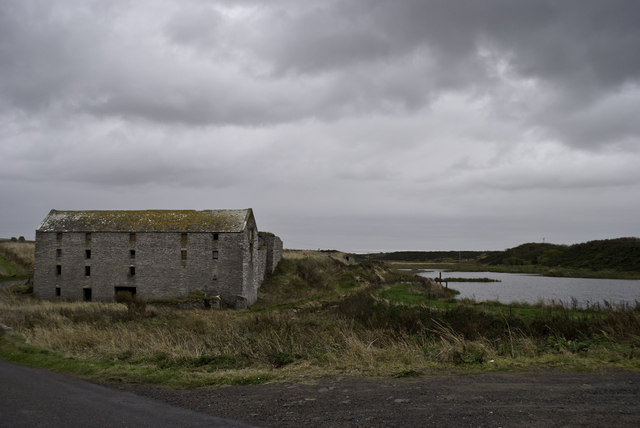
Ham is also steeped in history, with several notable landmarks in the surrounding area. The iconic Duncansby Head Lighthouse, located nearby, is a popular attraction for visitors. Additionally, the region is known for its rich archaeological heritage, including the remains of ancient settlements and standing stones.

Overall, Ham offers visitors a tranquil and scenic retreat, with its natural beauty and rich history making it a charming destination in Caithness.

If you have any feedback on the listing, please let us know in the comments section below.

Ham Images

Images are sourced within 2km of 58.63802/-3.3280787 or Grid Reference ND2373. Thanks to Geograph Open Source API. All images are credited.

Bluebells at Brough
Bluebells at Brough
Redshank at St. John's Pool
Arctic terns Full of the joys of Spring at St. John's Pool.
Arctic terns
Full of the joys of Spring at St. John's Pool.
Daffodils near Brough Looking from the B855 towards Clett and Little Clett, these daffodils adorn the hillside above the track leading down to Brough slipway.
Daffodils near Brough
Looking from the B855 towards Clett and Little Clett, these daffodils adorn the hillside above the track leading down to Brough slipway.
The Clett and Little Clett
Dunnet Head, Brough - 1987 Dunnet Head, Brough seen from A855.
Dunnet Head, Brough - 1987
Dunnet Head, Brough seen from A855.
Dunnet Head, Brough - 1987 Dunnet Head, Brough, Little Clett.
Dunnet Head, Brough - 1987
Dunnet Head, Brough, Little Clett.
Dunnet Head, Brough - 1987 Dunnet Head, Brough, The Stacks.
Dunnet Head, Brough - 1987
Dunnet Head, Brough, The Stacks.
Lighthouse Loading Platform The adjacent inscription reads "This platform was used for the loading of carts with oil and other stores for Dunnet Head Lighthouse.  Constructed c1831 by the Northern Lighthouse Board.  Restored by the Brough Bay Association 2011."
Lighthouse Loading Platform
The adjacent inscription reads "This platform was used for the loading of carts with oil and other stores for Dunnet Head Lighthouse. Constructed c1831 by the Northern Lighthouse Board. Restored by the Brough Bay Association 2011."
Ham Harbour Ham harbour has not been used or maintained for many years. The details of its construction have been revealed in the sections of wall which still stand. Compare with <a href="https://www.geograph.org.uk/photo/24555">ND2473 : Ham Harbour</a> taken nearly eight years ago.
Ham Harbour
Ham harbour has not been used or maintained for many years. The details of its construction have been revealed in the sections of wall which still stand. Compare with ND2473 : Ham Harbour taken nearly eight years ago.
Detail of old harbour wall at Ham Part of the remaining wall of the derelict harbour at Ham.
Detail of old harbour wall at Ham
Part of the remaining wall of the derelict harbour at Ham.
The scenic road to Dunnet Head Dunnet Head can just be seen in the distance 5 miles distant.
The scenic road to Dunnet Head
Dunnet Head can just be seen in the distance 5 miles distant.
A typical Caithness lane near Ham
Slipway at Brough
Slipway at Brough
Ham old mill
Ham old mill
Brough - 1975 Brough, The Kame, Grassy Clett.
Brough - 1975
Brough, The Kame, Grassy Clett.
Ham Harbour from the road One of the advantages of having to stop for oncoming cars on a single-track road is being able to grab a quick photo
Ham Harbour from the road
One of the advantages of having to stop for oncoming cars on a single-track road is being able to grab a quick photo
Ham Harbour Low Tide
Ham Harbour
Low Tide
Show me another place!

Ham is located at Grid Ref: ND2373 (Lat: 58.63802, Lng: -3.3280787)

Unitary Authority: Highland

Police Authority: Highlands and Islands

What 3 Words

///polished.masterful.nooks. Near Thurso, Highland

Nearby Locations

Kunks Hole Ham Kerry Geo

Related Wikis

Brough, Caithness

Brough is a small village (population 66) in Caithness in the North of Scotland. It is located on the B855 single-track road, the most northerly numbered...

Ham, Caithness

Ham is a village in the Caithness region in the Scottish council area of Highland. It has a very short river running from a mill pond to the sea - a total...

Brough Castle (Caithness)

Brough Castle is a ruined castle near Brough, Caithness. It is believed to date from the 12th to 14th centuries. == Description == The foundations of...
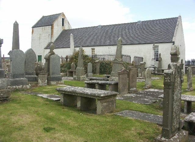
Dunnet Church

Dunnet Parish Church is a Church of Scotland church in Dunnet, Caithness, northern Scotland. References to St Mary's Parish Church are known from as far...

Dunnet

Dunnet is a village in Caithness, in the Highland area of Scotland. It is within the Parish of Dunnet. == Village == The village centres on the A836–B855...

Dunnet Forest

Dunnet Forest in Dunnet, Caithness, Scotland, is the most northerly community woodland on the UK mainland, and has been managed since 2003 by Dunnet Forestry...

Skarfskerry

Skarfskerry (or Scarfskerry; Scottish Gaelic: Sgarbh Sgeir) is a settlement located in the far northern county Caithness on a small peninsula northeast...

Loch of Mey

Loch of Mey is a loch near the north coast of Caithness, Scotland, and one of the most northern water features of mainland Britain. It lies just to the...

Nearby Amenities

Located within 500m of 58.63802,-3.3280787
Wester
Place: farm
Lat/Long: 58.6364071/-3.3264765
Power: pole
Lat/Long: 58.6419201/-3.3247427
Power: pole
Lat/Long: 58.6419413/-3.3259122
Power: pole
Lat/Long: 58.6419529/-3.3272807
Power: pole
Lat/Long: 58.6419666/-3.3281477
Power: pole
Lat/Long: 58.6419656/-3.3292685
Power: pole
Lat/Long: 58.6419835/-3.3306999
Power: pole
Lat/Long: 58.6419951/-3.3320257
Power: pole
Lat/Long: 58.636948/-3.3272279
Power: pole
Lat/Long: 58.6375429/-3.327232
Power: pole
Lat/Long: 58.6382604/-3.3272421
Power: pole
Lat/Long: 58.6389357/-3.3272543
Power: pole
Lat/Long: 58.6395137/-3.327234
Power: pole
Lat/Long: 58.6401276/-3.3272421
Power: pole
Lat/Long: 58.6406791/-3.3272543
Power: pole
Lat/Long: 58.6413469/-3.3272665
The data included in this document is from www.openstreetmap.org. The data is made available under ODbL.

Have you been to Ham?

Leave your review of Ham below (or comments, questions and feedback).