Brae of Scurdargue

Downs, Moorland in Aberdeenshire

Scotland

Brae of Scurdargue

Tap O' Noth from  Dunnideer A view over 12 Km to Tap O' Noth by Rhyinie. It has a vitrified fort on its summit too, similar to Dunnideer. Others in the area include Bennachie and Barra Hill.
Tap O' Noth from Dunnideer Credit: Andrew Wood

Brae of Scurdargue is a charming rural area located in Aberdeenshire, Scotland. Situated amidst the stunning Downs and Moorland landscapes, this region offers a picturesque and tranquil setting for nature enthusiasts and those seeking a peaceful retreat.

The Downs of Brae of Scurdargue showcase rolling hills and expansive meadows, providing breathtaking views of the surrounding countryside. Visitors can immerse themselves in the beauty of the natural scenery while enjoying leisurely walks or engaging in outdoor activities such as hiking and picnicking.

The Moorland of Brae of Scurdargue offers a unique and rugged environment, characterized by heather-covered hills and scattered boulders. It provides a habitat for a diverse range of wildlife, including various bird species, mammals, and plant life. Nature lovers can explore this untamed landscape and marvel at its untouched beauty.

In addition to its natural wonders, Brae of Scurdargue is also home to a small community of residents who take pride in their rural lifestyle. Traditional stone houses can be found dotted across the area, adding to its quaint and idyllic charm.

For those seeking a taste of Scottish heritage, the nearby town of Aberdeenshire offers historical sites, including ancient castles and museums. It also provides access to modern amenities such as restaurants, shops, and accommodations, ensuring a comfortable stay for visitors.

In summary, Brae of Scurdargue is a hidden gem nestled in the Downs and Moorland of Aberdeenshire. Its stunning landscapes, rich wildlife, and peaceful atmosphere make it an ideal destination for nature lovers and those seeking an escape from the hustle and bustle of city life.

If you have any feedback on the listing, please let us know in the comments section below.

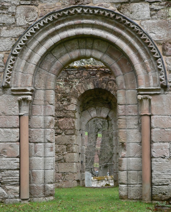
Brae of Scurdargue Images

Images are sourced within 2km of 57.345333/-2.8691722 or Grid Reference NJ4728. Thanks to Geograph Open Source API. All images are credited.

Tap O' Noth from  Dunnideer A view over 12 Km to Tap O' Noth by Rhyinie. It has a vitrified fort on its summit too, similar to Dunnideer. Others in the area include Bennachie and Barra Hill.
Tap O' Noth from Dunnideer
A view over 12 Km to Tap O' Noth by Rhyinie. It has a vitrified fort on its summit too, similar to Dunnideer. Others in the area include Bennachie and Barra Hill.
Looking towards Tap o'Noth... ...some 3 km north-west of the Craw Stane.
Looking towards Tap o'Noth...
...some 3 km north-west of the Craw Stane.
Nearing the summit of Tap o' Noth
Path to the summit of Tap o' Noth
Minor road and woodland at Nether Wheedlemont Looking north-eastward.
Minor road and woodland at Nether Wheedlemont
Looking north-eastward.
View towards Tap o'Noth... ...from about 1 km to the south.
View towards Tap o'Noth...
...from about 1 km to the south.
Heading up the hill... ...towards Tap o'Noth.
Heading up the hill...
...towards Tap o'Noth.
Deer fence and gate on the path to Tap o'Noth
Looking up at Tap o'Noth
Looking north from Tap o'Noth
Tap o'Noth It's a strenuous climb to the 563-m peak but the fascinating remains of the Iron Age hill fort and its vitrified fortifications (Canmore listing 1716: <span class="nowrap"><a title="https://canmore.org.uk/site/17169/tap-o-noth" rel="nofollow ugc noopener" href="https://canmore.org.uk/site/17169/tap-o-noth">Link</a><img style="margin-left:2px;" alt="External link" title="External link - shift click to open in new window" src="https://s1.geograph.org.uk/img/external.png" width="10" height="10"/></span> ) and the spectacular views for up to 50 km around are worth the effort.
Tap o'Noth
It's a strenuous climb to the 563-m peak but the fascinating remains of the Iron Age hill fort and its vitrified fortifications (Canmore listing 1716: LinkExternal link ) and the spectacular views for up to 50 km around are worth the effort.
Trig point at Tap o'Noth This is a 'secondary' trig point, reference number TP6317; for more on trig points, see: <span class="nowrap"><a title="https://en.wikipedia.org/wiki/Triangulation_station" rel="nofollow ugc noopener" href="https://en.wikipedia.org/wiki/Triangulation_station">Link</a><img style="margin-left:2px;" alt="External link" title="External link - shift click to open in new window" src="https://s1.geograph.org.uk/img/external.png" width="10" height="10"/></span> .   Scree and rubble from the remains of the walls of the iron Age hill fort can be seen in the foreground.
Trig point at Tap o'Noth
This is a 'secondary' trig point, reference number TP6317; for more on trig points, see: LinkExternal link . Scree and rubble from the remains of the walls of the iron Age hill fort can be seen in the foreground.
View towards Old Merdrum from Tap o' Noth Some of the fields in this photograph have now become forested especially to the south west of Old Merdrum.
View towards Old Merdrum from Tap o' Noth
Some of the fields in this photograph have now become forested especially to the south west of Old Merdrum.
View towards the Mains of Lesmoir and the A941 from Tap o' Noth The prominent hill in the distance is The Buck.
View towards the Mains of Lesmoir and the A941 from Tap o' Noth
The prominent hill in the distance is The Buck.
Tap o' Noth - vitrified fort
Essie Cemetery Essie Cemetery from the south looking toward the road. Once there was a church on this site but it has long been demolished.
Essie Cemetery
Essie Cemetery from the south looking toward the road. Once there was a church on this site but it has long been demolished.
Essie Croft A dumping ground at Essie, taken from the cemetery, with croft building by the roadside.
Essie Croft
A dumping ground at Essie, taken from the cemetery, with croft building by the roadside.
Essie Pasture A grass field with roadside trees at Essie and Tap O Noth dominant behind.
Essie Pasture
A grass field with roadside trees at Essie and Tap O Noth dominant behind.
Show me another place!

Brae of Scurdargue is located at Grid Ref: NJ4728 (Lat: 57.345333, Lng: -2.8691722)

Unitary Authority: Aberdeenshire

Police Authority: North East

What 3 Words

///cactus.technical.slanting. Near Huntly, Aberdeenshire

Nearby Locations

Brae of Scurdargue

Related Wikis

Nearby Amenities

Located within 500m of 57.345333,-2.8691722
Communication Mobile Phone: yes
Man Made: mast
Tower Type: communication
Lat/Long: 57.3494015/-2.8723906
Power: pole
Lat/Long: 57.3429019/-2.8634491
Power: pole
Lat/Long: 57.343156/-2.8646015
Power: pole
Lat/Long: 57.3432467/-2.8657445
Power: pole
Lat/Long: 57.3433407/-2.8669502
Power: pole
Lat/Long: 57.3434415/-2.8683962
Power: pole
Lat/Long: 57.3435449/-2.8696601
Power: pole
Lat/Long: 57.3436126/-2.8705409
Power: pole
Lat/Long: 57.3436702/-2.8713871
Power: pole
Lat/Long: 57.3437397/-2.8722286
Power: pole
Lat/Long: 57.3438041/-2.8731
Power: pole
Lat/Long: 57.3437033/-2.8742947
Power: pole
Lat/Long: 57.3436228/-2.8749228
Power: pole
Lat/Long: 57.3435855/-2.8756701
Power: pole
Lat/Long: 57.343522/-2.8767597
Power: pole
Lat/Long: 57.3431001/-2.8755005
Power: pole
Lat/Long: 57.3425994/-2.8753341
Power: pole
Lat/Long: 57.3459/-2.8750476
Power: pole
Lat/Long: 57.3457398/-2.8739533
Power: pole
Lat/Long: 57.3455992/-2.8729233
Power: pole
Lat/Long: 57.3459008/-2.8720222
Power: pole
Lat/Long: 57.3462075/-2.8711006
Power: pole
Lat/Long: 57.3450011/-2.8729799
Power: pole
Lat/Long: 57.3444175/-2.8730207
Power: pole
Lat/Long: 57.3456526/-2.8679543
Power: pole
Lat/Long: 57.344919/-2.8680861
Power: pole
Lat/Long: 57.3441862/-2.8682337
Brae of Scurdargue
Place: hamlet
Lat/Long: 57.3461229/-2.8709592
The data included in this document is from www.openstreetmap.org. The data is made available under ODbL.

Have you been to Brae of Scurdargue?

Leave your review of Brae of Scurdargue below (or comments, questions and feedback).