Bractullo Muir

Downs, Moorland in Angus

Scotland

Bractullo Muir

Water-logged minor road between Newton and Hatton Looking north-eastward. The result of several hours of heavy rain.
Water-logged minor road between Newton and Hatton Credit: Peter Wood

Bractullo Muir is a stunning expanse of moorland located in the Angus region of Scotland. Stretching across acres of rolling hills and rugged terrain, it is known for its breathtaking natural beauty and unique ecosystem.

Situated in the heart of the Scottish countryside, Bractullo Muir is characterized by its distinctive heather-covered hills, scattered with granite outcrops and boulders. The area is home to a rich variety of wildlife, including red grouse, mountain hares, and golden eagles, making it a popular destination for nature enthusiasts and birdwatchers.

The moorland is also rich in archaeological and historical significance. It is dotted with ancient stone circles and standing stones, providing evidence of human habitation dating back thousands of years. These remnants of the past offer visitors a glimpse into the region's fascinating history and cultural heritage.

Bractullo Muir is a haven for outdoor activities, attracting hikers, cyclists, and horse riders from far and wide. Its vast network of trails and paths allows visitors to explore the area at their own pace, offering breathtaking views of the surrounding countryside at every turn.

As a designated conservation area, Bractullo Muir is carefully managed to preserve its unique ecosystem and protect its wildlife. Visitors are encouraged to respect the environment and adhere to designated paths to minimize their impact on the delicate moorland.

In summary, Bractullo Muir is a captivating moorland in Angus, Scotland, offering a diverse range of natural beauty, historical significance, and outdoor activities. Its stunning landscapes and rich biodiversity make it a must-visit destination for nature lovers and history enthusiasts alike.

If you have any feedback on the listing, please let us know in the comments section below.

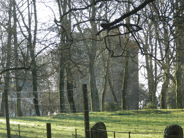
Bractullo Muir Images

Images are sourced within 2km of 56.563078/-2.8546475 or Grid Reference NO4741. Thanks to Geograph Open Source API. All images are credited.

Water-logged minor road between Newton and Hatton Looking north-eastward. The result of several hours of heavy rain.
Water-logged minor road between Newton and Hatton
Looking north-eastward. The result of several hours of heavy rain.
Minor road near to Hatton Looking southward.
Minor road near to Hatton
Looking southward.
Track between arable fields giving access to Labothie Looking north-eastward.
Track between arable fields giving access to Labothie
Looking north-eastward.
Chapel Road at Lady Park, Carrot Hill Looking north-eastward.
Chapel Road at Lady Park, Carrot Hill
Looking north-eastward.
Ordnance Survey Cut Mark This mark can be found on a stone that forms the track side wall near to Carrot Hill.
The recorded details give a height of 221.3751 metres above sea level.
For more detail see : <span class="nowrap"><a title="https://www.bench-marks.org.uk/bm162181" rel="nofollow ugc noopener" href="https://www.bench-marks.org.uk/bm162181">Link</a><img style="margin-left:2px;" alt="External link" title="External link - shift click to open in new window" src="https://s1.geograph.org.uk/img/external.png" width="10" height="10"/></span>
Ordnance Survey Cut Mark
This mark can be found on a stone that forms the track side wall near to Carrot Hill. The recorded details give a height of 221.3751 metres above sea level. For more detail see : LinkExternal link
Road leading to Greenburn near Carrot Hill
A start to the harvest A swathe of barley has been safely gathered in despite the recent bad weather
A start to the harvest
A swathe of barley has been safely gathered in despite the recent bad weather
Farmland near Hatton
Road junction at Hatton
Woodland at Carrot Hill
Barley, Carrot Hill The barley is still green, while stubble is being ploughed not far away. Carrot Hill has a conifer plantation, but is otherwise divided between an arable south and moorland north side.
Barley, Carrot Hill
The barley is still green, while stubble is being ploughed not far away. Carrot Hill has a conifer plantation, but is otherwise divided between an arable south and moorland north side.
North side of Carrot Hill The higher ground on the north side of Carrot Hill is moorland. The southern side is arable to the top.
North side of Carrot Hill
The higher ground on the north side of Carrot Hill is moorland. The southern side is arable to the top.
Road, Carrot The descent off Carrot Hill, looking towards Fotheringham Hill.
Road, Carrot
The descent off Carrot Hill, looking towards Fotheringham Hill.
Any colour you like... Aberdeen Angus cattle and crows, mostly jackdaws, at Carrot.
Any colour you like...
Aberdeen Angus cattle and crows, mostly jackdaws, at Carrot.
Barley, Hatton North side of the Sidlaw Hills.
Barley, Hatton
North side of the Sidlaw Hills.
Junction, Hatton A few years after the first image from here <a href="https://www.geograph.org.uk/photo/81646">NO4642 : Hatton farm</a>.
Junction, Hatton
A few years after the first image from here NO4642 : Hatton farm.
Cows in field at Carrothill
Forest track on Carrothill
Show me another place!

Bractullo Muir is located at Grid Ref: NO4741 (Lat: 56.563078, Lng: -2.8546475)

Unitary Authority: Angus

Police Authority: Tayside

What 3 Words

///liked.boardroom.infuses. Near Letham, Angus

Related Wikis

Whigstreet

Whigstreet is a village in the county of Angus, Scotland, between the towns of Forfar and Carnoustie. Nearby lie the remains of a temporary Roman marching...

Kirkbuddo railway station

Kirkbuddo railway station served the village of Kirkbuddo, Angus, Scotland, from 1870 to 1955 on the Dundee and Forfar direct line. == History == The station...

Kirkbuddo

Kirkbuddo (Scots pronunciation: [ˌkərˈbʌdə]; Scottish Gaelic: Cair Bhuite) is a village in the county of Angus, Scotland, between the towns of Forfar and...

Affleck Castle

Affleck Castle, also known as Auchenleck Castle, is a tall L-plan tower house dating from the 15th century, 4 miles (6.4 km) north of Monifieth and 1 mile...

Nearby Amenities

Located within 500m of 56.563078,-2.8546475
Labothie Hill
Ele: 232
Natural: peak
Lat/Long: 56.5640217/-2.8598667
Power: pole
Lat/Long: 56.5645886/-2.8474225
Power: pole
Lat/Long: 56.5651/-2.8484252
Power: pole
Lat/Long: 56.5656755/-2.8495926
The data included in this document is from www.openstreetmap.org. The data is made available under ODbL.

Have you been to Bractullo Muir?

Leave your review of Bractullo Muir below (or comments, questions and feedback).