Bampton Common

Downs, Moorland in Westmorland Eden

England

Bampton Common

Old quarry building A useful lunch spot
Old quarry building Credit: David Brown

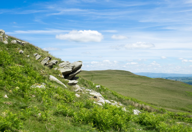
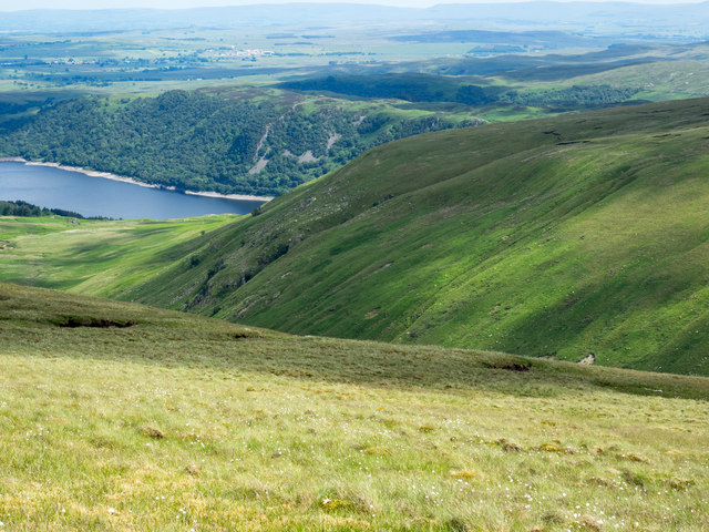
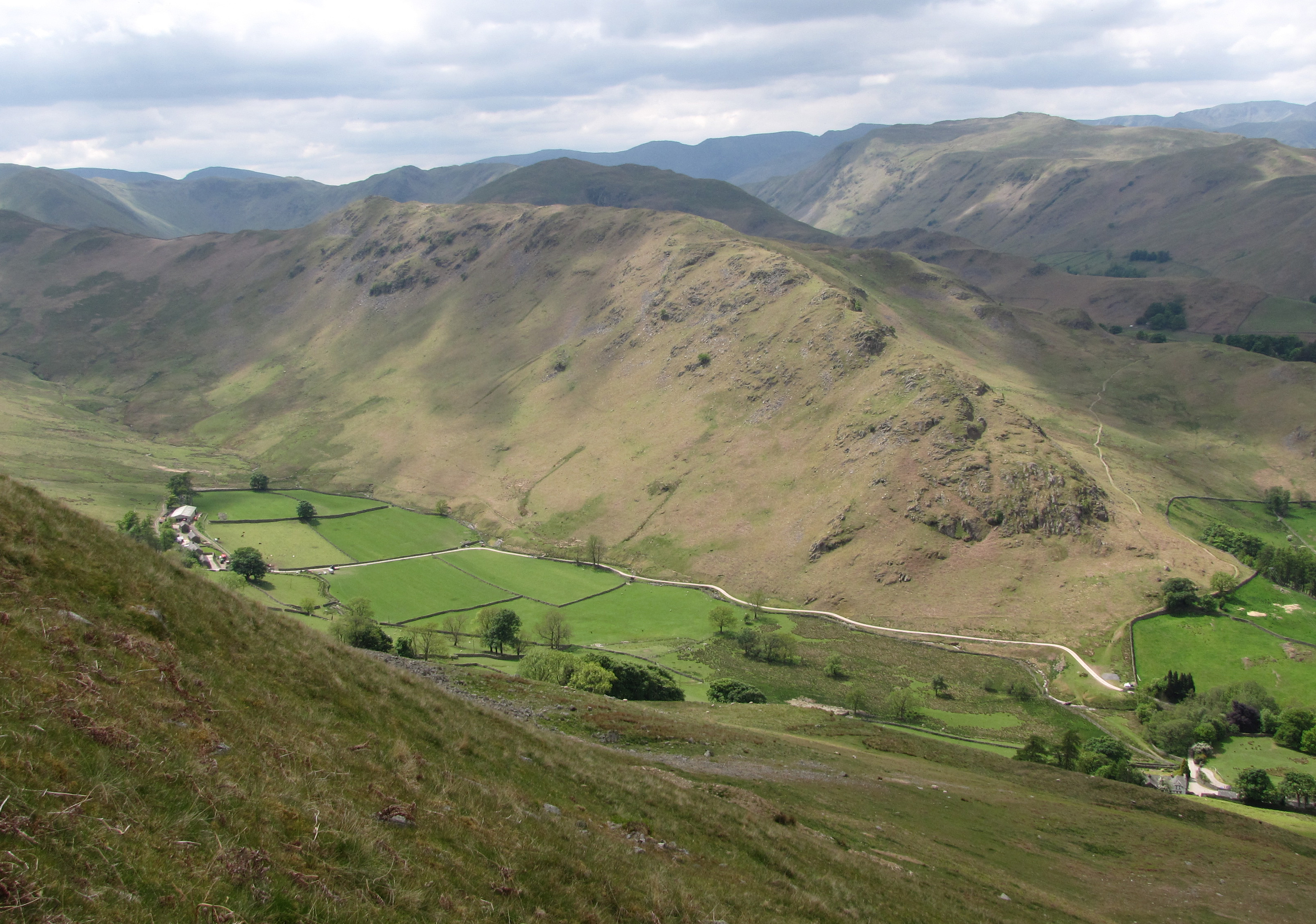
Bampton Common is a picturesque area located in Westmorland, England. Known for its stunning natural beauty, the common is a combination of downs and moorland, creating a diverse and unique landscape. Spanning across a vast expanse of approximately 1,500 acres, Bampton Common is a haven for nature enthusiasts and outdoor lovers.

The common is characterized by rolling hills, open grassland, and heather-covered moorland. It is dotted with scattered trees and shrubs, adding to its charm and providing habitats for a variety of wildlife. Visitors can expect to spot a range of bird species such as curlews, lapwings, and skylarks, as well as small mammals like hares and rabbits.

Walking trails crisscross the common, offering visitors the opportunity to explore its beauty on foot. The paths meander through the open grassland, providing breathtaking views of the surrounding countryside. In spring and summer, the common becomes a vibrant tapestry of wildflowers, including purple heather and yellow gorse, creating a picturesque backdrop for nature lovers and photographers alike.

Bampton Common is also home to several rare plant species, making it an important site for conservation. The common is managed by local authorities and conservation organizations to protect its natural heritage and ensure its continued preservation.

For those seeking tranquility and a connection with nature, Bampton Common in Westmorland offers a serene and unspoiled landscape that captivates the senses and provides a true taste of the English countryside.

If you have any feedback on the listing, please let us know in the comments section below.

Bampton Common Images

Images are sourced within 2km of 54.539175/-2.8130174 or Grid Reference NY4716. Thanks to Geograph Open Source API. All images are credited.

Old quarry building A useful lunch spot
Old quarry building
A useful lunch spot
Low Kop Is this the top?
Low Kop
Is this the top?
Path from Wether Hill The rough path is a little boggy at times.
Path from Wether Hill
The rough path is a little boggy at times.
North shore of Haweswater A near-full Haweswater Reservoir with just a little exposed 'rim' above the water level. Little Birkhouse Hill, Great Birkhouse Hill and  Four Stones Hill are among the low tops beyond.
North shore of Haweswater
A near-full Haweswater Reservoir with just a little exposed 'rim' above the water level. Little Birkhouse Hill, Great Birkhouse Hill and Four Stones Hill are among the low tops beyond.
Tree and ruined wall beside Haweswater A lone tree with bracken on access land descending towards the Haweswater Reservoir.
Tree and ruined wall beside Haweswater
A lone tree with bracken on access land descending towards the Haweswater Reservoir.
Valley of Measand Beck The valley of Measand Beck as seen from the steep slope on its north side. The perfectly flat area of Fordingdale Bottom is immediately below - surely the location of an old lake; it's now a bog.
(The image was recorded from close to the line of a public right-of-way as shown on OS maps - there's no trace of any definite route, just discontinuous animal tracks through bracken. The camera position was gained by a descent from easier ground above and navigation by GPS receiver.)
Valley of Measand Beck
The valley of Measand Beck as seen from the steep slope on its north side. The perfectly flat area of Fordingdale Bottom is immediately below - surely the location of an old lake; it's now a bog. (The image was recorded from close to the line of a public right-of-way as shown on OS maps - there's no trace of any definite route, just discontinuous animal tracks through bracken. The camera position was gained by a descent from easier ground above and navigation by GPS receiver.)
Rock outcrop on slope of Low Kop Low Kop is a minor interruption along a mountain ridge on the north side of the valley of Measand Beck; it lies some way uphill, left out of the image. The distant hill also has little identity of its own and is unnamed on OS maps but has become known to some hill-goers as Bampton Fell.
Rock outcrop on slope of Low Kop
Low Kop is a minor interruption along a mountain ridge on the north side of the valley of Measand Beck; it lies some way uphill, left out of the image. The distant hill also has little identity of its own and is unnamed on OS maps but has become known to some hill-goers as Bampton Fell.
Hill slope with cotton grass The slope is declining from the crest of a moorland-like ridge towards the valley of the Measand Beck. The distant mountain is High Raise which is at the head of the valley.
Hill slope with cotton grass
The slope is declining from the crest of a moorland-like ridge towards the valley of the Measand Beck. The distant mountain is High Raise which is at the head of the valley.
Summit area of High Kop High Kop is a location of very little significance having hardly any prominence of its own. It's an outlying lobe of moorland, part of Wether Hill much of which is seen cloud-shadowed in the image. Loadpot Hill is the farther sunlit dome.
Summit area of High Kop
High Kop is a location of very little significance having hardly any prominence of its own. It's an outlying lobe of moorland, part of Wether Hill much of which is seen cloud-shadowed in the image. Loadpot Hill is the farther sunlit dome.
Slopes of valley of Measand Beck The near slopes fall from the vicinity of High Kop; those on the far side of the valley from the broad ridge descending towards Haweswater ultimately from High Raise.
Slopes of valley of Measand Beck
The near slopes fall from the vicinity of High Kop; those on the far side of the valley from the broad ridge descending towards Haweswater ultimately from High Raise.
Head of Willdale The bracken-clad slopes of the valley head of Willdale.
Head of Willdale
The bracken-clad slopes of the valley head of Willdale.
Four Stones Hill Four Stones Hill as seen from the north-west on the slope of Bampton Fell.
Four Stones Hill
Four Stones Hill as seen from the north-west on the slope of Bampton Fell.
Grassy hill slope with sitting walker The slope is part of a ridge rising westwards towards Loadpot Hill. The distant hill is Low Kop, a minor rise of another ridge rising towards Wether Hill.
Grassy hill slope with sitting walker
The slope is part of a ridge rising westwards towards Loadpot Hill. The distant hill is Low Kop, a minor rise of another ridge rising towards Wether Hill.
Route along ridge crest east of Loadpot Hill OS mapping indicates two routes on the ridge descending eastwards from the summit of Loadpot Hill; one is a bridleway, the other a path or farm route shown at the 1:25 000 scale as a faint pecked line. The route in the image corresponds more closely to the latter.
Route along ridge crest east of Loadpot Hill
OS mapping indicates two routes on the ridge descending eastwards from the summit of Loadpot Hill; one is a bridleway, the other a path or farm route shown at the 1:25 000 scale as a faint pecked line. The route in the image corresponds more closely to the latter.
Head of Cawdale Several streams descend to meet at the head of Cawdale; they join to form Cawdale Beck. A cyclist is seen at the lower right corner of the image - a bridleway crosses the slope there.
Head of Cawdale
Several streams descend to meet at the head of Cawdale; they join to form Cawdale Beck. A cyclist is seen at the lower right corner of the image - a bridleway crosses the slope there.
Stone wall fragment The low section of dry stone wall on the east ridge of Loadpot Hill is a curious feature serving no obvious purpose. It doesn't show presently on OS mapping at any scale.
Stone wall fragment
The low section of dry stone wall on the east ridge of Loadpot Hill is a curious feature serving no obvious purpose. It doesn't show presently on OS mapping at any scale.
Wether Hill Summit Wether Hill Summit with the path heading to in the distance High Raise
Wether Hill Summit
Wether Hill Summit with the path heading to in the distance High Raise
Haweswater Looking towards Harter Fell
Haweswater
Looking towards Harter Fell
Show me another place!

Bampton Common is located at Grid Ref: NY4716 (Lat: 54.539175, Lng: -2.8130174)

Administrative County: Cumbria

District: Eden

Police Authority: Cumbria

What 3 Words

///cultivation.gossiped.dolphins. Near Shap, Cumbria

Nearby Locations

Low Kop Bampton Common

Related Wikis

Wether Hill (Lake District)

Wether Hill is a fell in the English Lake District, between Martindale and Haweswater. It lies on the main north-south ridge of the Far Eastern Fells between...

Haweswater Reservoir

Haweswater is a reservoir in the valley of Mardale, Cumbria in the Lake District, England. Work to raise the height of the original natural lake was started...

Loadpot Hill

Loadpot Hill is a fell in the English Lake District, between Haweswater and Ullswater. == Topography == Although of moderate height, Loadpot Hill and its...

Mardale

Mardale is a glacial valley in the Lake District, in northern England. The valley used to have a hamlet at its head, called Mardale Green, but this village...

West Ward Rural District

West Ward was a rural district of the administrative county of Westmorland. The area was directly based on the former West Ward rural sanitary district...

Naddle Horseshoe

The Naddle Horseshoe is a group of summits in the English Lake District, south of Mardale valley, Cumbria. It is the subject of a chapter of Wainwright...

High Raise (High Street)

High Raise is a fell in the English Lake District, standing to the west of Haweswater Reservoir in the Far Eastern Fells. Note that another High Raise...

Steel Knotts

Steel Knotts is a fell in the English Lake District, near to Ullswater in the Far Eastern Fells. It stands between the valleys of Fusedale and Martindale...

Nearby Amenities

Located within 500m of 54.539175,-2.8130174
Low Kop
Ele: 572
Natural: peak
Source Name: OS 1:25k
Lat/Long: 54.5409512/-2.8140077
Tail o' Ling
Place: locality
Lat/Long: 54.5370097/-2.8135575
The data included in this document is from www.openstreetmap.org. The data is made available under ODbL.

Have you been to Bampton Common?

Leave your review of Bampton Common below (or comments, questions and feedback).