Black Planting
Downs, Moorland in Shropshire
England
Black Planting

Black Planting is a stunning area located in Shropshire, England, encompassing the Downs and Moorland landscapes. This picturesque region is characterized by its unique dark-colored soil, which gives the area its name. The black soil is a result of the high organic content and the presence of iron oxide, creating an enchanting contrast with the surrounding greenery.
The Downs of Black Planting offer vast open spaces with rolling hills, providing breathtaking panoramic views of the countryside. The area is home to a diverse range of flora and fauna, including wildflowers, grasses, and various bird species. The landscape is perfect for outdoor enthusiasts, offering opportunities for hiking, cycling, and wildlife spotting.
The Moorland of Black Planting is another highlight of the area, boasting a rugged and untamed beauty. The moors are characterized by their heather-covered hills, rocky outcrops, and peat bogs. This habitat supports a range of wildlife, including grouse, curlews, and various species of wild mammals.
Black Planting is not only a haven for nature lovers but also a place of historical significance. The area is dotted with ancient archaeological sites, including burial mounds, stone circles, and remnants of Iron Age settlements. These remnants offer a glimpse into the rich history and cultural heritage of the region.
Whether visitors are seeking tranquility, outdoor adventure, or a journey through history, Black Planting in Shropshire offers a captivating experience. Its dark soil, stunning landscapes, and diverse wildlife make it a must-visit destination for nature enthusiasts and history buffs alike.
If you have any feedback on the listing, please let us know in the comments section below.
Black Planting Images
Images are sourced within 2km of 52.533826/-2.7805272 or Grid Reference SO4793. Thanks to Geograph Open Source API. All images are credited.


Black Planting is located at Grid Ref: SO4793 (Lat: 52.533826, Lng: -2.7805272)
Unitary Authority: Shropshire
Police Authority: West Mercia
What 3 Words
///tabs.dose.hugs. Near Church Stretton, Shropshire
Nearby Locations
Related Wikis
Hope Bowdler
Hope Bowdler is a small village and civil parish in Shropshire, England. It is situated on the B4371, 1.5 miles (2.4 km) east of the market town of Church...
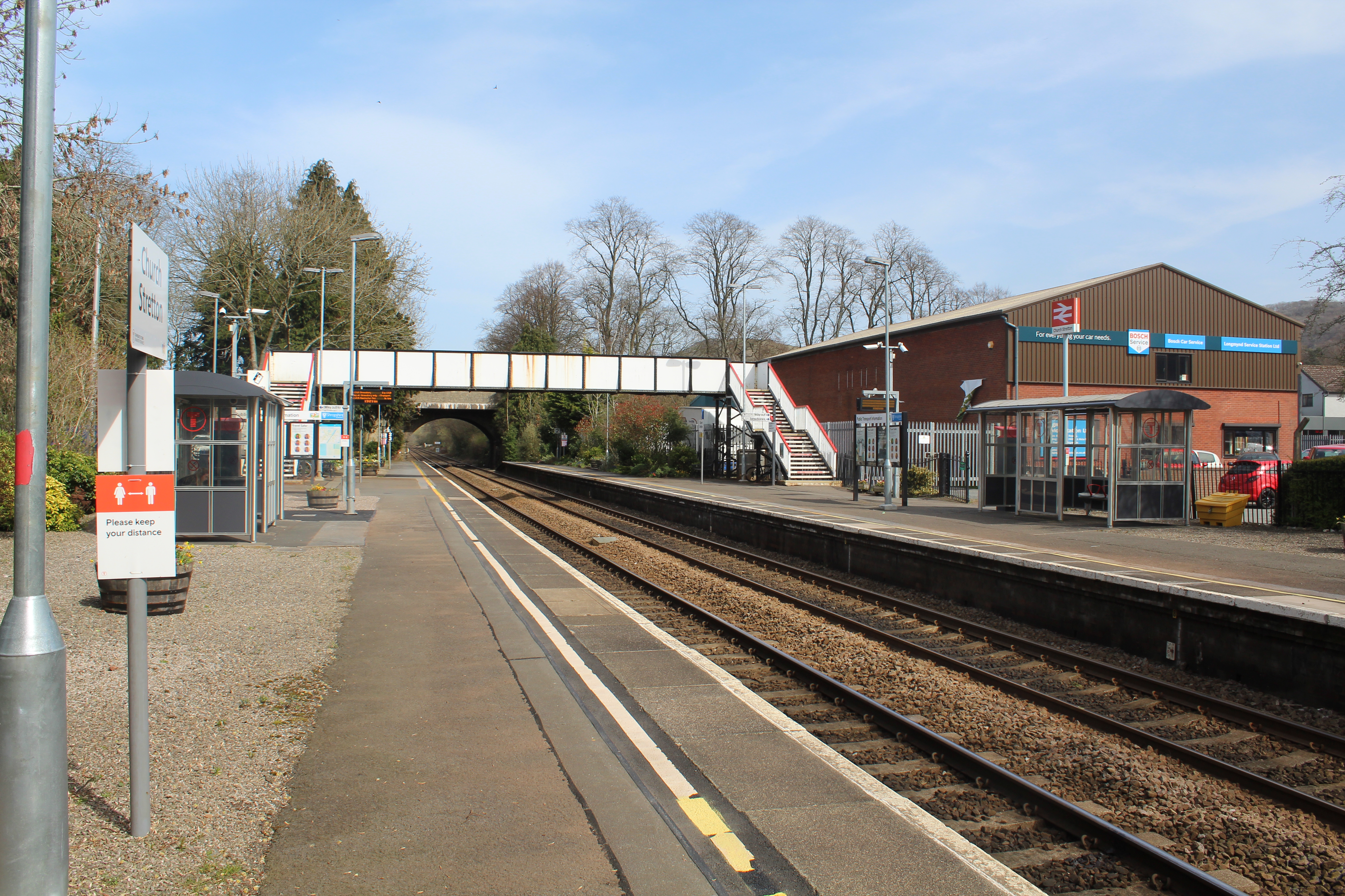
Church Stretton railway station
Church Stretton railway station is a railway station serving the town of Church Stretton in Shropshire, England on the Welsh Marches Line, 12+3⁄4 miles...

Church Stretton
Church Stretton is a market town and civil parish in Shropshire, England, 13 miles (21 km) south of Shrewsbury and 15 miles (24 km) north of Ludlow. The...

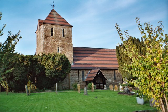
St Laurence's Church, Church Stretton
St Laurence's Church is in Church Street, Church Stretton, Shropshire, England. It is an active Anglican parish church in the deanery of Condover, the...
Nearby Amenities
Located within 500m of 52.533826,-2.7805272Have you been to Black Planting?
Leave your review of Black Planting below (or comments, questions and feedback).