Halvergate

Settlement in Norfolk Broadland

England

Halvergate

The unveiling of Wickhampton's new village sign The sign is almost identical to the former sign, seen here <a title="https://www.geograph.org.uk/photo/4292552" href="https://www.geograph.org.uk/photo/4292552">Link</a>
With the exception of the hare in the left spandrel which can be found on the interior wall of the church.
The church of St Andrew dominates the left side of the picture with Stone’s mill dominating the right. Between them is probably a Viking longship on Breydon Water. Webster’s Dairy and two milk churns represent a family business, been and gone. A grey heron, a bird seen here daily completes the picture.
In the spandrel on the right is a hand holding a bleeding heart which related to the 13th century effigies of Sir George and Lady Isabella Gerbrygge. Sir George who served as a Bailiff of Great Yarmouth in the 1270s, is holding a heart in his hand. The truth behind why, is lost but it is likely that he is demonstrating his love for his wife and died of a broken heart.
More difficult to believe is the legend which grew over the intervening 700 years and it is said that two brothers owned neighbouring parishes. They argued so vehemently over the parish boundaries that they came to blows and in a rage, they tore each other's hearts out. One of the parishes was then called Hell Fire Gate, which over time became Halvergate. The other parish was henceforth known as Wicked Hampton, which over time became Wickhampton.
The unveiling of Wickhampton's new village sign Credit: Adrian S Pye

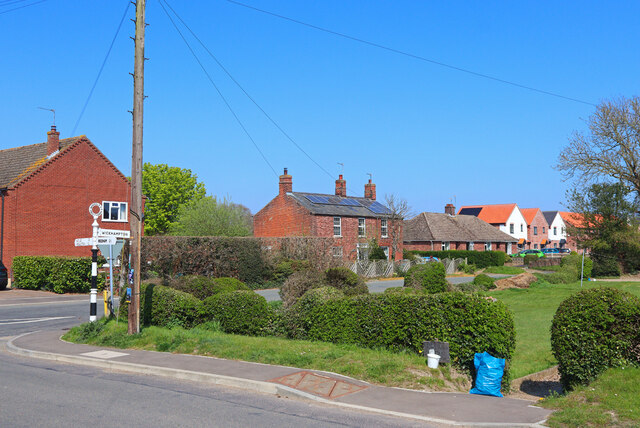
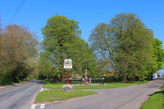
Halvergate is a village located in the county of Norfolk, England. Situated approximately 15 miles east of Norwich, it falls within the district of Broadland. With a population of around 700 residents, Halvergate is a small and close-knit community.

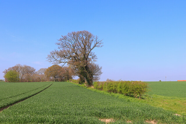
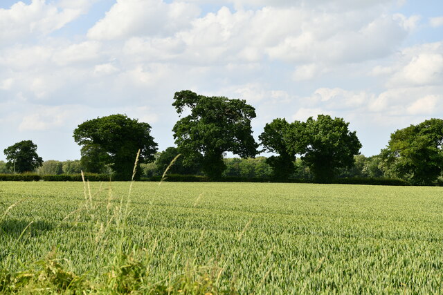
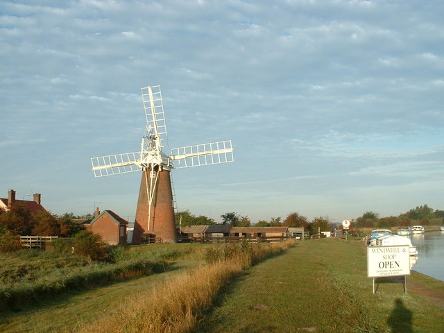
The village is known for its picturesque countryside, with an abundance of fields, farmlands, and waterways that surround the area. The River Bure flows nearby, providing opportunities for boating and fishing enthusiasts. Additionally, the Halvergate Marshes, a designated Site of Special Scientific Interest, can be found to the east of the village, featuring a diverse range of flora and fauna.

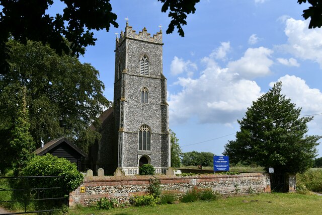
Halvergate boasts a rich history, evident in its architecture and landmarks. The village church, St. Peter and St. Paul, dates back to the 14th century and is a prominent feature in the area. Other historic buildings, such as Halvergate Hall and the Old Rectory, add to the charm and character of the village.

Despite its small size, Halvergate offers a range of amenities for its residents. These include a primary school, a village hall, and a local pub, providing a focal point for socializing. The village also benefits from good transport links, with nearby access to the A47 road, connecting it to Norwich and the wider region.

Overall, Halvergate offers a tranquil and picturesque setting, making it an attractive place to live for those seeking a peaceful rural lifestyle within close proximity to urban amenities.

If you have any feedback on the listing, please let us know in the comments section below.
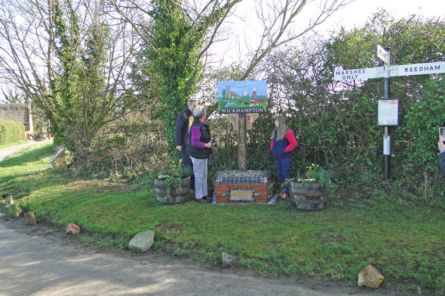
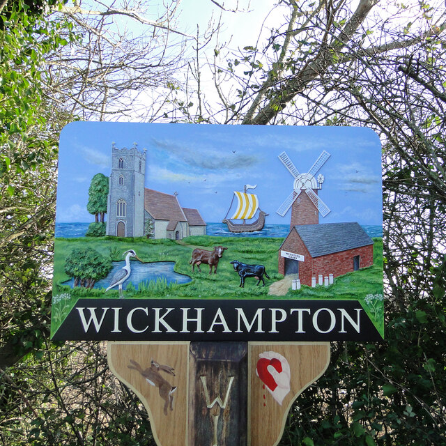
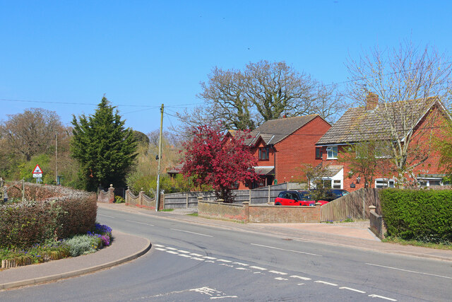
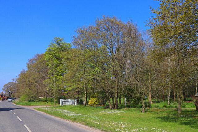
Halvergate Images

Images are sourced within 2km of 52.602687/1.567068 or Grid Reference TG4106. Thanks to Geograph Open Source API. All images are credited.

The unveiling of Wickhampton's new village sign The sign is almost identical to the former sign, seen here <a title="https://www.geograph.org.uk/photo/4292552" href="https://www.geograph.org.uk/photo/4292552">Link</a>
With the exception of the hare in the left spandrel which can be found on the interior wall of the church.
The church of St Andrew dominates the left side of the picture with Stone’s mill dominating the right. Between them is probably a Viking longship on Breydon Water. Webster’s Dairy and two milk churns represent a family business, been and gone. A grey heron, a bird seen here daily completes the picture.
In the spandrel on the right is a hand holding a bleeding heart which related to the 13th century effigies of Sir George and Lady Isabella Gerbrygge. Sir George who served as a Bailiff of Great Yarmouth in the 1270s, is holding a heart in his hand. The truth behind why, is lost but it is likely that he is demonstrating his love for his wife and died of a broken heart.
More difficult to believe is the legend which grew over the intervening 700 years and it is said that two brothers owned neighbouring parishes. They argued so vehemently over the parish boundaries that they came to blows and in a rage, they tore each other's hearts out. One of the parishes was then called Hell Fire Gate, which over time became Halvergate. The other parish was henceforth known as Wicked Hampton, which over time became Wickhampton.
The unveiling of Wickhampton's new village sign
The sign is almost identical to the former sign, seen here Link With the exception of the hare in the left spandrel which can be found on the interior wall of the church. The church of St Andrew dominates the left side of the picture with Stone’s mill dominating the right. Between them is probably a Viking longship on Breydon Water. Webster’s Dairy and two milk churns represent a family business, been and gone. A grey heron, a bird seen here daily completes the picture. In the spandrel on the right is a hand holding a bleeding heart which related to the 13th century effigies of Sir George and Lady Isabella Gerbrygge. Sir George who served as a Bailiff of Great Yarmouth in the 1270s, is holding a heart in his hand. The truth behind why, is lost but it is likely that he is demonstrating his love for his wife and died of a broken heart. More difficult to believe is the legend which grew over the intervening 700 years and it is said that two brothers owned neighbouring parishes. They argued so vehemently over the parish boundaries that they came to blows and in a rage, they tore each other's hearts out. One of the parishes was then called Hell Fire Gate, which over time became Halvergate. The other parish was henceforth known as Wicked Hampton, which over time became Wickhampton.
Wickhampton's new village sign See also <a title="https://www.geograph.org.uk/photo/7105782" href="https://www.geograph.org.uk/photo/7105782">Link</a>
The sign is almost identical to the former sign, seen here <a title="https://www.geograph.org.uk/photo/4292552" href="https://www.geograph.org.uk/photo/4292552">Link</a> with the exception of the hare in the left spandrel which can be found on the interior wall of the church.
The church of St Andrew dominates the left side of the picture with Stone’s mill dominating the right. Between them is probably a Viking longship on Breydon Water. Webster’s Dairy and two milk churns represent a family business, been and gone. A grey heron, a bird seen here daily, completes the picture.
In the spandrel on the right is a hand holding a bleeding heart, which relates to the 13th century effigies of Sir George and Lady Isabella Gerbrygge. Sir George, who served as a Bailiff of Great Yarmouth in the 1270s, is holding a heart in his hand. The truth behind why, is lost but it is likely that he is demonstrating his love for his wife and having died of a broken heart.
More difficult to believe is the legend which grew over the intervening 700 years, it is said that two brothers owned neighbouring parishes. They argued so vehemently over the parish boundaries that they came to blows and in a rage, they tore each other's hearts out. One of the parishes was then called Hell Fire Gate, which over time became Halvergate. The other parish was henceforth known as Wicked Hampton, which over time became Wickhampton.
Wickhampton's new village sign
See also Link The sign is almost identical to the former sign, seen here Link with the exception of the hare in the left spandrel which can be found on the interior wall of the church. The church of St Andrew dominates the left side of the picture with Stone’s mill dominating the right. Between them is probably a Viking longship on Breydon Water. Webster’s Dairy and two milk churns represent a family business, been and gone. A grey heron, a bird seen here daily, completes the picture. In the spandrel on the right is a hand holding a bleeding heart, which relates to the 13th century effigies of Sir George and Lady Isabella Gerbrygge. Sir George, who served as a Bailiff of Great Yarmouth in the 1270s, is holding a heart in his hand. The truth behind why, is lost but it is likely that he is demonstrating his love for his wife and having died of a broken heart. More difficult to believe is the legend which grew over the intervening 700 years, it is said that two brothers owned neighbouring parishes. They argued so vehemently over the parish boundaries that they came to blows and in a rage, they tore each other's hearts out. One of the parishes was then called Hell Fire Gate, which over time became Halvergate. The other parish was henceforth known as Wicked Hampton, which over time became Wickhampton.
Reedham Road Road junction in Freethorpe.
Reedham Road
Road junction in Freethorpe.
Road in Freethorpe Verge by the main road in Freethorpe.
Road in Freethorpe
Verge by the main road in Freethorpe.
Palmers Lane Road junction in Freethorpe.
Palmers Lane
Road junction in Freethorpe.
Freethorpe Road Trees and fields of crops near Freethorpe.
Freethorpe Road
Trees and fields of crops near Freethorpe.
Village Pond Pond in Tunstall.
Village Pond
Pond in Tunstall.
Approaching Tunstall Near Tunstall village.
Approaching Tunstall
Near Tunstall village.
Tunstall Road Minor road on the edge of Halvergate.
Tunstall Road
Minor road on the edge of Halvergate.
Village Sign Village sign and war memorial in Halvergate.
Village Sign
Village sign and war memorial in Halvergate.
Tunstall, Staithe Farm: Crop
Tunstall: Farm track
Tunstall: Lower farm
Halvergate: Crop
Halvergate: Crop
Wickhampton, St. Andrew's Church: Western aspect
Freethorpe: The Mill Road/ Church Road crossroads
Halvergate, St Peter and St Paul's Church: South western aspect
Halvergate, St Peter and St Paul's Church: A quiet corner of the churchyard
Show me another place!

Halvergate is located at Grid Ref: TG4106 (Lat: 52.602687, Lng: 1.567068)

Administrative County: Norfolk

District: Broadland

Police Authority: Norfolk

What 3 Words

///onto.increased.dined. Near Acle, Norfolk

Nearby Locations

Halvergate

Related Wikis

Halvergate

Halvergate is a village and civil parish in the English county of Norfolk, north of Reedham, between the Rivers Bure and Yare, within The Broads. To the...

Freethorpe

Freethorpe is a village and civil parish in the English of Norfolk. The village is located 7.2 miles (11.6 km) south-west of Great Yarmouth and 11 miles...

St Mary's Church, Moulton

St Mary's Church is a redundant Anglican round-tower church near the village of Moulton St Mary, Norfolk, England. It is recorded in the National Heritage...

Tunstall, Norfolk

Tunstall is a village and former civil parish, now in the parish of Halvergate, in the Broadland district of Norfolk, England. It lies some 14 miles (22...

Nearby Amenities

Located within 500m of 52.602687,1.567068
Bus Stop
church, opp
Naptan AtcoCode: 2900H0410
Naptan Bearing: SW
Naptan BusStopType: CUS
Naptan CommonName: church
Naptan Indicator: opp
Naptan Landmark: church
Naptan Locality: Halvergate
Naptan NaptanCode: nfoatpdg
Naptan ShortCommonName: church
Naptan Street: The Street
Naptan Verified: no
Source: naptan_import
Lat/Long: 52.6037241/1.5690523
Bus Stop
church, adj
Naptan AtcoCode: 2900H049
Naptan Bearing: NE
Naptan BusStopType: CUS
Naptan CommonName: church
Naptan Indicator: adj
Naptan Landmark: church
Naptan Locality: Halvergate
Naptan NaptanCode: nfoatpgd
Naptan ShortCommonName: church
Naptan Street: The Street
Naptan Verified: no
Source: naptan_import
Lat/Long: 52.6038091/1.5689965
Turning Circle
Lat/Long: 52.6039228/1.5661707
Halvergate & Tunstall
Inscription: 1086 / 1977
Man Made: village_sign
Material: metal
Old Name: Halfriate & Tunestalle
Short Name: Halvergate
Start Date: 1977
Lat/Long: 52.6043516/1.5707032
War Memorial
Description: Elaborate, semi polished, brown marble draped urn atop a tall pedestal (engraved on the four sides) on a plinth
Historic: memorial
Inscription 1: This Monument is Erected in Grateful Memory of the Men of Halvergate and Tunstall Who Laid Down Their Lives While Serving in H.M. Forces in the Great War 1914-1918 Their Name Liveth Forevermore.
Inscription 2: Sacred Also to the Grateful Memory of Those Who Fell in the War 1939-1945
Inscription 3: WW1 (18 mens names engraved). WW2 (3 mens names engraved).
Note: Could not upload full inscription in one tag
Website: http://en.tracesofwar.com/article/18562/War-Memorial-Halvergate-and-Tunstall.htm
Lat/Long: 52.6044385/1.5709379
Board Type: notice
Description: Parish notices
Information: board
Tourism: information
Lat/Long: 52.6037798/1.5688511
Entrance: main
Lat/Long: 52.6041141/1.5687843
Barrier: bollard
Material: concrete
Lat/Long: 52.604461/1.5709987
Bench
Backrest: yes
Material: plastic
Seats: 3
Lat/Long: 52.6043996/1.5705341
Dog Waste Basket
Waste: dog_excrement
Lat/Long: 52.6044627/1.5706367
Power: pole
Lat/Long: 52.5996726/1.5634851
Power: pole
Lat/Long: 52.6006753/1.5632303
Power: pole
Lat/Long: 52.6016641/1.5629862
Power: pole
Lat/Long: 52.6026709/1.562726
Power: pole
Lat/Long: 52.6036654/1.5624712
Power: pole
Lat/Long: 52.6047421/1.5621976
Power: pole
Lat/Long: 52.6058131/1.5619307
Telephone
Booth: K6
Covered: booth
Listed Status: Grade II
Lat/Long: 52.6044912/1.5720315
The data included in this document is from www.openstreetmap.org. The data is made available under ODbL.

Have you been to Halvergate?

Leave your review of Halvergate below (or comments, questions and feedback).