Draycott Moor

Downs, Moorland in Somerset Mendip

England

Draycott Moor

Bartlett's Bridge This bridge crosses the River Axe. The farm beyond is Riverside Farm, and I imagine (though I do not know) that the geese and chickens in the foreground belong to that farm.
Bartlett's Bridge Credit: David Purchase

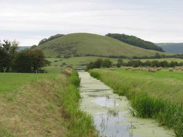
Draycott Moor, located in Somerset, England, is a picturesque area characterized by its unique combination of downs and moorland landscapes. Covering an expansive area, this natural marvel showcases the stunning beauty of the English countryside and offers a diverse range of habitats for various flora and fauna.

The moorland section of Draycott Moor is a sight to behold, with its vast stretches of open land covered in heather and grasses, accentuated by scattered patches of gorse bushes. This habitat is home to a wide array of bird species, such as skylarks, stonechats, and wheatears, which can be spotted darting through the open spaces or perched on the moorland vegetation.

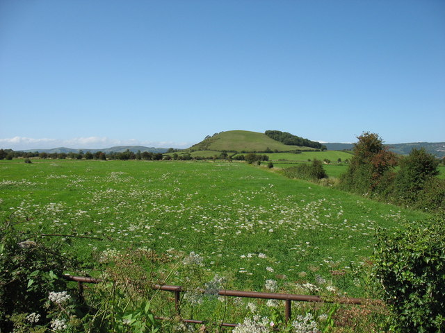
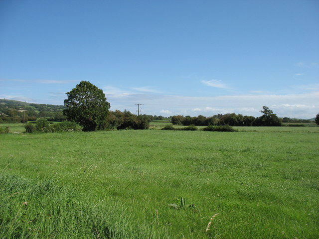
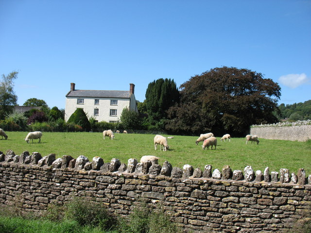
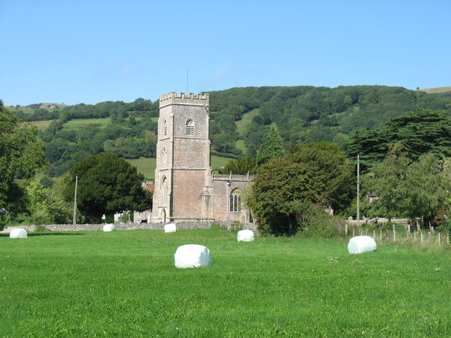
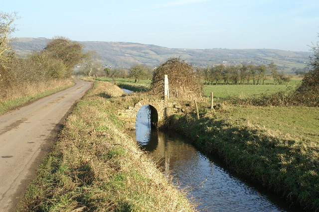
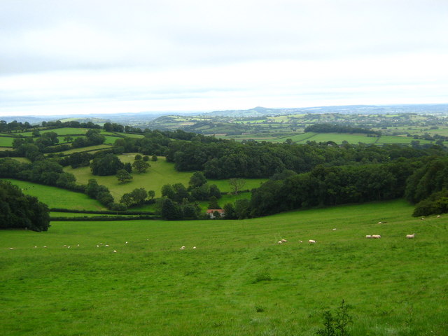
In contrast, the downs section of Draycott Moor presents a different landscape, featuring rolling hills and lush green pastures. The area is dotted with ancient hedgerows, adding to the charm of this idyllic countryside. The downs provide ample grazing opportunities for local livestock, including sheep and cattle, which add to the pastoral beauty of the region.

Draycott Moor is a popular destination for nature enthusiasts and hikers due to its extensive network of walking trails, providing stunning views of the surrounding countryside. Visitors can explore the various habitats and revel in the tranquility offered by this rural gem. The moorland and downs of Draycott Moor truly showcase the natural splendor of Somerset and provide a haven for both wildlife and humans alike.

If you have any feedback on the listing, please let us know in the comments section below.

Draycott Moor Images

Images are sourced within 2km of 51.245156/-2.7695263 or Grid Reference ST4649. Thanks to Geograph Open Source API. All images are credited.

Bartlett's Bridge This bridge crosses the River Axe. The farm beyond is Riverside Farm, and I imagine (though I do not know) that the geese and chickens in the foreground belong to that farm.
Bartlett's Bridge
This bridge crosses the River Axe. The farm beyond is Riverside Farm, and I imagine (though I do not know) that the geese and chickens in the foreground belong to that farm.
Hixham Rhyne This photo is taken from the road junction with Culvert Drove, and is looking as close to due north (grid) as one can get. The 76m hill (quite significant in the Somerset Levels) is Nyland Hill, one square north in <a href="https://www.geograph.org.uk/gridref/ST4550">ST4550</a>.
Hixham Rhyne
This photo is taken from the road junction with Culvert Drove, and is looking as close to due north (grid) as one can get. The 76m hill (quite significant in the Somerset Levels) is Nyland Hill, one square north in ST4550.
Draycott Moor Part of the Somerset Levels. Nyland Hill is in the distance.
Draycott Moor
Part of the Somerset Levels. Nyland Hill is in the distance.
Stoke Moor On the Somerset Levels.
Stoke Moor
On the Somerset Levels.
In Rodney Stoke
In Rodney Stoke
St Leonard's church, Rodney Stoke
River Axe This man-made water way is part of the River Axe drainage system.
The view is seen from Bartlett's Bridge.
River Axe
This man-made water way is part of the River Axe drainage system. The view is seen from Bartlett's Bridge.
River Axe at Bartlett's Bridge This view looking south shows it passing Riverside Farm.
River Axe at Bartlett's Bridge
This view looking south shows it passing Riverside Farm.
Bridge Farm Entrance This farm, named after the adjacent Bartlett's Bridge, is by the River Axe.
Bridge Farm Entrance
This farm, named after the adjacent Bartlett's Bridge, is by the River Axe.
Bartlett's Bridge This stone bridge over part of the River Axe system, gives its name to this small area.
Bartlett's Bridge
This stone bridge over part of the River Axe system, gives its name to this small area.
Entrance to Riverside Farm This is at Bartlett's Bridge on the River Axe drainage system.
Entrance to Riverside Farm
This is at Bartlett's Bridge on the River Axe drainage system.
St Leonard's church, Rodney Stoke - monument to Sir Edward Rodney This monument has two oval recesses featuring the busts of Sir Edward Rodney (†1657) and his wife (†1659) under a canopy with a raised curtain. They are flanked left and right by two seated angels, a third sits on a cloud below the canopy. It was Sir Edward who gave the church its chancel screen, pulpit, and font cover.
St Leonard's church, Rodney Stoke - monument to Sir Edward Rodney
This monument has two oval recesses featuring the busts of Sir Edward Rodney (†1657) and his wife (†1659) under a canopy with a raised curtain. They are flanked left and right by two seated angels, a third sits on a cloud below the canopy. It was Sir Edward who gave the church its chancel screen, pulpit, and font cover.
St Leonard's church, Rodney Stoke - monument to Anne Lakes This monument in the north chapel is to Anne Lakes (†1630), wife of George Rodney and daughter of Sir Thomas Lakes of Channons in Middlesex. Her effigy in alabaster lies on top of a sarcophagus base below a delicate arch supported by Ionic columns. The arch is decorated inside with stars and clouds.
St Leonard's church, Rodney Stoke - monument to Anne Lakes
This monument in the north chapel is to Anne Lakes (†1630), wife of George Rodney and daughter of Sir Thomas Lakes of Channons in Middlesex. Her effigy in alabaster lies on top of a sarcophagus base below a delicate arch supported by Ionic columns. The arch is decorated inside with stars and clouds.
St Leonard's church, Rodney Stoke - monument to Anne Lakes (2) detail
St Leonard's church, Rodney Stoke - monument to Anne Lakes (3) detail
St Leonard's church, Rodney Stoke - monument to George Rodney The monument to George Rodney (†1651) shows him as the demi-figure in a shroud rising from a coffin set between two earth -bound putti. An angel in the clouds in the open segmental pediment blows a trumpet. The base plinth is decorated with strapwork.
St Leonard's church, Rodney Stoke - monument to George Rodney
The monument to George Rodney (†1651) shows him as the demi-figure in a shroud rising from a coffin set between two earth -bound putti. An angel in the clouds in the open segmental pediment blows a trumpet. The base plinth is decorated with strapwork.
Little arched bridge over a Rhyne
Show me another place!

Draycott Moor is located at Grid Ref: ST4649 (Lat: 51.245156, Lng: -2.7695263)

Administrative County: Somerset

District: Mendip

Police Authority: Avon and Somerset

What 3 Words

///bath.kingdom.marmalade. Near Draycott, Somerset

Nearby Locations

Stoke Moor Draycott Moor

Related Wikis

Draycott railway station

Draycott railway station was a station on the Bristol and Exeter Railway's Cheddar Valley line in Draycott, Somerset. The station was opened with the extension...

Draycott, Somerset

Draycott is a village in Somerset, England, neighbouring the village of Cheddar on the southern edge of the Mendip Hills Area of Outstanding Natural Beauty...

Rodney Stoke

Rodney Stoke is a small village and civil parish, located at grid reference ST486501, 5 miles north-west of Wells, in the English county of Somerset. The...

Cheddar Ales

Cheddar Ales is an independent, artisanal brewery located in the village of Cheddar in Somerset, England, which produces a range of regular and seasonal...

Draycott Sleights

Draycott Sleights (grid reference ST483518) is a 61.95 hectares (153.1 acres) biological Site of Special Scientific Interest at Draycott in the Mendip...

Rodney Stoke SSSI

Rodney Stoke (grid reference ST492507) is a 69.6 hectare (172.0 acre) biological Site of Special Scientific Interest, just north of the village of Rodney...

Cheddar A.F.C.

Cheddar Association Football Club is a football club based in Cheddar, near Wells in Somerset, England. They are currently members of the Western League...

St Andrew's Church, Cheddar

The Church of St Andrew in Cheddar, Somerset, England dates from the 14th century and has been designated as a Grade I listed building.The church was restored...

Related Videos

bucklegrove holiday park Cheddar Somerset

We booked for two nights at Bucklegrove Holiday Park, Cheddar, Somerset. On our way up to the NEC Motorhome and Caravan ...

BUCKLEGROVE HOLIDAY PARK CHEDDAR, Not so good! #bucklegrove

We booked for two nights at #BucklegroveHolidayPark, #Cheddar, #Somerset. On our way up to the NEC Motorhome and ...

Draycott to Wookey Hole (West Mendip Way #4)

Sunday 9th January 2022 My final instalment in my series of walking the West Mendip Way. Officially, the route continues a bit ...

Across Cow Free Fields at The Moment, Part VI,'Briefly Passing Thru Westbury & Stoke Camps'

Another Re-visit to Westbury Beacon on the Rodney Stoke Nature Reserve but approaching from the East on this occasion as part ...

Nearby Amenities

Located within 500m of 51.245156,-2.7695263
Draycott Moor
Place: locality
Lat/Long: 51.2464149/-2.7685653
The data included in this document is from www.openstreetmap.org. The data is made available under ODbL.

Have you been to Draycott Moor?

Leave your review of Draycott Moor below (or comments, questions and feedback).