Black Moss

Downs, Moorland in Aberdeenshire

Scotland

Black Moss

Pheasants in the Road In the mornings there are usually upwards of 200 pheasants on and near the road. Between pheasants and potholes there is no temptation to drive at much more than walking pace.
Pheasants in the Road Credit: Anne Burgess

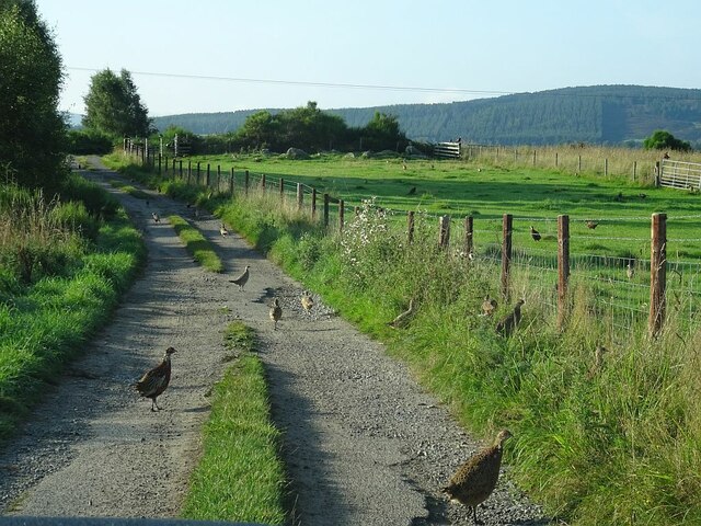
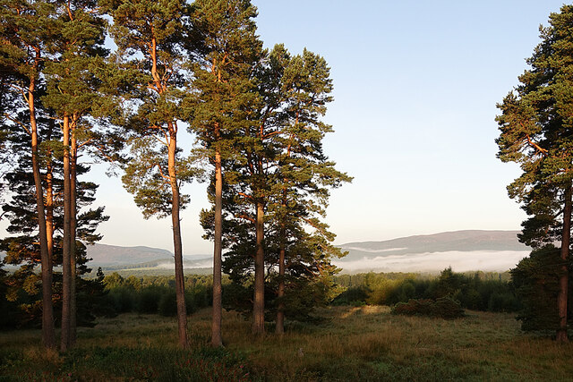
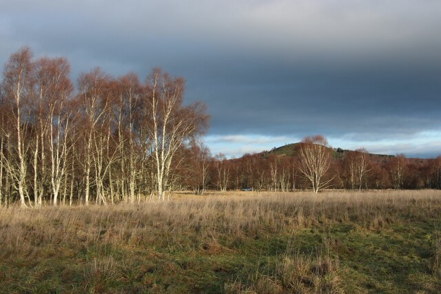
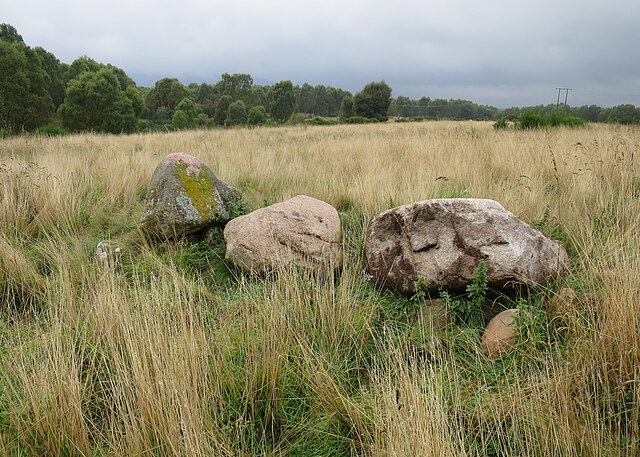
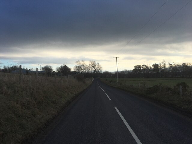
Black Moss is a remote and rugged area located in Aberdeenshire, Scotland. It is characterized by its vast expanses of dark, peaty moorland that stretch out as far as the eye can see. The landscape is dotted with patches of heather and gorse, adding a splash of color to the otherwise barren terrain.

The area is known for its harsh weather conditions, with strong winds and frequent rain showers creating a challenging environment for both wildlife and visitors alike. Despite the harsh conditions, Black Moss is home to a variety of plant and animal species, including red deer, grouse, and various species of birds.

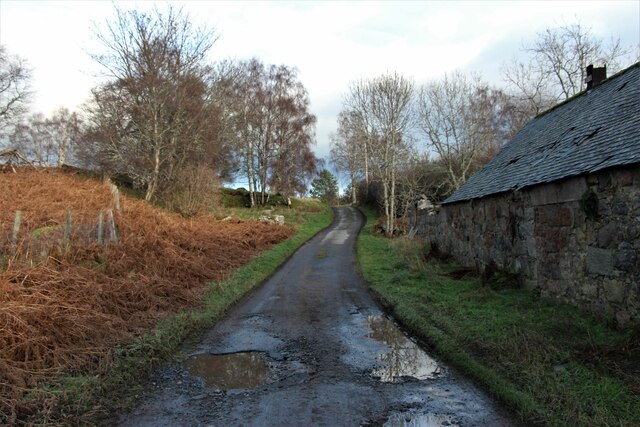
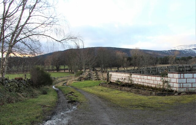
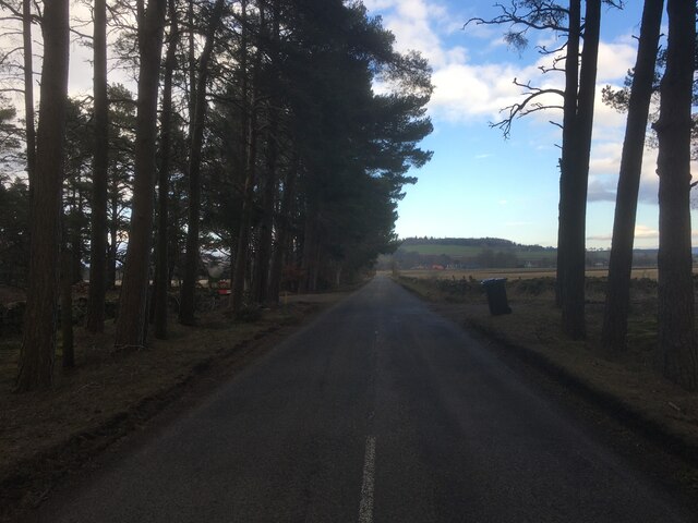
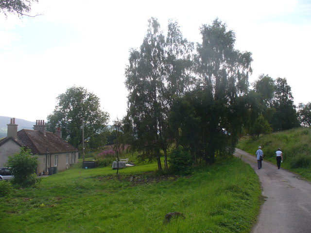
The moorland is crisscrossed with walking trails and footpaths, making it a popular destination for hikers and nature enthusiasts looking to explore the remote beauty of the Scottish countryside. Visitors can take in stunning views of the surrounding hills and valleys, and may even catch a glimpse of the elusive Scottish wildcat or golden eagle.

Overall, Black Moss is a wild and untamed landscape that offers a unique and immersive experience for those willing to brave the elements and explore its rugged beauty.

If you have any feedback on the listing, please let us know in the comments section below.
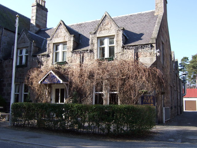
Black Moss Images

Images are sourced within 2km of 57.100712/-2.890326 or Grid Reference NJ4601. Thanks to Geograph Open Source API. All images are credited.

Pheasants in the Road In the mornings there are usually upwards of 200 pheasants on and near the road. Between pheasants and potholes there is no temptation to drive at much more than walking pace.
Pheasants in the Road
In the mornings there are usually upwards of 200 pheasants on and near the road. Between pheasants and potholes there is no temptation to drive at much more than walking pace.
Morning Mist Morning mist lies on the low ground north of Deeside.
Morning Mist
Morning mist lies on the low ground north of Deeside.
Winter birch woods at Dinnet
Road at Kinord cottages
Stones A friend had noticed a stone in the field, and wondered if it could be a standing stone. On investigation, however, they proved to be boulders cleared from the adjacent field.
Stones
A friend had noticed a stone in the field, and wondered if it could be a standing stone. On investigation, however, they proved to be boulders cleared from the adjacent field.
Path round Little Ord
Looking through birches to Monandavan
Timber outbuilding at Ordie Bakery House
Track to Greenhaugh, Ordie
B9119 road at Milton of Logie
A97 towards Dinnet
A97 towards Dinnet
B9119 near Milton of Logie
New Kinord A farm road leads from a small car park towards the Muir of Dinnet National Nature Reserve and Loch Kinord.
<span class="nowrap"><a title="http://www.nnr-scotland.org.uk/muir-of-dinnet/" rel="nofollow ugc noopener" href="http://www.nnr-scotland.org.uk/muir-of-dinnet/">Link</a><img style="margin-left:2px;" alt="External link" title="External link - shift click to open in new window" src="https://s1.geograph.org.uk/img/external.png" width="10" height="10"/></span>
New Kinord
A farm road leads from a small car park towards the Muir of Dinnet National Nature Reserve and Loch Kinord. LinkExternal link
Boggy Ground (west) This patch of ground is the lowest point between Mullochdhu to the north and Tomachallich to the south. None of the maps shows a burn, but there is a pipe  which links the bog on this side with the bog on the other side of the track here. It's not obvious which way the water runs, but probably towards the west. See <a href="https://www.geograph.org.uk/photo/2594433">NJ4700 : Boggy Ground (east)</a> for the opposite view.
Boggy Ground (west)
This patch of ground is the lowest point between Mullochdhu to the north and Tomachallich to the south. None of the maps shows a burn, but there is a pipe which links the bog on this side with the bog on the other side of the track here. It's not obvious which way the water runs, but probably towards the west. See NJ4700 : Boggy Ground (east) for the opposite view.
Boggy Ground (east) This patch of ground is the lowest point between Mullochdhu to the north and Tomachallich to the south. None of the maps shows a burn, but there is a pipe  which links the bog on this side with the bog on the other side of the track here. It's not obvious which way the water flows, but probably westwards. See <a href="https://www.geograph.org.uk/photo/2594417">NJ4700 : Boggy Ground (west)</a> for the opposite view.
Boggy Ground (east)
This patch of ground is the lowest point between Mullochdhu to the north and Tomachallich to the south. None of the maps shows a burn, but there is a pipe which links the bog on this side with the bog on the other side of the track here. It's not obvious which way the water flows, but probably westwards. See NJ4700 : Boggy Ground (west) for the opposite view.
Near Knockenzie Looking down from the drier ground near Knockenzie over tussocky grass to the boggy dip between Tomachallich and Mullochdhu.
Near Knockenzie
Looking down from the drier ground near Knockenzie over tussocky grass to the boggy dip between Tomachallich and Mullochdhu.
Near Knockenzie The track on the left leads down to the boggy ground below Knockenzie. The clearing offers a good view across to the hills south of the River Dee, including Mount Keen.
Near Knockenzie
The track on the left leads down to the boggy ground below Knockenzie. The clearing offers a good view across to the hills south of the River Dee, including Mount Keen.
Near Knockenzie I'm not sure whether the flattened pile of stones is the remains of a house, the remains of a cairn, a natural phenomenon, or a heap of stones taken off a field. There are several cairns around here, and the old maps show no building here, so I speculate that it is a former cairn.
Near Knockenzie
I'm not sure whether the flattened pile of stones is the remains of a house, the remains of a cairn, a natural phenomenon, or a heap of stones taken off a field. There are several cairns around here, and the old maps show no building here, so I speculate that it is a former cairn.
Show me another place!

Black Moss is located at Grid Ref: NJ4601 (Lat: 57.100712, Lng: -2.890326)

Unitary Authority: Aberdeenshire

Police Authority: North East

What 3 Words

///overhead.detonated.curtail. Near Aboyne, Aberdeenshire

Nearby Locations

Black Moss

Related Wikis

Loch Davan

Loch Davan is a small, triangular, freshwater loch approximately 5 mi (8.0 km) northeast of Ballater, Scotland and lying immediately north of Loch Kinord...

Dinnet

Dinnet (Scottish Gaelic, Dùnaidh) is a village in the Marr area of Aberdeenshire, Scotland. Approximately equidistant from Deeside towns Aboyne and Ballater...

Dinnet railway station

Dinnet railway station was opened on 17 October 1866 by the Aboyne and Braemar Railway and served Dinnet village from 1899 to 1966 as an intermediate station...

Kinord Castle

Kinord Castle, also known as Loch Kinord Castle, was a 14th-century castle on Castle Island in Loch Kinord to the south of Old Kinord, Aberdeenshire, Scotland...

Nearby Amenities

Located within 500m of 57.100712,-2.890326
Power: pole
Lat/Long: 57.1046323/-2.8931337
Power: pole
Lat/Long: 57.1041742/-2.8936902
Power: pole
Lat/Long: 57.1037639/-2.8941888
Power: pole
Lat/Long: 57.1033426/-2.8946697
Power: pole
Lat/Long: 57.1027504/-2.8949694
Power: pole
Lat/Long: 57.1021828/-2.8952565
Power: pole
Lat/Long: 57.1015687/-2.8955561
Power: pole
Lat/Long: 57.1009738/-2.8958709
Power: pole
Lat/Long: 57.1003583/-2.8961882
Power: pole
Lat/Long: 57.0997879/-2.8964929
Power: pole
Lat/Long: 57.0991601/-2.8968051
Power: pole
Lat/Long: 57.0985746/-2.8971073
Power: pole
Lat/Long: 57.10414/-2.895055
Power: pole
Lat/Long: 57.0997875/-2.8964749
Power: pole
Lat/Long: 57.1000652/-2.8974924
Power: pole
Lat/Long: 57.1003374/-2.89842
The data included in this document is from www.openstreetmap.org. The data is made available under ODbL.

Have you been to Black Moss?

Leave your review of Black Moss below (or comments, questions and feedback).