Black House Common

Downs, Moorland in Herefordshire

England

Black House Common

Yewtree Farm
Yewtree Farm Credit: P Gaskell

Black House Common is a picturesque area located in Herefordshire, England. Situated amidst the stunning Downs and Moorland landscapes, this region offers a tranquil and idyllic setting for nature lovers and outdoor enthusiasts.

The area's name is derived from the presence of several traditional black houses scattered across the common. These historic dwellings, made of locally sourced dark stone, add a touch of charm to the surroundings and provide a glimpse into the region's rich history.

Black House Common is known for its diverse and unspoiled natural beauty. The Downs provide rolling hills and expansive meadows, adorned with vibrant wildflowers during the summer months. The moorland, on the other hand, offers a more rugged and untamed landscape, with rocky outcrops and heather-covered hills creating a dramatic backdrop.

The common is home to a wide array of flora and fauna, making it a haven for wildlife enthusiasts. Various species of birds, including skylarks and buzzards, can be spotted soaring through the skies, while ground-nesting birds, such as curlews and lapwings, find sanctuary amidst the tall grasses.

For those seeking outdoor activities, Black House Common offers numerous walking and hiking trails, allowing visitors to explore the area's natural wonders at their own pace. The peaceful atmosphere and breathtaking vistas make it an ideal destination for those looking to escape the hustle and bustle of city life.

In summary, with its historic black houses, stunning Downs, and rugged moorland, Black House Common is a true gem in Herefordshire, providing a haven of natural beauty and tranquility for all to enjoy.

If you have any feedback on the listing, please let us know in the comments section below.

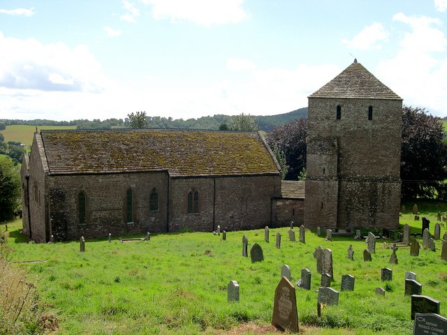
Black House Common Images

Images are sourced within 2km of 51.899403/-2.7904097 or Grid Reference SO4522. Thanks to Geograph Open Source API. All images are credited.

Yewtree Farm
Yewtree Farm
The Monnow Valley near Garway Looking across the valley to Craig Syr Yrddin.
The Monnow Valley near Garway
Looking across the valley to Craig Syr Yrddin.
Lane near Garway and Beech Lodge
The Monnow Valley near Garway Box Farm on the hillside near the centre of the picture.
The Monnow Valley near Garway
Box Farm on the hillside near the centre of the picture.
Former village hall (Garway) The former village hall opposite the primary school was possibly built as a mission room in the early 20th century. The building was abandoned when a new village hall/community centre was built in 2018, and the derelict condition is reminiscent of the former primary school across the road.
Former village hall (Garway)
The former village hall opposite the primary school was possibly built as a mission room in the early 20th century. The building was abandoned when a new village hall/community centre was built in 2018, and the derelict condition is reminiscent of the former primary school across the road.
The Old School (Garway) Built in 1877, this building housed the primary school in Garway for many decades until a new school building was built opposite in 1963. The building has remained derelict since and was threatened with demolition in June 2021 and March 2022.
The Old School (Garway)
Built in 1877, this building housed the primary school in Garway for many decades until a new school building was built opposite in 1963. The building has remained derelict since and was threatened with demolition in June 2021 and March 2022.
Garway Baptist Chapel The Baptist chapel at Garway was built in the late 18th or early 19th century, and was given alterations in the late 19th century. Grade II listed in April 1986, this is one of the few active Baptist chapels in Herefordshire as of 2022.
Garway Baptist Chapel
The Baptist chapel at Garway was built in the late 18th or early 19th century, and was given alterations in the late 19th century. Grade II listed in April 1986, this is one of the few active Baptist chapels in Herefordshire as of 2022.
Entrance gates to St. Michael's church (Garway) These wrought iron gates have well-designed patterns on them, and these gates provide the main entrance to Garway parish church from the north-west.
Entrance gates to St. Michael's church (Garway)
These wrought iron gates have well-designed patterns on them, and these gates provide the main entrance to Garway parish church from the north-west.
Lane to St. Michael's church (Garway) This country lane heads a few yards to the east that becomes a dead end at St. Michael's parish church.
Lane to St. Michael's church (Garway)
This country lane heads a few yards to the east that becomes a dead end at St. Michael's parish church.
St. Michael's church (Garway) Here is the parish church of St. Michael in Garway, built in 1180 by the Knights Templar. There was a monastery established here in 615 AD, and the parish church was described by Nikolaus Pevsner as "uncommonly interesting". Built in the 13th and 17th centuries, it remained untouched by Victorian restoration. The original round structure of 1180 by the Knights Templar was unearthed in 1927, and the parish church received grade I listed status in March 1960.
St. Michael's church (Garway)
Here is the parish church of St. Michael in Garway, built in 1180 by the Knights Templar. There was a monastery established here in 615 AD, and the parish church was described by Nikolaus Pevsner as "uncommonly interesting". Built in the 13th and 17th centuries, it remained untouched by Victorian restoration. The original round structure of 1180 by the Knights Templar was unearthed in 1927, and the parish church received grade I listed status in March 1960.
Sign to Garway church The Knights Templar cross a reminder that they founded the church in the twelfth century.
Sign to Garway church
The Knights Templar cross a reminder that they founded the church in the twelfth century.
St Michael's church, Garway The phenomenal square tower of Garway church was clearly of military use in this disputed borderland.
St Michael's church, Garway
The phenomenal square tower of Garway church was clearly of military use in this disputed borderland.
Garway Church from the Monnow Way Taken from the near the seat on the Monnow Way between Box Farm and Skenfrith.
Garway Church from the Monnow Way
Taken from the near the seat on the Monnow Way between Box Farm and Skenfrith.
Trevonny Farm Farm is on the Three Castles Walk, seen here from higher up on the Monnow Way.
Trevonny Farm
Farm is on the Three Castles Walk, seen here from higher up on the Monnow Way.
Entrance to Great Demesne This is a recreation of the first picture uploaded to Geograph in this grid square which was taken in December 2005 <a href="https://www.geograph.org.uk/photo/101799">SO4422 : Demesne Farm, Garway</a> since then some of the poplar trees have been lost and some young replacement trees have been planted.
Entrance to Great Demesne
This is a recreation of the first picture uploaded to Geograph in this grid square which was taken in December 2005 SO4422 : Demesne Farm, Garway since then some of the poplar trees have been lost and some young replacement trees have been planted.
View to Garway Hill View to Garway Hill from the road passing through the Monnow valley.
View to Garway Hill
View to Garway Hill from the road passing through the Monnow valley.
Tower of Garway church The tower of St Michael's church, once a detached tower which is a feature of some churches in Herefordshire.  Later the nave of the church was connected by a slype or corridor.  The church is Grade I, see: <span class="nowrap"><a title="https://historicengland.org.uk/listing/the-list/list-entry/1099751?section=official-list-entry" rel="nofollow ugc noopener" href="https://historicengland.org.uk/listing/the-list/list-entry/1099751?section=official-list-entry">Link</a><img style="margin-left:2px;" alt="External link" title="External link - shift click to open in new window" src="https://s1.geograph.org.uk/img/external.png" width="10" height="10"/></span>
Tower of Garway church
The tower of St Michael's church, once a detached tower which is a feature of some churches in Herefordshire. Later the nave of the church was connected by a slype or corridor. The church is Grade I, see: LinkExternal link
Show me another place!

Black House Common is located at Grid Ref: SO4522 (Lat: 51.899403, Lng: -2.7904097)

Unitary Authority: County of Herefordshire

Police Authority: West Mercia

What 3 Words

///demoted.soups.lock. Near Llanrothal, Herefordshire

Related Wikis

Garway

Garway is a civil parish in south-west Herefordshire, England. The population of the civil parish was 430 at the 2011 census. It is set on a hillside...

Archenfield

Archenfield (Old English: Ircingafeld, Middle English: "Irchenfield") is the historic English name for an area of southern and western Herefordshire in...

Battle of Pencon

The Battle of Pencon or Pencoed was a battle won by the Britons (modern Welsh), possibly against the Mercians or against themselves, around the year 720...

Lower Dyffryn House, Grosmont

Lower Dyffryn House, Grosmont, Monmouthshire is a farmhouse dating from the 16th century. Owned by a Sheriff of Monmouthshire in the early 1600s, it was...

Nearby Amenities

Located within 500m of 51.899403,-2.7904097
Post Office
Garway Post Office
Addr City: Hereford
Addr Housename: Garway Village Hall
Addr Postcode: HR2 8RQ
Addr Village: Garway
Fixme: verify by survey
Opening Hours: Tu 09:00-11:00
Ref Pol Id: 114470
Source: pol_branch_list_2018-02
Lat/Long: 51.9002246/-2.7849341
Generator Method: photovoltaic
Generator Output Electricity: yes
Generator Source: solar
Generator Type: solar_photovoltaic_panel
Location: roof
Power: generator
Lat/Long: 51.8993165/-2.7958703
The data included in this document is from www.openstreetmap.org. The data is made available under ODbL.

Have you been to Black House Common?

Leave your review of Black House Common below (or comments, questions and feedback).