Balivanich

Settlement in Inverness-shire

Scotland

Balivanich

Ruin of St Mary's Chapel, Nunton <span class="nowrap"><a title="https://canmore.org.uk/site/9972/benbecula-nunton-ruin-of-st-marys-chapel" rel="nofollow ugc noopener" href="https://canmore.org.uk/site/9972/benbecula-nunton-ruin-of-st-marys-chapel">Link</a><img style="margin-left:2px;" alt="External link" title="External link - shift click to open in new window" src="https://s1.geograph.org.uk/img/external.png" width="10" height="10"/></span>
Ruin of St Mary's Chapel, Nunton Credit: Sandy Gerrard

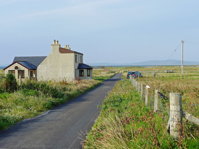
Balivanich is a small village located in the Inverness-shire region of Scotland. Situated on the Isle of Benbecula, it is part of the Western Isles Council area. With a population of around 1,000 residents, Balivanich serves as a vital administrative and commercial center for the island.

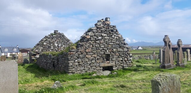
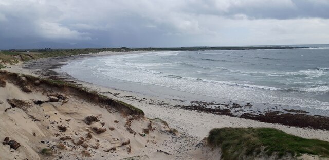
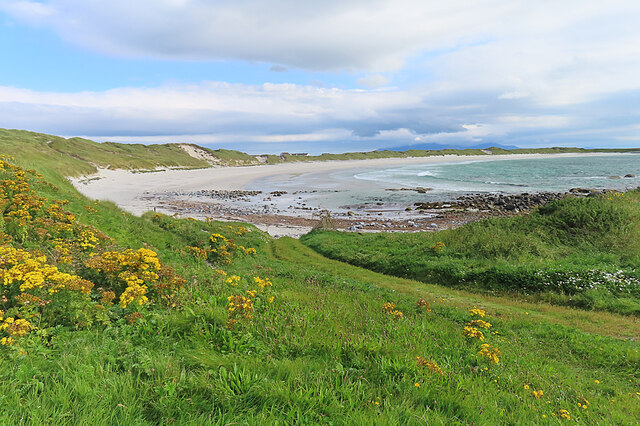
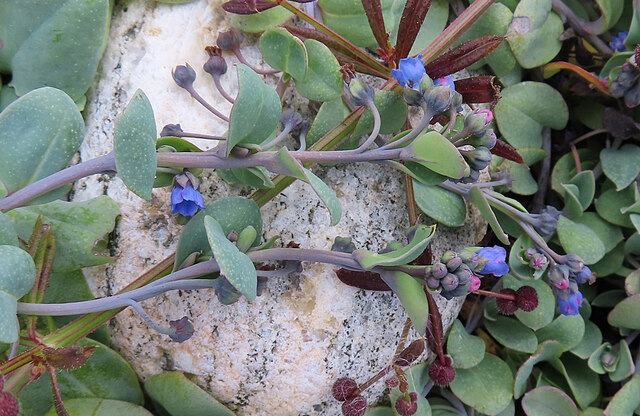
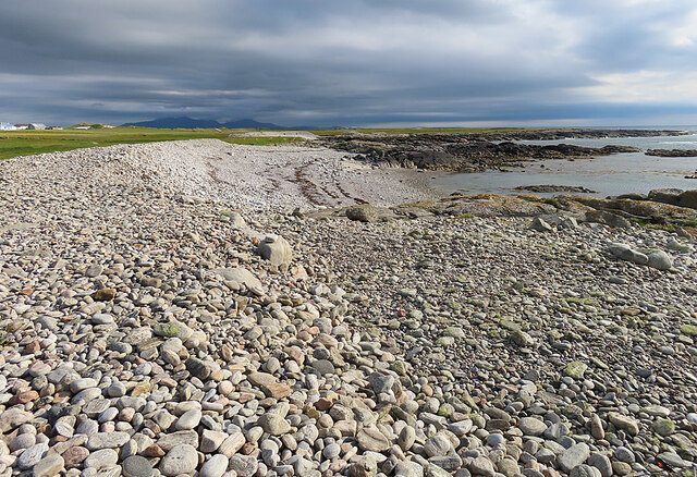
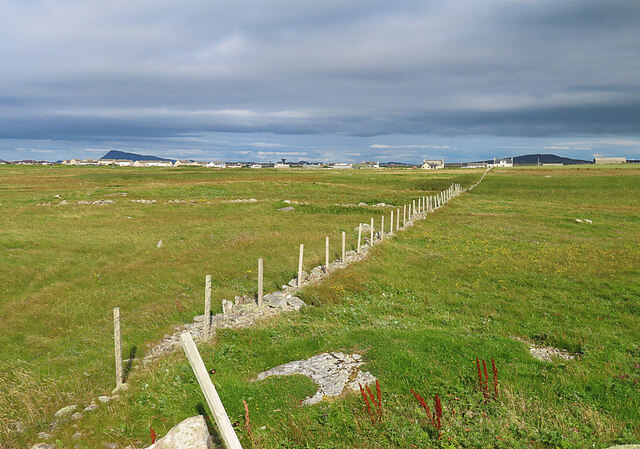
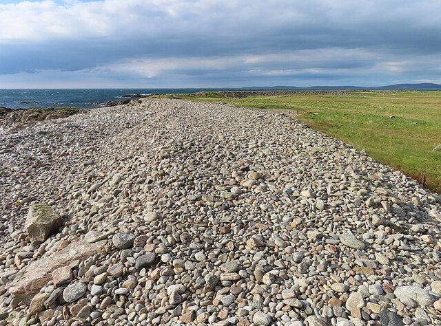
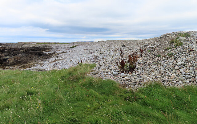
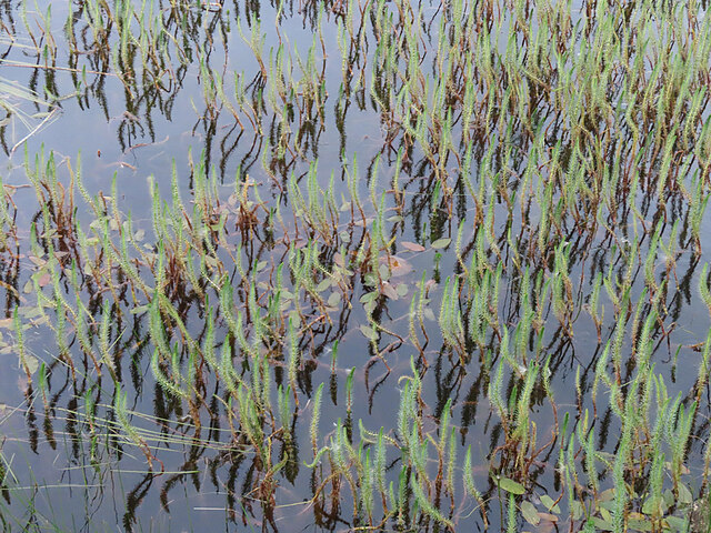
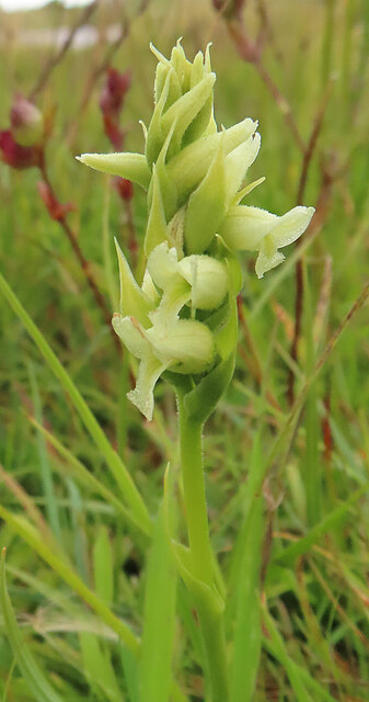
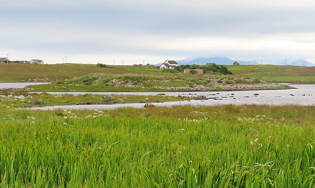
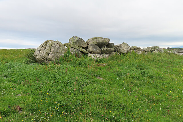
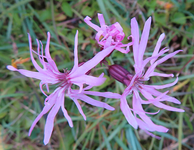
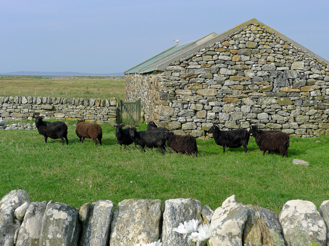
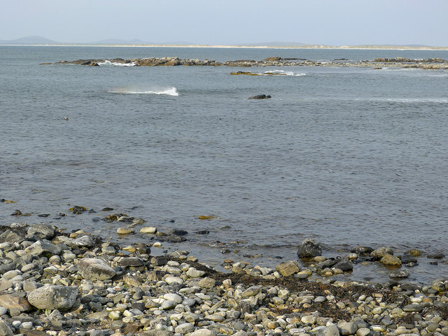
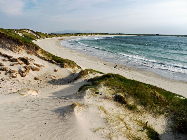
The village is known for its picturesque setting, surrounded by beautiful landscapes of rolling hills, sandy beaches, and crystal-clear blue waters. Balivanich offers stunning views of the neighboring islands, making it a popular tourist destination for nature lovers and outdoor enthusiasts.

Despite its small size, Balivanich boasts a range of essential amenities. The village is home to a variety of shops, including grocery stores, boutiques, and gift shops, providing residents and visitors with convenient access to daily necessities and local products. Additionally, there are several cafes, restaurants, and pubs, offering a taste of traditional Scottish cuisine and a cozy atmosphere to relax and socialize.

Balivanich is also home to a primary school, providing education to the local children. For secondary education, students typically commute to nearby islands or the mainland. The village is well-connected by road, with regular bus services linking it to other parts of Benbecula and the wider Western Isles.

The area surrounding Balivanich offers a range of recreational activities. Outdoor enthusiasts can enjoy hiking, fishing, and birdwatching in the nearby nature reserves and coastal areas. The village is also known for its traditional music scene, with regular performances and ceilidhs taking place, showcasing the rich cultural heritage of the Scottish Highlands.

Overall, Balivanich is a charming village that offers a peaceful and scenic getaway, combining natural beauty with essential amenities for both residents and visitors.

If you have any feedback on the listing, please let us know in the comments section below.

Balivanich Images

Images are sourced within 2km of 57.473388/-7.3784008 or Grid Reference NF7755. Thanks to Geograph Open Source API. All images are credited.

Ruin of St Mary's Chapel, Nunton <span class="nowrap"><a title="https://canmore.org.uk/site/9972/benbecula-nunton-ruin-of-st-marys-chapel" rel="nofollow ugc noopener" href="https://canmore.org.uk/site/9972/benbecula-nunton-ruin-of-st-marys-chapel">Link</a><img style="margin-left:2px;" alt="External link" title="External link - shift click to open in new window" src="https://s1.geograph.org.uk/img/external.png" width="10" height="10"/></span>
Ruin of St Mary's Chapel, Nunton
Sand Dunes at Culla Bay
BEA Vickers Viscount at Benbecula Airfield
Culla Bay One of the many fine sandy beaches on the west side of na h-Eileanan an Iar.
Culla Bay
One of the many fine sandy beaches on the west side of na h-Eileanan an Iar.
Oyster Plant (Mertensia maritima) This is a plant of northern latitudes, commoner on the east coast than here on the west. Its range is shrinking, to the extent that it no longer occurs in England and Wales, and this is the only site currently known in the Western Isles. See <span class="nowrap"><a title="https://plantatlas2020.org/atlas/2cd4p9h.906" rel="nofollow ugc noopener" href="https://plantatlas2020.org/atlas/2cd4p9h.906">Link</a><img style="margin-left:2px;" alt="External link" title="External link - shift click to open in new window" src="https://s1.geograph.org.uk/img/external.png" width="10" height="10"/></span> for discussion of its range.
Oyster Plant (Mertensia maritima)
This is a plant of northern latitudes, commoner on the east coast than here on the west. Its range is shrinking, to the extent that it no longer occurs in England and Wales, and this is the only site currently known in the Western Isles. See LinkExternal link for discussion of its range.
Storm Beach The berm of shingle and pebbles is a storm beach thrown up during westerly storms.
Storm Beach
The berm of shingle and pebbles is a storm beach thrown up during westerly storms.
Looking towards Aird The foreground field is in this square, but the houses are in the next square. On the horizon, at left, is the distinctive outline of Theacla on South Uist.
Looking towards Aird
The foreground field is in this square, but the houses are in the next square. On the horizon, at left, is the distinctive outline of Theacla on South Uist.
Storm Beach The berm of shingle and pebbles is a storm beach thrown up during westerly storms.
Storm Beach
The berm of shingle and pebbles is a storm beach thrown up during westerly storms.
Storm Beach The berm of shingle and pebbles is a storm beach thrown up during westerly storms.
Storm Beach
The berm of shingle and pebbles is a storm beach thrown up during westerly storms.
Marestail (Hippuris vulgaris) A plant that always grows in water, for once conveniently close enough to the land to be photographed.
Marestail (Hippuris vulgaris)
A plant that always grows in water, for once conveniently close enough to the land to be photographed.
Irish Lady's-tresses (Spiranthes romanzoffiana) A member of the orchid family, with a very western distribution.
Irish Lady's-tresses (Spiranthes romanzoffiana)
A member of the orchid family, with a very western distribution.
Dùn Buidhe The 'yellow fort' is on a peninsula, almost an islet, in Loch Dùn Mhurchaidh.
Dùn Buidhe
The 'yellow fort' is on a peninsula, almost an islet, in Loch Dùn Mhurchaidh.
Boulder Dyke On a peninsula in Loch Dùn Mhurchaidh.
Boulder Dyke
On a peninsula in Loch Dùn Mhurchaidh.
Ragged Robin (Silene flos-cuculi) Previously known as Lychnis flos-cuculi.
Ragged Robin (Silene flos-cuculi)
Previously known as Lychnis flos-cuculi.
Hebridean Sheep at Airdbheag, Benbecula Dry stone walling events have been held at Airdbheag and there is evidence in the walls and stone buildings of the skills of dry-stone wallers.
Hebridean Sheep at Airdbheag, Benbecula
Dry stone walling events have been held at Airdbheag and there is evidence in the walls and stone buildings of the skills of dry-stone wallers.
Coastline at Aird The shore of Baleshare on North Uist can be seen across the water.
Coastline at Aird
The shore of Baleshare on North Uist can be seen across the water.
The road through Aird
Culla Bay Reputedly the best beach on Benbecula and worthy of visit any time of the year.  Spot the difference <a href="https://www.geograph.org.uk/photo/2902289">NF7654 : Dunes at the northern end of Culla Bay</a> an April visit compared to this September visit.
Culla Bay
Reputedly the best beach on Benbecula and worthy of visit any time of the year. Spot the difference NF7654 : Dunes at the northern end of Culla Bay an April visit compared to this September visit.
Show me another place!

Balivanich is located at Grid Ref: NF7755 (Lat: 57.473388, Lng: -7.3784008)

Unitary Authority: Na h-Eileanan an Iar

Police Authority: Highlands and Islands

Also known as: Baile a Mhanaich, Baile Mhanaich

What 3 Words

///comb.stiff.nags. Near Balivanich, Na h-Eileanan Siar

Related Wikis

Balivanich

Balivanich (Scottish Gaelic: Baile a' Mhanaich [palə ˈvanɪç]) is a village on the island of Benbecula in the Outer Hebrides off the west coast of Scotland...

Deep Sea Range

The Deep Sea Range is an RAF missile range in the Outer Hebrides. It has also been known as the Hebrides Guided Weapon Range and the South Uist Missile...

Uist and Barra Hospital

Ospadal Uibhist agus Bharraigh (Uist and Barra Hospital) is a community hospital in Benbecula which provides services on the islands of North Uist, South...

Benbecula Airport

Benbecula Airport (Scottish Gaelic: Port-adhair Bheinn na Faoghla) (IATA: BEB, ICAO: EGPL) is located on the island of Benbecula in the Outer Hebrides...

Nunton, Benbecula

Nunton (Scottish Gaelic: Baile nan Cailleach) is a settlement on Benbecula in the Outer Hebrides, Scotland. Nunton is within the parish of South Uist,...

Uachdar

Uachdar (Scottish Gaelic: An t-Uachdar [ən̪ˠ ˈt̪ʰuəxkəɾ]) is a settlement on the Outer Hebridean Island of Benbecula. Uachdar is within the parish of South...

Uist

Uist is a group of six islands that are part of the Outer Hebridean Archipelago, which is part of the Outer Hebrides of Scotland. North Uist and South...

Benbecula

Benbecula ( ; Scottish Gaelic: Beinn nam Fadhla or Beinn na Faoghla) is an island of the Outer Hebrides in the Atlantic Ocean off the west coast of Scotland...

Nearby Amenities

Located within 500m of 57.473388,-7.3784008
Balivanich
Naptan AtcoCode: 6010731533
Naptan Bearing: N
Naptan BusStopType: CUS
Naptan CommonName: Balivanich
Naptan Indicator: MacGilverys Shop
Naptan Landmark: shop entrance
Naptan NaptanCode: 94723523
Naptan Street: MacGilverys Shop
Naptan Verified: no
Source: naptan_import
Lat/Long: 57.4739998/-7.3863939
Balivanich
Naptan AtcoCode: 6010731534
Naptan Bearing: E
Naptan BusStopType: CUS
Naptan CommonName: Balivanich
Naptan Indicator: Post Office
Naptan Landmark: near post office entrance
Naptan NaptanCode: 94723496
Naptan Street: Post Office
Naptan Verified: no
Source: naptan_import
Lat/Long: 57.4734301/-7.3783745
Aeroway: holding_position
Ref: A
Source: Bing
Lat/Long: 57.4758691/-7.3744036
Barrier: bollard
Bicycle: yes
Foot: yes
Lat/Long: 57.4737998/-7.3712834
Barrier: bollard
Bicycle: yes
Foot: yes
Lat/Long: 57.4738323/-7.3712758
Barrier: bollard
Bicycle: yes
Foot: yes
Lat/Long: 57.4738442/-7.3712469
Barrier: bollard
Bicycle: yes
Foot: yes
Lat/Long: 57.4738668/-7.3712332
Barrier: bollard
Bicycle: yes
Foot: yes
Lat/Long: 57.473896/-7.3712234
Barrier: bollard
Bicycle: yes
Foot: yes
Lat/Long: 57.4739217/-7.3712064
Barrier: bollard
Bicycle: yes
Foot: yes
Lat/Long: 57.4739422/-7.3711951
Barrier: bollard
Bicycle: yes
Foot: yes
Lat/Long: 57.4739657/-7.3711829
Barrier: bollard
Bicycle: yes
Foot: yes
Lat/Long: 57.4739796/-7.3705505
Barrier: bollard
Bicycle: yes
Foot: yes
Lat/Long: 57.4739909/-7.3711667
Barrier: bollard
Bicycle: yes
Foot: yes
Lat/Long: 57.4739953/-7.3706064
Barrier: bollard
Bicycle: yes
Foot: yes
Lat/Long: 57.4740153/-7.371153
Barrier: bollard
Bicycle: yes
Foot: yes
Lat/Long: 57.4740219/-7.3707051
Barrier: bollard
Bicycle: yes
Foot: yes
Lat/Long: 57.4740323/-7.3711425
Barrier: bollard
Bicycle: yes
Foot: yes
Lat/Long: 57.4740327/-7.37074
Barrier: bollard
Bicycle: yes
Foot: yes
Lat/Long: 57.4740493/-7.3707958
Barrier: bollard
Bicycle: yes
Foot: yes
Lat/Long: 57.4740541/-7.3711319
Barrier: bollard
Bicycle: yes
Foot: yes
Lat/Long: 57.4740576/-7.370842
Barrier: bollard
Bicycle: yes
Foot: yes
Lat/Long: 57.4740706/-7.3708825
Barrier: bollard
Bicycle: yes
Foot: yes
Lat/Long: 57.4740737/-7.3711182
Barrier: bollard
Bicycle: yes
Foot: yes
Lat/Long: 57.4740793/-7.3709198
Barrier: bollard
Bicycle: yes
Foot: yes
Lat/Long: 57.474088/-7.3709562
Barrier: bollard
Bicycle: yes
Foot: yes
Lat/Long: 57.4740946/-7.3711076
Barrier: bollard
Bicycle: yes
Foot: yes
Lat/Long: 57.4740989/-7.3710007
Barrier: bollard
Bicycle: yes
Foot: yes
Lat/Long: 57.4741094/-7.3710396
Barrier: bollard
Bicycle: yes
Foot: yes
Lat/Long: 57.4741133/-7.3710833
Balivanich
Bus: yes
Public Transport: stop_position
Lat/Long: 57.4732768/-7.377651
Barrier: cattle_grid
Lat/Long: 57.4728454/-7.3764217
Entrance: main
Lat/Long: 57.4728853/-7.3770003
Telephone
Booth: KX100
Covered: booth
Operator: BT
Payment Coins: yes
Lat/Long: 57.4730671/-7.3769533
Atm
Brand: Halifax
Opening Hours: 24/7
Operator: Bank of Scotland
Wheelchair: yes
Lat/Long: 57.4731196/-7.3781672
Shelter
Bench: yes
Shelter Type: public_transport
Lat/Long: 57.4732285/-7.3776749
Entrance: main
Lat/Long: 57.4733427/-7.386201
Man Made: tower
Lat/Long: 57.4730723/-7.3740191
Man Made: tower
Lat/Long: 57.4736558/-7.3756289
Barrier: cattle_grid
Lat/Long: 57.4738972/-7.3781599
Turning Circle
Lat/Long: 57.4745564/-7.3785243
Baile a' Mhanaich
Name En: Balivanich
Name Gd: Baile a' Mhanaich
Place: village
Population: 510
Wikidata: Q805000
Wikipedia: en:Balivanich
Lat/Long: 57.4740084/-7.3849146
Cafe
Island Kitchen Cafe
Addr City: Beinn na Faoghla
Addr City En: Benbecula
Addr Country: GB
Addr Postcode: HS7 5LW
Addr Suburb: Baile a 'Mhanaich
Addr Suburb En: Balivanich
Contact Facebook: https://www.facebook.com/Islandkitchenbenbeculaairport/
Lat/Long: 57.4738972/-7.3717933
Entrance: main
Lat/Long: 57.473857/-7.3717317
Business Gateway - Western Isles
Addr City: Beinn na Faoghla
Addr City En: Benbecula
Addr Country: GB
Addr Postcode: HS7 5LA
Addr Suburb: Baile a 'Mhanaich
Addr Suburb En: Balivanich
Government: yes
Office: government
Website: https://www.bgateway.com/local-offices/western-isles
Lat/Long: 57.4724143/-7.3769063
Fast Food
The Chinese Take Away
Cuisine: chinese
Fhrs Id: 806781
Takeaway: only
Lat/Long: 57.4724387/-7.3787141
Leisure: picnic_table
Lat/Long: 57.4738852/-7.371432
Macleod Insurance Services
Addr City: Beinn na Faoghla
Addr City En: Benbecula
Addr Country: GB
Addr Postcode: HS7 5LA
Addr Suburb: Baile a 'Mhanaich
Addr Suburb En: Balivanich
Office: insurance
Website: http://www.macleodinsurance.co.uk/
Lat/Long: 57.4725134/-7.3782655
Waste Basket
Lat/Long: 57.473426/-7.3861492
Bench
Backrest: yes
Material: wood
Seats: 4
Lat/Long: 57.4734555/-7.3861237
Bench
Backrest: yes
Material: wood
Seats: 4
Lat/Long: 57.4734392/-7.3861356
Finance Agent
Encompass Financial Services
Office: accountant
Website: http://www.encompass-fs.co.uk
Lat/Long: 57.473414/-7.3793437
Uist Property
Facebook: https://www.facebook.com/UistProperty
Office: estate_agent
Opening Hours: Mo-Fr 09:00-13:00, 13:30-17:00
Website: https://www.uistproperty.co.uk/
Lat/Long: 57.473427/-7.3792163
Charging Station
Capacity: 2
Fee: yes
Operator: ChargePlace Scotland
Operator Wikidata: Q105359316
Postal Code: HS7 5LA
Ref: 50254
Socket Type2: 2
Socket Type2 Output: 22 kW
Website: https://chargeplacescotland.org/cpmap/chargepoint/1972698/
Lat/Long: 57.4724456/-7.3767772
Pub
Low Flyer
Facebook: https://www.facebook.com/pages/Low-Flyer/227986673989259
Fhrs Id: 806468
Lat/Long: 57.4724425/-7.3788737
Access: yes
Entrance: yes
Lat/Long: 57.4728559/-7.3785723
Bicycle Parking
Access: customers
Bicycle Parking: stands
Capacity: 12
Lat/Long: 57.4724896/-7.3766328
Barrier: cattle_grid
Lat/Long: 57.4741679/-7.3840034
Barrier: cattle_grid
Lat/Long: 57.4731122/-7.3797105
Bank
Banca na h-Alba
Addr City: Beinn na Faoghla
Addr City En: Benbecula
Addr Country: GB
Addr Postcode: HS7 5LA
Addr Suburb: Baile a 'Mhanaich
Addr Suburb En: Balivanich
Atm: yes
Brand: Bank of Scotland
Brand Wikidata: Q627381
Contact Website: https://branches.bankofscotland.co.uk/isle-of-benbecula/balivanich
Name En: Bank of Scotland
Name Gd: Banca na h-Alba
Opening Hours: Mo-Fr 10:00-15:00
Operator: Bank of Scotland
Wheelchair: yes
Lat/Long: 57.4731403/-7.3780049
Telephone
Lat/Long: 57.4739161/-7.3719284
Post Box
Post Box Type: pillar
Ref: HS7 68
Lat/Long: 57.4735723/-7.3781599
Post Box
Lat/Long: 57.4738978/-7.3720677
Car Rental
Car Hire Hebrides
Website: https://www.carhire-hebrides.co.uk/
Lat/Long: 57.473908/-7.3718718
Toilets
Lat/Long: 57.473922/-7.3719817
Charging Station
Access: yes
Capacity: 2
Fee: no
Postal Code: HS7 5LA
Socket Type2: 2
Socket Type2 Output: 22 kW
Lat/Long: 57.4724604/-7.3860551
Power: pole
Lat/Long: 57.4731777/-7.3709254
Power: pole
Lat/Long: 57.4726917/-7.3706002
Power: pole
Lat/Long: 57.4705537/-7.3724636
Power: pole
Lat/Long: 57.4705944/-7.3734919
Power: pole
Lat/Long: 57.4706369/-7.3746507
Power: pole
Lat/Long: 57.4706835/-7.3756212
Power: pole
Lat/Long: 57.4707308/-7.3766408
Power: pole
Lat/Long: 57.4707728/-7.3776422
Power: pole
Lat/Long: 57.4708215/-7.3786656
Power: pole
Lat/Long: 57.4708668/-7.3798454
Power: pole
Lat/Long: 57.470926/-7.3809752
Power: pole
Lat/Long: 57.4711702/-7.3820876
Power: pole
Lat/Long: 57.471554/-7.3819863
Power: pole
Lat/Long: 57.4723147/-7.381792
Power: pole
Lat/Long: 57.4729745/-7.3815726
Power: pole
Lat/Long: 57.4712628/-7.3754471
Power: pole
Lat/Long: 57.471631/-7.3753341
Power: pole
Lat/Long: 57.4723329/-7.3751825
Power: pole
Lat/Long: 57.471319/-7.3733648
Power: pole
Lat/Long: 57.4722216/-7.3731596
Power: pole
Lat/Long: 57.4725532/-7.3731131
Power: pole
Lat/Long: 57.4732331/-7.3728081
Charging Station
Access: yes
Capacity: 2
Fee: yes
Operator: ChargePlace Scotland
Operator Wikidata: Q105359316
Ref: 53509
Socket Type2 Output: 22 kW
Website: https://chargeplacescotland.org/cpmap/chargepoint/2337445/
Lat/Long: 57.4729161/-7.376826
Barrier: cattle_grid
Lat/Long: 57.473702/-7.383494
Man Made: mast
Tower Construction: mast
Tower Type: lighting
Lat/Long: 57.4745783/-7.3711061
Man Made: mast
Tower Construction: mast
Tower Type: lighting
Lat/Long: 57.4741754/-7.3720489
Man Made: mast
Tower Construction: mast
Tower Type: lighting
Lat/Long: 57.4743588/-7.3730829
Generator Method: photovoltaic
Generator Output Electricity: small_installation
Generator Source: solar
Generator Type: solar_photovoltaic_panel
Power: generator
Lat/Long: 57.4712162/-7.3773024
Aeroway: threshold
Ele: 4.88
Ref: 06
Source: AIP
Lat/Long: 57.4769839/-7.3737451
The data included in this document is from www.openstreetmap.org. The data is made available under ODbL.

Have you been to Balivanich?

Leave your review of Balivanich below (or comments, questions and feedback).