Broadlee Moss

Downs, Moorland in Roxburghshire

Scotland

Broadlee Moss

Minor road beside Borthwick Water Looking north-eastward.
Minor road beside Borthwick Water Credit: Peter Wood

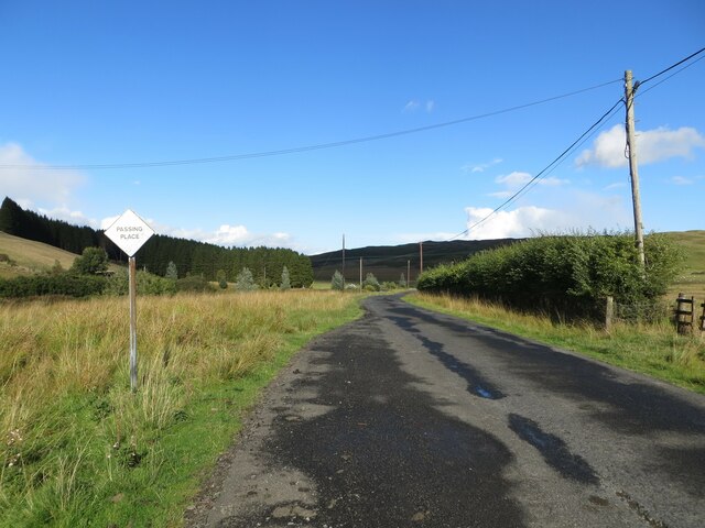
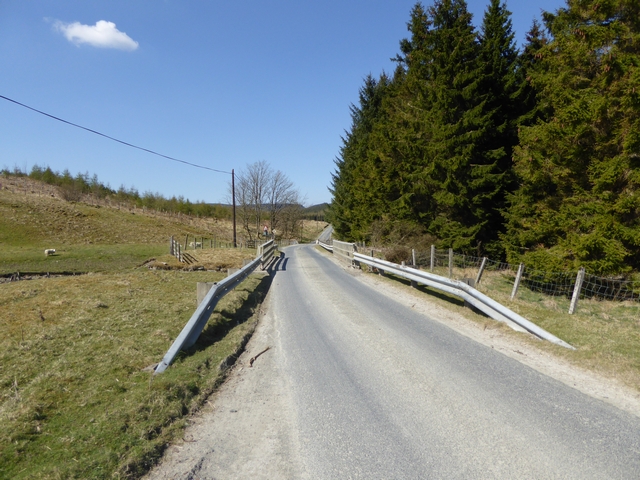
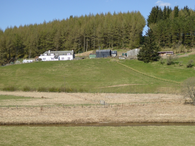
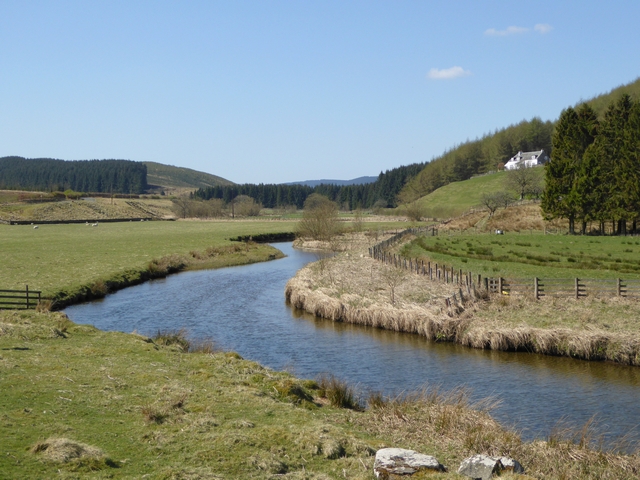
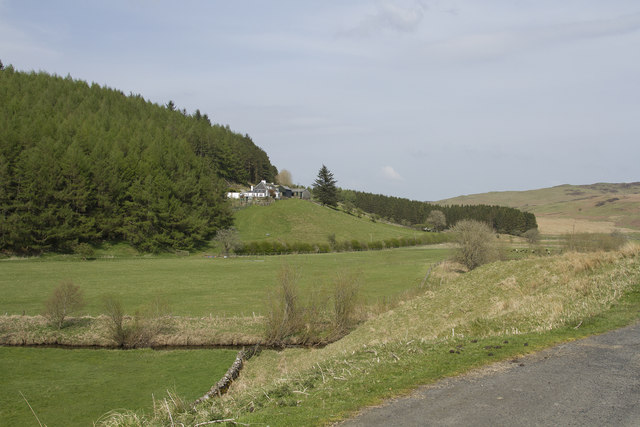
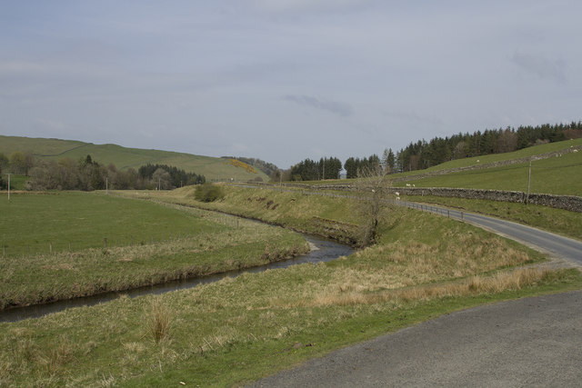
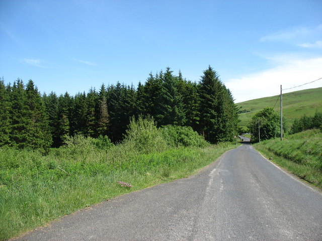
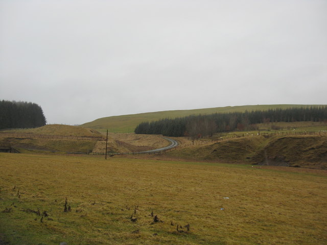
Broadlee Moss is a vast expanse of moorland located in Roxburghshire, Scotland. Stretching over an area of approximately 500 hectares, it is a significant natural feature in the region. The moorland is situated amidst rolling hills and offers breathtaking views of the surrounding landscape.

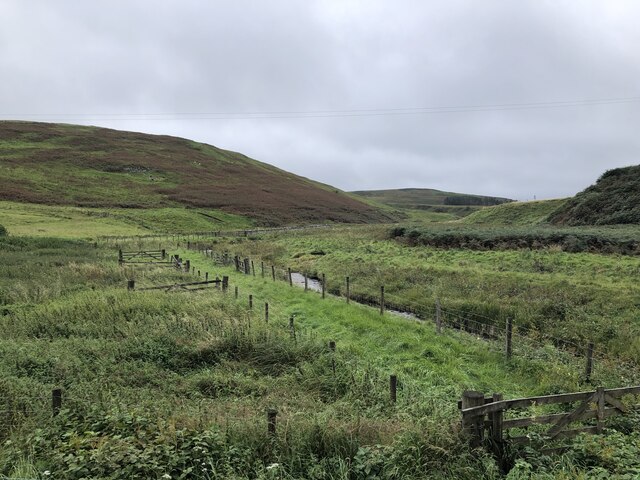
Broadlee Moss is characterized by its diverse flora and fauna. The area is home to a variety of plant species, such as heather, cotton grass, and bilberry, which create a colorful tapestry of purple, green, and red hues during the blooming season. The moss also houses several bird species, including skylarks, curlews, and lapwings, which find refuge in the vast open spaces and undulating terrain.

The site is not only aesthetically pleasing but also serves as an important carbon sink and water catchment area. The peat soils in Broadlee Moss act as a natural reservoir, absorbing and storing rainfall, thus contributing to the regulation of water flow in the region.

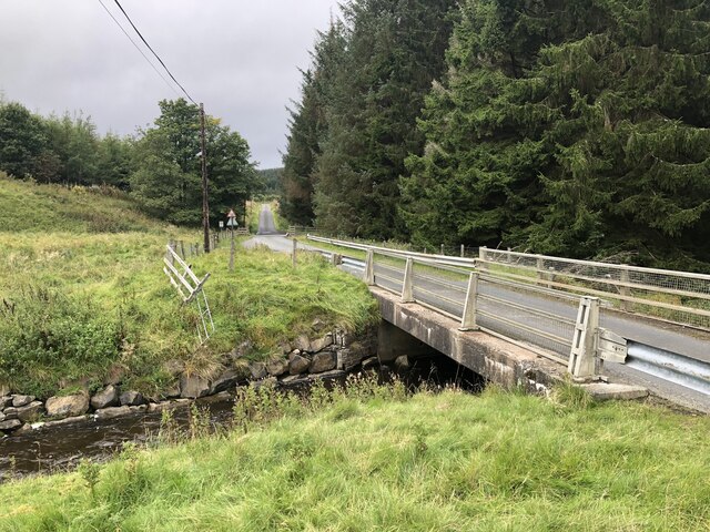
Broadlee Moss offers excellent opportunities for outdoor activities and nature exploration. Hiking and walking trails crisscross the moorland, allowing visitors to immerse themselves in the tranquility of the surroundings. The site also attracts birdwatchers and nature enthusiasts who come to observe the diverse wildlife that calls the moss home.

Although remote and secluded, Broadlee Moss is easily accessible. It is located a short distance from the village of Hawick, making it a popular destination for both locals and tourists seeking a peaceful retreat in the heart of nature.

If you have any feedback on the listing, please let us know in the comments section below.

Broadlee Moss Images

Images are sourced within 2km of 55.376795/-2.9518324 or Grid Reference NT3909. Thanks to Geograph Open Source API. All images are credited.

Minor road beside Borthwick Water Looking north-eastward.
Minor road beside Borthwick Water
Looking north-eastward.
Old Boundary Marker near Calfshaw Head Estate Boundary Marker beside a wooden fence on the edge of Craik Forest, 545 metres northeast of Calfshaw Head. Inscribed I on the north face. On the former boundary of Teviothead and Roberton parishes in Roxburghshire, but the inscription perhaps indicates this is an estate marker.

Milestone Society National ID: RX_TEVROB01em
Old Boundary Marker near Calfshaw Head
Estate Boundary Marker beside a wooden fence on the edge of Craik Forest, 545 metres northeast of Calfshaw Head. Inscribed I on the north face. On the former boundary of Teviothead and Roberton parishes in Roxburghshire, but the inscription perhaps indicates this is an estate marker. Milestone Society National ID: RX_TEVROB01em
Ordnance Survey Cut Mark This mark can be found on top of the parapet of a road bridge that spans Pilhope Burn. At one time the mark had an associated rivet but this is no longer there.
The recorded details give a height of 183.33 metres above sea level.
For more details see : <span class="nowrap"><a title="https://www.bench-marks.org.uk/bm164866" rel="nofollow ugc noopener" href="https://www.bench-marks.org.uk/bm164866">Link</a><img style="margin-left:2px;" alt="External link" title="External link - shift click to open in new window" src="https://s1.geograph.org.uk/img/external.png" width="10" height="10"/></span>
Ordnance Survey Cut Mark
This mark can be found on top of the parapet of a road bridge that spans Pilhope Burn. At one time the mark had an associated rivet but this is no longer there. The recorded details give a height of 183.33 metres above sea level. For more details see : LinkExternal link
Eildrig Burn Edge of the vast Craik Forest.
Eildrig Burn
Edge of the vast Craik Forest.
Road to Craik Crossing the Eildrig Burn into the forest.
Road to Craik
Crossing the Eildrig Burn into the forest.
Country road crossing the burn on the way to Howpasley Near Meadshaw in Roxburghshire.
Country road crossing the burn on the way to Howpasley
Near Meadshaw in Roxburghshire.
A view over the vale of the Borthwick Water With Meadshaw Farm being seen in the background and wet and miserable day in Roxburghshire.
A view over the vale of the Borthwick Water
With Meadshaw Farm being seen in the background and wet and miserable day in Roxburghshire.
Eildrig Burn A tributary of the Borthwick Water
Eildrig Burn
A tributary of the Borthwick Water
The road to Craik The long cul-de-sac road up to Craik and Howparsley crossing the Eildrig Burn. Better weather than in <a href="https://www.geograph.org.uk/photo/2308744">NT3709 : Country road crossing the burn on the way to Howpasley</a>!
The road to Craik
The long cul-de-sac road up to Craik and Howparsley crossing the Eildrig Burn. Better weather than in NT3709 : Country road crossing the burn on the way to Howpasley!
Borthwick Water and Meadshaw On the edge of Eilrig Forest, looking downstream.
Borthwick Water and Meadshaw
On the edge of Eilrig Forest, looking downstream.
Meadshaw Farm Looking across the Borthwick Water to the isolated Meadshaw Farm on the edge of Craik Forest.
Meadshaw Farm
Looking across the Borthwick Water to the isolated Meadshaw Farm on the edge of Craik Forest.
Borthwick Water Looking upstream. Meadshaw Farm on the edge of Craik Forest on the slope to the right.
Borthwick Water
Looking upstream. Meadshaw Farm on the edge of Craik Forest on the slope to the right.
Philhope Burn A tributary of Borthwick Water. Philhope Farm in the middle distance.
Philhope Burn
A tributary of Borthwick Water. Philhope Farm in the middle distance.
Meadshaw Farm Situated in a beautiful valley this farm has wonderful views over the river.
Meadshaw Farm
Situated in a beautiful valley this farm has wonderful views over the river.
The fertile river valley This is a quiet fertile river valley. The river is small but extremely clean and has salmon spawning in its upper reaches.
The fertile river valley
This is a quiet fertile river valley. The river is small but extremely clean and has salmon spawning in its upper reaches.
Leaving Craik Forest This lane leads, eventually, to Hawick.
Leaving Craik Forest
This lane leads, eventually, to Hawick.
Countryside in Roxburghshire Grazing and forestry land with the road to the left leading to Outerside.
Countryside in Roxburghshire
Grazing and forestry land with the road to the left leading to Outerside.
The Borthwick Water Near its confluence with the Camp Burn below Broadlea.
The Borthwick Water
Near its confluence with the Camp Burn below Broadlea.
Show me another place!

Broadlee Moss is located at Grid Ref: NT3909 (Lat: 55.376795, Lng: -2.9518324)

Unitary Authority: The Scottish Borders

Police Authority: The Lothians and Scottish Borders

What 3 Words

///ringers.fronted.renews. Near Teviothead, Scottish Borders

Nearby Locations

Broadlee Moss

Related Wikis

Falnash

Falnash (Scots: Fawenesh) is a village in the Scottish Borders of Scotland. It is near Teviothead, in the former Roxburghshire, and in the parish of Teviothead...

Burnfoot, Roberton

Burnfoot (Scottish Gaelic: Bun na h-Aibhne) is a hamlet in the Scottish Borders area of Scotland, close to Roberton, by the Borthwick Water. The nearest...

Teviothead

Teviothead (Scottish Gaelic: Ceann Tìbhiot) is a small village and civil parish in Teviotdale in the Scottish Borders, known locally as Teviotheid. It...

Caerlanrig

Caerlanrig - also spelled 'Carlenrig' - (Gaelic: Cathair Lannraig) is a hamlet in the parish of Cavers, Borders, Scotland, lying on the River Teviot, 6...

River Teviot

The River Teviot (; Scottish Gaelic: Abhainn Tìbhiot), or Teviot Water, is a river of the Scottish Borders area of Scotland, and is the largest tributary...

Craik, Scottish Borders

Craik is a hamlet in Craik Forest, by the Airhouse Burn in the Scottish Borders area of Scotland, close to Roberton, Scottish Borders (grid reference NT348084...

Broadhaugh

Broadhaugh is a hamlet in the Scottish Borders area of Scotland, in the parish of Teviothead, in former Roxburghshire. == See also == List of places in...

Craik Forest

Craik Forest is a forest near Hawick in the Scottish Borders area of Scotland, and managed by the Forestry Commission. It is adjoined to the south-west...

Nearby Amenities

Located within 500m of 55.376795,-2.9518324
High Seat
Ele: 347
Natural: peak
Source: NLS-OS-1st_Series
Lat/Long: 55.3746008/-2.9454947
The data included in this document is from www.openstreetmap.org. The data is made available under ODbL.

Have you been to Broadlee Moss?

Leave your review of Broadlee Moss below (or comments, questions and feedback).