East Plain

Downs, Moorland in Lancashire South Lakeland

England

East Plain

West side of Humphrey Head, looking inland
West side of Humphrey Head, looking inland Credit: Stephen Dawson

East Plain is a picturesque region located in the county of Lancashire, England. It is characterized by its diverse landscape of downs and moorland, making it a popular destination for nature enthusiasts and outdoor enthusiasts alike.

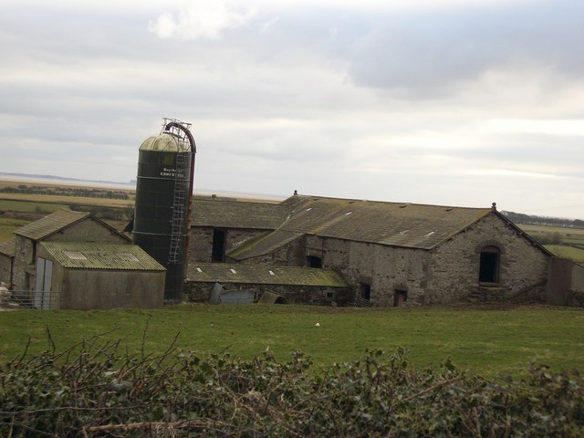
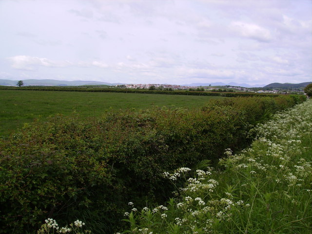
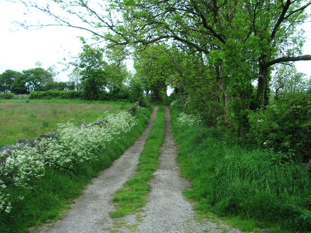
The downs in East Plain offer breathtaking views of rolling hills and wide open spaces. The area is dotted with small villages and farmlands, adding to its charm. The downs provide ample opportunities for hiking, horseback riding, and cycling, with well-maintained trails that cater to all levels of fitness.

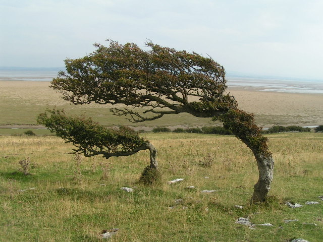
Moorland is another prominent feature of East Plain. It is characterized by expansive stretches of heather-covered hills, providing a unique and rugged beauty to the region. The moorland is home to a variety of flora and fauna, including rare species such as the golden plover and the black grouse. It offers a tranquil escape from the hustle and bustle of city life, with its serene atmosphere and vast open spaces.

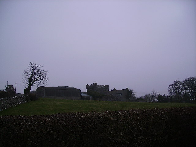
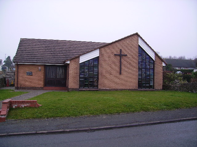
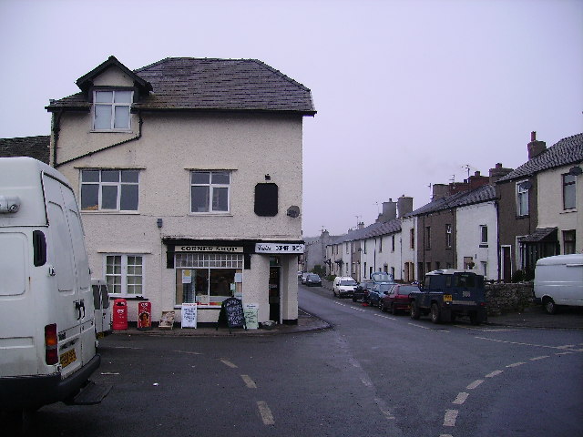
In addition to its natural beauty, East Plain is rich in history and culture. The region is dotted with ancient landmarks and historical sites, such as castles, churches, and ruins, which provide a glimpse into its past. The local communities are known for their warm hospitality and traditional way of life, preserving the heritage of the area.

Overall, East Plain in Lancashire is a captivating destination that offers a perfect blend of natural beauty, outdoor activities, and historical significance. Whether one seeks adventure or relaxation, this region has something to offer for everyone.

If you have any feedback on the listing, please let us know in the comments section below.

East Plain Images

Images are sourced within 2km of 54.159961/-2.9593982 or Grid Reference SD3774. Thanks to Geograph Open Source API. All images are credited.

West side of Humphrey Head, looking inland
Rougholme Point from Humphrey Head From Humphrey Head (approx. <a href="https://www.geograph.org.uk/gridref/SD390742">SD390742</a>) looking east. A path leads along the crest of Humphrey Head from north to south.
Rougholme Point from Humphrey Head
From Humphrey Head (approx. SD390742) looking east. A path leads along the crest of Humphrey Head from north to south.
Morecambe Bay west of Humphrey Head
Wrysholme Tower A farm near Kents Bank
Wrysholme Tower
A farm near Kents Bank
St. Cuthbert's Church, Flookburgh A relatively modern church.
St. Cuthbert's Church, Flookburgh
A relatively modern church.
Flookburgh The bustling centre of Flookburgh.
Flookburgh
The bustling centre of Flookburgh.
Farm On the road between Allithwaite and Flookborough
Farm
On the road between Allithwaite and Flookborough
Hedge Flookburgh Looking towards Cark with the Lakeland Fells beyond. Some big caravan parks in the area.
Hedge Flookburgh
Looking towards Cark with the Lakeland Fells beyond. Some big caravan parks in the area.
Humphrey Head Looking towards the point from the foot of the cliffs on the west side. Humphrey Head is allegedly the place where the last wolf in England was killed in the 14th century.
Humphrey Head
Looking towards the point from the foot of the cliffs on the west side. Humphrey Head is allegedly the place where the last wolf in England was killed in the 14th century.
Humphrey Head Humphrey Head is a limestone outcrop which juts into the sea at the entrance to the Kent estuary and is allegedly the place where the last wolf in England was killed in the 14th century. This shot is taken from north of the trig pillar looking inland towards the village of Allithwaite.
Humphrey Head
Humphrey Head is a limestone outcrop which juts into the sea at the entrance to the Kent estuary and is allegedly the place where the last wolf in England was killed in the 14th century. This shot is taken from north of the trig pillar looking inland towards the village of Allithwaite.
Raven Winder Farm Its neighbour Cannon Winder - both have the strange name incorporated. Wikipedia will elucidate.
Raven Winder Farm
Its neighbour Cannon Winder - both have the strange name incorporated. Wikipedia will elucidate.
West Plain Farm
West Plain Farm
Cark Airfield Home to the NW civilian parachute school. On a still day you can hear the cries of 'Geronimo' as the parachutists exit the plane. (Apparently the exhalation of breath when shouting at the top of your voice quells the fear of what lies ahead). It's all in the head anyway!
Cark Airfield
Home to the NW civilian parachute school. On a still day you can hear the cries of 'Geronimo' as the parachutists exit the plane. (Apparently the exhalation of breath when shouting at the top of your voice quells the fear of what lies ahead). It's all in the head anyway!
Village Square Flookburgh village square. The village is well known for its potted Morecambe Bay shrimps and cockles. They can usually be bought from the door of the very people who catch them. It also has a thriving brass band which practices in the local pub by the market square.
Village Square
Flookburgh village square. The village is well known for its potted Morecambe Bay shrimps and cockles. They can usually be bought from the door of the very people who catch them. It also has a thriving brass band which practices in the local pub by the market square.
Low Marsh The sands here are quite firm and walking out at low water into no-man's land affords a wonderful vista of Lakeland to the West through to the North-east. Whilst over to the East and South-east the forest of Bowland hills are visible on the horizon.
Low Marsh
The sands here are quite firm and walking out at low water into no-man's land affords a wonderful vista of Lakeland to the West through to the North-east. Whilst over to the East and South-east the forest of Bowland hills are visible on the horizon.
Humphrey Head Beautiful landscape at "Humphrey Head Point".
Humphrey Head
Beautiful landscape at "Humphrey Head Point".
The caravan park at Cark
Footpath to Applebury Hill Farm
Show me another place!

East Plain is located at Grid Ref: SD3774 (Lat: 54.159961, Lng: -2.9593982)

Administrative County: Cumbria

District: South Lakeland

Police Authority: Cumbria

What 3 Words

///conclude.lamppost.volume. Near Flookburgh, Cumbria

Nearby Locations

East Plain

Related Wikis

RAF Cark

Royal Air Force Cark or more simply RAF Cark is a former Royal Air Force station in the county of Cumbria (formerly Lancashire) which was operational between...

Wraysholme Halt railway station

Wraysholme Halt was a railway station on the Furness Railway in the Furness exclave of Lancashire. Situated between Cark and Cartmel and Kents Bank the...

Ravenstown

Ravenstown is also a nickname for Baltimore, Maryland. Ravenstown is a settlement in the Lower Holker parish of the Cartmel Peninsula in Cumbria, England...

Humphrey Head

Humphrey Head is a limestone outcrop situated south of the village of Allithwaite in Cumbria, England. It is whale-back-shaped and accessible for walkers...

Nearby Amenities

Located within 500m of 54.159961,-2.9593982
Noexit: yes
Lat/Long: 54.1579945/-2.9565463
Noexit: yes
Lat/Long: 54.1581392/-2.9580976
Noexit: yes
Lat/Long: 54.1581523/-2.9567362
Noexit: yes
Lat/Long: 54.1584932/-2.9580932
Building: yes
Source: bing
Lat/Long: 54.1585273/-2.9602375
Noexit: yes
Lat/Long: 54.158918/-2.9570631
Noexit: yes
Lat/Long: 54.1595246/-2.9594791
Noexit: yes
Lat/Long: 54.1595344/-2.958998
The data included in this document is from www.openstreetmap.org. The data is made available under ODbL.

Have you been to East Plain?

Leave your review of East Plain below (or comments, questions and feedback).