Balvalley Moss

Downs, Moorland in Aberdeenshire

Scotland

Balvalley Moss

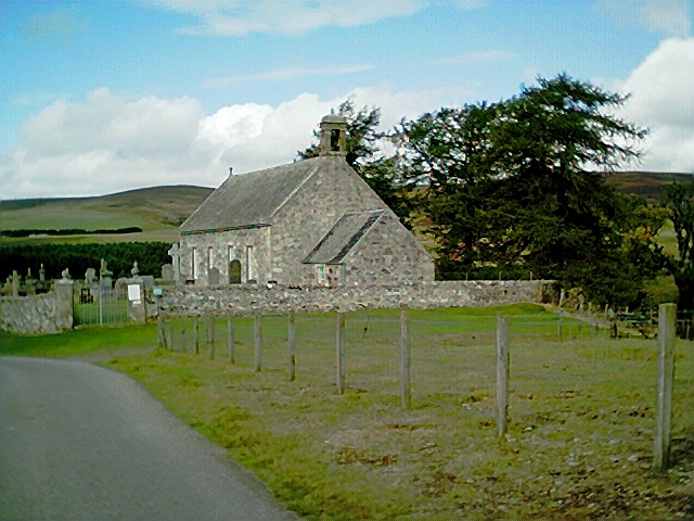
Old School at Cabrach
Old School at Cabrach Credit: Peter Moore

Balvalley Moss is a picturesque and serene natural area located in Aberdeenshire, Scotland. Nestled amidst the rolling hills and moorland, it offers breathtaking views and a tranquil ambiance. Covering a vast expanse of land, Balvalley Moss is primarily characterized by its unique moss-covered landscape, which is a result of the region's damp and cool climate.

The moss, which thrives in these conditions, creates a carpet-like layer over the ground, giving the area an otherworldly appearance. The vibrant green hues of the moss contrast beautifully with the earthy tones of the surrounding moorland, creating a visually stunning sight.

The area is home to a diverse range of flora and fauna, with several species of plants and wildlife calling Balvalley Moss their habitat. Rare and endangered species, such as the bog rosemary and the black grouse, can be found here, making it a haven for nature enthusiasts and birdwatchers.

Balvalley Moss is a haven for outdoor activities, including hiking, nature walks, and photography. The winding trails and paths that crisscross the area provide ample opportunities for exploration and discovery. Visitors can immerse themselves in the peaceful surroundings, breathing in the fresh air and marveling at the natural beauty that surrounds them.

Overall, Balvalley Moss in Aberdeenshire is a captivating destination that showcases the raw and untouched beauty of Scotland's countryside. Its moss-covered landscape, diverse flora and fauna, and tranquil atmosphere make it an enchanting place to visit for those seeking a connection with nature.

If you have any feedback on the listing, please let us know in the comments section below.

Balvalley Moss Images

Images are sourced within 2km of 57.317722/-3.0413316 or Grid Reference NJ3725. Thanks to Geograph Open Source API. All images are credited.

Old School at Cabrach
Minor road and deserted former school building in Cabrach Looking south-eastward.
Minor road and deserted former school building in Cabrach
Looking south-eastward.
Minor road from Cabrach joining the A941 Looking north-westward.
Minor road from Cabrach joining the A941
Looking north-westward.
Minor road near Milltown Looking eastward.
Minor road near Milltown
Looking eastward.
Minor road at Aldunie Looking south-westward.
Minor road at Aldunie
Looking south-westward.
Minor road between Kiln Hillocks and Aldunie Looking south-westward.
Minor road between Kiln Hillocks and Aldunie
Looking south-westward.
Ordnance Survey Flush Bracket S7624 This bracket can be found on the wall of the former Cabrach School building. The benchmark height is recorded as being 321.463 metres above sea level.
For more detail see : <span class="nowrap"><a title="https://www.bench-marks.org.uk/bm11391" rel="nofollow ugc noopener" href="https://www.bench-marks.org.uk/bm11391">Link</a><img style="margin-left:2px;" alt="External link" title="External link - shift click to open in new window" src="https://s1.geograph.org.uk/img/external.png" width="10" height="10"/></span>
Ordnance Survey Flush Bracket S7624
This bracket can be found on the wall of the former Cabrach School building. The benchmark height is recorded as being 321.463 metres above sea level. For more detail see : LinkExternal link
Graveyard of church at Cabrach Cabrach is a sparsely populated area but perhaps with a growing population; of the relatively few deserted and semi-derelict cottages close to this church several were undergoing renovation when the image was recorded in May 2019. The manse, visible through tree branches, appeared to be boarded up.
Graveyard of church at Cabrach
Cabrach is a sparsely populated area but perhaps with a growing population; of the relatively few deserted and semi-derelict cottages close to this church several were undergoing renovation when the image was recorded in May 2019. The manse, visible through tree branches, appeared to be boarded up.
Upper Cabrach church
Rough grazing near Cabrach
Minor road at Aldunie This lane is a cul-de-sac, terminating at Aldivalloch, less than a mile ahead (and in the same square).
Minor road at Aldunie
This lane is a cul-de-sac, terminating at Aldivalloch, less than a mile ahead (and in the same square).
Fields and woods near Cabrach
OS Flush Bracket OSBM S7624: Cabrach, School Ordnance Survey Flush Bracket OSBM S7624: Cabrach, School
OS Flush Bracket OSBM S7624: Cabrach, School
Ordnance Survey Flush Bracket OSBM S7624: Cabrach, School
Information Point The information point provides maps and details of walking routes on the Cabrach, Glenfiddich and Glenlivet estates. Since I took <a href="https://www.geograph.org.uk/photo/341414">NJ3526 : Keeper's Cottage at Aldivalloch</a> over 13 years ago, the abandoned cottage has been restored and is now occupied, and a small car park provided for people wishing to enjoy walking and cycling here.
Information Point
The information point provides maps and details of walking routes on the Cabrach, Glenfiddich and Glenlivet estates. Since I took NJ3526 : Keeper's Cottage at Aldivalloch over 13 years ago, the abandoned cottage has been restored and is now occupied, and a small car park provided for people wishing to enjoy walking and cycling here.
Steplar Way Trailhead The information boards at the car park at the Cabrach (east) end of the Steplar Way.
Steplar Way Trailhead
The information boards at the car park at the Cabrach (east) end of the Steplar Way.
Cattle at Aldivalloch The Steplar Way passes through a field currently occupied by a herd of cattle. The glen beyond them is the course of the Perkie Burn.
Cattle at Aldivalloch
The Steplar Way passes through a field currently occupied by a herd of cattle. The glen beyond them is the course of the Perkie Burn.
Cabrach 'Panorama' It's not a proper panorama, of course, because it isn't a 360º view, but a view from the Steplar Way to the Cabrach. The Buck is hidden in the low cloud.
Cabrach 'Panorama'
It's not a proper panorama, of course, because it isn't a 360º view, but a view from the Steplar Way to the Cabrach. The Buck is hidden in the low cloud.
December sun on Cabrach church
Show me another place!

Balvalley Moss is located at Grid Ref: NJ3725 (Lat: 57.317722, Lng: -3.0413316)

Unitary Authority: Moray

Police Authority: North East

What 3 Words

///quantity.thundered.plump. Near Dufftown, Moray

Related Wikis

Cabrach

The Cabrach (Scottish Gaelic: A' Chabrach, A' Chabraich) is an estate and largely depopulated rural community in Moray, Scotland. The meaning of the name...

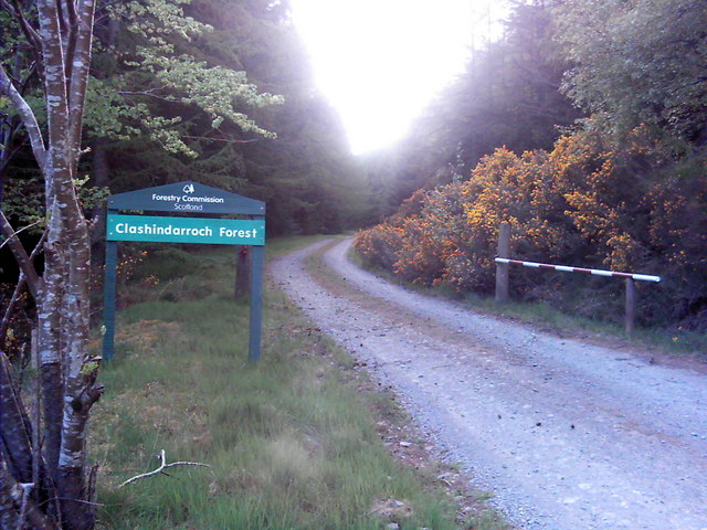
Clashindarroch Forest

Clashindarroch Forest is possibly the largest forest in Aberdeenshire, situated to the south-west of the market town of Huntly. Managed by Forest Enterprise...

Peatfold Burn

Peatfold Burn is a burn which marks the boundary of the parish of Huntly, Aberdeenshire, Scotland. == References ==

Badenyon

Badenyon (from Scottish Gaelic: Bad an Eòin - Knoll of the Birds) is a former clachan, or village, in Aberdeenshire, Scotland. The last farming inhabitant...

Badenyon Castle

Badenyon Castle was a castle, dating from the 13th century around 7.5 miles (12.1 km) west of Kildrummy, north of Coulins Burn, in Aberdeenshire, Scotland...

Wormy Hillock Henge

Wormy Hillock Henge, also known as The Dragon's Grave, is a small henge in Aberdeenshire, Scotland. It is a Scheduled Ancient Monument located in the Clashindarroch...

Clova Monastery

Clova Monastery (also called Cloveth) was a medieval Culdee monastery in Kildrummy, Aberdeenshire, Scotland. == Founding == Clova was founded in the late...

Lesmoir Castle

Lesmoir Castle was a 16th-century castle, about 2.0 miles (3.2 km) west of Rhynie, Aberdeenshire, Scotland, south-west of Tap o' Noth, at Mains of Lesmoir...

Have you been to Balvalley Moss?

Leave your review of Balvalley Moss below (or comments, questions and feedback).