West Moor

Downs, Moorland in Somerset Sedgemoor

England

West Moor

Seats on NCN3 beside Kings Sedgemoor Drain Riverside seating beside the Kings Sedgemoor Drain on the NCN path between Chedzoy and Bawdrip.
Seats on NCN3 beside Kings Sedgemoor Drain Credit: Kevin Pearson

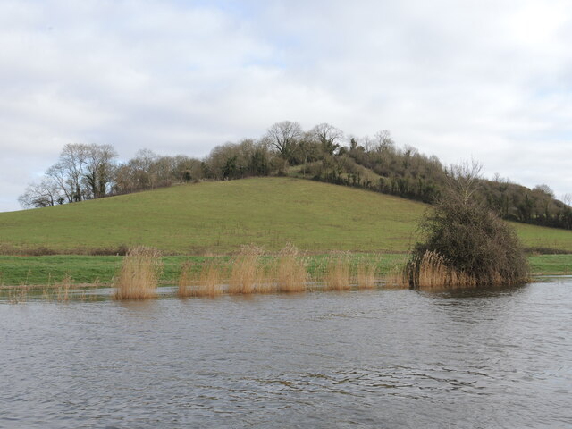
West Moor is a region in Somerset, England, characterized by its expansive downs and moorland landscapes. The area is known for its rolling hills, open fields, and rugged terrain, making it a popular destination for outdoor enthusiasts and nature lovers.

Covering a large expanse of land, West Moor offers stunning views of the surrounding countryside and is home to a variety of wildlife, including birds of prey, deer, and other native species. The area is also dotted with quaint villages and historic sites, adding to its charm and appeal.

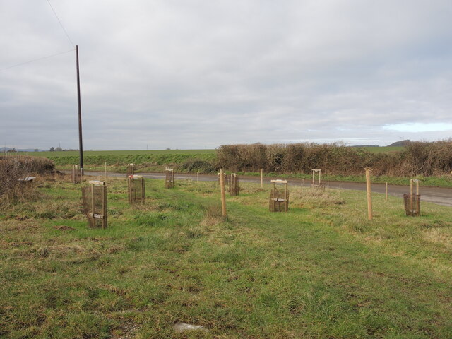
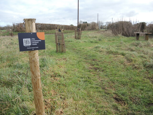
Visitors to West Moor can enjoy a range of outdoor activities, such as hiking, cycling, and horseback riding, as well as bird watching and nature photography. The region is also popular for its traditional farming practices, with sheep grazing on the hillsides and fields.

Overall, West Moor offers a peaceful and scenic escape from the hustle and bustle of city life, allowing visitors to immerse themselves in the natural beauty and tranquility of the Somerset countryside.

If you have any feedback on the listing, please let us know in the comments section below.

West Moor Images

Images are sourced within 2km of 51.13457/-2.9190577 or Grid Reference ST3537. Thanks to Geograph Open Source API. All images are credited.

Seats on NCN3 beside Kings Sedgemoor Drain Riverside seating beside the Kings Sedgemoor Drain on the NCN path between Chedzoy and Bawdrip.
Seats on NCN3 beside Kings Sedgemoor Drain
Riverside seating beside the Kings Sedgemoor Drain on the NCN path between Chedzoy and Bawdrip.
NCN by Parchey Bridge Photograph of NCN3 as it runs alongside the Kings Sedgemoor Drain, looking west from Parchey Bridge.
This section of NCN3 is well surfaced with a packed grit top, and is free from obstructions for the entire length beside the Drain.
NCN by Parchey Bridge
Photograph of NCN3 as it runs alongside the Kings Sedgemoor Drain, looking west from Parchey Bridge. This section of NCN3 is well surfaced with a packed grit top, and is free from obstructions for the entire length beside the Drain.
Track by the King's Sedgemoor Drain The river path is lined with red grit.
Track by the King's Sedgemoor Drain
The river path is lined with red grit.
Pendon Hill A small feature by landscape standards but a clear landmark in the Somerset Levels, which are running high of late. Atop is Badgers' Wood.
Pendon Hill
A small feature by landscape standards but a clear landmark in the Somerset Levels, which are running high of late. Atop is Badgers' Wood.
Chedzoy Tilting Weir A part of the water management and drainage of the Levels between the River Parrett and the King's Sedgemoor Drain. A tilting weir has a hinge along the bottom of its paddle and can adjust to the requirements by how far it swings down.
Chedzoy Tilting Weir
A part of the water management and drainage of the Levels between the River Parrett and the King's Sedgemoor Drain. A tilting weir has a hinge along the bottom of its paddle and can adjust to the requirements by how far it swings down.
A soggy dip in the track As the river nears Parchey Bridge the path suffers a slight depression in the landscape; in times of heavy rain the river can swamp walkers against the fence.
A soggy dip in the track
As the river nears Parchey Bridge the path suffers a slight depression in the landscape; in times of heavy rain the river can swamp walkers against the fence.
A footpath on drier days The King's Sedgemoor Drain is a large man-made drainage channel that often floods over the banks. Walkers using the footpath from Parchey Bridge need a stout pair of wellies today.
A footpath on drier days
The King's Sedgemoor Drain is a large man-made drainage channel that often floods over the banks. Walkers using the footpath from Parchey Bridge need a stout pair of wellies today.
Tiled block on Ward Lane The entrance to an old building is blocked by a concrete block, decorated by colourful ceramic tiles. Presumably the building is inaccessible and no longer used.
Tiled block on Ward Lane
The entrance to an old building is blocked by a concrete block, decorated by colourful ceramic tiles. Presumably the building is inaccessible and no longer used.
An orchard for the next generation A small patch on a bend in Ward Lane has been selected for planting. The village of Chedzoy has added some fruit tree saplings here as part of a concerted effort to enhance the area. The village was awarded funding from the Fair Share Project and several things have happened, including this embryonic orchard.

Several fruit trees (including apple, plum, greengage and shipova) are hoped to provide food and habitat in the future. A circular walk takes in this area near the village.
An orchard for the next generation
A small patch on a bend in Ward Lane has been selected for planting. The village of Chedzoy has added some fruit tree saplings here as part of a concerted effort to enhance the area. The village was awarded funding from the Fair Share Project and several things have happened, including this embryonic orchard. Several fruit trees (including apple, plum, greengage and shipova) are hoped to provide food and habitat in the future. A circular walk takes in this area near the village.
Lord Burghley An apple sapling near Chedzoy.
Lord Burghley
An apple sapling near Chedzoy.
Blenheim Orange Another variety of apple in prospect.
Blenheim Orange
Another variety of apple in prospect.
Old Greengage A variety of plum, planted on Ward Lane.
Old Greengage
A variety of plum, planted on Ward Lane.
Bloody Ploughman One of several apple tree saplings planted on Ward Lane, near Chedzoy.

The variety was developed in the Carse of Gowrie, Scotland, and has a distinctly red appearance and flesh. Its name is said to derive from a ploughman who was shot dead by a gamekeeper for stealing apples from the Megginch Estate.
Bloody Ploughman
One of several apple tree saplings planted on Ward Lane, near Chedzoy. The variety was developed in the Carse of Gowrie, Scotland, and has a distinctly red appearance and flesh. Its name is said to derive from a ploughman who was shot dead by a gamekeeper for stealing apples from the Megginch Estate.
A plum sapling near Chedzoy One of several new fruit tree saplings planted by the village.
A plum sapling near Chedzoy
One of several new fruit tree saplings planted by the village.
Clapp's Favourite A pear variety is part of the small orchard planted along the lane near Chedzoy.
Clapp's Favourite
A pear variety is part of the small orchard planted along the lane near Chedzoy.
Community Orchard guide Chedzoy has enhanced the village with many initiatives of late. One such vision is the planting of a small group of fruit tree saplings on Ward Lane. The twenty-first century style of using a Q.R. code is proof of how the villagers are embracing the future.
Community Orchard guide
Chedzoy has enhanced the village with many initiatives of late. One such vision is the planting of a small group of fruit tree saplings on Ward Lane. The twenty-first century style of using a Q.R. code is proof of how the villagers are embracing the future.
Chedzoy sewage pumping station A small unit on Ward Lane. At the rear is the entrance to an underground chamber - which must be very close to the water table here.
Chedzoy sewage pumping station
A small unit on Ward Lane. At the rear is the entrance to an underground chamber - which must be very close to the water table here.
The word on Front Street Although the telephone box no longer contains equipment, it does have books to read.
The word on Front Street
Although the telephone box no longer contains equipment, it does have books to read.
Show me another place!

West Moor is located at Grid Ref: ST3537 (Lat: 51.13457, Lng: -2.9190577)

Administrative County: Somerset

District: Sedgemoor

Police Authority: Avon and Somerset

What 3 Words

///zaps.agreement.brass. Near Westonzoyland, Somerset

Nearby Locations

West Moor

Related Wikis

Stawell, Somerset

Stawell is a village and civil parish 4.5 miles (7 km) north-east of Bridgwater, and 2 miles (3 km) north-west of Moorlinch, in Somerset, England. The...

Church of St Francis, Stawell

The Anglican Church of St Francis in Stawell, Somerset, England was built in the 13th century. It is a Grade II* listed building. == History == Construction...

Sutton Mallet Church

Sutton Mallet Church in the village of Sutton Mallet, which is within the parish of Stawell, Somerset, England, was built in 1827 incorporating elements...

Chedzoy

Chedzoy (alternatively Chedzey) is a civil parish village 3 miles (4.8 km) east of Bridgwater in Somerset, England. == History == The village is at the...

Have you been to West Moor?

Leave your review of West Moor below (or comments, questions and feedback).