Carrock Fell

Downs, Moorland in Cumberland Eden

England

Carrock Fell

Carrock Beck ford On the minor road that skirts the eastern edge of the fells south of Hesket Newmarket.
Carrock Beck ford Credit: Gordon Hatton

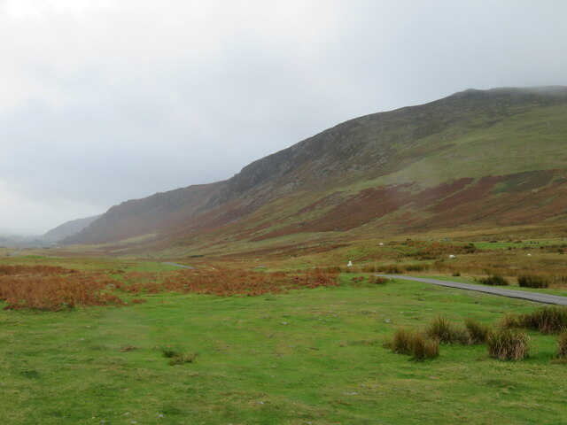
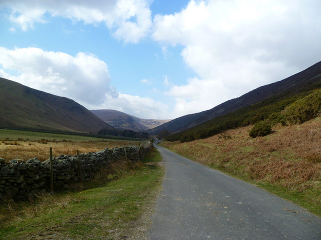
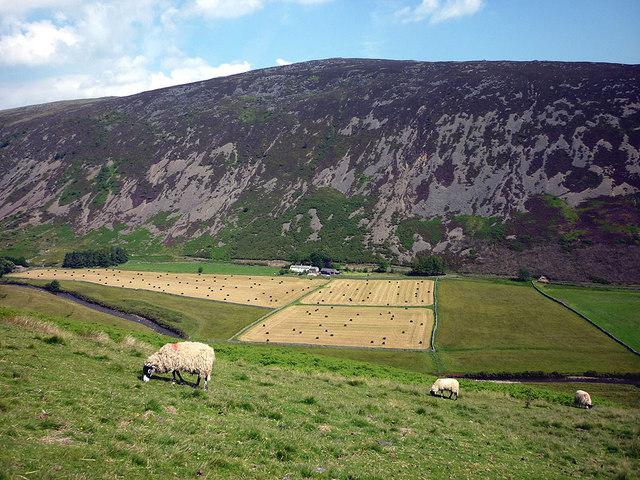
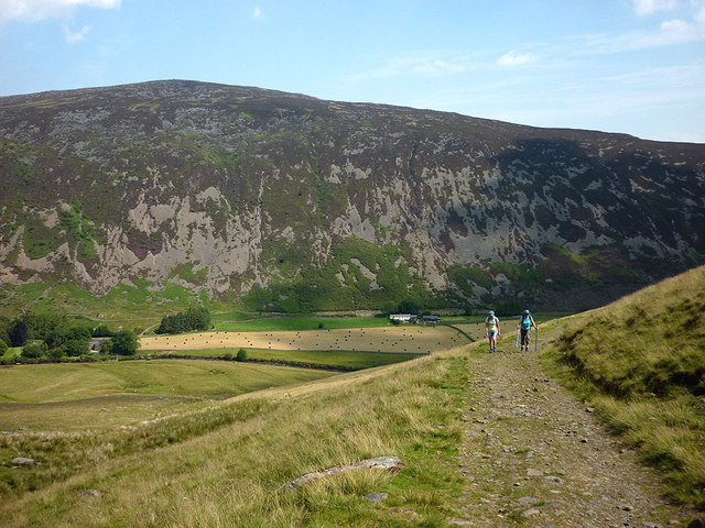
Carrock Fell is a prominent hill located in the county of Cumberland, in the northwestern region of England. Rising to an elevation of 663 meters (2,175 feet), it is part of the Caldbeck Fells range within the Lake District National Park. The fell is situated near the village of Mosedale, approximately 15 kilometers (9 miles) northeast of Keswick.

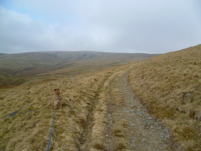
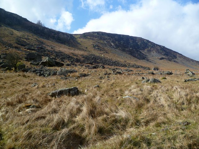
Carrock Fell is characterized by its rocky and craggy terrain, with its slopes covered in heather and grasses. The summit offers breathtaking panoramic views of the surrounding landscape, including the nearby valleys of Caldbeck and Uldale, as well as the Skiddaw and Blencathra mountains to the south.

The fell is renowned for its rich mining history. In the 19th century, it was a significant source of lead, zinc, and copper, attracting miners from across the region. The remains of several mining operations, including shafts, adits, and spoil heaps, can still be seen on the slopes of Carrock Fell, providing a glimpse into its industrial past.

Today, Carrock Fell is a popular destination for hikers and climbers, offering various routes to its summit. The most common starting point is the small hamlet of Mosedale, from where a well-defined footpath leads to the top. The fell's rugged and challenging nature attracts outdoor enthusiasts seeking a rewarding and adventurous experience. However, caution is advised, as the weather conditions can change rapidly, and the terrain can be treacherous, particularly during winter months.

Overall, Carrock Fell is a striking and historically significant hill, offering both natural beauty and a glimpse into the area's industrial heritage.

If you have any feedback on the listing, please let us know in the comments section below.

Carrock Fell Images

Images are sourced within 2km of 54.692743/-3.0188764 or Grid Reference NY3433. Thanks to Geograph Open Source API. All images are credited.

Carrock Beck ford On the minor road that skirts the eastern edge of the fells south of Hesket Newmarket.
Carrock Beck ford
On the minor road that skirts the eastern edge of the fells south of Hesket Newmarket.
Moorland road below Carrock Fell One of those Lake District days when the fells are cloaked in cloud and drizzle fills the air, whilst to the east the sun shines over the Vale of Eden. Here the minor road heading south towards Mosedale runs along under the steep slopes of Carrock Fell.
Moorland road below Carrock Fell
One of those Lake District days when the fells are cloaked in cloud and drizzle fills the air, whilst to the east the sun shines over the Vale of Eden. Here the minor road heading south towards Mosedale runs along under the steep slopes of Carrock Fell.
Old mine spoil below Carrock Fell There's not much to see here except areas of stone waste along what appears to be a quarried area. I wasn't sure what type of mining was done here, so was on the lookout for such as galena, fluorspar, or greenish rocks that might indicate copper deposits. Checking the area on old OS maps, the first edition shows a copper mine here, but no indication of shafts or levels. Later editions of the 6 inch map fail to show anything.
Old mine spoil below Carrock Fell
There's not much to see here except areas of stone waste along what appears to be a quarried area. I wasn't sure what type of mining was done here, so was on the lookout for such as galena, fluorspar, or greenish rocks that might indicate copper deposits. Checking the area on old OS maps, the first edition shows a copper mine here, but no indication of shafts or levels. Later editions of the 6 inch map fail to show anything.
Bowscale Fell's NNW ridge The rather level summit plateau of Bowscale Fell ends abruptly at steep ground dropping to Bowscale Tarn 180m below in a NE-facing coire. Looking across the corrie, the NNW ridge can be seen, with a network of paths on its lower slopes.
Bowscale Fell's NNW ridge
The rather level summit plateau of Bowscale Fell ends abruptly at steep ground dropping to Bowscale Tarn 180m below in a NE-facing coire. Looking across the corrie, the NNW ridge can be seen, with a network of paths on its lower slopes.
Boulder under Carrock Fell One of many on the Common by Carrock Beck
Boulder under Carrock Fell
One of many on the Common by Carrock Beck
Carrock Beck At Rospow Hills
Carrock Beck
At Rospow Hills
Carrock Beck Near Rospow Hills
Carrock Beck
Near Rospow Hills
Bield, Carrock Beck A crumbling wall line on the south bank of the beck. It is marked on the OS map.
Bield, Carrock Beck
A crumbling wall line on the south bank of the beck. It is marked on the OS map.
Old Fold, Carrock Beck Small tumbledown fold by the beck
Old Fold, Carrock Beck
Small tumbledown fold by the beck
Under Sunny Bank On the track above Carrock Beck
Under Sunny Bank
On the track above Carrock Beck
Miton Hill The flat summit area
Miton Hill
The flat summit area
Round Knott A small rocky top on the Carrock Fell ridge
Round Knott
A small rocky top on the Carrock Fell ridge
On Carrock Fell Looking down the ridge towards High Pike on the ascent of Carrock Fell. As befits a fell with an Iron Age Hill Fort on its summit the name is ancient. First recorded in 1208 as 'Carroc' being from the Cumbric language 'Carreg' meaning rock. (Whaley 2006).
On Carrock Fell
Looking down the ridge towards High Pike on the ascent of Carrock Fell. As befits a fell with an Iron Age Hill Fort on its summit the name is ancient. First recorded in 1208 as 'Carroc' being from the Cumbric language 'Carreg' meaning rock. (Whaley 2006).
Descending Carrock Fell On the north flank looking towards High Pike
Descending Carrock Fell
On the north flank looking towards High Pike
Apronful of Stones Under Carrock Fell. Similar names appear in other places in the Lakes i.e. Sampson's Bratful and relate to legends about giants or the devil who carried stones in an apron.
Apronful of Stones
Under Carrock Fell. Similar names appear in other places in the Lakes i.e. Sampson's Bratful and relate to legends about giants or the devil who carried stones in an apron.
In Mosedale Quiet valley between Bowscale and Carrock Fells
In Mosedale
Quiet valley between Bowscale and Carrock Fells
Sheep in Mosedale Swaledale sheep beside the bridleway to Bowscale Tarn. The grass in the fields at Swineside has been cut and baled.
Sheep in Mosedale
Swaledale sheep beside the bridleway to Bowscale Tarn. The grass in the fields at Swineside has been cut and baled.
The bridleway to Bowscale Tarn Across Mosedale Carrock Fell rears out of the hay meadows of Swinside in a wall of heather, scree and bracken.
The bridleway to Bowscale Tarn
Across Mosedale Carrock Fell rears out of the hay meadows of Swinside in a wall of heather, scree and bracken.
Show me another place!

Carrock Fell is located at Grid Ref: NY3433 (Lat: 54.692743, Lng: -3.0188764)

Administrative County: Cumbria

District: Eden

Police Authority: Cumbria

What 3 Words

///begun.autumn.broth. Near Keswick, Cumbria

Nearby Locations

Carrock Fell Carrock Fell

Related Wikis

Carrock Fell

Carrock Fell is a fell in the English Lake District, situated in the northern region of the national park, 8 miles (13 kilometres) north-east of Keswick...

Mosedale, Cumbria

Mosedale is a hamlet and former civil parish, now in the parish of Mungrisdale in the Eden district, in the county of Cumbria, in the north west of the...

Bowscale

Bowscale is a hamlet and former civil parish, now in the parish of Mungrisdale, in the Eden district, in the county of Cumbria, England. In 1931 the parish...

High Pike

High Pike is a fell in the northern part of the English Lake District, it is located 4.5 kilometres (2+3⁄4 miles) south of Caldbeck. It has a height of...

Nearby Amenities

Located within 500m of 54.692743,-3.0188764
Carrock Fell
Alt Name: Carrock
Ele: 662.3
Natural: peak
Source: OS1:25k;https://www.hill-bagging.co.uk/mountaindetails.php?qu=S&rf=2336
Wikidata: Q5046490
Wikipedia: en:Carrock Fell
Lat/Long: 54.6934828/-3.022823
The Trough
Place: locality
Lat/Long: 54.6931084/-3.0134136
Pike
Place: locality
Lat/Long: 54.6931477/-3.0171967
Ele: 663
Man Made: survey_point
Source: OS1:25k
Lat/Long: 54.6935863/-3.0226797
Man Made: cairn
Lat/Long: 54.6934863/-3.0203194
The data included in this document is from www.openstreetmap.org. The data is made available under ODbL.

Have you been to Carrock Fell?

Leave your review of Carrock Fell below (or comments, questions and feedback).